
Hike #1605: 5/11/24 Palmer/Wilson PA Area Loop with Evan "Joe Millionaire" Van Rossum, Ayssa Lidman, Jim "Mr. Burckett" Mathews, Eric Pace, Eric Mitchell, Kirk Rohn, Dan Lurie, Professor John DiFiore, Kenny Zaruni and Scout, Jenny Tull, Sev ?, Violet Chen, Conrad Blease, Cheryl Mahala Glaser, and Alyssa ?

This next hike was an interesting one that I planned to be a loop, but things didn't quite go as planned.

I feel almost like I've already exhausted just about everything there is to do in the entire Easton Pennsylvania area, but then I realize I'm not even close to it when I do a hike in the area again.
I have a million and one places I want to see, and except for when I was doing the weekly night hikes, I try not to revisit the very familiar places all that often.
I made an exception this time because my brother, Scott "Tea Biscuit" Helbing, and my sister in law Amanda were having a meet and greet with their daughter, my niece, Wilhelmina.
I really hate trying to juggle doing the hikes with all of the family events, but I wanted to make an exception for this one. There are only a few things I'll make any exceptions for, because the obligations really come out to be too much.
If I were to attend all of the family events that was was sort of expected to attend, I would not have been hiking for an entire month straight. To me, that's just unacceptable. Doing these hikes grounds me and keeps me sane.

Now more than ever, with online content for Metrotrails poised to begin paying off, I really need to focus and make sure I have enough to keep the content going.
As of this writing, we're less than 500 followers from 40K, and some of the payoffs are showing making over $6K in a month period of time. Keeping it going can be lucrative
Aside from all of that, when there's all of this gift giving and such, I really have barely any money at all. I like doing crafty things, but between running the hikes and working, finding any time is not easy.

In fact, even writing these journals, is just my way of relaxing before bed. I start writing these things in the evening and basically fall asleep before I get very far every night.

Of all of the stuff going on, I wanted to be sure to make my brother's thing, and I was able to easily make it so that the hike would pass through it, because it was being held at Hugh Moore Park on the Lehigh Canal.
My planned route would be through all sorts of oddball stuff, some of which I'd only in the past done as parts of night hikes, some familar stuff, and then loop back to where we had started.
My starting point was the former K Mart off of 25th Street west of Easton. I'd met there several times for night hikes, so it was a perfect spot, right by Wendy's and Taco Bell.

Quite a few people signed on for this one, so I was quite happy about that. Conrad even brought his mom with him again for the first time in a while.

I was happy about the route, that there would be things I hadn't seen at all so close, as well as things I hadn't seen at all during the daylight.
Once the majority of the group was together, we started walking directly from the area by the Wendy's.
In the past, versions of this hike had taken us to the lands just to the south of Rt 22. I'd done some stuff north of 22 immediately, but not a ton. I figure we would walk this side for the start of it, in a way I'd never tried to go through before.

We headed downhill to 25th Street, then passed beneath Rt 22 to the north side. Then, we cut across and into the lot of Tacos y Tequilas.

From there, we headed through some parking lots of businesses that parallel Northampton Street, which was north of us.
We cut across Corporate Drive, then passed through some grass, and behind a daycare or something, followed by Lehigh Valley Adult Services. After that there was I think a nursing building.
We continued to the west, behind this building, and then out to the dead end on Washington Street.

Whenever we reached a gate or something that required assistance to go over or under, Ev was calling for "Uncle Kirk" to help out with it. The problem was, Kirk wasn't on the hike yet, but he was coming. He'd meet up with us just ahead near the park areas.
We took Washington Street a couple of blocks west to Greenwood Avenue, and then had to turn right, to the north, to reach Northampton Street, where we turned left to continue to the west.
We only had to get out beyond Watson Street, and the entrance to the Palmer Elementary School was at the end.

We entered this property, and then went off trail in a sort of disturbed area of construction to the left. We skirted the property to the south for a bit, heading toward Rt 22.
When we got to the south side of the open field area, there was a paved trail, and a connection over to Hay Terrace to the left. We turned to the right to continue along the edge of the open area to continue to the west.
The paved trail took us west a bit to to the south side of some baseball diamonds, in Palmer School Park. We continued walking along this south side on the paved trails.

Pretty soon, we passed by the Charles Chrin Community Center. I remember on night hikes passing by this place while it was still apparently under construction.
We continued on the paved path, which had a little memorial area side pathway, and then there was a labyrinth mowed into the land on the left just after that.
There were a few signs reading no dogs were allowed through this area, but we kept seeing people walking dogs, so clearly no one cares about it.

We were passing through pretty quickly, and so Ken took the chance with Scout for a bit. We turned right, to the north, near the west side of this community land. It took us across the fields toward Green Pond Road, and then turned right to parallel Green Pond Road.
The paved trail continued across an access road and slightly away from the road to a little parking area to the east.
We took a little break at this point, and Joe Millionaire and Alyssa were parking to come and meet up with us.

We didn't see them after a short bit at this point, so we continued on ahead along the paved trail.
The main paved trail went to the right when we got to football fields, but we went to the left, to the north. This took us along the fields and then up to Green Pond Road again.
We continued straight across the road, and into a cemetery on the other side, called the Northampton Memorial Shrine. I didn't know if that was a cemetery name at the time, or if it was some structure, so I started heading to where it said memorial shrine on the Google maps.

There was a spot where Google maps pointed that was an enclosure of plants and such, with a little statue we checked out.
We continued east through the cemetery from here, and Joe Millionaire and Alyssa came walking in from the main entrance road on that.
We continued north through the cemetery to John Street, where we walked to the left and around the fence at the far side to the road.
We headed west on John Street, and made our way out to Farmersville Road. We turned slightly left on this and headed uphill a bit.

After a little bit of time, a weird sort of trail breaks off to the right. The paved pathway leads out to Commerce Park Drive. I had never hiked this during any daylight as I recall.
There was a beat old no trespassing sign on it that hadn't been there the last time I was there, which must have been more than four years prior. I made sure Eric wouldn't see it, because he wouldn't want to go through then. I assume that this thing was from when construction was going on at buildings on the other end of the path. There were no such signs further up on the opposite end of the trail.

When I last walked this, buildings on that road to the north were still under construction. On the night hikes, we even went into some of these buildings before they were finished.
The trail took us north, and there's a mowed access to the right, to Newton Street. The trail then turns left, to the west, and passes through nice meadows.
Pretty soon, we reached Commerce Park Drive and continued to the right. It was strange to see the place built up the way it was, because the very last building wasn't even started yet when last I was there, and the next one up was only metal frame I think.

We continued up, and it was obvious where the original road used to continue straight where the road curved. We kept with the curve and walked through an adjacent car dealership to avoid some traffic.
It was getting pretty hot out. This would be the last time I'd wear a suit and tie on one of my hikes until cooler weather, and I think I was rather regretting it this time because it was so warm.
We soon reached Hecktown Road and turned to the left to cross over Rt 33 on an overpass. We then turned to the left to cut through the parking lots of the Brown-Daub dealerships.

While we walked, I could see sales personnel coming barely out of the buildings and looking at us, but not approaching. They clearly thought maybe we were looking to make a purchase until they saw how many of us there were in the group.
We paused at the south side of this place; the lawn of the dealership borders and transitions to the Louise Moore County Park property.
I'd hiked through this as well, but never in the daylight. Once everyone was caught up, we continued to the south through the sprawling park lands, which actually had a lot of people in it.

There were a couple of little playgrounds, and we stopped at I think the second one for Ev to play a little bit while I looked over the maps.

I wanted to be sure to get to my brother's thing on time, and I was definitely a little too ambitious when it came to how much I wanted to cram into this hike.
Some of the twists and turns we did went a little further than we needed to go, and some of the others that I was considering, which we didn't do (development paths around homes) would have added far too much.
From here, we would need to be rather direct with our route for the most part. I had to pick and choose what to leave in and out, and I chose to keep the loop on the west side of Louise Moore Park, but we would have to go right away.

We started walking to the west a bit through the park, on a paved path that comes to an abrupt end before reaching Country Club Road. We crossed Country Club Road directly, and then continued under trees along the edge of the park until we came to perimeter trail around the west side of it.
There was a pretty windmill in the very center of the park that added a lot to the ambiance.
I decided that we would do the inner of two perimeter ones to make it slightly quicker, and the surface of it was paved to make it easier to push Ev's stroller, while the outside one was a more natural surface. I recall John stayed on the outer one.

Ev didn't want to sit in the stroller. He kept running on the trail, and Joe Millionaire and Alyssa stayed back with him while he ran like nuts a bit. The entire layout of this part of the park was barely out of sight of anywhere in it. They connected with those of us in the front when we were almost at the bottom of the loop again.
We regrouped on the south center part of the western loop, and Ev was running into all of the flower beds and such through the park. We had to leave the trail system and cut across an open field that looks at some times cultivated, to reach Country Club Road.

As we headed south, we passed the Hope Lock Farm on the right. I think Country Club Road used to be part of Hope Lock Road, which runs from "Hope Lock" on the Lehigh Canal, which was officially Lower Division Lock #46, to the north to around present day Rt 22 and maybe farther north. Some of that road has been re-aligned today and is simply called "Hope Road", and some of it seems to have been obliterated by construction of Rt 33.
We continued just a bit further south below the farm, and the road was closed. This was another little gamble, because I didn't know if we were going to be able to get through.

The bridge over Rt 22 had been closed for some time for replacement, and I wasn't sure if it was something that could be crossed yet.
Fortunately, this worked out pretty well. The bridge was extant, and the road was not open to traffic yet. It made it just perfect for our pedestrian purposes.
We crossed over the unopened bridge with views to Rt 22, and on the south side continued right along Church Road. This traveled in a southwest direction for a bit.

This section was also a bit of a gamble, but there really wasn't much choice. Fortunately, this worked out well for us as well
After a bit, we turned left just after passing Loyal Lane on the right, on a sort of ATV path into a somewhat cleared area. This looks like it's going to be a new development of sorts.
We continued into an open construction area, and then there was some sort of fence straight ahead, where we had to go to the right through a sort of muddy area. This brought us to an access road that went around the fencing and directly into the William Penn Highway Park and Ride lot.

It worked out perfectly. We could just walk through this lot to the south, and we were right back on track. I walked with Mrs. G, Conrad's mom, and talked about old times going over to her house when I was in high school, working on her farm, and being ball busters with her sons over the years.
I don't know what is being built in that area we had passed through. Maybe another warehouse.
We continued across William Penn Highway, and continued along Emrick Blvd to the south. We were able to avoid the road by staying in the parking lots immediately adjacent.

The terrain had not been kind to the stroller on this one. One of the wheels had broken a spoke after all of the punishment we'd put it through. The one in the Furnace Hills of Pennsylvania the two weeks prior was probably the culprit because the previous week's pine barrens trip was overall easy.
The sand on that last one was at one point rough, but it was taking its toll.
While going through this mud at the construction site, one of the spokes on one of the wheels came off. I didn't think a whole lot of it at first, but that one spoke apparently has an effect on the entire stroller and the balance of it.

The one wheel was not straight and wobbling terribly. I was afraid it would fail on me before the end of the hike, so I tried my best to keep it balanced while pushing.
There were some medical and other buildings on the left, and we cut through those lots, then a paved path cut away from Emrick to the east a bit, more closely parallel to Rt 33.
The path took us out around a retention pond which was surprisingly pretty in the middle of suburban development. We cut away from that into the parking lot behind some box buildings.

We continued from the first long building over grass into a second one, then through grass and lots past a third, fourth, and fifth.
I was nervous every time we had to jump a curb with the stroller and go slightly downhill because it changed the weight distribution on it.
We passed through the lot for the Courtyard Bethlehem hotel, and then the lot for Ruby Tuesday before descending to cross over Freemansburg Ave at the end of Emrick Blvd.
At this point, Alyssa, Conrad, and his mom all cut out a bit early. I'd been having a good conversation with both Alyssa and Mrs G, but it sort of abruptly ended without goodbyes because I was stressed out and moving too quickly ahead across the highway with the stroller.
We turned left, and then crossed the on ramps to Rt 33 along Freemansburg Road. There were sidewalks and curb cuts for walkways, but no crosswalks all the way across on Freemansburg Rd. We had to be cautious as we moved along to the east.
We continued to the east to the intersection with Hope Road, and turned right to head slightly downhill.

From here, we reached the intersection with the road to St Luke's Conference Center. We turned onto that briefly, and then right onto the Two Rivers Trailway section that follows the former Central Railroad of New Jersey grade, which connected the Jersey Central main line below to the Lehigh Valley Railroad's Easton and Northern line a bit to the east.

The branch was used as a connection between the lines, and has been a trail through this section going way back years, since probably before I started doing the hikes.
Soon, we passed beneath Rt 33 as we headed west for a bit. The railroad bed continued to parallel closely along Hope Road, which lost elevation much more quickly than the rail bed did. We turned to the south and entered a more wooded area.
Just as we were coming around this corner, the wheel on the stroller started to break off one spoke at a time. A sort of "ping" noise was audible, and the wheel got to where it would no longer adequately roll.

I was a bit worried at first. I couldn't carry Ev in the thing really at all at this point, but I could kind of push the stroller while holding the rear side with the broken wheel up a bit.
This was a bit rough, and although Ev walked for a little bit of time, he was not willing to keep going, and he was getting tired and cranky. Usually, he lays down and takes a nap in the stroller somewhere during the course of the hike, and he had not done so yet.
It was too hard for me to hold him on one arm and walk with him, although I tried for a time. Eventually, I had to put him up on my shoulders and carry him that way.
We headed downhill and passed beneath Rt 33 again, and then headed down to reach the former junction site where this roundabout line connected with the former Jersey Central main line.

We were not all that far from the party at this point, and I realized that by this point, we would hit almost fourteen miles. By walking around at Hugh Moore Park a bit, we would easily be hitting 15.
As such, I would be happy to just end the hike at Hugh Moore Park and get a ride back to my car from there. I could actually just stay and enjoy the party more that way.
While we took our break, Ev ran around like a lunatic for a bit, which tired him out pretty well.

By the time we got going again, Ev was falling asleep. Kirk helped quite a lot by pushing the stroller for me with the one end sort of up.
I carried Ev on my shoulders, but even though he was propped up there, he started falling asleep. Somehow, he managed to get in a good nap while propped up on my shoulders.
We continued to the east, and eventually came through to Chain Dam and then to Riverview Park. I think we took a brief break there.
I was getting really tired. It was I think 3.6 more miles to where the picnic was happening, and I was feeling it having Ev on my shoulders. I have one bad shoulder, so it was definitely wearing on me.
We continued on the trail, which remains on the railroad bed across Lehigh Drive at grade, and then beneath the new Glendon Bridge.
We continued a little further through some woods, and then the trail leaves the railroad bed just across Lehigh Drive from the old Glendon Bridge. We turned and crossed the through truss bridge, and entered Hugh Moore Park.

We made our way through the park back to the west again, and passed the former site of the Glendon Ironworks. I pointed out where the bases of the former chimneys were.
We passed over the access road, and the picnic was going on at a little pavilion off to the right before a playground and before the canal boat ride areas on the Lehigh Canal.
I hadn't seen my dad in quite a while, so we talked a bit, and he told me he'd completely quite smoking, which I'm immensely proud of him for.
My youngest brother Bobo was leaving as I was arriving, so I got to see him, and Ev was awake by that time to say hi.
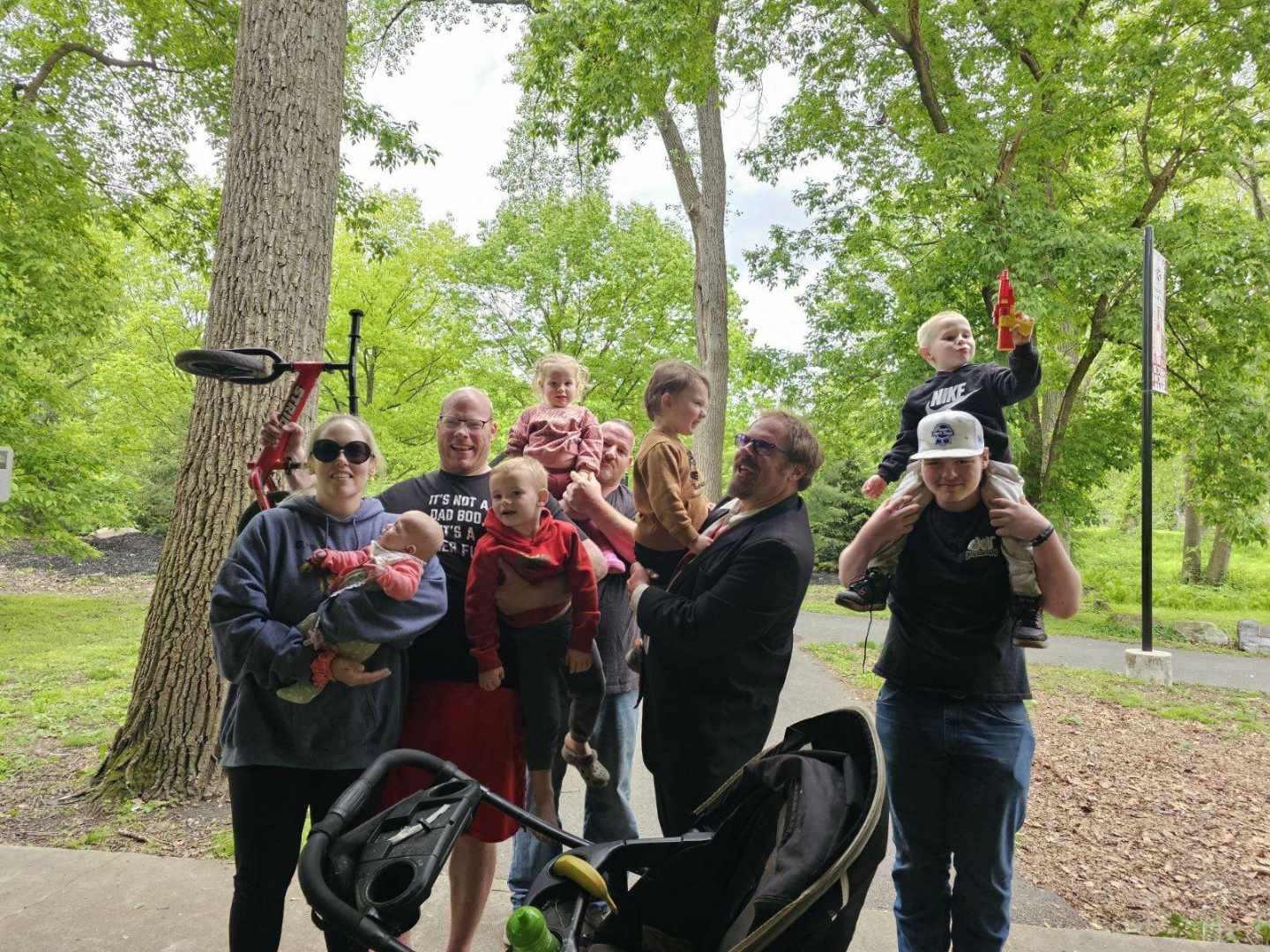
My sister and other two brothers were there, with their kids, and so we got the first photo of all of my dad's grandchildren together.

I saw a lot of people I hadn't seen in a long time at the party, some that I'd hiked with in the past, some that were just friends from the neighborhood, so it was really nice.
I got to see old friend Luke for the first time in years as well. We're facebook friends, but don't really see much else, and I'm also friends with his wife and finally got to meet her.

t was the first time I'd seen him since his sister had tragically died during the pandemic, found dead in a swamp under questionable circumstances, which seem to have been swept up and almost forgotten by all but those who cared about her.
It was a shocking and angering thing while all of that was going on, because had all of that craziness not been happening, she would probably be alive today. I'd been chatting online with her about coming on hikes, and was hoping to be a part of her improving her life.
It was nice to talk about how it felt and offer condolences in person, so at least there was that.
This was a great time for Ev as well, because my mom was there, and she took him to the playground for quite a while. He had a blast running around with her, and I was glad that she finally got to spend some quality time with him, because she doesn't get to see him too often. I really need to get him up to see my dad and stepmom Donna as well, because they're both really great with him.
Much of the group decided to go ahead and finish the hike as I had planned it, and I let them know how to go about doing so.

I waited around, and I forget who, but someone gave me a ride back up to my car while Ev played with my family. I was only gone a few minutes while I got it.
It had been a really fun day, except for the fact that the stroller left me stranded a bit. I can't say I'm surprised after the punishment it went through about two weeks prior.
Thankfully, I had spare wheels from other strollers that fit, and a couple more that Kirk had given me recently, so it was as simple a fix as just putting another wheel on the thing.
I was glad to have something close to have actually, and to be able to support a family thing as well as a hike. This was definitely the one to try to work out with this plan, and it ended up being a great time for all the right reasons.
No comments:
Post a Comment