
Hike #1604: 5/5/24 North Pemberton to Kelsonville with Jack Lowry, Sarah Jones, Violet Chen, Diane Reider, David Adams, Kirk Rohn, Jenny Tull, Dan Asnis, and Everen

This next hike would be a point to point in South Jersey, put together at the request of my old friend Jack Lowry. He and Sarah had just purchased their home down in the Pine Barrens somewhat recently, and we had already had one hike down there ending at their place.

I came up with several hikes that could be done ending at their house, and all of them are quite good looking really, for a change of pace in the Pine Barrens now and then!

When last we hiked down that way, the one we did was from the east, to cover some of the old Jersey Central line out of Whiting, then back through Brendan T Byrne State Forest.
This time, we would again use the state forest, but only from the other direction, as well as a lot of other stuff out of Pemberton area. A bit of it would be a repeating a little of what we'd done before, but most of it would be all new and quite interesting.
We met at Jack and Sarah's in Kelsonville where they'd had a party the night before.

From there, we would shuttle with as few cars as possible to our starting point in North Pemberton.

I came up with a route that would cover some of the old railroad beds of the area, then shift onto some other trails and back roads into the state forest, which comes out literally behind their house.
Even though I'd done some of the railroad bed stuff in this area before, there were a lot of side trails from it I'd never done, so I made the plan to include as much of that as I could.
Our starting point would be a small park, the Fort Dix Road ball courts. There was enough parking there, and it didn't look like we'd have trouble if it were after dark.

We started walking from here across Fort Dix Road, onto Sheldon Road to the east, through a neighborhood.

I was tired and forgetful in the morning on this one. I had to keep looking for stuff, and kept forgetting important bits.
We passed through the neighborhood, which turned ninety degrees to the north out to Pointville Road.
My plan in doing this was to get on a bit of the long abandoned Union Transportation line, which was an abandoned railroad, now a trail, but an obscure one that hardly anyone uses or knows about.
I had only found out about this odd one when we did our series to hike the entire Union Transportation, and it was on a weekday when hardly anyone could attend. I figured it was worth slapping back on this hike.


This was built as the Pemberton and Hightstown Railroad in 1868. It came under the control of the Pennsylvania Railroad, and Union Transportation was created to manage it in 1888.

Passenger service on the line continued until 1931, and it was scaled back over time. Highway construction severed a portion of it, and Fort Dix used it for a time, but was no longer needed after they discontinued the use of coal. Tracks were all removed by the early 80s.
I had done the section between Hightstown and New Egypt mostly twice. Once was before some was completed as trail, and the other was more recently, as a backup plan because it was raining too much for my scheduled planned hike.


I did a second section south from New Egypt that also incorporated the Kinkora Branch of the Pennsylvania Railroad, and the third one was from there to Pemberton, and heading east on former Pennsylvania Railroad.


After we turned right, the railroad used to cross almost immediately. To the left, we could kind of see the right of way, but to the right it is overtaken by a front yard.

However, if we walk directly across the front yard, the park gate is just beyond and the right of way is a mowed path behind other houses, complete with park signage.
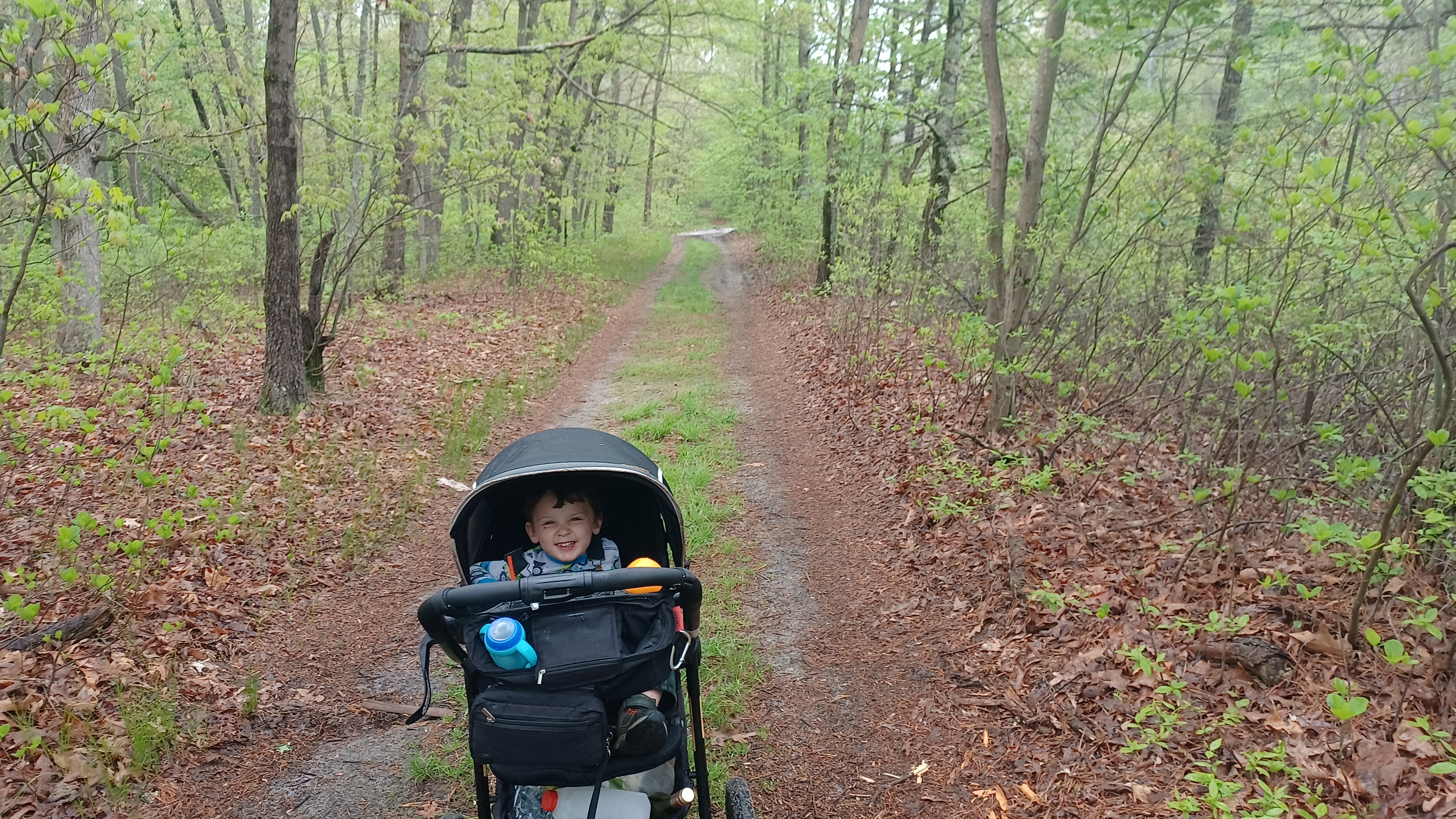
We headed onto this nice mowed right of way, and I let Ev out of the stroller to walk it on his own.
Everyone seemed to like this odd, hidden rail trail.
We continued on to the south, and it emerged at the east end of Wilbert Street to the south. The right of way becomes overgrown from there out to Fort Dix Road behind some more homes.


We followed Wilbert Street out to the road again, and then crossed over to where the trail begins again at the old Pemberton Station.

The current station building was built in 1892 to replace an earlier wooden structure.
The Pennsylvania Railroad had a spur connection to here from its Atlantic Division, which had another station in parallel South Pemberton. That line went from Camden east to Ocean Gate and across the bay up to Bay Head.
We had also done the entire Atlantic Division as a series in the past. I'd traced stuff from Bay Head south years ago, but we jumped on the main bit of it from Camden east to Ocean Gate and completed it in early 2020, just at the start of the pandemic craziness.
 |
| 1960s |

That line has been scaled back over the years, with tracks to the west side still in place nearer to Camden.

Today, a trail follows some of the Pennsylvania Railroad west toward Smithtown, but it is segmented. The entire thing should really be made into a trail from where it becomes abandoned at Mt Holly.
I had a ton of historic photos taken at this site and around the yard, some of them I believe stills from videos of the yard area. I started running around trying to get them, while Ev ran around on the wooden platform.
Passenger service continued to North Pemberton until 1969. After that, the station fell into some disrepair, as these things tend to go, and it was saved and treated as a gateway to the Pine Barrens for many years starting I think in 1999. It was open as a museum by Pemberton Township Historic Trust.

The Trust started accruing various transportation artifacts during their time there, and Pemberon Mayor David Patriarca was quoted as saying they were an “eyesore” and wanted them removed. The trust purchased an old Roebling diesel, after which Patriarca convinced the town council to cancel the lease on the property in 2012.

The Pemberton Township Historic Trust was ordered to remove all of its artifacts within a couple of months, which is a pretty much impossible task. The collection had to be donated where possible, and sadly some irreplaceable artifacts had to be scrapped.

Once I was finished taking all of the photos I had, we continued on our way down the trail, into the woods.

We got well out of sight of the station when I realized I'd forgotten the big container of chocolate milk I'd purchased for Ev. I didn't have any regular milk for him either, and it would be a bit before a store.
I decided that I would run as fast as I could back to the car to get it. The rest of the group could push his stroller for a bit.
I managed to get back quickly, and dashed across the Wawa parking lot and other lots. Then, I got in my car and moved it to a corner parking space in Wawa with hopes that no one would bother it (it was fine).

I got back on the trail and jogged, then power walked for a while. I actually managed to catch back up.

I was quite happy to be caught back up. We'd taken the trail out across the North Branch of the Rancocas Creek, and I brought up to the group my intent to do an entire Rancocas Creek series in the future, and this sort of fit in as a precursor to it.
We continued on ahead, and soon reached the former junction site with the main Atlantic Division right of way, which is also a trail to South Pemberton. We paused for a few moments to have some refreshments, and Dave offered up some honey orange tripel Belgian stuff that was pretty good.

I had some Dark Horse wine or something, which was on sale really cheap, and so I grabbed it.

We all turned back to the east after heading west for a bit, and continued pleasantly through the woods toward South Pemberton.
My intention was to turn to the right to do a bit of a loop trail that passes through the Beechwood Nature Preserve to the west of town. Unfortunately, I didn't see the turn to the right where we would have had to go.
It probably wouldn't have been so good for the stroller anyway, because if it were maintained I probably would have noticed it.

The one trail I did notice was one that went to the left from the rail be area, into an expanse of land where the North Branch of the Rancocas Creek curves. We followed that out and back for a bit. When the trail started to disappear, it was just a sort of clearing back there where buildings must have been at one time.

We just headed back the way we came and continued to the east.

The trail turned to the left, away from the railroad bed where it continues out to a property of a frozen food warehouse. Around this point, the trail from the right came in. It wasn't well maintained, which meant the other end of that loop was probably worse, so I was glad not to have followed it.
While parallel to the rail bed and closer to the creek, we passed a Beechwood Preserve sign.
Pretty soon, we approached the access to the property, and a large dam on the North Branch of the Rancocas Creek.

This was actually just one of two dams, each on the other side of an island in the stream. This was the narrower of the two dams, and the second one begins on the end of the island and goes for a longer distance at an angle.

The leaves were young and coming in strong, and the water looked dark but not really dirty. It was a really beautiful spot.

We made our way out to Fort Dix Road, where we had more good views of the creek, and across at Mill Creek Park. Ev saw the playground there and wanted to cross to it, but it was a bit out of the way so we waited a bit.
In a short distance, we came to where the railroad used to cross, which is just a gravel lot on the right hand side now, and Magnolia Road overtaking part of it on the left.
The rail line last saw traffic here around 1968 I believe. The former site of the South Pemberton Station appears now to just be a heap of brush straight ahead and on the left looking over.

I had a few more historic images I wanted to try to emulate for this one, so I hurried over to the former station site and started taking the shots. The group came over with me.

I think Sarah ran to the Burger King to use the restroom, just barely up the street, not knowing that we would be going up there anyway.
I checked with historic aerials and such to be sure I had the views of the former station site just about right, and then we all headed across Fort Dix Road again, and to the south a little to the Burger King for a bit of an early lunch.
Burger King is one of Ev's favorites. I take him there somewhat often, maybe once a week, because not only are the burgers better than the average, he can run amok in the place because hardly anyone goes inside.


This was no exception to that. He ran around the place like crazy. One of his favorite things to do is to take the yellow wet floor signs and move them around. He starts trying to block the door so other people can't get in. He also moves around chairs.


It was a good stop, and we continued on our way. Ev wasn't quite ready to get in the stroller yet, but we'd have to have him alongside a busy road so I didn't give him a choice.

We walked beside the Magnolia Road, which sort of follows on or along the former railroad bed. I think the main turn of it is just north of the grade, which has been expunged completely.
We soon reached Rt 530, the Pemberton Bypass, and had to follow along that for a bit. It seemed obvious that the railroad bed was along the north side of the road through this stretch.
We'd hiked along this before, but it seemed somewhat unfamiliar for me at this point.


My plan next was to cut to the south a bit, to get off of the main road for a bit and then cut through the Pemberton Lake area to the east.

This was a part of the hike I changed on the fly. I wasn't intending to use it because I really didn't know what was in there at the time of planning.
Then, on my drive to Jack and Sarah's, I had to pee really bad and I pulled into the parking lot for Pemberton Lake. In doing so, I saw that there was a very nice trail going either all the way or part way around the lake. This would be easy to add into the hike, so I looked it over and planned to do it.
In order to get there, we would have to cut over to the south, from the Bypass to Magnolia Road, which had cut over to the south side of 530. We should have just kept going on it.

I instead planned to cut over to a road that use to go through, Shady Lane. Unfortunately, it was way too shady. It had grown in completely and there was barely a path to connect.

I managed to get the stroller through with the help of the group, and then it was fine to walk beyond.
We continued down Shady Lane to Magnolia Road and turned left. There was a business on the right which I thought was strange, because it offered the option to pay utility bills inside. I didn't even realize that was something people used to be able to do back in the day, and that there are still some holdout businesses around that do it, like this one.
We didn't need anything so didn't go in this time. We continued down the road, and there was an old estate entrance with lion statue or something on top of old pedestals.

The entrance was still used it seems, but grown over completely with plants and brush. Any more into leaf season and it won't be visible at all. I'm not sure what the place was.

We continued down the road a little bit, and pretty soon came to the parking area for the Pemberton Lake.
I let Ev down out of the stroller and we started walking the trail along the near (west) side of the lake. At first, it had a wooden boardwalk to a waterfront access, and then became more natural surface.
There was a fishing or lookout pier, and then the trail around the lake was marked with yellow blazes and occasional carsonite posts.


There was a fence that went right out to the edge of the water, from a time I suppose when this was off limits.

It turns out most of the property is now the state owned Pemberton Lake Wildlife Management Area. The look of everything had me thinking that this must have been some sort of sand quarry operation.
It turns out I was wrong. This was once a cranberry bog operation. As we continued around the fence, there was a concrete foundation, and then a path that continued on, with lower land to the left of us which would have also been inundated with water at some point. Some of the water from the existing lake was coming up onto the trail as we made the next corner.

I was very interested in this yellow blazed trail. It wasn't on any of the maps around the area and not much came up on a google search.

It seems as though it is just a trail that goes around Pemberton Lake, but I wondered if maybe it was part of the High Point to Cape May Trail plan, which I was a part of some meetings on a few years back.
It turns out this is not really related to that, but it seemed like it did more than just go around the lake from what I could see, because of the way it turned as we found later.
We just followed the trail at first along the shore for a bit, until we came out close to the Pemberton Bypass again. My plan was to cut to the left a very short distance, and then cut over on a trail that came out to that road from the North Branch Preserve, which goes along the North Branch of the Rancocas Creek.

I had an idea of about where the trail was supposed to connect, so we went out to the road and turned to the left, to follow it just a little east.

I was seeing nothing. Ev still wanted to walk, which I didn't really want to have him do on the busy road, but the group stayed right with him the whole time so it was okay.
When I got beyond anywhere this trail could have been, we turned back the other way again. I watched as closely as I could, and did not see anything of a trail.
What we did see was the obvious former route of the Pennsylvania Railroad bed, really overgrown. Some of the group went in to follow that as we walked looking for this trail.

We never found the connection as it was shown on the maps, and I gave up on it. I didn't want ot be going a lot of extra distance. Instead, I decided we would head back onto the yellow blazed trail and continued along the shore of Pemberton Lake.

We got back to the same spot where we had turned out to the road and headed back into the woods.

We turned left on the yellow blazed trail as soon as we entered and, then walked along the lovely shore of the lake heading to the east.
The others got behind a bit, and I walked out into the pleasant looking water when there was a good spot.
We continued along the shore, and some of the trail got to be pretty badly flooded over.
I was able to push Ev's stroller pretty easily right through the puddles. I of course just walk through the things, but the rest of the group tried to go around which took a bit longer.

The trail meandered a bit, and by a sort of smaller side pond as we headed to the east.

None of it was really hard walking. It was actually quite nice, and there are apparently plans to try to make this an ADA accessible trail for people with disabilities.
The trail emerged into a large sandy open area. I waited there for the others to catch up.
Once everyone was together, we came out to a large parking area off of Coleman Bridge Road.
I would have thought the trail would have followed the unpaved road to the right if it were in fact the one that goes all the way around the lake, but it turned to the left.

I was rather confused by this and kind of wanted to keep following it to see where it went. I still don't know quite where this thing goes.

We followed it for a little bit, north on Coleman Bridge Road.
We weaved around a corner, and came somewhat close to the Pemberton Bypass once again, where the road turnd to the left. I think the trail continued on the road or turned left, I can't quite remember.
At this point we crossed the old Pennsylvania Railroad grade. I'd done this before, when we did that line as a series, but of course we were without a stroller that time. I forgot what it might be like.

We stayed on the road for a bit, where the railroad bed was off just to the right of it.

I don't know what I was thinking, but we soon cut onto the railroad bed, which was good and clear enough to walk, but it was somewhat rough for the stroller.
I had to weave back and forth over some of the fallen trees, and we were somewhat close to private properties to the right.
It also started raining just a bit in this stretch, but the showers didn't last all that long.
This wasn't a very long stretch anyway, because soon we came out to a private driveway. There was access to Coleman Bridge Road out to the left, but the railroad bed was a clear dirt road ahead. Also at this point, a power line joins the right of way.

The power line pretty much follows the right of way all the way from this point east to Toms River.

It was a pretty nice route along here for a bit. The clearing from the power line was off to the right, and we were on the rail bed down below it to the left.
After a bit of time, the right of way started getting a bit more beat up. There were some fallen trees and such, and Dave was helping me to get through it.
Eventually, it got to the point where the actual right of way was not as good for walking, and we had to bushwhack just a little bit uphill to the right to reach the clearing on the power line.

The right of way joined with the power line clearing and became its access road, and it was pleasant again.

We had a nice amount of shade along the right of way despite it being on the power line, because much of it hugged the south side, and the sun was behind that.
Much of the time, the power line section bore no resemblance really to a railroad bed. The south Jersey lands are already pretty flat anyway.
The first real indication was the crossing of a tributary that leads to the North Branch of the Rancocas Creek. A concrete former rail bridge was still in place here, and I recall there was another one over a second tributary ahead.
There was some small fenced in building on the left as we walked, but that was no problem. I did get a little nervous when we saw a car moving up the right of way toward us for a while.

I thought for a moment to get off of the grade and hide in the weeds, but then it turned off to the left. It turns out someone uses the right of way as part of their driveway, and they were going to a nearby house.
We continued past the driveway easily, and with nice wetland views, and then finally came to the bridge over the Greenwood Branch, another tributary of the Rancocas River.
After crossing this, we began to enter the community of New Lisbon, which was once a station stop on the old railroad.

The railroad bed went into some private land and yards to the right, and we walked the immediately parallel Meadowview Lane.

Pretty soon, we reached 4 Mile Road, where the tracks used to cross over.
The station was just across the street and to the right of where we emerged. There's some sort of foundation there in the weeds now. There was also a tower at this site, I think an interlocking.
I really don't know much about this little settlement. It's very old, and when the railroad came through, it grew to bigger than it is now. At one point it was known as just Lisbon, as that is what is shown on the old maps of the area, and at some point was made "New Lisbon".

I suppose this might have had something to do with the post office like so many of these things do. If another town already claimed the name, they'd have to change or alter it.

I had a couple of photos of the station at this location, so I asked everyone to give me a few moments while I tried to get modern shots of the same images. There was one of the tower, and a couple of the station, but I don't think I got them quite right.
There was also once a junction in New Lisbon. When I initially was reading into all of this, I thougth it was just a spur to some sort of industry, and didn't think too much on it at the time. I had totally forgotten some of the stuff I'd done on previous hikes.

This was the eastern terminus of the Kinkora Branch of the Pennsylvania Railroad. I can't believe I didn't realize it.

The Kinkora Branch started out as the Columbus, Kinkora, and Springfield Railroad in 1838, one of the first inland connections from the Camden and Amboy Railroad serving south Jersey agriculture and business. It continued as a branch of the Pennsylvania Railroad and made connection with the Union Transportation out of Fort Dix, making it for a time a critical connection.
The southernmost section was abandoned early on, but the northern bit remained in place until November 1972.
We had hiked the bits north from the Union Transportation as close as we could all the way to the former junction with the Camden and Amboy, but I'd never tried to do anything to the south. Maybe in the future I might have to try to cover this last bit.
The USGS maps show the branch still in place to the connection with the Atlantic Division at New Lisbon back in 1918, but shows it gone by 1942.

The right of way was totally overgrown from beyond the station site, but fortunately, Mt Misery Road closely paralleled the grade from this point.
It was pretty easy walking from here. When we had done this as part of the series on the Pennsylvania Railroad back in I think late 2019 at this point, we were able to get over to and stay on the railroad bed in a short distance.
As we walked by, there was a large section of the grade trenched out so a stream could pass through, so there would be no way of getting across if we were to do it again now. It'd have to be a road walk.
We didn't have to worry about that this much on this trip, because my plan would soon divert us from the railroad bed anyway.
We continued walking Mt Misery Road to the east, and didn't parallel the rail grade even as far as the old Browns Mills Station site before we turned to the right onto Greenwood Bridge Road.


This was a splendid road to walk. At the start, it didn't even look like something we were allowed to be walking. It just looked like a private farm road.

The road was unpaved, and had high wire fences around both sides of it to protect the crops.
I was way ahead of everyone else in the group, and so I started walking very slowly so they could see where I had turned onto this back road.
We passed several buildings and a couple of homes, and then entered rather deep woods.
This was the start of Brendan T. Byrne State Forest, which until somewhat recently was known as Lebanon State Forest.


The forest is over 36,000 acres and was previously home to Lebanon Glass Works from 1851 to 1867.

The original name of the forest was for the glass works, but it was renamed for former Governor Brendan T Byrne because he was the one that championed the Pinelands Legislation that curbed much of the development through the region.
Ev was starting to get pretty tired and dozed off in the stroller while walking down this section of road.
Pretty soon, I was still ahead of the group, and I reached the Greenwood Bridge.
This pleasant wooden bridge over the Greenwood Branch was at a very inviting looking spot. I walked across the structure and down to the tributary of the Rancocas Creek and waded in to just above my knees.

The others soon showed up, and we took a little break at this very pleasant little spot.

We had some of my Bird Dog drink I'd brought with us, which was quite good, and we had a laugh about how the chocolate whiskey looked almost identical to the colors of the tannin-stained waters of the Greenwood Branch.
We have our funny back story about how the honey whiskey, which looked like piss when we first found it, was in fact not piss, and somehow this particular drink, at this time, gained the nickname "not shit".
Jenny corrected us rather quickly that we have a child with us that is now learning to repeat just about everything we say, and that we should use poop or crap or something as not to teach him curse words.
The road switched from being a sort of gravel surface to simply sand, and we continued walking to the southeast.
After only a short distance, we came to the intersection with Lower Mill Road on the left. We turned here.
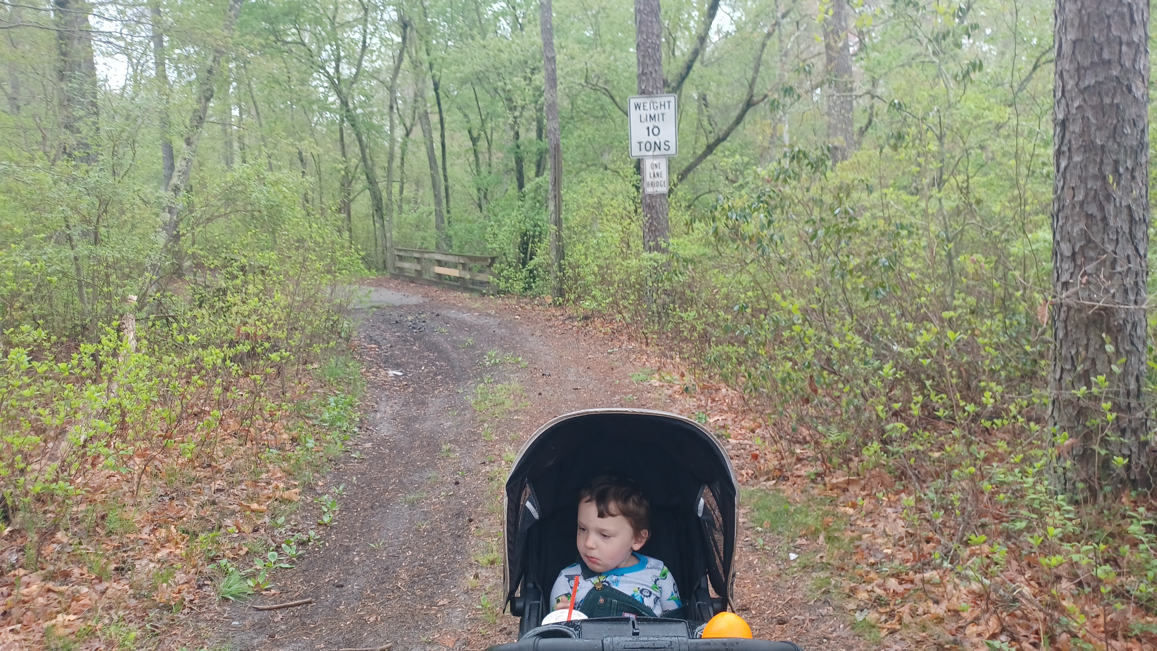
This is shown as just a simple sand road off into the woods, but roads like this made up the bulk of what I had planned for the remainder of the hike. Not many of them are considered official trails in the state forest, but they provide good access for otherwise very remote places.

I was quite surprised on this tiny road, which is certainly not fit for anything but the hardiest four wheel drive, had a weight limit 10 tons sign and "one lane bridge" posted on it.

I was a little worried that some of these roads might be a mess to go through, so this was a bit of a gamble, but it turned out to be great.
The bridge took us across what was called Bispham's Mill Creek, another tributary of the Greenwood Branch.
We continued gradually uphill a little, and then continued gradually to a height of land.
We made our way through these woods, and the sand wasn't terrible like it would be walking on a beach.

Everything was overall hard packed from the amount of ATV use on these old roads. The area had served something called the Lower Mill, as well as the nearby bog iron furnace.

The Mary Ann Furnace supposedly went into service around 1790, and by 1877 it was on maps noted as "no longer in service".
Undoubtedly, some of these old roads we were walking had once been used to access the furnace lands.
In later years, where that had been went into use as another cranberry bog operation.
After a bit, we came to a fork in the road. Lower Mill Road continued to the right, while a road that maps simply referred to as "east" continued straight, to the east.

We continued on this road, which also was quite easily. Occasionally, there was a down tree that someone would help me get over, but overall it was great and relaxing.

At some point, we came to another fork in the road, and I didn't recognize where it was going, and we ended up going to the right. I think maybe I thought the other one went to the north.
Either way, we took the south of the two roads that were both labeled "east". This brought us south a bit, and instead of following the road that followed the Gum Spring to the east, we instead headed toward the development.
We reached another much wider road, and I was at this point not completely certain what we might run into. I knew that the wider road was going to take us out to the Presidential Lakes Estates.

We got going on this road, but the sand was much more agitated along it. It was much harder to push the stroller, and I started to struggle a bit.

Thankfully, John stepped in and offered to push the stroller for a bit, at the roughest part. He knows from having his kids how hard it can be to get through such things, but I think this sand was a bit harder than average.
After I'd been given a good chance to catch up and have some swigs of a drink, I took over pushing again.
At some point, the sand roads leave the state forest and go into private lands, or community lands or something, associated with the Presidential Lakes Estates.
It started raining a bit again in this stretch, but not terribly.

Soon, we reached a huge open clearing of sand. I'm really not sure what this used to be. Some sort of sand quarry, or maybe borrow pits or something for grading the development.
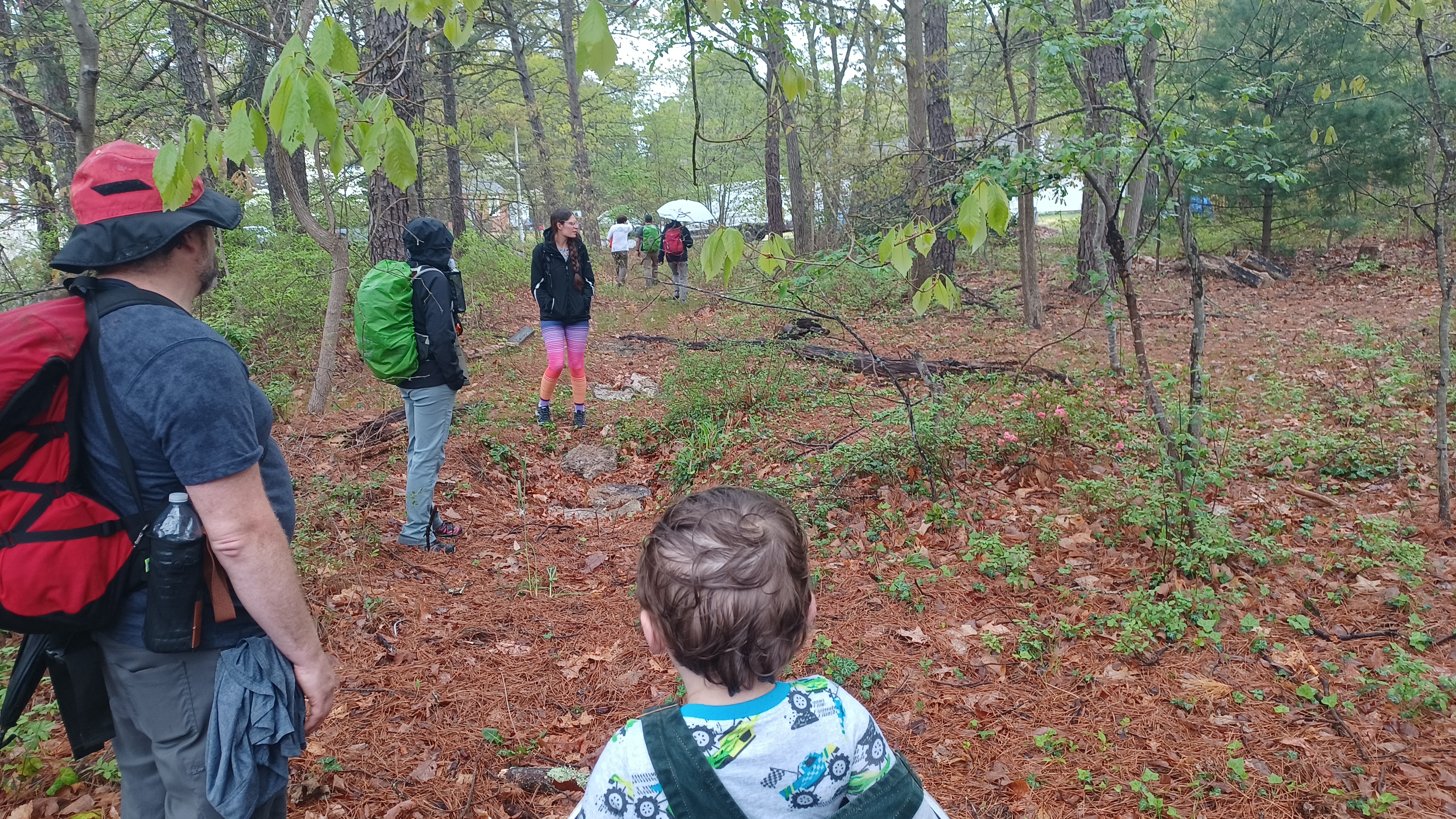
Dan had fallen behind us in this area, and we took a break in the middle of the place where he actually came up on us pretty quickly. He's been improving since joining us again more often.
It was an interesting little spot. We continued south through this, and then into the tree line along that side. Another sort of path continued just inside the woods, and we followed it west.

There were nice views of the sandy expanse here. The path at the tree line eventually came out to the main access road to this area, an extension of Washington Blvd out of the development.

We turned left when we got to that road, and soon came out to the pavement within the development.
My initial plan was that we would not come out to the development at all. We'd have remained in the woods and along ponds along the north side of it.
We passed a couple of houses, and then came to the intersection with Wisconsin Trail, a development road lined with homes heading to the northeast.
This development, by design, was all named after states. It seems that this must have been halted somewhere along the way. I want to guess because of Pinelands Legislation, but the houses seem a little before that.

Only 22 of the state names were used in the development, and two more roads were put in but never developed to the north side, for a total of 24 state names.

We continued on Wisconsin Trail past lots of houses and out to the end. There, the dirt and incomplete Arizona Trail went to the right out to New York Road.
We re-grouped here once again, and then headed onto the unpaved continuation of New York Road into the woods to the intersection with Arkansas Trail, the other incomplete development road.
There were a few ponds on the north side of the development that looked like former cranberry bogs. They were probably to be considered as a centerpiece to the development they never finished.

The segmented pond sections were named Monroe Lake, Adams Lake, Grant Lake, and Manson Lake. I'm not sure where they got the name Manson from, not being one of the president names.

All of these lakes on the north side of the development are fed by the Gum Spring.
My original intent was to have walked up on this development on Arkansas Trail, which segues from one of the simple roads labeled "east". Oh well, we can do that another time.
We continue to the east on Arkansas Trail for a bit, then had to cut over in the area of the unfinished Connecticut Trail, to get south to the Arizona Trail, which would lead directly into Kelsonville.

I was thinking this would be a great, clear shot, but it ended up being probably the toughest part of the entire hike.

Dave or Kirk stuck close to me in this section and helped get over all of the fallen trees on this stretch of unfinished road.
It became evident as we passed through that these were not just fallen trees. Someone had dropped them intentionally to keep anyone from accessing them and their adjacent properties.
We continued to push through, and eventually came out in a yard just off of Kelsonville Road, one of Jack's neighbors. Apparently, he talked to the neighbors who were all pretty cool about accessing and coming through at this point.

We turned left on Kelsonville Road just very briefly, and then came to a worn but covered over path.
Jack explained that this was part of that Arizona Trail that used to go through before his development was built, and now its his property that leads right to his house from behind.
We simply followed this path right to their place to complete the hike.
It had been a really great day, and there are still so many other different routes we can take to finish at this location. It's really far and sort of in the middle of nowhere, but when it comes to trails and hikes, it is actually a pretty good place to be overall!
 |
I've already got, based on this and the previous hike to this location, several other hikes that are almost entirely different ending at the same location!
No comments:
Post a Comment