

Hike #1638: 12/21/24 Manhattan/Astoria Loop with Evan "Joe Millionaire" Van Rossum, Alyssa Lidman, Stephen Argentina, ?, Gadi ?, Violet Chen, Jeff ?, Cindy Wolkin, Dan Asnis, Jenny Tull, Theresa I, Cory Salveson, Linda Salveson, Damien ?, Mike Selender, Steve Sanbeg, Jack Lowry, Sarah Jones, Ann M, Pete Fleszar, Pete's daughter, Diane Reider, Serious Sean Dougherty, Justin Gurbisz, Jim "Mr. Buckett" Mathews, Eric Pace, "Major Tom" Conroy, Carolyn Gockel Gordon, Tom Vorrius, and Alex Gisser
This would certainly be no exception, and I should have learned some lessons about it from last year, but oh well. Overall, it was still a really great trip.
Although I'd decided not to do more of these hikes meeting at New York Penn Station again and again, I did decide to do that again this time.
I figured it was easy to do the route I wanted to do and include some other cool stuff. I was glad we did what we did, and it allowed for at least Cory and I to do a full 25 mile day.

There are always these different things I want to do on these, and so this time my big priority was to do the Triborough Bridge. It is one of those bridges I had never walked before, and there was a bunch of stuff in between there I had also never walked before.

It was one of the coldest days we'd had in a very long time for the holiday hike. In the past, some of them were downright warm, but this time we had a lot of people cutting out just because they didn't like the temperature.
I really didn't find it to be that terrible, but I suppose I'm a bit crazier than most.
Initially, I was just going to take my van to a train station and offer to shuttle whoever wanted to go with me. But then, Joe Millionaire offered to put me in his car with he and Alyssa to get to the Short Hills Station and we would go from there.

The morning of the hike, I got up extra early and walked from my house to Joe Millionaire's. He made me an excellent ham, egg, and cheese sandwich with other stuff on it as well. A great way to start the day.
.jpg)
We hung out there for a few minutes until the Uber driver arrived. It was a nice middle-aged lady who had grown up in Astoria, so she was surprised to hear that we were not only going hiking, but that we were going to her old neighborhood.
I recall the roads were a little sloppy in the morning. It had been rain and sleet and maybe a little snow prior to heading out, and so we were glad to have a ride rather than deal with anything else.
Everything was quite smooth until we got on Interstate 78 heading east. Fortunately, we were double navigating along with the driver, and approached a major backup on the highway. We managed to get off of the exit right in time in the Watchung Reservation area, and then took a roundabout route to get to the Short Hills Station. We almost shifted to Summit or Millburn, but our timing was still going quite well.
We got to Short Hills, and I rushed over to the platform and bought tickets for all three of us rather than take the time.
Diane made it there as well, and it was quite lucky because she didn't usually use a car GPS, and she has no smart phone. Mr. Buckett, Eric, and Major Tom had planned to meet us there, but ended up going to another nearby station because of the same backup.
 |
| NY Public Library Collection |

We waited for just a short bit for the train to arrive, and pretty soon we were on our way to the city.

This was the first time I didn't have my son Ev with me on a hike since the Spruce Run Perimeter thing I'd done in November, which doesn't seem like long, but it's very weird doing a hike without him now.
There is definitely the feeling that something is horribly wrong when he is not there, and I just feel more inclined to push harder and harder.
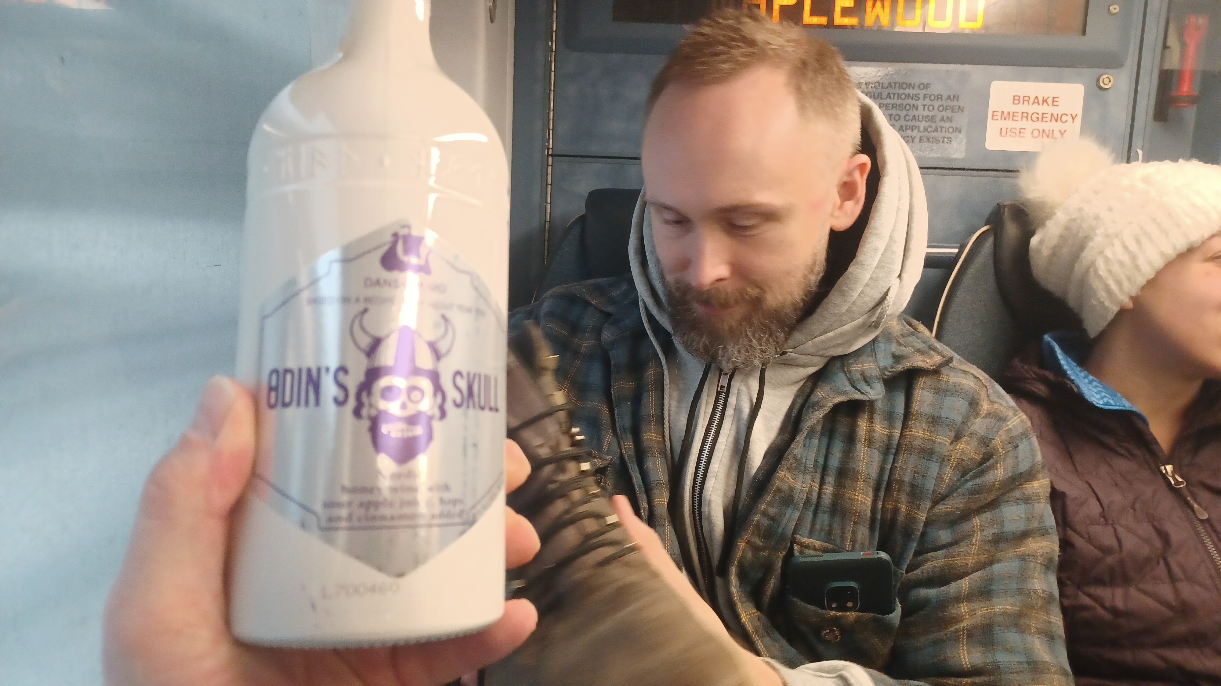
As such, while we were on the train, I began getting out the good drinks to get the mood lightened up.
I brought an arsenal of drinks with me, a pretty full backpack. I am also used to pushing the stroller, which I can keep everything in, so I rarely have a backpack. I feel that I will likely keep that going even as Ev gets bigger, not only to have a backup for him, but potentially for long trips that might be on old rail beds.
It was a comfortable ride as I broke out two different kinds of coffee stouts, one with Tiramisu flavor, and the other with Creme de something.
Joe Millionaire also had some sort of thing that we got going with on the way over as well.

Soon, we were at New York Penn Station. We hurried out of the train and up the steps to the mall area above Penn Station.

Another level of confusion on this one was that there is another Penn Station area that didn't used to exist apparently last year, the Moynihan Train Hall.
Some of the group ended up at this Moynihan place, and so we ended up having to wait for them to find their way over.
I was getting some phone calls not only from members of our regular group, but also from several newcomers that had signed up for this hike. That always gets me a little concerned, especially for hikes that are as wild and crazy as the Holiday NY one. It's not really a great gauge for what to expect from all of our hikes.
I can't even remember who exactly it was that showed up in the group. I should really get back to doing a sign in sheet at the start of these things, because if we keep getting newcomers, I will not be ready to keep track.
There were lots of bathroom breaks and such, and Jack already started with singing and playing the Christmas carols on his carbon fiber guitar, wearing his santa suit, while in the station. No one really seemed pissed that we hadn't started, as they were having fun socializing.

Other people also got caught up in the traffic and missed the first trains, then drove to closer stations, so we had to make do with that as well.

This ended up being one of the smaller holiday hikes either way, in terms of group size.
Too bad too, because there was a lot of stuff incorporated into this hike that people come to expect on holiday hikes just because of some past traditions.
Several people get upset that I don't include the same places every year: Macy's displays, Rockefeller Center, the High Line, and more. The first two of those would be part of the hike this time.
I had a tough time getting in the holiday spirit right from the start. The hike was a rare Saturday one instead of Sunday. I often do the holiday hike on Saturdays either way, just to have a recovery day before work the next day, but this time was not for that reason.
This time, Ev's mother had her family Christmas gathering on Saturday, and she told me to make sure I plan my holiday hike for that Saturday specifically. I was not welcome to be there (because of her, not because of her family).

We headed out of Penn Station, and the way we were initially going to go was blocked off for some sort of construction, so we had to go around another way. We did walk right by the Macy's displays, on the opposite side of the street, but I didn't bother to slow down or take any photos of it this time.

We headed up 5th Avenue for a bit, which can be hard to hold such a large group together in the streets.
We stopped when we got to the New York Public Library, crossed to the left side of the road, and approached the area in front of it so I could go over some history here.
The library was built on the foundation of the old Croton Reservoir, at the corner of 5th Avenue and 42nd Street, Manhattan.

In the early 1800s, there began a problem with water borne pathogens in Manhattan. Prior to artificial waterways and pipes, the main supply of fresh drinking water in the city was a pond at the south side that was referred to as “The Collect Pond”.

Jonathan B. Jervis, the same man who designed the Delaware and Hudson Canal, set up the Old Croton Aqueduct to bring water from the Croton River up in Westchester County, dropping one foot per mile, to Manhattan.
The first collecting reservoir in the city is now the square area in Central Park known as The Great Lawn. That one was replaced by the New Croton Reservoir, which was later renamed Onassis Reservoir. From there, pipes carried water to the library location.

The Egyptian style reservoir was also used as a sort of park, because a walkway promenade was put in top of it. It opened in 1842, and a song called “The Croton Ode” was joyfully played to celebrate the first clean drinking water “piped” to New York City.

By 1870, it was obvious that the original aqueduct could not keep up with the demand of the ever-growing city, and so it was replaced by the New Croton Aqueduct soon after. The original reservoir was abandoned by the early 1900s, and the site was eyed for the new library. It was completed and dedicated in May of 1911.
The two famous lion sculptures at the New York Public Library in Manhattan are named Patience and Fortitude. I always liked them because they were prominently shown in the original Ghostbusters movie, so I brought that up as well. The first scene in that movie took place in the library.

Mike S was calling me around this time. He had missed a train or something and was trying to catch up with us. He knows the city pretty well, but we kept changing trajectory a bit.

We decided to try to connect up by Rockefeller Center. I didn't think we'd do great getting close to it, but it wasn't too terribly busy in the city, so I figured we would walk near it.
It turned out to be a great idea, because when we got there, it was not at all too crowded to get up to see the famous tree, maybe the most famous Christmas tree in America.
The tree at Rockefeller Center, in this plaza, with all of its other approaching decorations, has been a New York City tradition since 1931.

Near this spot, we saw the famous bronze statue of Atlas, the Titan who held up the Heavens from Greek Mythology, in front of Rockefeller Center in Manhattan.

The statue was erected in 1937, by sculpture Lee Lawrie, with help from Rene Paul Chambellan.
We waited for a moment for everyone to catch up from checking out the tree and statue, and then we crossed 5th Avenue to the St. Patrick's Cathedral.
St Patrick's Cathedral of Midtown Manhattan is one of the most recognizable churches in the world.
Work began in 1858 to serve NYC's growing Catholic population, but was stalled in 1860 during the Civil War.

The building was completed in 1878 and dedicated in 1879. The iconic spires were added in 1888.

The iconic James Renwick designed Catholic cathedral is the largest such structure in North America. It is also the seat of the Archbishop of New York.
Additionally, I brought up that the Stay Puft Marshmallow Man stepped on this church in the first Ghostbusters movie.
At this point, I had been regularly drinking my fun drinks, and I had to pee really badly. I decided to run into St. Patricks to see if I could use the restroom, but there were lines like crazy. I would have to hold it.

It was stunningly beautiful inside this church. I don't think I'd ever peaked inside before, but I was glad I saw it at least once.

We headed out and continued to head eastbound on 51st Street. I saw that there was a pedestrian bridge out to the waterfront at the end of it, and it was one that I believe I have never been out to yet, so it was a good spot to reach.
Along the way, I saw a parking garage and tried to run in, hoping to find a restroom inside. There was nothing. Unfortunately there were guards in there as well, so there was no sneaking in to take a pee either. This was getting to be the most emergency urination issue I've ever had, and I wasn't sure if I was going to make it at all!

Along the way, we passed yet another handsome and interesting church on the right.

This was St. Bartholomew's Church of Manhattan, historic Episcopal parish built 1917-18 in Byzantine Revival style by Bertram Goodhue. The portal to the predecessor church from Madison Avenue was incorporated into the design, which I find pretty interesting.
Just before reaching the 51st Avenue Pedestrian Bridge, we passed though an area known as Beekman Hill. This was a very historic neighborhood that used to be all the workers from the East River ports. It was all separated from it when the highway went in below.

There used to be an old manor house in the area, and I'm not sure what else, but I noted that the newer apartment buildings along the edge of the city here had handsome masonry bases, but newer brick tops. It looks as though some of the earlier buildings were just added to on top for more room.

Before anyone could have a chance to catch up, I ran to the pedestrian bridge and then down from it on steps to the right. There was a corner on the steps where I could just face away and relieve myself, and I couldn't wait any more.
I relieved myself, and we let some of the other guys come over and use the same spot while we watched out for them.
I am not sure what the ladies did at this point. There may have been some better spots to hide, but I'm not sure. The lower path led down to a nice little waterfront park area.

We headed up and crossed the pedestrian bridge over the FDR Drive, which had some great views near the end of it.

The walkway unfortunately did not go through. I figured it might not be a full route, but it has not been connected yet.
We had a good view here across to Roosevelt Island, which had been the subject of one of these hikes fo us back in 2015.
The Native Americans called the island Minnehanonck, and after that, Varkens Eyelandt by the Dutch New Netherlanders. In the late 1600s, it was briefly Mannings Island, and Blackwells Island came in during later colonial days, but the name was changed again to Welfare Island from 1921 to 1971 when it was mostly hospitals.

From 1832 until 1935, the island was like New York City’s own version of Alcatraz, home to a penitentiary. An insane asylum followed, as well as other hospital buildings. The island was home to a Smallpox quarantine hospital as well.

Most of the hospital buildings were abandoned by the 1950s, and some were demolished by 2014.
Franklin D. Roosevelt Four Freedoms Park opened to public in 2012 on the south side.
Freedom of Speech, freedom to worship, freedom from want, and freedom from fear.
Once we got across the bridge and took in the views, we walked to the north just a bit, and some of the group went ahead to see if there was going to be a way through. Unfortunately, this section had not been connected to the newer East River Esplanade yet, although we could see it ahead.

We would have to backtrack a bit and head through a few blocks to get to the new esplanade section, which extends like a bridge, separated from the streets, out onto the water.

We headed back up across the pedestrian bridge and to 51st Street on Beekman Hill. We headed back to 1st Avenue, and went two blocks to 53rd Street where we turned right.
We followed this out to Sutton Place South, where we got on a path that led to the north a bit, and then to the East Midtown Greenway, onto the aforementioned esplanade.
This was a beautiful walkway. We headed out underneath the Queensboro Bridge with great views, and then into Andrew Haswell Green Park. There we turned to the left up a series of steps, and then to a sort of pavilion thing with a red curving steel overhead section that looked like it was an out of service rollercoaster (but wasn't).

We headed out to 60th Street, and then paralleled the edge of the bridge west beyond 1st Avenue again to make our way on the pedestrian lane up to the walkway over the bridge.

The Ed Koch Queensboro Bridge (named for Ed Koch, former Mayor, in 2011) is a cantilever bridge opened in 1909 between Long Island City and Manhattan between 59th and 60th Streets, so it’s also known as the 59th Street Bridge.
The bridge held the record for largest cantilever bridge in North American until it was surpassed by one in Quebec in 1917.
When it was constructed, it was known as “Blackwell’s Island Bridge”, for the earlier name of Roosevelt Island. The bridge crosses in the middle.

There were once elevators going down to the island, and one that carried vehicles that wasn’t demolished until 1970.

The bridge is excellent for walking and viewing the East River, and I had done it before on a past hike.
Like that last time, Jack and I sang Simon and Garfunkle's "59th Street Bridge Song (Feelin' Groovy)" as we walked.
It was cold when we started the hike, but the temperature was going down pretty fast. Normally, I'd wear a suit and tie on these hikes, but this time I actually wore a heavier coat knowing it would be cold.

The wind was so rough going over the bridge that it was nearly unbearable.

Before we even got to the walkways, Linda and Damien cut out and went back. She wasn't happy about doing it, and that Cory got to keep doing the hike, but it was only fair because the last time he had to cut out early with Damien while Linda and her sister continued with the hike.
Heading up onto the bridge was a bit treacherous at times for a large group. Not only was it cold and windy, there had been no effort to clean any of the snow or ice off of the structure. As such, there was no visibility for the lanes going across. There is a bike lane as well as pedestrian lanes, but the people were riding bikes across in the pedestrian lanes.

Dan Asnis was getting pretty annoyed with the people about it and made a couple of comments as they went by.

By the time we got to the middle of the bridge, I started feeling like I had to pee again. This was rather frustrating, because there was hardly anywhere to go.
Just then, near the very middle of the bridge and over the guard rail into the center, there was a porta-john! It was in fact unlocked and Sarah went to use it first. When she was done, I also went up to use it.
It was really weird to be way up on this enormous bridge, in a porta-john. With cars rushing by close by.

In other ways, this was a reprieve from the crazy wind we hit on the bridge. Sarah was wearing a bunny suit without enough layers, so she was pretty cold.

The elevated rail line came into view after got across Roosevelt Island and onto the Queens side of the bridge. We also had views of the cable car between the island and Manhattan, which we rode on a previous trip.
We got down off of the bridge in Queens, and a lot of the group disappeared to get a bite and to use a restroom. There was an open restroom out along the waterfront at Queensbridge Park, but they didn't know that.
Pete and his daughter had to cut out early at this point, but I asked them if they would be able to continue just a little farther to Queensbridge Park to get in the group shot. They agreed.

We followed the nice walkway parallel with the bridge heading west, and directly into the park to the restroom where we took a long break. We had to wait for the others to catch up as well anyway.

I got a nice group shot, but then several more members of the group decided they were going to bag it as well. Major Tom, Mr. Buckett, and Eric were all out along with the Fleszars, and I think a couple of others also backed out here.
Before Pete left, he handed me a special beer gift. He had picked up a Troegs brewery thing called the Tripel Nator, which is a stronger version of their signature Troegenator beer, barrel aged.
This was right up my alley, and I was sad he wasn't going to be around to share it with me.

We followed the waterfront for as far as we could in Queensbridge Park, then cut inland a bit to Vernon Blvd and continued north.

At 36th Ave, we passed the entrance to the Roosevelt Island Bridge, which we had walked across on a previous hike.
Originally called the Welfare Island Bridge, the Roosevelt Island bridge opened to traffic in 1955 over the east channel of the East River. The vertical lift bridge provides ships with one hundred feet of passage.
We continued north on Vernon Blvd, and soon reached the Vodonia Towers, where a somewhat new walkway extends out to the East River waterfront, so we followed it to see if there was any option to continue.

There was a great view of the Roosevelt Island Bridge from the end of the walkway, but it does not yet continue through. It was obvious that there are future plans to connect these walkways through however.

Our next bit of greenway was supposed to be Rainey Park on the waterfront, but as we approached, there were tall chain link fences, and it was all blocked off for some kind of work. We had to remain on the road parallel with the park.
At 33rd Street, we were able to walk to the left parallel with Rainey Park, and the waterfront walkway remained open from the end of that.
I popped open my beer from Pete, and it was excellent. My favorite thing I've ever had from Troegs by far.

The trail followed the waterfront directly behind the Costco store. I didn't have my membership car, which is expired, but I've used it to get my in anyway.

We continued on along the waterfront when the building ended and we were parallel with the parking lots.
After a couple of turns, we ended up at a little cover where Sunswick Creek flows into the Sunswick Creek.
The trail followed the end of this parking lot all the way out to Vernon Blvd again where we turned hard left, but only briefly. We then turned left again, into the Socrates Sculpture Park.

I had been hearing how cool this little art park was, and so it was cool to go in and have a look around.

I made my way in the front of the group, and a couple of guys working there greeted me warmly.
I moved on pretty quickly, and there was a porta-john we could make use of again.
As the rest of the group came through, Jack and Sarah were coming through singing. The two guys working the place told him he had to stop, because it was against the rules to have music in the park.
It was kind of dumb because clearly, this was an art park, and their rules seemed like they were clearly pertaining to amplified music. They didn't back off though, and Sarah kept singing in front of them.

I think the one guy was on his high horse really enjoying having authority over someone. When I could see there was a conflict going on, we just moved on closer to the waterfront.

We got to the East River edge of the park, and there were good views across again, to the north tip of Roosevelt Island among other things.
Here, there is a very nice looking stone light house, the Blackwell Island Light, which has other names to reflect the island’s previous names. It’s made of cut gneiss and ashlar, and was constructed in 1872 by prison labor.
There are some interesting local legends associated with the construction of the light.
The light was one of many improvements to the island made after the city purchased it in 1828. Two names are associated with the construction of the light house, John McCarthy and Thomas Maxey. An inscription reading “This is the work Was done by John McCarthy Who built the Light House from the bottom to the Top All ye who do pass by may Pray for his soul when he dies” was once reportedly on a stone.
An 1870 warden report claims that an inmate had constructed some sort of fortification on the north side of the island to fend off against British attacks that he feared, and a contractor was offered a fake sum of money to demolish the fort and construct the light house. Other accounts claim the inmate built the light house. Whatever the case, the lovely structure stands in good shape, having been restored completely in 1998 thanks to an anonymous donor.

We continued to the north side of the park, then cut back inland a bit again. Fortunately, there was another exit from this park out to Vernon Blvd again.

We turned left, and then passed by a little cove with one little piece of natural beach, probably one of the only remaining bits of natural beach remaining in Queens. It is known as Hallet's Beach.
I jumped down and got a couple of photos from the spot. I also just wanted to experience feeling the sand rather than pavement.
We started making our way up the road to the north. This took us right along Hallett's Cove with lots of views across to Roosevelt Island.

There were some nice older buildings to the right as we were walking, but I really paid them no mind until I saw them more from a distance.

We made our way to the Hallett's Cove Playground area, where a walkway went to the left, to the west along the north side of Hallett's Cove, away from the road.
This entire stretch of walkways passed along the south side of a development known as the Astoria Houses. There was a ferry landing on this stretch, and when we got far enough out, there were good views across the bay area.
It was here I took notice of the old Sohmer and Company Piano Factory.

The Rundbogenstil/Romanesque Revival style brick building with classic clock tower was built in 1886, and expanded upon in its L shape in 1906-1907.

This is a fine example of creative reuse with residential and business that started in 2007, and underscores the fact that these strong historic structures are worth saving.
We made our way out to where the walkway shifted from west to north again.
From here, we had more great views across to Manhattan, back down to Roosevelt Island, and north on the East River and Harlem River. We could see the Ward's Island Pedestrian bridge connecting over to the island in the distance.

Wards Island Pedestrian Bridge was originally known as Harlem River Pedestrian Bridge, completed in 1951. It connects the Harlem River Greenway to Wards Island and Randall's Island Parks.

The center section is a lift span that allows for the passage of larger ships.
Also slightly blocking the view of Manhattan was Mill Rock. Mill Rock was originally two separate islands that had a mill erected upon it by John Marsh in 1701.
During the War of 1812, a blockhouse was established on the island as part of Fort Stevens.
The walkway took us north as far as Hallett's Point, and then we had to turn to the right, back to the east. The walkway ended and went into the neighborhoods again. Industry blocked the waterfront.

We reached 1st Street and had to turn to the left, north along the sidewalk. When we reached 26th Ave, we were able to go slightly left and then into a small ball field park called Whitey Ford Field.

We kept to the left, and then skirted to the north side of the park where we had splendid views over the confluence of the Harlem River and East River.
We reached the northeast side, and had some of the Evan Williams honey whiskey, which I call the Joe Millionaire Not Piss, because Joe Millionaire's real name is Evan, and the "not piss" thing was an in joke from a hike where we found a bottle of honey whiskey on a hike a few years ago, but held back on drinking it until it had been concluded with certainty that it was indeed "not piss".

Joe Millionaire was pretty tanked, and he accidentally dropped the remaining bottle on the pavement, but fortunately there wasn't a ton left. We picked up the glass and put it in a nearby receptacle.

From here, we headed out to 2nd Street and turned right as there was no way to continue on the waterfront just yet.
When we got to 26th Street, we turned left and continued walking. This brought us to a sort of dead end. It showed like 26th should be a through street, but it was gated and I think there was construction going on, so we had to go right on 4th Street to the south, then left on 27th Avenue until we got to 9th Street.
It was somewhere in this area that Tom Vorrius met up with us. He'd missed the start of the hike, and had a complicated almost all day route to try to catch up with us, but he made it.

We went north on 9th to Shore Towers Condominiums, which are supposed to have a public walkway in front of it. Unfortunately, these were closed because there was some snow on them, so we had to backtrack.

It was frustrating that we had to walk all the way back south to 27th Ave, turn left, and then walked to 12th Street back to the north again.
This became Shore Blvd, which ran directly into Astoria Park with more great views of the waterfront. I had to piss like crazy, so the first order of business when we got to the end of the condos was for me to duck down into the weeds and relieve myself.
We continued on the walkway closest to the waterfront into Astoria Park, where we had great views of the bridges ahead.

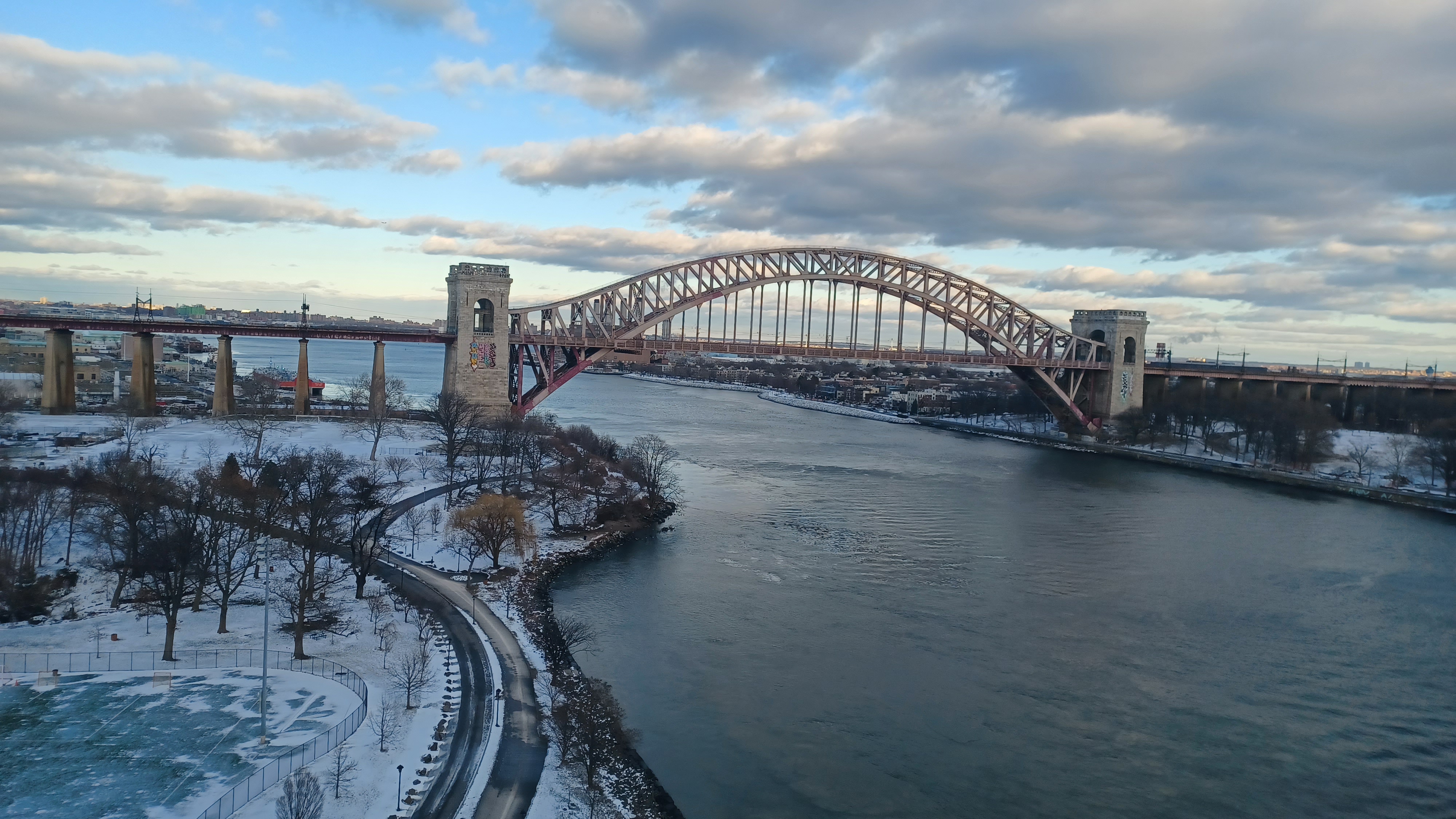
The first was the Robert F Kennedy Bridge, or the Triborough Bridge, at the suspension section over the Hell Gate, from Wards Island to Astoria, Queens, New York.

The complex expressway viaduct has a series of spans connecting Manhattan, the Bronx, and Astoria Queens over Wards and Randall's Islands, which were previously two separate Islands connected by a landfill.
The spans terminate in all three boroughs with connection on Randall's Island. It has been described as "not a bridge so much as a traffic machine, the largest ever built". In fact, the Manhattan connector incorporates the largest vertical lift bridge in the world.

Ground was broken for the span in Astoria in 1929 but was badly delayed due to the Great Depression.

The Y-shaped sky highway was opened July 11th, 1936, with President Roosevelt in attendance.
Beyond is the rail bridge known as the Hell Gate Bridge. The bridge was opened in 1917 by the New York Connecting Railroad as a connection between Pennsylvania Railroad and the New Haven Railroad.
The combination five span structure is over 3 miles long.

The waterway it crosses was so named by Dutch settlers.

The 1,017 ft long combination span bridges between Astoria, Queens, and Wards and Randall's Island Manhattan. Randall's Island and Wards Island were separated by Little Hell Gate, but have been filled in by a massive wastewater treatment plant.
As we walked along the edge of the park and drive, Alex Gisser walked toward us. We hadn't hiked together in a couple of years, and he had wanted to meet my son, but that would have to wait for another time. It was good to see him again, and we all walked together to the north. My plan was to get to the north side of Astoria Park.

I figured there was not much more to see on the waterfront to the north, but looking at it again later, there is certainly more to see, and I'll have to specifically plan an Astoria hike.

We headed north, passed beneath the Triborough, and then approached the Hell Gate, which is officially the Connecting Railroad Bridge, but basically no one has ever called it that.
Beneath the bridge was grand plaque installed at the time of its construction, and the sides of it were adorned with art reading "Hell Gate" in bright colors.
We continued on beyond this to the north side of the park, and then headed east. We had to get back to the pedestrian walkway up to the Triborough Bridge, and I figured we would do so by walking through the park on the uphill side of it, which would be a little different.

We passed along the North Lawn, back under the Hell Gate, and then over the South Hill and above the pool area.

When we got close to the Triborough Bridge again, we turned left and started heading to Hoyt Avenue North, which leads to the nearest access to the Triborough Bridge. I think it is at Hoyt and 27th Street.
At this point, we lost much of the group. Obviously, Alex and Tom had only just recently joined us, so they were in for the remainder. Jack, Sarah, Joe Millionaire, Alyssa, Violet, Steve S, Diane, Mike, Cory, and I think maybe Anne were there for this next crazy bit of the hike, which would probably be the coldest and windiest we had to deal with.

I was surprised that Jenny wanted to cut out here, but they decided to go warm up and get a bite to eat, then cross over via train back to Manhattan, so much of the group left by that point.

We made our way up onto the bridge, and it was much narrower a walkway than the other bridges we had been across. I never hear of anyone walking across the Triborough, so that made me want to do it more. I don't think we passed a single person walking across the entire way. This was actually one of my favorite NYC bridges I've walked across.
I was told by someone, I forget who, that we had already gotten something like 14 miles finished by the time we got to Astoria Park, so I also can't blame anyone for wanting to cut out there knowing that, but I'm glad we went on.

The bridge walkway had chain link on the edges initially, when we were out ove the park and roadways.

As we went up, there was a flight of stairs, probably one of the reasons they don't let people ride bikes on it, and we got out over the water. At that point, there are no more barriers and we can see out at the surrounding area. There was a superb view of the Hell Gate Bridge probably unmatched elsewhere, and the sun was beginning to set to the west, which looked amazing through the strings of the suspension structure.
It was cool to get across to where we were over the island areas, where Ward's, Randall's, and Sunken Meadow Island used to be all separate. We had walked pretty extensively around those islands in the past, and looking back at where we've been is always great.

We descended from the north side of the bridge toward the island, and much of the group got far ahead of me. I was stopping to take pictures and just not walking too fast. Jack and Sarah were close to where I was, and the others waited a bit ahead.

The walkway came to a point where it went down another couple of flights of steps, and then was surrounded completely over the top as a sort of chain link tunnel.
The bridge maintains elevation above the island, but the walkway continues to descend gradually until coming down to the island. It is not possible to walk the entire length of the bridge, which I knew, and so I had plotted a route for us to continue along the island when we got down, straight ahead on a paved pathway that parallels Hell Gate Circle.

We continued north until we got to a turn on the Harlem River Pathway, which goes to the east. Jack and Sarah had some words and Jack decided to cut out. He turned back, and Sarah continued to walk with us for a bit until she also turned away. They fortunately met up later alright.

The rest of us went beneath the Triborough Bridge, then downhill along what used to be known as the Little Hell Gate, a smaller channel that had separated Randall's and Wards Island that had been mostly filled in, save for this small cove that remains with a trail bridge across it.

By this point, some of the group just went ahead, and in the back, it was only Mike, Alex, Tom, Cory, and I remaining in our group. We moved on a bit more slowly, and I took more photos.
The sun was setting beautifully as we reached and crossed Little Hell Gate, with wonderful views across to Manhattan as things were just beginning to light up.
I noticed the lovely former Benjamin Franklin High School on the east side of Manhattan, now Manhattan Center for Science and Mathematics. The original high school was built in 1934 and closed in 1982. It reopened as the four year specialized high school it is today. I had walked past that on the hike last year, in the section where everyone left me, and had to look up the history because it was so impressive.

We took the boardwalk across the Little Hell Gate Salt Marsh and continued on the waterfront to the north, and just past a ferry landing, we reached the walkway bridge span that gradually ascends to the westernmost structure of the Triborough Bridge.

This last section of the bridge is the lift span over the Harlem River.

There were amazing views of the highway ramps to the bridge, and the giant salt shed in the middle of it all, as well as of the Harlem River and all of the buildings.
My ultimate goal of the hike, what I presumed our end point would be, was Crack is Wack Park.
Years ago, we had a hike planning to get to Crack is Wack Playground north of the Triborough Bridge, and Justin got really drunk and passed out. We had to carry him to a pizza place, then someone called an ambulance and he got stuck in the hospital.

He was fine, but we never made it to Crack is Wack Park on that one. I decided it would be fun for us to just get there, and from that point, we could take a subway back any time, and some of us could just walk back to the south as far as we wanted.

At the very end of the bridge walkway, where we could get off, was 2nd Avenue. We could then turn right for a couple of blocks and get to the Crack is Wack Playground easily.

Some of the group I found out late had made it to that point earlier than us.
It was only about four blocks to the north, but it was disappointing to find that the park was closed due to some sort of construction. Fortunately, we did get our photos with the signs that read "Crack is Wack" on the gate on the outside.
I was happy to at least get to this point. I found out late that it wasn't just some 1980s Nancy Reagan war on drugs thing, that it was actually named because of a popular mural located here that read "Crack is Wack". I'll see it one day.

From here, we had to decide what was next. I was good to walk more, and the other guys were also feeling up to it, so we continued onward.

We continued directly west until we got to Madison Avenue, and then turned left, to the south. On that trajectory, it brought us to Marcus Garvey Park, which is another I do not believe I had walked through before.
The park was created in 1840 around a schism outcropping known as Mt Morris, and named for then NYC mayor Robert Morris.
It was named Mt Morris Park, and remained undeveloped until landscaping and paths were created starting in 1869.
The park was home to the Harlem Cultural Festival in 1969, sort of the Woodstock of Soul Music.


The park was renamed for activist Marcus Garvey in 1973.

We headed south through the park along the slope of the land and the aforementiond outcrop. We could see the lower activity areas, which way back in the early 1800s used to have a horse track on it.
We went down some stairs, and meandered through surprisingly pleasant paths for a few blocks distance to come out directly in line with 5th Avenue, which is not continuous because of the park.
We continued south about four or so blocks on 5th Avenue, and then turned right onto pedestrian paths through the sort of plaza area around the Martin Luther King Jr Towers.


We had a pleasant walk through these paths and came out on 112th. My plan was to use some of these pedestrian pathways to get through a little further to Central Park eliminating some of the roadside walking.

This ended up being a pretty good idea. We headed into Central Park, and it was just a totally pleasant walk to the south.
We got over more to the center section of the park away from the roads, and skirted the edge of the Harlem Meer. By this time, it was already pretty dark, but Central Park is always really nice. I was just glad to have some company. I walked the entire length of the park last year by myself.
We continued south and reached the Onassis Reservoir.


Originally the Central Park Reservoir, Upper Reservoir, or New Croton Reservoir, it was completed in 1862 above the Yorkville Reservoir, Old Croton Reservoir, or Lower Reservoir, which is today the Great Lawn and Turtle Pond.

This reservoir was decommissioned as water supply in 1993 and renamed for the former first lady in 1994 to honor her contributions to the city.
We continued south, and I honestly don't remember which streets we decided to take to do it. We were just heading back toward NY Penn Station.
I was hoping to catch up with Joe Millionaire and Alyssa, figuring I'd have a ride back with them to the station, then we'd all Uber back home. I figured they'd wait for me because I bought their round trip train tickets.
Hurrying through the crowds near the Rockefeller Center area again, we somehow lost Tom and Alex. It's not shocking really, it was a complete mob scene and hard to navigate at all.
Cory was getting hungry, and he was planning on taking a bus back to near his house, so I said goodbye to him and started running back toward the train station to try to catch any of the rest of the group.


When I was only a couple of blocks away from the station, they got back to me that they were on a train with Diane heading back to Short Hills. I'd missed them.

I was alone in the station, and my phone was dying fast. I had brought a charger with me, but I forgot to bring the chord. I was tired and drunk from the excess of the day, and dealing with the situation by myself was going to be tough.
I figured my only chance was to run back a few blocks to the north and try to find Cory at the McDonalds he went to. It had been a mob scene in there, so I figured he would have to wait for some time either way.
I ran back, and fortunately found Cory inside. I even went ahead and ordered a McDouble so that I could get something in my system.
I am usually fine with drinking, but as soon as I introduce food into my system after a long time of not eating, I crash and burn really fast. The small burger was enough to make me start feeling comatose.
I struggled to hold my eyes open, somewhat upset that I'd been abandoned by everyone else, but glad I found Cory.


Cory and I were the only two of the entire day to do the mileage we did. By the time the two of us had our food, scarfed it down, and walked back to Penn Station, we had covered at least 25 miles.

I already had purchased my return ticket, and in retrospect, I should have just used that to get back to Short Hills I suppose, and then gotten home from there, but I didn't. Maybe it was for the better that I went with Cory because I was so tired.
Cory had an extra bus ticket for me, and so we got to that section of Penn Station, which I'd never been to before, and boarded the bus to officially end our hike.
This was not nearly the end of the night for me however. Cory had a spare charging chord he lent me, and I was able to use my phone for a bit while we were riding.
I don't remember if Cory had a car at the bus station, or what we did when we got there, but it was no time before we were at Cory and Linda's house. They were asleep, and he brought me to his basement to relax and work on getting an Uber or Lyft back home.
When I tried to open the Uber app, it just wasn't working. I was getting annoyed and really just wanted to get home, and I wanted to see my son.

I think I passed out from exhaustion for a bit there before I could finally confirm the Uber to get home.
When I had a confirmed car, I had to figure out how to get out of the house, which I managed to do in the dark.
I think I had to go out a garage door or something, and then stumbled out toward the middle of the street. At that point, I felt like I was escaping in the middle of the night or something.

Before the car came, I had to pee something terrible. I could see it was still a couple of minutes before the car was to show up, and so I relieved myself in the middle of the street. Clearly, no one was looking.

Soon, the car pulled up and I was on my way back to Washington. I was very glad to not have to be driving at least, although it would be a rather expensive trip.
I got home, got inside late, and I think Ev was already in bed, and his mom had no good words for me about having been out late.
I took a shower and went to bed. Coming home after these giant adventures to feeling no love at home is sometimes really hard, and this was one of the times I really felt it, but fortunately I passed out from the exhaustion pretty quickly.
When I got up in the morning, it was rather hilarious that I was caught on Cory's doorbell cam taking a piss in the middle of the street.
It had been a really fantastic day for 99% of all of it, and there are no bad feelings about being left there. I had Cory there to save me, and I'm thankful for that. Everyone had a great time, and the truth is I was forgotten because everyone was having such a good time, and that was the goal, so the day was a success. Next time I'll know to be sure to have my own car ready and just stop hitting the drink earlier like I normally would on a regular hike.
No comments:
Post a Comment