

Hike #1637: 2/15/24 Gwynedd Loop with Jenny Tull, Diane Reider, Robin Deitz, David Adams, Professor John DiFiore, Galya, and Everen

This next hike would bring us back once again to the Wissahickon Creek series.
Like I've done with so many other rivers, I am trying to trace all of the trails and all of the major tributaries within the watershed of the Wissahickon Creek. So far, this one has truly been exceeding my expectations.
There has been an opportunity to do a lot of loop trips through this watershed, and what strikes me as interesting is that these loops crisscross one another, but it is sort of like drawing a circle on a map, and then drawing a circle just out of sync with the previous one, right next to it.

The hike might cross over the previous one on multiple occasions, but it is actually a mostly new hike altogether.

That was certainly the case with this one, because we had met a couple of times at this shopping center, the Gwynedd Crossing, and passed through it one other time.
This one was fun to plan because it was basically the same loop we had done one of the previous times, but just slightly off. The mileage would be about the same, but we would cover a whole lot of new stuff.
I ended up absolutely loving this one. There wasn't the burden of a ton of road walking, and what little there was, was mostly at the end, and it was sort of in lieu of doing extra miles on other parallel trails.

I pieced together several trail systems we'd been on before, but different trails, as well as some new stuff, and a little more of the Wissahickon Green Ribbon Trail we had not done before, with a little we'd done.

We met for this one over near Firebird's Wood Fired Grill. I figured that if we wanted to eat at the end of it, we would be right there.
The trip would bring us from here, around the side of the establishment parallel with Welsh Road, and then down to the traffic light where we would cross Welsch onto Darden Lane.
Here, just ahead, the Trewellyn Trail System begins.
The last time we came through here, it was from the west side of Darden Lane, just a little ahead. This time, we would go a shorter distance on the sidewalk, and get on the trail system in the development on the east side.

The trail was paved, and brought us through a narrow swath of trees between roads to the left and homes to the right.

The trail came out to and crossed over Sloan Way just ahead. We crossed and skirted the edge of a grassy area behind homes on our left. The trail followed Sloan just briefly to cross a tributary of the Trewellyn Creek.
We continued along the trail as it emerged onto Kellogg Drive. We turned right here, and then right almost immediately onto Tuck Court.
At the end of this short road, another bit of trail continued on. It crossed the Trewellyn Creek, almost a continuation of the road that does not go through.

From this point, looking downstream, we could see the ruins of an old dam on the brook. There must have at one time been a farm pond at this location.

At the other side of the bridge, we crossed another section of trail. This was the route we had taken on the previous hike. Here, we turned to the left and followed the route we'd done before.
After a bit, there was another trail that broke off to the left. I had considered taking this one, but figured there was more stuff to do directly along the creek. This other trail would go out of the way a bit more.
We stepped onto the bridge, and I noted it was actually a much older bridge, maybe some sort of farm crossing.

We continued ahead on the trail to the south, and then came to a much wider bridge over the creek to the left. This was the location we had gotten on this greenway on the past hike here. We had come through the Gwynedd Mercy University trail system that time.

We turned left and crossed the bridge, where there is a side trail that weaves to make a loop with the trail on the Trewellyn Creek.

We followed this eastern fork around corners and through pleasant woods in unpaved trail.
The trail came out to intersect with the main trail along the creek again, near the site of a small dam and pond.
We checked this out, and then continued south along the trail, as the creek quickly was impounded into another pond.
Another side trail went to the left, out to some parking, but we continued south along the pond to the south, which afforded us some nice views.

We came to the next dam, and it had some stone abutments with concrete central section. I was getting the feeling that this was a former estate rather than something that was a farm utility.

Just below this next dam was a handsome stone arch bridge over the creek.
This span has atypical overhanging view spots, two on each side, apparently just for standing and viewing. I am not certain when this was constructed, but it was north of the Sumneytown Turnpike and it is not shown on 1877 Montgomery County atlas maps.
We walked over to the arch bridge to give it a closer look. We weren't taking the route on the other side of the thing, but we all still wanted to look at it more closely. Ev got out of the stroller to walk around a bit here.

For some reason, although the creek is called Trewellyn, the trail system is called the Treweryn Farm Trails. I assume that both come from the same place and are just oddly different pronounciations, but I really don't know for sure.

We headed back across the stone arch and began following the foot path to the south along the east side of the creek downstream.

In a short distance, we came to the ruins of yet another dam. This one looked just lik the one just upstream, with the same kind of stone work and concrete capping, but this one had deteriorated badly.
We continued south from here, and soon came to the Treweryn Farm Trail parking area. Here, we turned hard to the left, and continued on a trail just parallel with the old Sumneytown Pike, which was quite busy at this point. We followed the trail to where another paved trail comes in from the left, and there was a crosswalk across Sumneytown Pike to a development at Wellington Drive.

I had one of my oddball routes planned at this point. We crossed to Wellington Drive, then turned left into the cross across lawns within the community parallel with a road called Sweetwater Circle.
We paralleled Sumneytown Pike in the trees to the end of Sweetwater Circle, then cut between two townhouses on the right side of the cul de sac, and made our way through grass directly out to the next road, Wellington Drive. We turned left on Wellington Drive, and then left again onto Bridle Lane, which came back close to Sumneytown Pike again.


We walked beyond a closed connection from Bridle Lane and the road became known as Bridle Lane Court, and we continued to follow it east to its dead end.

We got on the grass, cut across a power line, and came to the dead end of Nevin Lane. We followed this one to the intersection with Wellington Drive again, and we continued across onto Bangor Lane.
We soon cut between two more townhouses out to a paved trail and foot bridge across Willow Run, another tributary of the Wissahickon Creek.
We crossed the creek on the bridge, and entered a little community area known as Spring House, just north of Ambler.

The location has been a prominent stop since the Spring House Hotel was first established at the crossroads in 1719. It was an important stopping point between Philadelphia and Bethlehem, where the Bethlehem Pine and Sumneytown Pike intersect.

The paved trail went south along Willow Run for just a bit, and then turned hard left out to the Penllyn Pike.
I had intended to walk the grass behind these next apartments, but there was a fence and it wasn't welcoming, so we took the trail in front.
After the end of these apartments, the trail ended totally around the last apartment building, but good paved pathway was directly across on the other side of the pike, so we crossed over to walk that instead.

We walked only a short distance on the other side when I noticed a very prestigious looking house on the opposite side.

At first, we figured this was a modern building, and it looked like it had to have been, but things changed as soon as I got a closer look.
This was the historic George Reiger Mansion near Penllyn. I was able to use my shot as part of a then and now compilation using a shot from the collection of Andrew Mark Herman.
The building now serves as part of the Silver Stream Nursing and Rehabilitation Center, and is well cared for.

The home was built about 1897-98 in Victorian and Queen Ann styles, of granite with handsome turret section and gate and wall structures capped with Indiana Limestone.

The estate was known as the Willow Run Farm, for the Wissahickon tributary that flows through it, and was integrated in the landscape with ponds and bridges.
George Reiger was a manufacturer/Brewster for the Louis Bergdall Brewing Company, also known as the City Park Brewery.
Many additions and alterations are present, but the home retains its historic charm, as does its adjacent carriage house.

The trail continued just parallel with the old Penllyn Pike for a bit, and just enough off the side of the road that it didn't feel like a sidewalk. I was feeling quite happy with this hike so far.

Ahead, there was another beautiful old stone home across Penllyn Pike from us, just about between Penllyn and Spring House, reportedly built in 1843. The 1877 J D Scott Atlas of Montgomery County shows this might have been the home of A J Hoover.
We continued to the south, and crossed the front of the Bethlehem Baptist Church, then crossed Dager Road.
Here, the trail meandered a bit from the road and came out into a large field, which is part of a preserved property. Mowed paths deviated from the main one ahead, and another followed parallel to Dager Road to the east. I'll do that on a future hike.

The trail turned south and skirted another house to the right that looked to be quite old, and then meandered to the field edge closer to Penllyn Pike again.

Across the fields to the left was a stately, sprawling home with a lot of stone components. At least part of this building, I could tell, was historic, but that it had been added upon substantially.
The history of this site was much more interesting when I looked it up than I had imagined. It is known as the Meadow Farm, and I can't remember the name of the non profit that preserved it. I think it might have been Heritage Conservancy.
The 1877 J D Scott Atlas of Montgomery County shows this as the farm of A. F. Hoover. It seems the original home was added upon and the current look and additions date to about 1922.

It was owned then by Albert L. Smith of the Smith Barney Investment Firm. It was then conveyed to the Lippincott family of publishing fame, who published the story of the Trapp Family Singers, which became the beloved film "The Sound of Music". It is said that Maria Von Trapp stayed at this home while writing her story.


As we headed to the south, the trail came to where it crossed the lane back to the Meadow Farm. At this entrance, we saw what appeared to be an old stone farm house at the intersection. This was not shown on the historic atlas, although it looks to date to prior to 1870s. Maybe it doesn't.


We continued on the trail ahead, in front of these homes, and there was a community garden next to the old stone house, which I guess is a part of the conservancy property now.
The trail made its way south and we soon passed a fire hydrant that read "American Darling" on it, which I thought was funny and cute. I didn't realize this was a regular make of fire hydrant, and one that is well preferred among clients who buy hydrants.
Still, I got a photo of John hugging it because I thought it was funny.
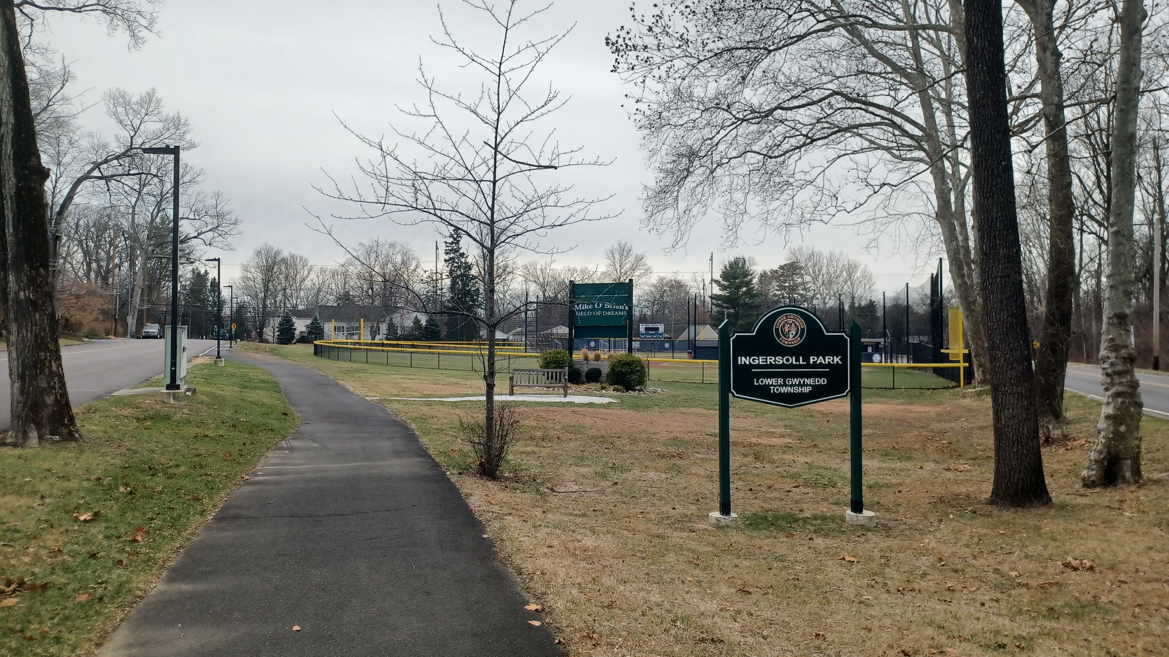
We continued and the trail crossed over a small brook on a prefabricated bridge next to the road, and soon we crossed over and into Ingersoll Park, then past the Mike O'Brien Field of Dreams toward the Penllyn Station.

We crossed the crosswalk, and then there was a subterranean underpass beneath the active tracks to the station building on the other side. Ev liked that quite a bit.

We had done quite a lot of hiking on and parallel with this historic line.
The North Penn Branch of the Philadelphia and Reading Railroad was built here as the North Pennsylvania Railroad in the 1850s. The line was completed through this area about 1857, and the original Penllyn Station was made of wood. There was a separate freight station that lasted until 2005.
The current station was built by the Reading about 1903. It had been leased to the Philadelphia and Reading since 1879.

The line traveled north from Philadelphia to Bethlehem Pa. The original plan was to extend it all the way to Waverly New York.

Passenger service continued to Bethlehem until 1981 when it was scaled back. The rails remained in place after that for many years, but removal began around 2011 when construction began on Saucon Rail Trail at the north end. Today, it is trail from Quakertown to Bethlehem.
Talks of reactivating passenger service to Quakertown have persisted over the years but never got farther than discussion.
A recent government study recommended reactivation of the entire branch to Bethlehem. The right of way was double tracked all the way through, so there is room for rail with trail, although complicated.

Events such as Musikfest, Celtic Classic, and year-round concerts and casino suggest such a reactivation could be beneficial to the area.

For the time being, passenger services available to Lansdale and to Doylestown via the branch.
I highly doubt the line will be reactivated to Bethlehem. Because grant money was used to build the trail to the north, I think they'd have to reimburse the grant in order to do it, and they made sure they created a ridiculous amount of infrastructure, so it likely can't be done without a lot of work.
I got a few then and now shots of the station, and then we were on our way in back of it along Pershing Road for a bit.

The group was getting hungry, and there were not a lot of options for lunch along our entire route. Pretty much the only thing after Spring House was Penllyn Pizza, just ahead.

Online, it said the place opened at 11, and it was just before 11.
We followed Pershing out to the current alignment of Penllyn Pike (old Penllyn Pike is on the other side of the station and would have had a grade crossing. This road goes beneath the tracks).
We crossed and headed to Penllyn Pizza, but it was closed. We had a few minutes to wait until 11, so we did. Unfortunately, it did not open at 11. We waited a little longer, and some of the group went out back.

There were no cars around, and so it seemed like they were not opening. We tried calling but got nothing.

I was ready to head onward, and I figured we would have to go way out and around a few blocks to get to the Penllyn Park.
Just then, a young man came walking down a sort of path between two houses, down to the edge of the railroad tracks, across a little concrete bridge, and then into the lot of the pizza place.
As he approached, I asked him if that was an actual path that we were allowed to walk. He said yeah, that the people who lived there didn't mind people walking through. This was pretty good news, because we'd have an easier way through!

We started walking across the bridge, then up a path where the broken pavement beyond the bridge ended (maybe this was a farm bridge, maybe an earlier trail, I don't know), and up onto East Avenue.

I was feeling pretty good about this way when I got a holler to come back. The pizza place had opened!
I really didn't want to be walking back through this person's yard a second, let alone a third time after we had lunch, but I knew that much of the group really wanted to stop and eat.
We headed back and went in, and I ordered a couple slices of pizza. I think Ev took a nap through much of this again.
The pizza was actually pretty good, and the people very friendly. It was kind of a cold day, so being inside for a bit of time was also not a bad thing. Some of the group didn't eat and instead waited outside.
Once everyone was done, we continued on our way, back across the little concrete bridge below the tracks and onto the broken pavement path, then up to the driveways and out to East Avenue again.
We continued on East Avenue a bit, continued around a corner, and then turned right onto Pershing Road, which might at one time have connected to the previous Pershing Road we had been on.

We emerged at Gwynedd Avenue, directly across from the entrance to Penllyn Park.

We entered the park, and immediately there was a playground with fake dinosaur and turtle in it, so Ev played around on those a bit. I think there was some frost or something on the slides, or that they were wet, and so he wouldn't go down those. I used the time to check our trajectory and where we would be turning next.
We followed the paved trail through this part of the park, left the open area and entered woods where we crossed Willow Run on a large footbridge.
When we came out to another access point, thee was another trail to the right, which ran in the woods immediately parallel to Talus Field, an active recreation field.

We followed this to the east until we were very close to the railroad tracks again, and then turned left, more north, to parallel them on a trail in the grassy field edge.

When we we got to the end of the field section, one trail went to the left, but another went straight into the woods. Google maps didn't show this one, but it was going the direction I wanted to go, so we followed it on in.
We came out of this woods parallel with the tracks at the Penlyn Woods Park. We were at a large ball field, and we followed it to the north end.
This was known as Cutler Field. There was nothing at the north end, so we had to head to the west a bit, around the edge of the ball field. After a bit, we did come to a side trail that went into the woods to the right, and so we turned to follow it.

This was more of a narrow foot path, and then there were signs saying it was an equestian trail. I got the feeling that this was not open to walkers, only horses, but we were already committed and in there.

It was some rough walking at times, with tree roots and such, and I had to get some help at times to get the stroller through it, but we managed. It wasn't terrible.
We remained pretty much parallel with the tracks, which were usually within sight, until a hard left turn to the west. This path section took us directly to the Wissahickon Green Ribbon Trail, in a section we had been on previously from the time we did the Crossways Preserve connection.
This time, we would follow the trail directly through to the north. We had already done three other hikes recently that incorporated some of the Green Ribbon, but we always went into the Gwynedd Preserve and did not actually cover the section of it parallel with that preserve. This time we'd do that.
We turned right and followed the trail to the north, and soon reached where it crosses beneath the former Reading Railroad.

There is a narrow walkway on the edge of the abutment that is just wide enough to get the stroller along, but I could not push Ev in it just in case since it is dangerous, and I could not get him up the slope on the other side by himself.
This time, Heshy helped him to walk up the hill on the other side for a bit, and he got back in the stroller when we were on more level ground. Ev wasn't really in the mood to walk just yet.
After a little bit of easy stuff, we came to the Plymouth Crossing, where the trail crosses over the Wissahickon by way of concrete blocks placed in the stream.

These are always a fun and unique way of crossing, and Ev loves to get out and walk across on them.

We got across this one, and then made our way uphill to Plymouth Road. The trail goes straight acoss the road here onto a private driveway known as Station Road.
We went down the road past the huge houses, and then cut into the woods again at the end of the driveway.
The trail led gradually downhill and parallel with the former Reading tracks, which were now on a high fill directly to the left of us as we traveled.

In just a little while, we came to our second underpass of the Reading, which is a deck girder bridge situated on older stone abutments.

This was a tougher crossing than the previous one, because it is much longer time that I need to carry the stroller, which meant that someone had to stay with and help Ev walk.
Heshy took up this challenge again. I carried the stroller to my side over the rough rocks beneath the railroad bridge, and then out and around a deep wash that flows into the Wissahickon from the left. There is only one short and easy bit just ahead from there where I would have been able to push the stroller, and the trail goes back to being on a narrow shelf along the stream where it must be carried.

The rough stuff comes to an end at an old fireplace and chimney directly along the trail where we stopped to take a little break (and got our group shot).

Ev did a great job walking through the rougher section and along the shelf once he really got going.
At this chimney spot, we could see the remnants of another mill race close by, a mill ruin with a window archway still intact across the Wissahickon, and some likely milling foundations on the edge of the trail just ahead.
I don't know the history of any of these mills here, but they were certainly developed after the 1870s, because none of these appear on the county atlas I have been referring to.

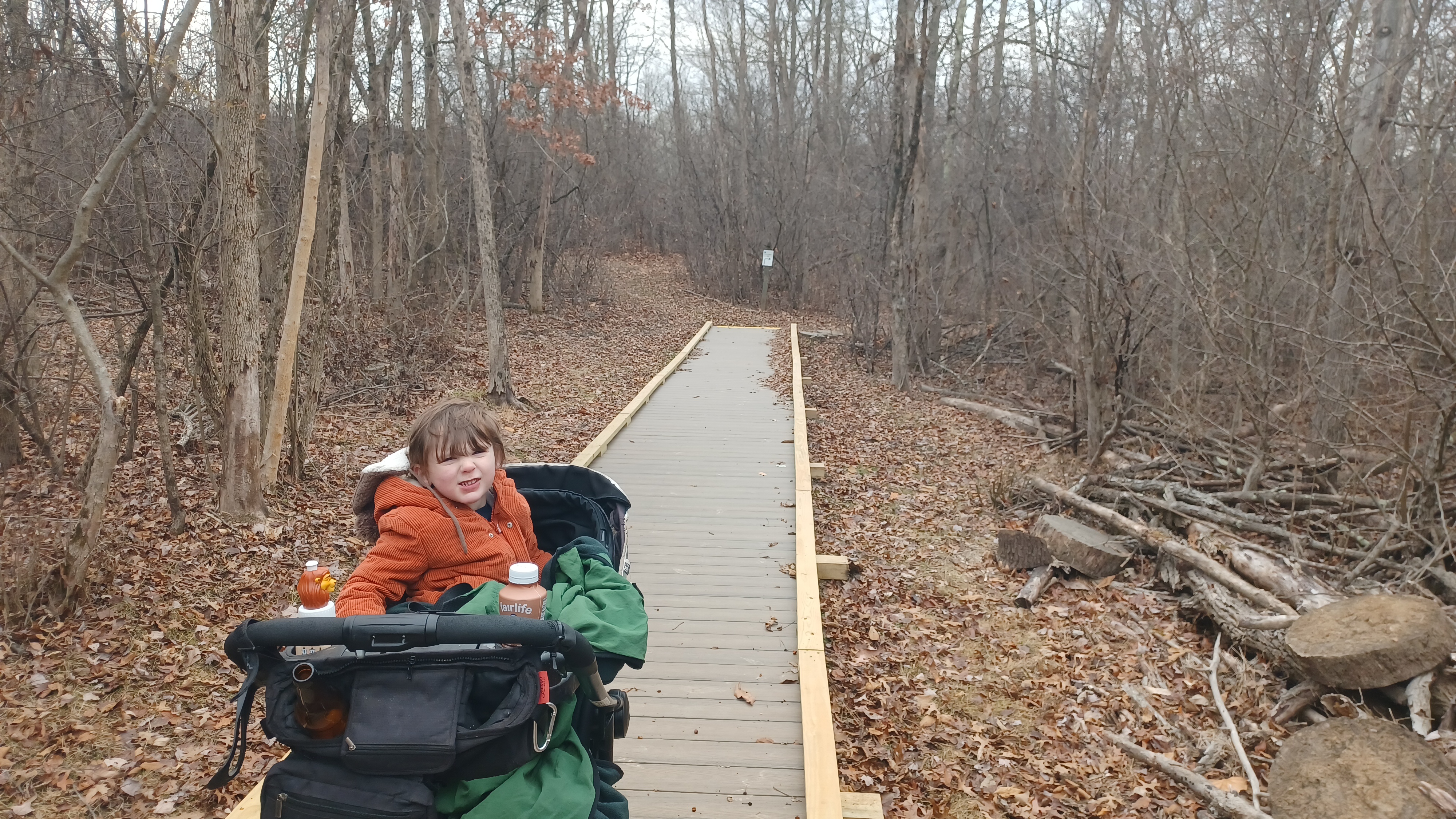
When we were all good to go, we continued across the raceway and along the trail heading upstream. Ev got out of the stroller here and there, especially at the sections where there were some boardwalks, because he loves walking those.

This entire section was very pleasant, and we continued to the new Rt 202 overpass where the trail has a good concrete walkway beneath. It is then mowed on the other side up from the closer flood plain.
Once we were back into the wooded area, we came to the Runner's Crossing of the Wissahickon, where we had crossed over on a previous hike. The Green Ribbon Trail ahead was stuff we hadn't done since when I did the entire trail last, more than 11 years prior.

It was a very pleasant section ahead, with plenty more little sections of boardwalks and puncheons that Ev liked to go across.

Soon enough, we came to Swedesford Road, where we had a lovely view to the right of the Evans-Mumbower Grist Mill along the Wissahickon in Upper Gwynedd.
Thomas Evans acquired the land in 1698, and milling began on site by 1744. The current mill building was constructed in 1835 by John and Elisa Keefe.
Henry Mumbower purchased the mill in 1856 and operated it until his death in 1892, and his son David operated it until its closing in 1930.

The abandoned mill was badly collapsing until Wissahickon Trails purchased it in 1987, and saw it to it's current beautifully restored state.

The Swedesford Bridge, a handsome double stone arch, was constructed in 1873, and rehabilitated more recently.
We didn't cross on the trail directly, and instead walked over a little closer so that we could get a better view of the mill and the bridge.
We made our way back to the trail and entered the young woods again. This section too had lots of little board walks and foot bridges. There are apparently a lot of springs and such through this area.

It wasn't long before we approached the next road crossing, an access road to a sewage treatment plant. We passed through an open, grassy meadow first, then crossed the road into more woods.

There was a side trail here, which went to the left apparently, but I didn't feel as though the route was obvious.
The section ahead was a bit different, as it made its way up onto a high shelf above the creek. I held onto Ev's stroller tight. If there had been any ice at all, this could have been a bad area. I took extreme caution for the short distance we were at this big slope.
It was in this area that the dam used to be that provided the water for the mills downstream. Some of the stonework for one of the dams was visible on the far side of the creek. The dam had been situated on top of a small rock that extended out across the creek.

At this point, the creek was tiny compared to the other spots. This is known as the Merck Crossing, probably because I guess Merck funded the development of it or something.
We crossed, and the Wissahickon Green Ribbon Trail soon continued to the left, but this was where we would turn off, on the connector trail up along the power line into the Gwynedd Preserve.


When the second trail broke off to the right from the power line trail, we turned right. It was a pleasant grassy path out through open fields, with some occasional trees, into the middle of the large meadow area.
When we reached the next tree line, we headed into it on a mowed trail just briefly, and then emerged onto a wider field one. We turned left I recall, and this became the access road to the headquarters building where there is a restroom. We followed it to there, took a little break, and sat down for a bit.

I should have changed Ev's diaper while we were there and it was warmer, because he apparently needed a change.

When we got done with the break, we headed down from the access lane a bit, and then on a dead end side trail to a viewing area over a pond south of the road.
While there, Ev told me he needed a diaper change, so I quickly got it done. He wasn't happy about the cold but it wasn't too bad yet.
When everyone caught up, we backtracked and headed south on a wide access lane that soon is parallel with Evergreen Drive, behind the homes.

We followed this lane all the way out to Swedesford Road. We then crossed, turned right, and followed along the edge of a split rail fence until an opening. We went though, and then followed a path downhill through a grassy area.

At the bottom of the hill, the trail in the middle of the field turned to the left past a large tree. I understand that this is not party of the Gwynedd Preserve, but rather some of the Wissahickon Conservancy.
We followed the trail through the center of the field until we reached a tree line. We entered the woods, and continued through. There were no blazes, and the trail got tougher to follow as we continued on.
I had to get some help at a couple of points because of fallen trees. We came back within sight of the Wissahickon below, and pretty soon we could see absolute evidence of a major raceway.

The raceway was completely washed off into the creek at one point, but we could see where it continued on beyond the washout ahead.
The trail seemed to disappear at one point, but we found it going uphill a bit, and soon we emerged at a wider, mowed trail, where we turned right. We then came to the intersection with the trail that descends to the Runners Crossing over the Wissahickon where we had been earlier.
We continued ahead on the mowed trail, which meandered out to the Gwynedd Preserve again, on the south side of Swedesford Road. We went from a succession area of young growth to a field where many young trees are planted in an effort to reforest the area.

We passed through the rather open area to the end, and at the next intersection, turned to the left, past a house which brought us back to Swedesford Road. We crossed the road directly, went slightly uphill, and then turned immediately right on another trail back downhill and parallel with Swedesford Road up on a slight slope.
We had walked this trail before; it leads beside the road to the north for a bit, and used to have more trails in the north part of the preserve, but was closed were some sort of management purposes.

I used this route a few months back as a connection from the Gwynedd Preserve to the Penn Oak Trail system, which makes for very little road walking between.
The Penn Oak system was kind of cool, all through developments, but there was a way of doing it almost entirely differently than on the past times, so it was worth it to do this little bit we'd done before.
Soon, we passed the beautiful Tunnel Farm, and then ascended to the bridge over the same former Reading Railroad tracks we had crossed earlier. The deep cut beneath the bridge on Swedesford Road was formerly the site of the Gwynedd Tunnel.

The tunnel was completed in 1857 and daylighted in 1930 to make way for overhead catenary electric wires.
We got to the north side of the bridge, and then turned immediately right on School House Lane. It was only a short distance on the road until we reached the start of one of the Penn Oak Trails on the left. We turned and began following it to the north.
We came to an intersection where the one trail turned hard to the right. This was where we went previously, but we went straight ahead, along the backs of homes continuing north.


The trail continued for a bit, and then turned to the east for a shot time skirting the rear of the development, then came to an intersection. We turned left on another paved trail that continued to the north. This brought us through a nice swath that sometimes allows us to forget we are in a development, and then had a crosswalk over Penn Oak Road.


Here, we turned to the left instead and headed up the road a very short distance, and another trail cut off to the left. We continued on this to the west for just a bit.

The trail went right and then left, shifting from north to west again, and out to Swedesford Road. We turned right, north, and then went for a distance parallel with Swedesford Road yet again.
We crossed North Penn Oak Road, continued a short distance farther, and then turned hard to the right.
We made a southeast trajectory from here for a bit, and the rest of the group was getting ahead of me a bit. I was relaxed and feeling really good at this point, because I knew right where we were going at this point.


The trail shifted to the south a bit, and when we came to grassy area on our left, where we had been before on the previous hike in this area, with a small pond, we turned.

The last time here, we had taken the Penn Oak Trail system at the extreme east side, and this time we remained to the west.
We made our way down to the end, and then I needed a hand getting the stroller uphill on the other side of the dip, and into the back of the cemetery at the Church of the Messiah.
We emerged in the cemetery, continued through to the south a bit, and then made our way along the walkways out toward the church and the front.
The Church of the Messiah and cemetery is at a location known as Gwynedd Corners and was built in 1871. The congregation was founded in the 1860s by summer crowds that worshipped in private homes and schools until they outgrew those spaces.

The nearby Reading Railroad served to attract more congregation members just when the church was getting ready to close its doors. It has been going strong ever since.

Finding information on all of this was a little harder, and a bit confusing. Some of the old photos I found of the church, before the large stone steeple was added, made it look like an entirely different place. Also, the websites on these churches focus very little on the history of the buildings, and make almost all focus on religion and worship.
I got a few comparison shots of the church as we approached the front, and then we headed north on Rt 202 to the intersection of Sumneytown Pike.

At this intersection is the historic William Penn Inn on the southwest side.
Established by David Acuff, who secured the license to operate at in and Tavern on the site in 1827. He named it the William Penn Hotel to pay homage to the historic figurehead that used to visit the area's local Friends Meeting House.
The site served as a major Stagecoach stop on the turnpikes before the arrival of the railroads.
Modifications and additions to the property were made starting in 1900, possibly the beginning of its upscale dining reputation.

We crossed over the intersection, which really sucked when it came to how much space there was there, but we made it, and on the other side was the historic Quaker Friends Meeting House of Gwynedd Corners.
The current meeting house was constructed in 1823, and the community room addition was built in 1902, and school in 1948.

The congregation was founded in 1699, and the first log meeting house was built in 1700. A more permanent stone one was built in 1712 and served until the current one replaced it.
We crossed Rt 202 to the east, and followed some paths into what is known as the Foulkways at Gwynedd. This is a sort of retirement community that is nice for walking. We made our way to the northeast almost directly through the site. I wanted to make it a slightly different route than we had done the previous time, and so we did. It led us eventually to a breezeway area where there was a mirror, which we used for a group shot on the previous hike. From there, we walked out under a long awning, and then parallel with Perimemeter Road to the east.

There was a good trail that paralleled the road on the south side, and it even passed through woods as a sort of footpath at some points.
When we got to an access road with good view of the road, I turned left and crossed. There was a newer trail on the opposite side, so we went over and walked that one instead. It eventually came to the Parsons Lane Trail, which goes north and leaves the property, to emerge at the cul de sac on Parsons Lane.
We continued here, then east for a bit, then to a trail that breaks off of Parsons Lane to the left. It led us uphill from the development to another cul de sac called Lamplighter Circle. This road heads to a larger and busier road called Meetinghouse Road.
I probably should not have taken the direct route because it was busier than I'd liked, but we did. We turned right and walked the road east to Evans Road and turned left, cutting the corner near a little building.
The only thing of particular note on the road was a giant stone home on the right, which I think was built in 1900 John figured out. It looks modern, but vey well done. I was impressed.
When we got to the next big bend in Evans Road, there was a driveway ahead, and I wished there was a way to the Trewellyn Creek and greenway straight, but there wasn't at we had to continue.
Eventually, we crossed the creek, and then turned to the left on the trail into John C. Parry Bird Sanctuary. We went by a little plaque, and meandered along the trail for a bit, until it intersected a trail behind Hunt Club Apartments. We had hiked this on a trip where we connected from Rt 202 Parkway east to the Horsham Power Line Trail.
We continued around this pleasant little trail to the northeast corner of it, and headed back out to the corner of Welsh Road and Evans Road. We crossed here, headed uphill a bit, and then hard right, steeply to the back of the shopping center where we had parked in the morning. It was then just a short distance to our cars to finish the day.
I would have liked to have shifted the last part of the hike from the road walking, but it was alright. The entire other portion of the hike I absolutely loved, and I can't wait to continue with more of this series.
No comments:
Post a Comment