

Hike #1639: 12/29/24 Adamstown to Reading with Diane Reider, Professor John DiFiore, and Everen

This next trip would be the next in my PA Highlands series.
I had been working on doing the bits of the Pennsylvania extension of the Highlands Trail, which is mostly piggybacking on other trails, and in the case of the Furnace Hills, it is superimposed onto the Horse-Shoe Trail.
I had done the entire Horse-Shoe Trail through this region years, ago, but there are reroutes and such today, so it is in some cases like doing an entirely different trail. It's changed a bit over the course of a decade.


For this hike however, we would not be focused so heavily on the Horse-Shoe Trail. We would do a bit of it from Adamstown to a point near Knauers, but then cut away from it on backroads and through park lands heading to the north.


One of the park areas that had been on my "to do" list for years, but I had never gotten around to, was Nolde Forest near Reading. I found a way I wanted to connect to it, and from there head to points I'd been before in Reading itself.

I decided we would meet at the Brentwood Trailhead on the Schuylkill River Trail in Reading PA, which was close to where the Angelica Creek Greenway comes in and intersects.

I felt like a had a pretty interesting hike to go between these points, and I was right!
From here, we shuttled to the west, to Adamstown on the Horse-Shoe Trail, where we'd begin our walk a little bit west of where the trail actually turns, where there was good on-street parking.
Before we really got going, I set up a couple of then and now compilations in Adamstown, which is a very interesting little community.

The settlement was first established in 1761 by William Addams on the former site of a native American village known for its good springs. The original colonial name was Addamsburry. It became an independent Borough in 1850.

In 1855, a stage road was established between Reading and Lancaster, which later became Rt 222. The highway with that designation now bypasses historic downtown.

The town is the self-proclaimed antiques capital of the United States, because of the abundance of antique dealers located here.
The first one I got was looking east up the street with trolley tracks in place, with the beautiful Amethyst Inn within view, built in the 1830s, and now a bed & breakfast.
It looks as though this was a mansion of E. Billingfelt at one time as per the historic atlas maps.
The second one was of the historic 1907 Musser Memorial entrance to the Cedar Grove Cemetery of Adamstown, which was established in 1885. Peter M. Musser was the benefactor of the cemetery and entrance, a memorial to John and Cassiah Musser.

It had been a really cool experience hiking through this town on the previous hike and learning of all of its history, including the nearby Bollman hat factory, which is still in use.

Another good thing about having the springs in town was that it was an important part of the hat making process.
We found a good spot to park on the right side of the road, and began unloading and prepping as we do for the long day ahead.
I got everything we needed into the stroller, and I had to be sure this time to have everything so that it could be covered. It was raining just a little when we started, but only as a light drizzle.

I was rather surprised that Ev wanted to be out and walking right from the start, down the street through town. I allowed it for a bit, but I was a bit worried with traffic.

We stated moving along, and soon came to the intersection where Furlow Road went ot the right, and Old Lancaster Pike continued straight. This was where the Horse-Shoe Trail came from the left to the right around the sharp bend to head eastward.
I've always very much enjoyed these strange trails that go all over the place, so this trail is totally a great one for me. It has an even greater history.
The Horse-Shoe Trail in eastern Pennsylvania owes much of it’s existence to a man named Henry Woolman.

Woolman, a business man with the Supplee-Willis-Jones Company, and before the merger with the previous, General Manager of Woolman Dairies. He was a graduate and trustee for the University of Pennsylvania, and through these connections certainly would have had some social pull.

In 1926, Woolman purchased the Cressbrook Farm in the northeastern corner of Tredyffrin Township. An avid equestrian, he would spend his free time riding the many trails through area hills.
That same year, Woolman embarked on a two week horseback riding trip through the Great Smokey Mountains, through North Carolina and eastern Tennessee along the Appalachian Trail. Between 1926 and 1930, Woolman would embark on three more trips to the Great Smokey Mountains with hopes of having the Appalachian Trail opened to equestrian as well as foot traffic.

"Gradually the idea germinated in my mind that here at home we could have a little Smoky Mountain Trail and although the depths of the valleys were in hundreds of feet rather than thousands, the colors of the sunrises and sunsets were just as gorgeous. There were ridges and ridges stretching across Chester, Berks, Lancaster, Lebanon and Dauphin counties connecting Valley Forge and the Appalachian Trail." Woolman said of the beginnings of the Horse-Shoe Trail Club.

By 1934, Woolman had ridden his favorite horse, Hackaway, along many of the woods roads, and in farther areas we explored by car.

In March of that year, he called a meeting of the University Club in Philadelphia to discuss the organization of a club that would build, mark, and maintain the trail. Many different organizations and officials from both the state and clubs attended, and appointed Woolman temporary Chairman.
The remainder of 1934 was spent locating, blazing, and blazing the trail with yellow painted horseshoes (which was later abandoned for standard paint, though occasionally an old horseshoe can be found along the trail).

"Let us work for a trail in the East, free from the automobile, without gas stations, billboards or hot dog stands on the entire length of 120 miles, dedicated as a parkway from Valley Forge to Manada Gap for hikers, riders and nature lovers." Woolman said of the new trail.

The club was officially incorporated and the trail opened in 1934-35.

Even though there was this light drizzle, the day was warmer than it had been in a while, which is probably why Ev was so eager to walk on his own.
We followed Furlow Road uphill a bit, and although there was no sidewalk through much of this, he did as he was told and stayed over in the grass for the duration of the time we were on it.
We continued out along this and could see up the hill from us where the trail comes down behind houses from the Adamstown Ridge, where we had come from on a previous hike. I believe the last time we were out in this area, the trail cut down the field between the two roads, but there was what appeared to be a newer house build in that area, which probably resulted in the closure of the trail there.

Near where Furlow Road comes out to Rt 272 at the crossing of Rt 222, we turned left onto Adams Drive, a dead end cul de sac the trail follows before coming out to 272, Alleghenyville Road, to go beneath Rt 222.

To the right of us was the famous Crystal Springs, formerly known as Addams Springs, which are now closed to public. The last time we walked through, they had only recently been closed after failing some sort of tests.
Shekelamy/Schuykill Native American paths converged on the spring, and in 1762 these paths were used to create the first colonial roads between Lancaster and Reading. It became an important watering hole through the nineteenth century. The water passes through a natural sand pocket before surfacing and is recognized as a natural landmark.

The large white sign that used to say "SPRING WATER" on it is now just bare white. Stone pedestals and other structures were still in place around it, but there were also no trespassing signs.

There was an historic marker on the Crystal Springs, and another sign denoting the area that still was obviously a parking area as "wildlife sanctuary".
Ev continued to walk very well. We came out to the exits to and from 222, and I made sure he walked to the side and stayed close to either me, Diane, or John through the whole thing.
Once we got out from under the overpasses for 222, a lady stopped her car whe she saw us walking to ask if we were okay, and if we needed a ride.

She seemed rather shocked to discover that we were out walking for pleasure rather than broken down somewhere!

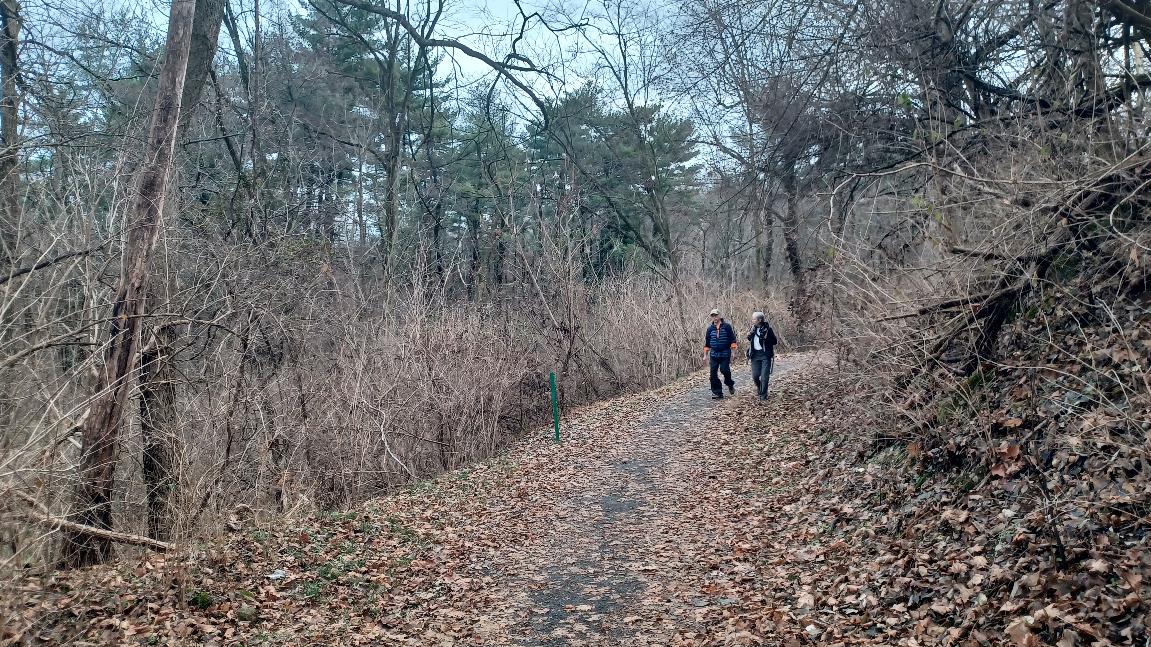
In a short distance from here, the Horse-Shoe Trail turned right away from the road and began climbing gradually. Ev said to me that he wanted to get in the stroller, just as we were crossing Alleghenyville Road, so I put him in.
Almost immediately, we had to go over a lip from the road onto the grassy trail, and Ev was not at all happy about it. He said he wanted to get out again, and so he continued to walk,
I pointed out the yellow blazes, and how they went up along a growing over field, with a house to the right of us. He happily got on the trail and started running ahead uphill.

The trail heads were marked with wooden posts, with the trail name routed into them vertically. This makes them much easier to see at crossings.

We continued uphill, and there was an electric fence along the right side, which I told Ev not to touch. He was good and didn't get at all close.
We passed by some big trees near the old field lines as we made our way up. Ev is at the point where he not only knows to look at the camera and smile (which he does with a silly face), but he also requests to have his picture taken. "Daddy take picture me" he'll say.
The trail emerged from the tree line onto an unpaved farm road with a home on the slope. We turned left on this briefly, and came to an enclosure where horses and Shetland ponies were kept.

There was also a pretty good view to the north, out over the valley beyond. Ev liked seeing the horses at this point, and they came over to greet us.

The area looked a bit different than it had the last time I walked through nearly a decade earlier. There were fences that had not been there before, or at least I didn't remember them. The trail passed through between a couple of these fences as it continued to ascend, and Ev continued to climb on his own.
The farm to the right of us had utilized the top of an old silo as a pavilion on their property, which looked pretty cool.
We continued walking uphill, and the views to the west got to be much more dramatic. It looked to me like photos I'd seen of the countryside in Ireland or Germany, as long as we weren't looking at the giant iron lady power lines the trail passed beneath here.

The view was about 180 degrees at the top, and then the trail cut to the left into a tree line, parallel with the utility line. It then turned abruptly right, uphill through the woods. Ev continued to walk.

Every yellow blaze was enthusiastically pointed out to me, as I hoped it would be. I remember hiking the Appalachian Trail with my grandfather, and excitedly pointing out the next paint mark on the trees that showed the way.
There were some nice seasonal views through the trees as we reached the crest of a hill, and the trail turned to the left. I was glad Ev was still out and walking here, because the side hill would have been near impossible for me to push him along if he were in the stroller.

Diane and John both took Ev's hand while I tried to power ahead with the stroller through this segment. Soon, we turned hard right, and the trail began to descend somewhat steeply. Ev started to oppose walking, but this was where I really needed him to move along.

I pushed the stroller down the first flight of the switchback, and turned hard right at the bottom. Ev started squealing behind me as I made this turn, and I could still see him above on the path descending. As we walked ahead a bit, I just had to get the stroller over some of the really rough rocks, and then I went back to get Ev.

By this time, he was upset and was walking too fast down the slope for my liking. I didn't want him to fall and hurt himself. Fortunately, he only fell once a bit, and didn't really hurt himself.

I held his hand back to the stroller, and guided him to John and Diane. I then pushed the stroller through the remainder of the rough stuff until the trail emerged onto a private back yard. I put him in the stroller and slowly pushed him downhill through the grass because we were just about to Witmer Road.
The trail went behind a shed, and then skirted the tree line through the yard before reaching the driveway and Witmer Road, where we turned hard to the left.

The trail follows Witmer Road for just a short distance, which is pleasant and easy. Ev sat in the stroller for this bit, and when we got to where it turned to the right off of the road again, he didn't like the bumps, so he decided to get back out and walk again.

the trail went through a wetland and soon approached a wooden footbridge over the eastern fork of Little Muddy Creek. Ev loves these little bridges, so he was quite content to be going across. It was wet from the rain, but fortunately he did not slip.

Ahead, there were a couple more little puncheon bits, and then the trail began ascending rather steeply up the other side of the little valley. Ev got in front of me, and I pushed the stroller behind him.
He made quick time going up the hill, and did so happily. I was very impressed that he went up this hill the entire time without stopping or complaining. It was a hard push for me with the stroller, even without Ev in it, so again it was a good thing that he was out and walking.

The trail remained rocky for this bit, and we came close to another power line. Ev continued to walk here thankfully, as we skirted the side of a hill and climbed for a bit more.

Just as we were reaching the height of the land, and the trail was coming to the end of a wooded section parallel with the power line, Ev started squealing that he wanted to ride again.
Fortunately, this was just about exactly as far as he would need to go in order to make things easier for me. The trail went from rocky to just grassy, and then emerged into a field environment again.
The field was very muddy from the rain, and the front tire was sinking more than what I would have liked, but it was still far easier to push through on this than back over the rocks in the woods.

The trail crossed over the power line to the south side, all of which is now cultivated farm fields, and picked up a more solid farm lane to continue heading east.

The farm lane went downhill a bit, to the right and left until it skirted the south side of a field heading east. There were a couple of fallen trees on the trail, and one in the field required me to go out into the tilled mud in the fields, but I got through it.
It wasn't too long until we came out to a small pull off parking area along New Holland Road, where there were Horse-Shoe Trail signs. This is where we would leave this trail to head on to other stuff, and a good spot to pick up on the next hike for this trail, where we could leave a couple of cars.

We turned to the left on the busy road, and fortunately there was enough grassy land along the left side that we could be safe as we headed north.

The views to the east from the road were really nice, as we could see a bit farther into the valleys with horses. To the west, our left, we passed a nice little farm that had chickens, geese, and a black pig.
Pretty soon, we turned left on a side road known as Grey Lane, which went closer to the old farmsteads. This was certainly the original oute of New Holland Road years ago.
We continued back onto the main road at the end of this, and then reached the intersection with Norman Drive, which descends into development.

I decided that even though this route was a bit farther, it was going to be the route we took because it got us away from major traffic.

We stopped on the road as soon as we were away from traffic to pop a drink, and then continued down to the intersection with Andrew Drive, where we turned right.
Andrew Drive took us back uphill a bit to New Holland Road, where we turnd left again, to the north.
In a short bit, we came into the little community of Knauers, where New Holland Road crosses Alleghenyville Road.

As we walked, there was some old equipment on the left side of the road, which I don't know what it was, but they were antiques used as planters or something.

At the intersection, there was a Turkey Hill store on the left, and so I went in to get some snacks and such for Ev for along the way.
Just across the street was a handsome old building with a mansard roof.
This was the historic former Knaur's Hotel and post office, in Knauers, which is part of Brecknock Township. The hotel was reportedly built about 1850 and so named for its proprietor.
We decided to stop for lunch at Screpesi's Sandwich shop, which occupies some of the former hotel.


We crossed the road, and there was not an easy way to get on through to the porch section. The structure was built into a hill, and we had to get through from the roadside where there was no sidewalk, but a good amount of traffic coming from the north.

We made our way around the front to entrance and went in to order some sandwiches. I ordered an Italian sandwich to share with Ev, which was pretty good.

I understand that Screpesi's is actually a few different locations, and that the couple who started it were originally in Reading.
Ev was less interested in food, and more interestd in running back and forth on the upper level of the two story porch on the building, which afforded a rather nice view of the area.
We moved around to the rear of the building to eat our lunch, where there were a couple of tables, and Ev could have the run of the place for a bit, going back and forth.

When we were all finished, we had to head back out onto the road a bit, and make our way uphill a bit on New Holland Road.

Heading uphill, there was an old house on the right side that looked to be abandoned. I took a photo of it, and as we got around the other side, a car seemed to be parked there, and it was in fact not abandoned at all I guess.
We continued along the road, which wasn't terribly busy, but enough that I had to watch he edge and pull the stroller over when I head a car.
We passed by another restaurant called Doc and Bubba's, a bar and grill. This certainly would have been an interesting stop if we had held off. I kind of wanted to just go in for a drink, but decided against it this time, although I don't know any situation that would bring us through this area again.

Just after the bar, we made a left turn onto Wyomissing Road. There was a very nice old farmstead on the right, which is now surrounded by new development homes, but it retains its historic ambiance.

The 1876 Reading Publishing Company Atlas of Berks County shows this as the home of A. Zimmerman.
While we were walking this road, I was off in the grass to stay way from traffic with the stroller. John was a few steps behind me when a very friendly cat came out of a house to greet us. I of course had to turn back and pet this car.
It was a very young cat, certainly no more than a year old, and small. It was the kind of friendly cat that didn't just beg to be pet, but would get up on its hind legs in order to push its head into my hand even harder than I would have otherwise. It danced back and forth and just couldn't get enough attention.

When we finally went to leave, of course the cat followed us. That hasn't happened in a while, but it isn't a new thing. Cats that love attention that much will just keep trying for more.

We continued down the road to cross over a little branch of the Wyomissing Creek, and the entrance to what maps are calling "Ultimate Athletic Complex" on the right. I understand this had, until rather recently, been Alvernia University Sports Park in Cumru Township.
The maps are now showing this as Berks County park property. There was a very nice bank barn on the right of the entrance road that was obviously quite old, but still used for storage.
The 1876 Reading Publishing Company Atlas of Berks County shows this as part of the Glassmoyer Farm.

We were faced with a problem here. The sports complex was closed off. We had had some snow and such recently, and maybe it was closed off to keep damage from occurring on the sports fields, but I'm not sure.

The no trespassing signs were only facing into the entrance road, and there was a mowed path that went straight ahead, parallel with Wyomissin Road, and to the north side of the property.
After going this far in, I did not want to turn back and circumnavigate the property.
I knew that there would be a way through, because Diane took a drive out and checked on it for us a few weeks back since she lives so close. I planned the route of the hike to specifically pass through here.

We all agreed to follow the path beyond the signs to the north, which immediately brought us out of sight from the road and just about anything else for a time.

At the north boundary where there are some more houses off of a private lane, we turned to the right. There was another cat out in the fields here, but not friendly. It took off running fast when we saw it.
We continued to the right, then left, then right again at the very north side of the property. The path remained mowed very nicely, but was kind of slippery in the grass.
We ascended parallel with some ball fields, and then to a height of land where we had a nice view to the west over the fields and private farmlands beyond.

The mowed trail remained on a large hilltop above the active recreation fields. At one point, the mowed area was at such a slope that it was hard to hold the stroller from tipping over.

We cut through a swath of young trees, and then came out along another area of fields, the last ones on this property. Then, the trail remained mowed and continued into the young woods to the east.
We made our way through these woods gradually uphill. Private property to the left became cleared, and there was a house soon in view. The trail goes to near the end of the property at Eschelman Lane, and then weaves back the way to the south and then west to make a long loop.

We cut to the left, over a few logs over the corner of a private yard out to Eschelman Lane, and then quickly turned to the left. We followed the road only a short distance out to Welsh Road, and turned left.

We only had to go a bit on Welsh Road, and at a fork, we turned right on Ledge Rock Road, which was a lesser used back road that continued to the east.
It was a pleasant walk. There were some personalized properties, like one with art stuff all over the front of it to the right, and a nicely done nativity setting on the left.
We reached a height of land in these hills, and then the road started weaving back and forth a bit and heading downhill. We followed this until we reached the intersection with Oregon Road.

There were some nice old houses in this area, and we turned hard to the left and began following the road steeply uphill. This was the last really rough push of the hike.

In a short distance, we reached the parking and trailhead at the southern end of Nolde Forest Outdoor Education Center, which is a Pennsylvania State Park.
I am rather ashamed I never made an effort to visit this location before, because it was just so nice, and there was a good opportunity to connect it to other things I've done to the north. It also has a very interesting history.
Jacob Nolde was a German immigrant who arrived in Philadelphia in the 1890s. He made his fortune in the hosiery business and lived in Reading.

Jacob Nolde began acquiring land for what would become Nolde Forest Environmental Education Center here starting in 1904. There was only a single pine tree growing on the property at the time, which came to be known as the "Inspiration Pine".

Nolde began creating a "luxury forest" of conifers he named "Sheerlund". He hired an Austrian born forester named William Kohout to supervise the property.

Nolde continued to acquire and plant until his death in 1916, and his family continued to operate the property.
The Sheerlund estate was acquired by the Commonwealth of Pennsylvania in the late 1960s, and is now known as Nolde Forest.
History paints a fine picture of Jacob Nolde. I read that in his textile mills, he was known to step into the factory, roll his sleeves up, and work side by side with his employees. When it comes to the oasis of nature he was creating, he took great pleasure in bringing anyone with interest to the property to tour the roads developed across the property.

Diane gave me an idea that this park was perfect for the stroller, and that although some of them get rather rocky, many of them are quite great.

For my first trip to this park, I chose a rather straightforward route through, which would connect beyond the pak, but also hit some important sites.
I had saved some maps of the park as screenshots before coming, so that I wouldn't have to keep opening a PDF document on my phone, but then found a good paper copy in a kiosk at the trailhead, so I deleted the files and closed the PDR window.
We made our way into the trail system, and there was an old water pump off to the left, and the old Kissinger Road to the right. This was the way I chose to go.

This road might have been older than Nolde's Sheerlund estate itself, or maybe it wasn't. It's hard to say which old roads were originally charcoal roads used for the processing of wood to charcoal for the colonial and early American iron industry.

We know the charcoal industry was a big deal here, because it would not have been completely denuded of trees as described otherwise.
The trail was easy and pretty level. Ev started falling asleep as we were passing along this.
The somewhat improved surface made for pretty easy travel.
I was really taken by the size of the evergreens along this route. Considering how late they were planted, not much over a century ago, the fact that they have grown so large is quite impressive.
The trail descended vey gradually, and we came to a fork where we turned right on the Chestnut Trail. This one was a bit more of a natural surface trail, where I had to deal with a few stones and tree roots, but overall, it was pretty easy. Ev started waking up when we came to some of these obstacles on this trail.
I chose this route because it cuts almost directly over to the old Nolde Mansion, which is now operated by the park. Just before coming out to that spot, the trail was in a deeper rut from erosion, but still easy to push through.

We came out to the mansion and driveways. On some days, these roads are open to people to drive up, but at this time, I don't think any parking close to the site was available, which makes it a nicer walk.

There was a large wooden sign that was shaped like a saw at the entrance to the maintenance area, which I thought was pretty cool.
Soon, we approached the beautiful mansion. It was not opened for us to tour at this time, but we could walk all the way around it and admire it.
The Tudor-Revival style structure built starting in 1926 by Hans Nolde, son of original proprietor Jacob Nolde, is a piece of art, and closer inspection of its details reveal even more.

Diane directed us over to a narrow door to the right, which had its church peak top that made it look more like the entranceway to a gothic castle. A close look at the metal bracing and hinge work revealed that it was adorned with metal representations of classic children's stories worked into the hinge metal.

There was a cat with a fiddle, a cow jumping over the moon, a witch riding a broom, what looked like a kid sticking his thumb in a pie, and more.

We headed over to the left side of the building where there was an arched area we could stand under as it rained just a bit as we were getting there. It was a good spot to stop and take a little break.
We looked at all sides of the building, as well as the garden area to the left that had a little fountain, which was turned off at this time.
Other people were walking around this area also. We had not passed anyone else on any trail section we had followed just yet, but people were going around the mansion, reading the many historic signs on display, and taking to some of the easier trails.

Soon, we headed out from the place and onto the old Sheerlund Road, which had been the main road to the estate. It is now closed to all but pedestrian traffic from the mansion.

It was a perfect, relaxing walking route. We descended with some very nice stone walls lining the edge of the road. A view to the left revealed the Watershed Trail passing along the edge of the stream known as Punches Run, with a whole lot of little footbridges along it, and the Boulevard Trail, another old service road, directly on the other side of the creek.
We continued downhill to the intersection with these two other routes, where there was a nice little kiosk along the edge of the brook.

There were some old stone stairs coming steeply down to the Sheerlund Road from the right, which used to be an access all the way to the top, to the Nolde Mansion.

A beautiful stone arch bridge carried the Boulevard Trail to the intersection with the old Sheerlund Road. The Watershed Trail continued on the old Sheerlund Road downstream.
The kiosk was a nice spot for a little break. It had a sort of step in front of it for children, and several photos of different birds and animals and such, with instructions to move the photos of the critters to the box of we had seen them on our walk.
Although I wasn't paying particular attention to any of this during the walk, it was still fun for Ev to play with the things and move them around on the board.

It was a good little break, and we soon continued on along the old Sheerlund Road to the south, now part of the Watershed Trail.

The segment was very close to the creek and quite pretty. The trail remained on the old road to where it turned left and crossed the stream, then climbed uphill a bit to the north.
Here, there was a gate. The road apparently goes by a private residence (which I later found out is likely the former forester's home, and might to this day be an employee residence, I'm not sure).
The trail turns away from the road to the right and follows closely along the edge of Punches Run.

The trail was very well done, with built up walkway and steady surface. There were often poles laying sideways and holding back some dirt from being washed out into the creek.

We continued along this pleasant trail, and Ev wanted to get out as soon as we were on a narrow one again. He ran much of the entire thing south to the junction where a side trail went to the right.
We tuned right, and passed along the grown over top of an old dam. Then, a set of stairs took us up and over the top of the old dam spillway. This certainly wasn't the original one, because it was made of concrete.
Off to the left, from the old dam, we could see what we assume was the forester's house on the hill to the west of us. The architecture looked pretty much the same, so it is pretty safe to assume it was probably built around the same time as the main mansion, around 1926.

The water was passing though one section of the spillway, but the rest of it was dry. I understand the remnants of the dam are planned to be removed.

As we emerged from the edge of the spillway, we reached the historic old sawmill building.
It was near this location that the "inspiration pine" as it was called, used to stand, as it was seen by Jacob Nolde during his visit in 1904.
We had to be careful walking into this lot because it was a large parking area and it was pretty much full.
We walked over to have a closer look at the old sawmill, which had a Smokey the Bear fire danger sign in front of it, and then moved on through the parking area to the north.

We reached the bridge over the creek, which was the route of the Sheerlund Road as it came back down. The road is now abandoned as a though route, but it used to go out to New Holland Road to our right and cross, then climbed a bit to make its way toward Reading. It is now closed in that direction.

We walked around the edge of the parking area, and then back across a bridge over Punches Run.

The Watershed Trail continued to the south from here, following an old road which apparently is also a buried utility line. Ev remained out of the stroller to run through this section.
We had passed a lot of people in the segment between the mansion and the parking lot, but there was only maybe one other person beyond this point.
We continued on this pleasant and easy trail all the way out to Church Road. From here, we had a view west on the road to the Old School Apartments.

I've tried looking up information on this spot, but I couldn't find anything on this building with the gabled roof. I assume it was once a school, but I haven't found anything more on it.

We had to turn right out to New Holland Road, which was pretty busy, in order to continue. Ev still wanted to walk, but I couldn't let him walk on the busy road, so he had to get in the stroller.
We continued until we reached the intersection with Mountain View Road, and we turned right, up hill.
We continued up this road rather steeply to the intersection with High Blvd on the right. This road was smaller, and Ev wanted to get back out of the stroller pretty badly, so I let him get out and walk the road as long as he stayed close.

I had a big plan on where the hike was going from this point.

High Blvd was shown on Google maps as going straight on through when we hit the intersection with the old Sheerlund Road again. That road continues to the right and left, but to the right it goes into the private farm.
To the left, that road is still public.
My plan was to continue on High Blvd straight ahead where it was a narrow, pleasant road through farms. It was shown all on Google street view as a through route.

We continued up and the area leveled off with a nice older home on the left side.

The 1876 Reading Publishing Company Atlas of Berks County shows this area as having been the property of the Yocum and Hertzog families, both associated with the early iron forges of the area.
As we reached the intersection, I was a bit confused. The old Sheerlund Road to the right was of course private, and to the left was open to public, but there was no road straight ahead.
I was able to check it on my Google maps complete with street view on site. The High Blvd section straight ahead had been closed off to public. There wasn't even a way into it anymore.
 |
| Inspiration Pine to the right of the white house, at the old sawmill |
The entire intersection was covered over with earth, and the fencing that had continued along that road was continued straight across as if the road was never even there.

At the intersection to the left, Gilbert homestead that stood on the northeast corner across from the one extant home is gone. It appears to be only recently removed as well, probably at the time the road was closed off.

To the right on the Sheerlund Road, beyond the private gate, there were two farm buildings that looked almost like mirror images to one another, but the second one was obviously an old stone bank barn building, because of the ramp into the middle level. Still, the builings also look like forge buildings.
The old atlas maps of this area show that the aforementioned forge was actually to the west of here, so this was likely not the forge building. It can be difficult trying to figure out where these buildings were compared to what is there now, and sometimes there are mistakes on these maps.

I wouldn't know any better in this area I'm less familiar with, but I know of mistakes in some of the old atlas maps closer to my home, so I can only wait and defer to local historians, if they even read this and get involved.

I had to look over the maps again and adjust my plans since my original one obviously was not an option.

Obviously, the only choice initially was to turn left and go down the old Sheerlund Road to the north. I let Ev continue walking at first since this too was not a busy road.
We walked gradually all the way down the Sheerlund Road to the next intersection, with Mountain View Road again. At this point, I didn't want Ev to be out running and walking, just because he does sometimes get excited and run off sort of randomly. I didn't want him getting into traffic, so I had to insist he got back in the stroller.

We continued straight ahead on Mountain View, and into a more residential area. We soon came into the little community known as "Grill".

This spot was probably the sort of center of commerce for the little town, and had we gone the other way I had been planning, we likely would have missed this area.
We reached Philadelphia Avenue, sort of the main intersection, and continued straight on Mountain View.
To the right at this intersection was the historic Centre House Hotel, now California Bar & Grill.
The hotel was built by Eliias Fritz in 1870. It also served as the Grill Post Office for the relatively short time the community had one, from 1888 to 1907.

Today, it is just part of Cumru Township, and just one of those places we never hear about.

We continued ahead on Mountain View Road just a short distance, and then the Sheerlund Road again turned off to the left. We followed this route.
Apparently, portions of the Mountain View Road are the old Sheerlund Road, but over the years, the newer name took precedent over the old one.
We followed this, and the road again came back to High Blvd. Yes, it was the same one we had been on eariler. This road doesn't follow a standard grid pattern. It went uphill where we followed it, used to pass through the farm, and then wrapped around to the east of Grill, and then whipped back around to this point and continued into area known as Shillington.

We turned left on High Blvd for just a short bit, and crossed over the road bridge across the Angelica Creek. The Angelica Creek Trail or Greenway crosses the road there.

Most of the remainder of the hike would be following this greenway downstream. I noted that it does continue in the other direction, but I'm not totally sure where it goes, and I decided against trying to figure it all out because the options were not obvious.
At least as far as the next road upstream should be public, but I'll look into that further in the future.
We turned right and began following the creek. Almost immediately, we came to a large drain pipe on the right. I decided to hop down and have a look at the bridge and drain by standing in the water.

Ev was happy to get out of the stroller again for a time here, as the path was nice enough for it.

The trail passed through a grassy area adjacent to the Sri Ashtalakshmi Temple, and continued beside the creek along a field edge, and then as a cleared swath through a line of trees, also along the creek.
The surface was a sort of crushed stone, but it was not terribly well maintained. It was growing in with grass and such, but never was it so bad that it was impassable.
Beneath likely the entire thing were buried utility lines. There were occasional manholes along the way.

We continued on the trail until it emerged onto the cul de sac of Woodcrest Drive. The trail was marked to take to the side walk to the right.

Ev continued to walk for a bit, and he got picky about wanting to push his stroller by himself. John and Diane went ahead of us, and Ev kept having a hard time steering it along the sidewalk.
Eventually, I started pushing it and tried to coerce him to go, but he started having a tantrum. Eventually, I had to pick him up and put him in the stroller, which he objected to initially.
Once I got him in and we were on our way down the street, the trail headed back off of the road at the next cul de sac to the north.
We went up a bit, and there was a concrete stream thing that was over a small brook. Ev was still hollering when I pulled up, but he's easily distracted by interesting things.

I really wanted to try to move on more quickly from this point because more rain was predicted later in the night. The hike had light attendance because these ridiculous forecasts always say that we're going to get way more than we do, but occasionally there is some truth to them.
The crushed stone surface trail resumed following a buried utility to the north, at this point rather high above the Angelica Creek.
To our left, on a hill was Alvernia University. The trail skirts this property on a sloped section ahead.

Ev calmed down after being in the stroller for a little bit, and getting some chocolate milk.

In this next section, we passed by several manhole covers on the trail, but when we got closer to the university itself, one of those manhole covers had an enormous rock perched on top of it!
This looked quite odd, and it occurred to me that the kids going to school there would likely want to try to get into these manholes and travel some distance underground, so they probably had to put this heavy block on top of it.
Someone brought up later, either John or our other friend Pete, that the block might actually have been on there because it might have been a sewer main, and that if it ended up overflowing, it might blast off the manhole cover if there wasn't enough weight on top of it.

I am not sure what the real reason is, but it was interesting to see.

The unpaved trail all of a sudden became paved, and dropped very steeply to St. Bernardine Street, and then crossed.
From here, it was much more of a developed trail, marked with little diamond markers that had the Angelical Creek name on it.
St. Bernardine Street crossed the creek to the right, and there was a lot of mowed, grassy park like environments around. We continued on the trail, which climbed to the left just a bit into an open area along the east side of the college property.

We continued ahead with some nice scenery ahead, with the height of land in view beyond the Schuylkill River. Another paved trail came in from the left, and we continued ahead to a T intersection. It looked like the trail used to continue straight, and probably used to cross the Angelica Creek on another foot bridge, but now it turns right and crosses the creek on another closer foot bridge.

We turned and headed down to cross, and what looked like a footing for a previous bridge was in view just downstream.

We turned to the left, and Google maps still shows another trail going off to the left here. It looks as though there was one at one time, but it must have been completely washed out in some recent flooding.
We continued on ahead on the paved trail to another intersection and some parking.
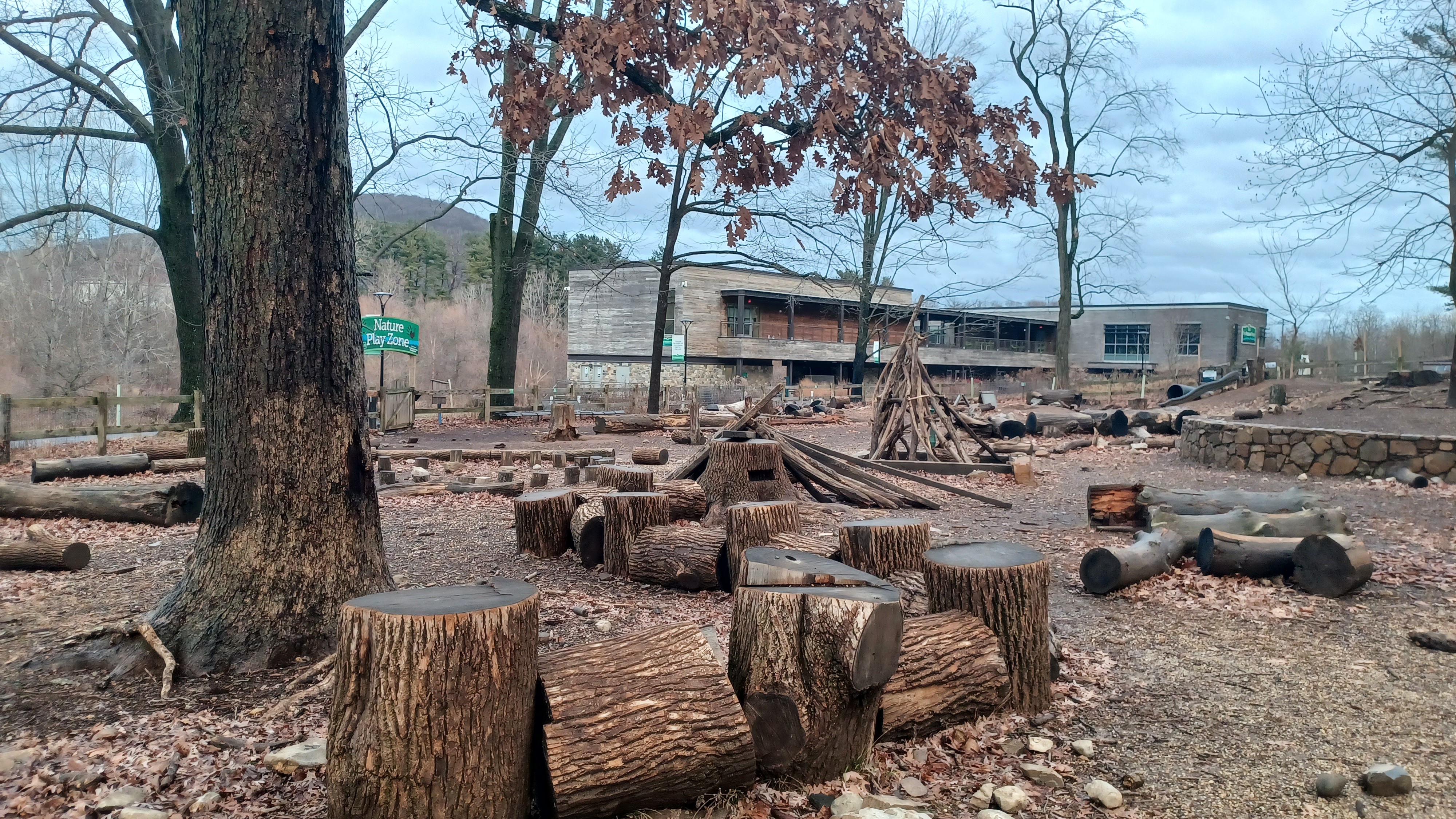
To the left, we came upon the Nature Play Zone, which is a natural playground at Berks Nature Place.
The site along the Angelica Creek features placed logs and branches for children to have tangible, tactile connections with Nature within a safe, enclosed area.

Ev seemed somewhat interested in it, but he was also kind of inclined to remain in the stroller for a bit. I would like to bring him back to this spot because it really was cool, but when we have more time. I wanted to beat the rain to the cars.

We took a hard left here, out onto a trail that went onto the flood plain of the Angelica Creek. This was quite nice.
The long boardwalk weaved back and forth quite a bit, and Ev was amused by a side area on the boardwalk where it got wider. He was saying that it was a parking spot for strollers.
We continued further onto this boardwalk, and the trail seemed to come to an abrupt end. There was a slight mowed trail to the right, and there was even some beat up wood from the old route sitting around.
Unfortunately, we could not get through this way. We would have to go around. I decided we would try to take the mowed path to the around to the east of the nature center.

When we got to the other side, there was no good way through it seemed again. We ended up having to go over close to the edge of the nature center to try to get up on the sidewalk structure.
We ended up walking up along the edge of the building past the retention pond, and then onto the trail on the other side, parallel with the parking area.
Another trail that was shown to follow the creek on Google Maps was no longer in place. We made our way to the remaining trail, which soon dipped down closer to creek level again.

Next, we reached the bridge beneath Morgantown Road. The trail remained on the south side and passed beneath the bridge, then continued along the creek downstream.

The underpass had all sorts of almost diamond shaped art shapes painted on the edge of it.
We continued along, and to the right, behind a fence, there was what looked like the ruins of a burned out building.
This was not a fire vicitim at all, but rather a building constructed specifically for the training of fire departments in structural fires.
We had passed by one of these once before down in Philadelphia just last year. It's quite interesting to see.

To the left, a set of wooden steps went down to the creek, and a once fallen tree grew across from the base, almost like it was cooperating with the steps for a crossing.

We continued ahead just a bit more, and there was a former road bridge across the Angelica Creek. The trail tuned left to cross this bridge.
This entire area is confusing with its transportation history. The historic 1915 USGS maps of the area call this settlement "Millmont", and interestingly, there was a railroad spur that once served industry that stood just about where the Berks Park Place stands today, which we went around.
We might have gone into the building, but it was closed as we went by anyway.

Heading closer to the confluence with the Angelica Creek and Schuylkill River, the trail turned abruptly left to follow the Schuylkill upstream. I walked down to the shore of the river to have a look at this perspective that I had never seen before.

Historically, the Schuylkill Navigation would have passed through this area, although there was no evidence of the towpath at this point on the other side.

The historic Union Canal also passed along the edge of the Schuylkill, and it terminated near this area, but I am not totally sure where.
I think the Union Canal might have terminated just a little upstream of where we would be finishing, but I'm not totally sure. I have not tried to trace that yet below the confluence with the Tulpehocken Creek. It was abandoned in 1885, and some of it became a railroad known as the Union Canal Branch though the Reading area in the years to follow, and I have not fully looked into that yet.

Just upstream from this spot, I could see the Schuylkill Navigation towpath on the far side.

We began walking north on the remainder of the trail, and soon approached two railroad bridges spanning the Schuylkill.
The first one was the former Philadelphia and Reading Railroad, which is still active today.
This is not the first bridge to have crossed at this location, known as Poplar Neck. Some of the old USGS maps also call the near side of the river "Orrton".

The Wilmington and Reading Railroad was the first one through here, which dates back to the 1870s I believe at this point. It became the Wilmington and Northern Railroad through a reorganization, and was soon operated by the Reading Railroad. By 1900, it became the Wilmington and Northern Branch of the Reading, except for this bit into Reading, which became part of a more main line.

There was sort of a belt line of rail built by the Reading Railroad along the southwest side of the Schuylkill, which this ties into more. The original Wilmington and Northern used to turn and go up along the Schuylkill a bit more from this area as I understand.

We passed under this, a deck girder structue, and approached the second one.
This one was the former Pennsylvania Railroad Schuylkill Branch, now abandoned and the route of the Schuylkill River Trail. I'd walked across this one already a couple of times.
The Schuylkill River Trail is constantly improving, following historic corridors and such, but it still has a substantial amount of road walk necessary to do it. I kind of want to do the entire thing again now.

I'm looking at possibly starting that off again in the Summer, and doing this hike now sets us up for more of that by that time.

There was an earlier Pennsylvania Railroad bridge that spanned this point, and some of the piers and abutments are still remaining next to the newer concrete arch bridge footings in and along the river.
The concrete viaduct looks somewhat similar to the Lackawanna viaducts I grew up going to, with the smaller arches atop the larger ones. Always a lovely design.
There was another trail following another right of way upstream along the Schuylkill from this point as well, unpaved. There was some construction work going on at this point, with barricades and equipment around. Maybe they are getting ready to do some more trail work, or maybe it's just utility work. I'm not sure, but I certainly have a lot more exploring do in Reading.
The Route 422/Benjamin Franklin Highway bridge over the river was straight ahead also, but we didn't continue to pass beneath that.
We made our way beneath the former Pennsylvania Railroad bridge, and the Angelica Creek Trail turned hard to the left to begin climbing the far slope.

Date marks on the bridge denoted that the Pennsylvania Railroad completed this structure in 1918.


After the end of the bridge, there was another underpass area we saw on our left, also marked 1918. I understand this underpass area was where the aforementioned Wilmington and Northern Branch of the Reading used to pass beneath.


We continued uphill to the grade of the former Pennsylvania Railroad, now Schuylkill River Trail, and continued ahead following that.

The trail led us in a short distance around a slight curve and back to the parking area where we had started off the day. Ev got out and walked very close to the end, and wanted to sit on a nice bench that was in the parking area.
Diane got me back to my car in Adamstown. We leave my spare car seat for Ev in a car at our end point typically, and things work out well for getting us back.
We had made it just on time. It started raining when we got into the cars, and by the time I started driving home in the van, it rained harder. We had gone through most of the entire day with barely more than a spritz, and Ev spent a the most amount of the day walking himself than he has in quite a long time.

From this point, I had really only one more section of the Horse-Shoe Trail that I wanted to try to get done before the warmer weather comes, and I'd connected back over to the Schuylkill again to start with more swimming weather stuff along the river.
By the time we get into the warmer weather, it looks like Ev might be walking more, and we'll be covering the stuff out by French Creek as well as along the Schuylkill. We can also shift down to the Wissahickon, and wherever else with all of the good swimming options, plus we still have plenty more cooler weather options.
Things are certainly going to be interesting.
No comments:
Post a Comment