

Hike #1650: Bristol to Pennsbury with Diane Reider, Professor John DiFiore, Mike Heaney, David Adams, Matthew Davis, Robin Deitz, Kirk Rohn, Heshy Buscholz, Laura Nycum, ?, and Everen
This next hike would be a point to point specifically planned around Charter Day in Pennsylvania.

Last year, we had done the Railroad Museum of Pennsylvania for Charter Day, which was a great time, because it was open for free.
Charter Day refers to the very beginning of Pennsylvania as a colony.
In March of 1781, King Charles II granted the charter to William Penn, and he became the first Royal Governor of Pennsylvania. The charter is often regarded as Pennsylvania's "birth certificate". In celebration of this day, typically on a Sunday in March, many museums and historic sites in Pennsylvania offer tours free of admission.

Diane was the first person to really make me aware of Charter Day, and it was she that recommended we visit Pennsbury as part of a Charter Day hike.

It was only appropriate to visit the home of William Penn in celebration of this, of all of the locations offered.
I knew I wanted to do it, and I figured it would be pretty easy to plan something. I didn't want to do a lot of stuff that I'd already done, but I figured it would still be easy to put together. After all, I was already somewhat familiar with the area having hiked the rail beds, the Delaware Canal, and other parks through the area.

This proved not to be as easy to plan as I thought.

I was looking at a route that would loop us to and from Pennsbury, but that wouldn't work at all.
There was no good or safe way walking to approach the Keystone Trade area from the north. The only good way in was via a causeway to the west out of Tullytown.
I had to give up on any route that connected us to Pennsbury as a loop or from the north.
I decided I would look at Bristol, the Delaware River waterfront, the former Pennsylvania Railroad, and the west portion of Silver Lake Park, which I'd never done before.

This turned out to be an outstanding route, but it did run too long, and we almost missed the last Pennsbury tour! We had a similar situation last year with Strasburg as well.

We met near the end point at Quaker Penn Park, which is just briefly down the road from the Pennsbury Manor site. From there, we could shuttle west to Bristol and Silver Lake Nature Center.
I had a lot of plans of other stuff we could do, and I was considering doing a trail across from Silver Lake Nature Center known as Delhaas Woods as the start of the hike, but it was a good thing we didn't, because we would not have made it!
We simply parked at the Silver Lake Nature Center main parking lot to begin this one. Ev was on his feet and walking for this hike right at the start.

There were signs and pictures of animals and such, and other stuff to see.

I'd only hiked Silver Lake Park before back in the fall of I think 2007, when I headed north along watershed greenways heading north.
I'd been aware that there was more to the park on the west side, but I'd never seen it before. It was far more impressive than anything I'd seen on the east side, but that also might have changed in the past 17 plus years!
The trails were delineated well and often times they were boardwalks and puncheons over wet areas. Ev loves walking all of that, so he was on his feet a lot here.

We continued through the park and made our way out onto the waterfront, where there was a greater boardwalk and a high viewing platform overlooking a beautiful spot on Silve Lake.

The lake's configuration has been the same since the 1930s when the original lower end was filled over for the construction of Rt 13.
The first impoundment was constructed about 1689 on the Otter and Adams Hollow Creeks, used to power the mills of Bristol.
The mill pond was enlarged in 1692-93 to a size of 100 to 150 acres. The present marshes were once part of the original pond that silted in.

In the 1700s, it was believed that the waters here had healing qualities, and bathing in them came at the recommendation of Dr Benjamin Rush in 1773.

Bath houses were completed in 1810, and Bristol became a tourist destination.
The baths fell out of favor by the 1870s, and the property came into the ownership of the Pennsylvania Railroad during their realignments. The line originally went more through downtown Bristol, but straightening the line brought it close to the body of water.
The lake was purchased by the Pennsylvania Fish Commission in 1935-36, and the site was subject of WPA projects during the Great Depression, which was the birth of the park we know today.

It is really amazing that this simple place had so many different "lives", serving such diverse functions over the span of over 340 years.

We admired all of the views from the platform, then descended to continue following more boardwalk trail heading to the south.
Ev walked on the trails for just about as long as the boardwalks continued before he got tired and wanted to get into the stroller.
There was an amazing section ahead where these boardwalks went right out onto the edge of the open water of Silver Lake providing us with some of the best views yet.

Soon, we emerged at the open grassy portion of the park. The trails continued paved through this open section as we headed to the south.

We soon approached the main dam for Silver Lake.
The modern incarnation of the dam was very small. It is really amazing that such a low dam, only a couple of feet, can impound so much water, so far back as it does. The area is pretty level though, so it wouldn't take much I suppose.
We continued onto Bath Street and crossed the Bristol Pike at the crosswalk. On the other side, we could see there was some construction going on ahead.
We continued walking down Bath Street to the south, and there was a police office there, with signs reading that the walkway was closed beneath the active railroad, which is four tracks wide northeast corridor here.

There was no other good way to get through this, so I went up to the cop car and asked the officer if we would be able to walk under. I was ready to explain where we were going and what we were doing, but no further questions were necessary.

The officer was as nice as could be. He walked with us beneath the bridge as an escort by the construction workers beneath, and we were on our way.

We followed Bath Street south until we came to the intersection of Otter and Mill Streets. Here, we reached where the Delaware Canal used to pass beneath Mill Street. My plan was that we would follow the old canal a distance to the north first.
I had several historic photos taken through this area, and I wanted to try to emulate them, plus I never really looked at the canal in great detail in Bristol when I hiked it in the past. I remembered going over the old lock sites, getting a couple of photos, but I wasn't as much into the details then.

Now, I am much more versed on the rest of the canal, and Bristol has become much more interesting to me since the canal is more obliterated there than anywhere else on the nearly sixty mile length.

The canal was built as the Pennsylvania Canal, Delaware Division, in 1832. It was a major piece of the puzzle when it came to getting the anthracite coal from mines to market in the early days before railroads prevailed.
The Lehigh Canal actually began construction earlier than this one, and they started building their locks up in Mauch Chunk (today's Jim Thorpe) to the size of the Schuylkill Navigation, because it was anticipated that the Delaware Division would be building to that size.
 |
| Lock 2 |

When the Delaware Division locks were built to the same size as the Morris Canal instead, the remainder of the Lehigh Canal locks were build to smaller size.

When the state sold off most of its canal system, and the Main Line of Public Works between Philadelphia and Pittsburgh mostly went to the Pennsylvania Railroad in 1857, the Delaware Canal was operated by the Lehigh Coal and Navigation Company.
The Delaware Canal is considered to be among the longest lived of America's historic towpath canals, because it was in operation longer that most of the others, until 1932. There are some reports that a bit of the lower Lehigh Canal was even used for some limited operation into the 1940s during World War II, but otherwise the Delaware Canal is considered to be the longest lasting.


The entire area around Bristol really confuses me as far as the canal is concerned.

There were basins on the canal where it connected to the Delaware River, but comparing the maps to what is there now is very confusing. There is still a long basin there now, but apparently there was another and a spit of land that extends to the Delaware River where the canal itself is filled in.
I read over and over articles about the canal and what had been. Some of these articles claimed that the second lock was located under an automotive garage, but checking aerial images suggests this is entirely false.
 |
| Lock 3 |

My comparisons to maps seemed to show that it was much different, but there are too many discrepancies. I think I have a good idea of the layout now, but I'm still not totally sure.

This first bit of the canal was obliterated pretty early on, with basins filled in through Bristol. Much of the rest of the canal was made a state park, initially named Theodore Roosevelt State Park, but then changed to Delaware Canal State Park, and Theodore Roosevelt got a recreation area along the canal named for him.
We were not going all the way to the eastern terminus of the canal at the start. We'd instead head away from that a bit to the north, and in that section, I had a much better understanding of where the locks were and what numbers they were. The compilations I'd get on those sections would be pretty spot on.


As we approached Mill Street, I went down to the former bridge site to have a look. This one had been completely filled in. We went down to the left from this and approached the site of Lock 2.

Unfortunately, lock 2 had been completely filled in. I'm not even sure of the tops of the lock walls were visible through the grass in this area, but there had been some work done to try to delineate exactly where the lock would have been.
The big problem with this work was the fact that they apparently made the miter gates of the lock facing in the wrong direction when they had placed the mock lock.
I had the group stand with Ev while I ran around the site trying to get comparison photos to the historic ones I'd saved to the phone before this trip.


Lehigh Coal and Navigation Company boats could be recognized clearly by a sort of bullseye emblem on the front of the stern of each boat.

I had one shot of a boat right in the lock, and another of one passing over the foot bridge section of the lock, showing how tight the clearance was for boats going under.
Only light boats would have trouble with this. Fully loaded boats full of coal were always held down lower and had no trouble clearing these structures.
Beyond Lock 3, the Snyder - Girotti Elementary School parking lot had been built directly over the canal, which was filled in through this area.


Boatmen would use the Grundy clock as an important mark in their travel. They knew that when they saw the Grundy clock, their journey on the canal this time was almost through.

We continued across and got back on the canal route again.
Here, there were some cut outs of canal men and mules affixed to the fence to the right of the former towpath. We have these in Warren County on the Morris Canal, but these ones were a bit more humorous!
The very first one featured a stubborn mule not wanting to walk, with a mule driving pulling him, and a high bowed boat behind.

The filled canal came to an end at Washington Street, and became watered again adjacent to the Grundy building. I remained on the towpath, and Matt went across to the trail on the other side.

I always thought this was a particularly pretty section. We walked ahead and crossed Jefferson Street, where there was a little peninsula off into the canal into what is now Lagoon Park. This was probably and industry and turning basin back in canal days.
The former Pennsylvania Railroad station was in view a short distance to the north just below the tracks, which were up on fill.
The original station for Bristol I understand was a wooden structure on the corner of Pond and Market Streets.


Matt, Ev, and I were far ahead of the rest of the group, but we continued on a bit more, soon to reach the former Pennsylvania Railroad overpass, from the re-aligned main line.
We went through to the other side and I stopped to get another drink. We waited there for a bit for the rest of the group to catch up.
John fell behind somewhere; I'm not sure if he was using a restroom or made a wrong turn or what, but we gave him time to catch up before we moved on ahead.

Once everyone was caught up, we continued down the canal a bit more. A train went by so we could barely see it on the former Pennsylvania Railroad as we continued.

After just a bit of walking in the first secluded section, there was a sort of new trail breaking off to the right that I was not expecting to find. I decided this was as good a time as any to explore it.
The path was a little rough, made of a regular gravel. This trail headed to the south through woods, and was wide enough for a truck to get down. We continued on this path to a point where it turned hard to the left.
As we made this turn, I noticed railroad rails out in the woods parallel with us, so I paused to go over and have a look at them.

They were at a lower level than the currently active tracks, so I wondered if they might have been a spur that was a remnant of the earlier alignments.

This was on the wrong side of the tracks for it to be anything to do with an earlier alignment, but still interesting that they were there.
We continued parallel with these along the trail parallel with the tracks, and then the trail turned hard to the left to head back to the north once again.
There was no good way I could see to continue to the east, which was the way we needed to go, so we just headed on this trail until it got back to the canal towpath again. It was a nice little excursion, and at least we checked it out to see what was out there.

We continued on the canal east for a bit, until we got out to Green Lane and the Bristol Amish Market. Here, we turned to the right and started following Green Lane to the east.

We passed under the former Pennsylvania Railroad tracks up ahead, and then headed into the neighborhoods. We turned right when we got to Wilson Avenue, and then turned left on DeGuisseppe Drive or Railroad Ave, I forget which one. Both took us where we needed to go.
Immediately at the end was a trail parallel with Trenton Avenue leading to the left, the Bristol Spur Line Trail.
This trail follows the older Pennsylvania Railroad right of way through Bristol, built in 1834.

The main line was straightened and elevated in 1910. The original Main Line track bed remained in service until early Conrail days before it was abandoned, just as an industrial spur line.

I had walked a piece of this on a hike in the past, but never followed it all the way through.
Ev was tired already by this point, and I recall he fell asleep again, while we were walking parallel with the active tracks and he was certain to miss them going by.
It's a busy area with some fast trains. Both SEPTA and Amtrak pass through this area, but only one of them stops, and the other is super fast.
We continued along the path, which remained immediately parallel with Trenton Avenue until ball fields and a track on the right side.

There, the rail bed moved off away from the roads for a bit, but we were still in pretty open and exposed area.

We crossed over Jefferson Avenue yet again, and then passed the Grundy Commons.
We continued on the trail through a grassy swath, then Lafayette, Washington, and Dorrance Streets. We skirted some parking areas, crossed Beaver Street, and then passed along the front of the Snyder - Girotti elementary school.
Here, we came upon a very nice historic marker, and a segment of tracks put in place for ambiance.

The sign tells of how President Elect Abraham Lincoln's train stopped here, and he gave a speech in February 1861.

Ahead, Old Rt 13 is built on top of and next to the railroad bed heading west out of town, and the paved path took the place of sidewalk along it.
As we walked this stretch, there was an historic marker as well as the "Bristol Stomp" mural on a building across the street from us.
The 1961 hit by the Dovells, inspired by the stomping dance of the kids in Bristol, put the Pennsylvania town on the Rock and Roll map, and the mural memorializes the local anthem.

Bristol Stomp: https://youtu.be/XCOB5-E4P6Y?si=bPcDsa-66Az8mSCr

I had known and loved the song for many years, because I grew up listening to a lot of oldies and Doo Wop on the radio stations my mom played. Bristol Stomp was always really catchy.
Many other towns have tried to take credit for the popularity of the Bristol Stomp, but it really is this Bucks County town that it refers to.
There are claims that local deejays had really pushed sales and such to elevate this particular song to the charts, but whatever the case, it was catchy and got popular.

People are always saying "Kids in Bristol are sharp as a pistol when they do the Bristol Stomp", but I had always heard they were "sharp as a thistle", which makes a whole lot more sense. I suppose it was more popular and badass to say something like pistol though.

We continued east past this point, and soon reached where the railroad used to cross over the canal. Tracks start back up a little further near the intersection with Canal's End Road.

We turned to the left and descended to the old dry canal bed below where the tracks and road crossed.
We made our way through the grass and along the delineated walkway through the parking lot to the south.
In Canal's End Road to the left, there is a spot in the road that has pavers that supposedly are the site of the buried lock. I'm not sure if I buy that or not.
There seems to be some discrepancies between the historic aerials, historic maps, and what is said though the area.

The one article that claims the lock is under a garage on the corner of the road is pretty certainly false.

Because of some of the obviously false articles, I was doubting just about everything.
The articles say that the last basin was totally filled in, but there is a huge basin of water at Bristol that is quite obvious. It doesn't seem possible that it was filled.
Then again, the last street appears to be farther inland today than it was historically. While we were walking, I was convinced that idiots did all of the work and that it all must be wrong, but I've changed that feeling because the road grid agrees with some of these claims. I don't think anything agrees that the garage is built over a lock.

Ev stayed with the group as they took a break near the head of the water, and I ran over to the right, to an inlet area near the end of Canals End Lane.

I figured the lock area must have been at the end of this, and that much of the stuff posted was wrong.
Now that I've looked at it more closely, the delineated spot in the road is closer to it, but it's been changed so much, it's really hard to say exactly where anything was.
It does look to me that it is possible what they delineated as the lock might have been a sort of mill race that came off of the canal a little further to the north known as Malone's Gut.

I climbed through some of the weeds to the waterfront to see if I could find any remnants of any lock, but found nothing. What I did find was what might have been some dumped old tomb stones in the edge of the water, within the weeds.

I'm not sure what those were about and couldn't find anything in particular on them.

I made my way back around from the edge of the waterfront to Canals End Drive, and walked onto a spit of land in the middle.
In this area, I was trying to find specifically where the raceway known as Malone's Gut would have terminated. All of this land has been so altered since the close of the canal, it's nearly impossible to pick up any anchor points to the past.
I had some historic photos that showed what the lock house used to look like for Lock 1, but I couldn't figure out where it had stood.

Ev started waking up around this time, and so I took him out into the little peninsula area to look around. There was one giant tree out there that was quite impressive, and it must have been there since before 1932.

I think I may have gotten only one then and now compilation at the site that came out right, featuring the basin above Lock 1, looking north from Canals End Lane.
Aside from that, I was perplexed, and just ready to start heading to the Delaware downstream and to do more stuff I had never done before.
As we were walking along the trail beside the body of water, to the right in the grass was an odd potato, just laying there. It had googly eyes taped onto it, and looked quite funny. I told Ev to check it out.

At this point, Ev has begun labeling things with names, like some of his toy trains.

Ev has become obsesses with trains, which is a given, but with his Thomas the Tank Engine stuff, those trains get names. Others do not. Only the ones with eyes.
When asked about what it takes to get named, Ev would respond "him have eyes".
As such, Ev was referring to it as "potato with eyes". I grabbed it up and handed it to him to carry.
I asked Ev what we were going to name the potato, and he had no answer. I told him "let's name him Jeremy!
For the rest of the day, Ev had this potato in his stroller, referring to it as "Jeremy Potato with eyes" or a segment of that name.
We continued down along the waterfront on the Delaware Canal State Park path to the former site of the tide lock, where boats were lashed together and towed the rest of their journey, if there was any, down toward Philadelphia by tugboat on the Delaware. I had one more then and now to set up here.

We all walked out onto the very corner of the spit of land where the lock had been.

There is a circular thing in the walkway that seems to state that was about where the lock was, but I'm not totally sure on that. I need to do more research into it.
We walked as far out as we could, where we had good views across part of the Delaware River. I say part because we were actually looking mostly at Burlington Island, which sits between this shore and the Jersey side.
After I'd gotten a few photos, we moved on to the left, directly on the waterfront heading upstream on the Delaware.

I'd never walked along the Delaware directly north from this area, and we'd find all sorts of interesting stuff right from the start.

The first of the interesting points we found in the waterfront park was the Harriet Tubman Memorial statue.
Tubman escaped from slavery and fled to Philadelphia where she became active with the Underground Railroad. She led over 300 slaves to freedom in 19 trips back south. She also served as a spy and a nurse to the Union Army during the Civil War.
Turman is depicted in the statue with a haversack over her shoulder and pistol at her waist, symbolically pointing to the North Star.

Just a little bit further upstream from the Tubman memorial was the Puerto Rican Memorial, dedicated to the Puerto Rican people who made their home in Bristol.

The memorial is a replica of a Garita, or guard house, that lined the forts of San Juan. I'd seen this thing before, but never knew what it was. I didn't realize its significance until we stopped to look more closely.
Next just in from the waterfront, and near a boat ramp area, we walked out onto the Delaware onto some docks and such, which afforded us some more great views.
On the inland side here was the historic King George Inn. This is believed by many to be the oldest continuously operating Inn in the United States, save for a brief closure from 2010-2015.
Built in 1681, it was original the ferry house of Samuel Clift. The Inn has had multiple additions and names, and King George II Inn was used from 1765 until the Continental Army approached in 1781. It was also called The Fountain House and Ye Olde Delaware House, until the King George name was restored in the 1940s.
Other watering holes claim to be older, and I'm not sure which is correct or not. The Broad Axe Tavern in Montgomery County might have been considered close, but that was recently closed.

I had eaten at the place with Jillane and our friends Cupcake and Darlene, and very much enjoyed it. I always like the historic places the most of all.

The park ended, and from there we had to walk through Market Street parking in order to continue on the waterfront, but even that was only for a bit more before we had to turn uphill a bit and out to Radcliffe Street to continue east.
From the point where we turned in, there were good views up the Delaware, with all of the stately homes and building on the shore in good view.
One of these buildings was the more prominent.

The stucco Greek Revival building with the white wooden columns is a bank, originally built as a residence for Joseph Craig in 1818. It was sold to the Farmers Bank of Bucks County in 1830, the oldest bank in Bucks established only a decade earlier. It has served as several banks since, and the two wings were added in 1952.

Radcliffe Street was really nice to walk up. I seem to recall we had to use some stairs to get through on it.

After going about a block, we came to the lovely old Dorrance Mansion. The structure built in Italianate style in 1862-63.
The home was built for John Dorrance Sr, prominent owner of mills and industry, politician, and stakeholder in steamboats, rail, and shipping. His heirs held the property until 1921, and it became home to the Bristol Knights of Columbus. It returned to private ownership in 1982.
We continued ahead a bit further, and soon came to what appeared to be one of the old stone highway mile markers we had been seeing on recent hikes for old turnpikes.

This one was actually a replica of mile marker 9T on what was the Philadelphia, Frankford, and Bristol Turnpike chartered in 1803. The T is miles to Trenton.

The turnpike was completed in 1812, and it served as a toll road for decades until it was sold to the city of Philadelphia in 1892.
We continued on ahead another two blocks, and the next point of interest was the famous Grundy Mansion.
Renovation was in progress, with scaffolds and such up around much of the building as we went by.

There was a promenade along the river usually open to the public when the Grundy Library is open, but it is closed on Sundays, and therefore so is the walkway.

The original portion of the house was built in 1818 by coppersmith William Heiss. The property was purchased by Captain Joseph B. Hutchinson in 1834, who built an addition on the south side.
William and Mary Grundy took up residence after Hutchinson's death in 1875. They purchased the property from the Hutchinson estate in 1884, and a year was spent extensively remodeling in Queen Anne style with modern amenities of the time.
As we walked by the front of the handsome building, we could see a tug boat going by out on the Delaware Rive, a really nice scene.
Just after the building was Margaret's Garden, a beautiful little property adjacent to the house which was also not open as we were going by this time.
People were starting to ask about food, and I knew we had to keep moving. The group was looking into what was nearby on their phones, and I didn't see anything in particular that would be close or fast.


Matt wanted to go down a side street to the left where there was a pizza place, and that looked like a good idea for fast service, so we all walked about four or five blocks northwest to the place.

When we got there, there was a little convenience store at the cross street, but the pizza place was tiny and they did not sell pizza by the slice. I decided not to order anything because if we wanted a pie or two more to go in, we would not make it on time for the closing of the museum.
Matt said he would order the pizza and catch up with us, and I started moving back toward Radcliffe Street to head to the northeast, upstream on the Delaware.

The next historic point of interest was the St Mark Church of Bristol, the first Catholic Church in the lower portion of Bucks County.
The first church here was constructed in 1846. The original structure was destroyed by fire in 1867, and the current structure was constructed in 1868. Another fire occurred in 1882, and the building was partially reconstructed and expanded to today's configuration.
Just past the chruch, we crossed over New Brook, and then followed the street for just a few more blocks to the intersection with Pine Grove Street.
This was pretty much the end of the downtown section of Bristol. We walked the one block on Pine Grove, and a paved trail, part of the Delaware River greenway, began at the end and led us toward the waterfront.
We turned to the north to begin following the river upstream. It was quite pleasant, with some views out into the part of the Delaware River known as the Keystone Range.


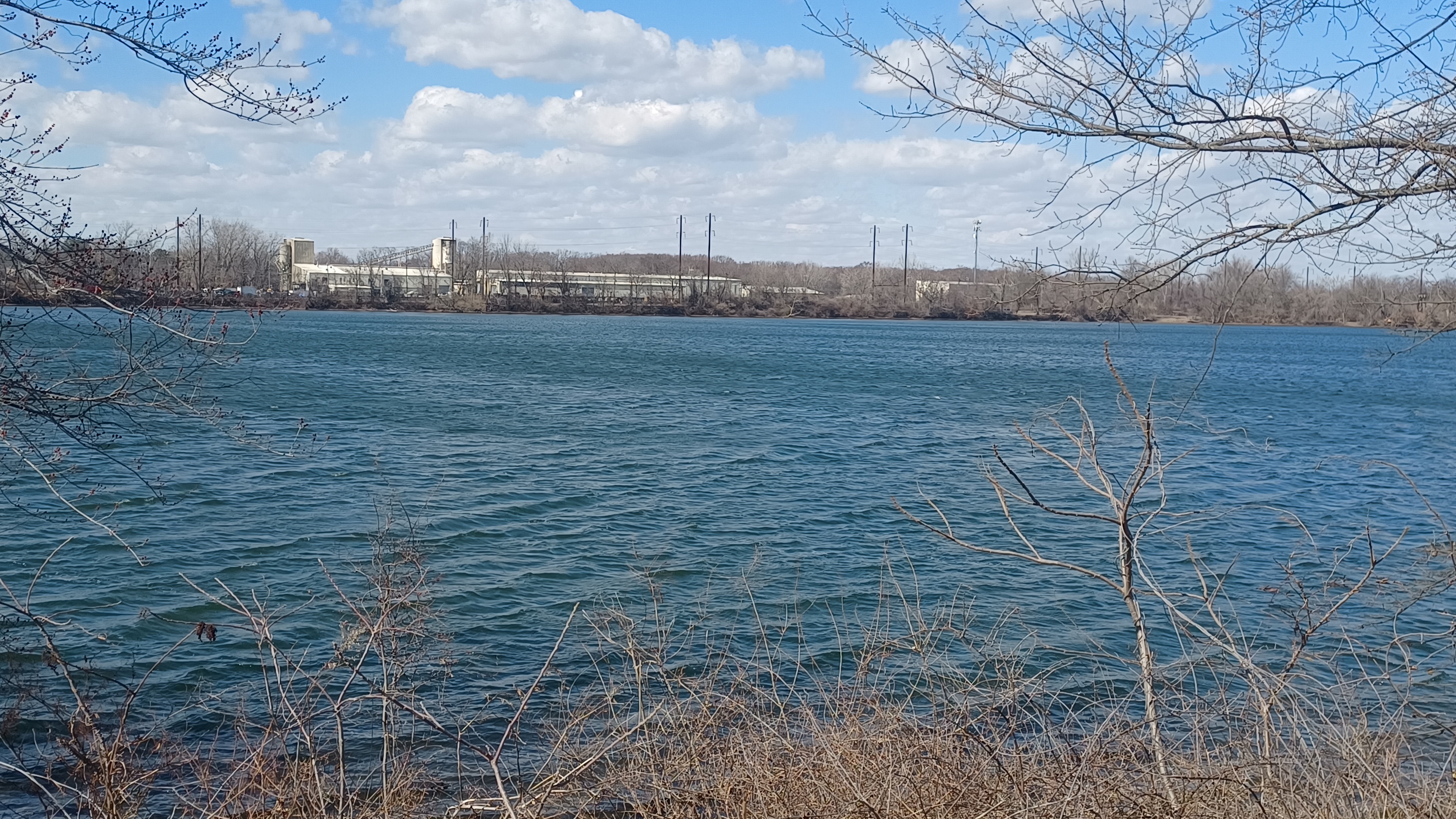
The upstream end of Burlington Island was just to the right, and across from us was wooded riverfront, and the Ta Chen International building, and the Walter R. Earle Burlington industry.

The paved trail along the river followed the back of the parking lot of the 1SEO Digital Agency, whatever that is.
When we got to the end of the section parallel with the parking lot, the trail continued, somewhat newer with newer pavement, along the back of a recent development.
The paved trail, at the end of the new development, came back out to the main road, and only one other parallel road called Seabird Drive paralleled it closer to the water, but only for the distance of about a block.
Just before we came in from the waterfront, Matt showed up with pizza and gave Ev and I two slices to share. That was quite nice, and he was finally getting hungry. He had fallen asleep for a time.
Upstream from the development trail, we could see the Delaware access from the Gold Bond place on the NJ side.
Up until this point, the hike had been pretty good for walking with the stroller. There was always either trail or a sidewalk, but that all ended at about this point.


Just ahead, the Bristol Spur Line Trail joined Radcliffe Street to the left of us. I think this might have been a rail spur to the Delaware at one time, which connects with the rest of the trail we had been on, but I'm not sure.


We continued up Radcliffe Street, and soon passed the Pines Tavern on the left. This building had the shape of a sort of railroad station, but I couldn't find ay information on it.

I thought maybe at one time it had been a trolley stop, but I have nothing to go on for this other than the fact that the building resembles railroad stations I had seen elsewhere.
I would have liked to stop at this place for some food and drink, but we really needed to keep moving.
We continued through a residential area of highway. The shoulder was wide enough to walk, but it lacked the charm of what we were on before. This felt more like some of the obligatory waterfront roads we had to do in order to cover the entire perimeter of NJ.


Soon, things got a bit more interesting as we approached the Delaware River Turnpike Bridge, which opened to traffic May of 1956.

A second, identical parallel bridge was to be built to address increased traffic but now plans call for an entirely new structure upstream from the original.
Hopefully, a new structure will involve a pedestrian lane as well as habitat replacement for the Falcons currently nesting beneath the bridge.
As we approached the bridge underpass, there was a lady watching birds from her car directly beneath.


We paused to say hello to her, and she told us what exactly she was doing.

She was very concerned about the future of the bridge, and was watching the falcons very closely. She said there was a meeting coming up that week about the future of the bridge, and that now, rather than building the second parallel bridge, they are considering full replacement.
She said preliminary work had already been done to build a parallel span to replace the one that is there, and the properties had already been purchased.
Indeed, there was an abandoned house just up ahead on our right, on the river side of the upstream side of the bridge.


She wanted to be sure that whatever new structure would have place that might be amenable to nesting beneath.

It was actually kid of a shame about that next house as well, which sat up higher than flood waters would go on sticks, and had a dark wood facade to it. It was actually quite nice.
We continued walking along the road upstream from here, in in a couple of blocks of distance we came to another historic mile marker. This one was apparently an authentic one.
It was mile maker 22T, again with T for Trenton. The modern historic marker posted near the stone marker noted it was from 1810.

Just past this, we could see over a fence into the yard of a stately mansion, and we were rather surprised tos ee there was an old style Durham Boat in the yard.
It turns out, this was a replica at the headquarters of the Washington Crossing Foundation. This was not open to public, but it was noted on Google maps what it was.
Durham Boats were used by General George Washington and the Continental Army for the Christmas crossing of the Delaware in 1776.


We continued on the road, and Radcliffe Street made its way past a couple of ball fields, and then up alongside the former Pennsylvania Railroad, to our left.

There was a crossing in this area, where tracks broke off to the right to access the Riverside Industrial Complex. We saw one train pass by while we were parallel with the commuter line.
We continued ahead, and the road we had been following changed names to Main Street as we approached the little community of Tullytown.


As we continued into the area of Tullytown with all of the businesses, I had intended to make a right turn into the industrial area and end up on River Road and Gunpowder Road.
The route heads out toward the Delaware, and there is a little bridge over a stream called Martins Creek. I wanted to go left at that, and we could get into the south side of Tullytown Park, which has a paved trail through it back up to the main road.
I unfortunately missed the turn because I was in deep conversation and just didn't notice.


Missing the turn did mean that we got to pass by a very nice old church across from us on the left, and I got to do another then and now compilation.

The building is now Christ the King Russian Orthodox Church. This denomination took over the church building in 1993.
The Cornerstone of the historic church building reads 1874, but there has been a church on this site since 1822.
Some say this is the original 1822 church, after a rehabilitation, and at the cornerstone reflects the date that the mortgage was paid off, 1874. I'm not sure what the answer really is, but it's interesting nonetheless.


We crossed the Martins Creek on the road, and we could see the trail I had intended to follow coming in from the right, adjacent to the Tullytown Borough administration offices.

We veered off to the right here on Bordentown Road, which turned us to the east, and toward our destination out on the interesting wetlands approaching Pennsbury.
On the left of this road was the pretty Tullytown Cemetery. We turned off and walked through a small portion of it.
The earliest known burials here go back to 1810, when the settlement was still known as Riche - Town.
We cut through a line of trees at the east side of the cemetery, and out to an access road along the west side of Van Sciver Lake, an enormous body of water. We then tuned right back out to Bordentown. We had some really nice views of the lake as we went by.


There was once more land and Marsh through this area, along the Scott's Creek, and before that known as Sepaessing Kill. This means plum tree to the native people, and "kill" is Dutch for "creek".

The area was heavily excavated for the Warner Sand and Gravel Company in the past, leaving little of the original creek.
This was all once part of the estate of William Penn, but the majority of the area is now lake and landfill owned by Waste Management, and bears little resemblance to the former landscape.
Bordentown Road goes up on a large causeway over the Van Sciver Lake, with a power line and grassy clearing on the north side parallel with it. That made for a pretty good walking route for us.

Of course, it was bumpier than it would have been down on the road, but I was happy not to have to contend with the traffic.

All of the land surrounding the road was heavily posted with no trespassing signs. It all seemed kind of strange. There was an area just to the north that was clear but no one was allowed in. That first road we emerged on was also marked private.
We continued along the Tullytown Causeway, and thee was a spot where the water connected between the two sides of Van Sciver Lake. We had to come down off of the grassy land beneath the power lines and onto the bridge to get across.
When we did this, we crossed the road, and then continued on the grass on the other side of the road. This gave us another nice walking area, and we got to go around the edge of some trees, which made it feel a bit more like a hike. Overall, this causeway section was not nearly as bad a walk as what we had thought it would be.

Soon, the Dike Road broke off to the right, and we crossed. Just after that, there was a nice view into the Scott's Creek pond area associated with the Penn Warner Club. There was a long boardwalk bridge there out onto a tiny island.

We turned to the right across the grass, and into the parking lot fo the Penn Warner Club, which was full of cars, trailers with boats, and guys just standing around.

I figured no one would mind us walking through. I had my suit on and looked official I suppose! Cutting through the lot gave us a better route to get over to the Pennsbury Memorial Drive, our route down to Pennsbury.
I continued along and past several people in the lot. Ev was sitting in the stroller looking around. There is certainly something to be said of carrying a child around in a stroller. People look with more delight and appreciation that he's out there and experiencing these things.

I too look at people with children with a different frame of reference than I used to. I also notice that I am still so different than most any other parent. Literally no one else would be doing what I am doing, especially not for the distance and as consistently as I do.

I find that parenthood leads to much stronger opinions than most anything else, to a degree that some parents feel they have some sort of rights over my life that they did not have prior to parenthood. There is a lot more imposing upon other parents if they feel things are not a standard they agree with.
Fortunately, I don't care about that much. For the most part, people appreciate that I bring Ev out on all of these things, and I appreciate him as my child more all the time as our bond grows.

I waited for the rest of the group to catch up when I got over near the end of the parking lot and we continued on the Pennsbury Memorial Road.

We skirted another waterfront to the right, and this part is known as Manor Lake, still more of the formerly quarried out Scotts Creek wetlands.
We continued on and reached the entrance gate to the Pennsbury Manor property, a 43 acre historic site and once home to Royal Pennsylvania Governor William Penn, once an 8,000 acre tract. The entrance was a little side road to the left.
The estate included a central manor house, a baking and brewing house, stables, boathouse, and other outbuildings.

Work began on Pennsbury Manor soon after William Penn's arrival, about 1682. The site was completed by 1686.

Quaker William Penn was granted land by King Charles II in 1681, in part to offset debts owed to his father, admiral and politician Sir William Penn.
Although he spent only about four years in the New World, Penn is best known for land grants secured with his peaceful relations with the native people (which sadly did not last after his departure) and his early support of colonial unification over 70 years before America declared independence.
Of course not all of William Penn's time was at Pennsbury Manor. Some of this time was spent at the slate roof house in Philadelphia.
In 1701, Penn traveled back to England, never to return.
Penn's sons noted the house was nearly ready to fall by the 1730s, and it was a ruin by the time it was sold out of the Penn family in 1792.
Before 1830, another farmhouse known as the Crozier House was built on the original Pennsbury foundation.
The Warner Sand and Gravel Company of Philadelphia came to own the former estate. By the mid 1800s, the only original building standing was the malt house, and that too was soon demolished.

The transfer of property took place in 1932.
The early 19th century farmhouse was moved to the northwest, and Pennsbury Manor was rebuilt using as much historic notation as was available. Some scholars feel the reproduction was built more lavishly than what the original Pennsbury would have been.
Still, it is known that the building had a breakfast side facing the Delaware River from which many Travelers as well as Penn accessed the estate.

One must remember, at the time, there were not many roads to reach the site. There was probably some form of access from the main land, but it was likely a long and difficult traverse.
The reconstruction took place in 1939-40, and was one of the last federally funded facilities of this kind.
An incredible amount of passion and research went into the development of this site, and the current staff and volunteers do an amazing job interpreting this amazing site we would soon find out.
We continued through the main gate and around a line of trees.
Soon, we went to the left, and over to the visitor center area. There was a nice statue of Penn to the left of the building where we entered.

We were directed through the visitor center by one of the employees who told us we should get to the manor house soon, because we might just be able to make the final tour through the place.
I think some were using the restroom or something, because we had to wait for some of the group to get together just outside the back of the visitor center.
There, there was a pavilion building with a small boat, which was labeled as a "barge", a reproduction of what William Penn supposedly used to travel to and from Pennsbury.
I've had people argue with me on the status of this as a barge, but we have to remember that the term has changed quite a lot over the centuries. What we today call a barge also bears little resemblence to some of the old canal barges in use though the early twentieth century.

The William Penn barge was built in 1968, and had apparently traveled the world before finally coming to Pennsbury for permanent display.
We walked to the right of the Crozier House, and I wondered if any of the material in this building might have been original to Pennsbury. There were questions I never got around to asking.
If Pennsbury were in ruins by the time anyone else took over the property, it might have had some good beams still in place. Knowing how houses collapse and deteriorate, and having seen countless nineteenth century homes abandoned for nearly a century, I would think something of the original Pennsbury may have been salvageable.

When the Crozier House was built, there wasn't a whole lot of trees around the area to choose from. So I wonder.
We continued down the lane toward the main Pennsbury area, and there were some nice interpretive panels telling the history, from the past and from the reconstruction.
I wonder if the reconstruction is too stately for the time. For one, the dormer windows on the upper roof level seem pretty posh. Those types of things are tough to maintain.
However, when John Penn was on site, maybe those are where the roof failed and the building began collapsing.

We walked clockwise around the building, where we could enter from the river side. There were some fantastic views toward the Delaware River here.
Laura and her boyfriend didn't go for the tour and just walked back to the cars. It was his first time out on any of our hikes, and he was slowing down quite a lot by the end of it, not really ready for the mileage yet.
Heshy made his way in to the door, and just in time because they had already closed it while we were inside, and they let him in.

A man and women dressed in period clothing greeted us to interpret the history. The man was dressed how William Penn would have been, and the woman said she was dressed how a lady servant on the property would have been dressed for gardening or house work.
The man went over history first in the front room. Ladies would have gone to the right, and others would wait in this front area. in the room to the left of the front entrance was where Penn would have met with government business with whomever showed up to discuss with him.

We walked into this room. Each room was furnished with authentic period pieces similar to those that would have been in the buildings during William Penn's time.
If visitors to Pennsbury wanted to have a more private discussion, there was another room behind this front room where they could sit and discuss more.
There were drink containers sitting on the table, and visitors would be offered tea. However, William Penn's drink of choice was not tea, but rather hot chocolate. Although, at the time, hot chocolate would have been more bitter than what we would appreciate today.
When we were going over these first two rooms, Ev hurried ahead into the next room and excitedly talked to the lady also doing tours.
I at first tried to get him to stay with us, but she said it was alright and went with him to the next room. He was quite enjoying the visit, and she enjoyed his company.

When we got back to the room Ev was in with her, she said "I've already heard all about Jeremy.", referring to the potato with eyes that Ev was still carrying around with him everywhere.
We stepped around through the rear portion of the building to the dining area.
It was set up with chairs only one one side of the table, and I made a joke about the famous painting of "The Last Supper", where everyone is sitting on the one side. I said something like "waiter, table for 24. I know there's only 12 of us, but we're all going to sit on the same side."
Jokes aside, the lady told us that this was actually a common way for them to be seated back then, because it was easier for servers to get to each person without having to reach over anyone.
Another thing we never think about when considering the eating, was that they did not have forks back then. Forks were used in some foreign countries, but Penn and others at his time used spoons and such. Forks didn't come into use until much later, and were predominantly a dessert item.
We went one room over into a brick kitchen sort of area, which I think they said was one of the later things associated with the other house that occupied the site, but I can't quite remember.
We all sat here for our group photo before exiting Pennsbury Manor.
We walked from the building down around the back again, and then down to the Delaware River to take in the lovely views.
The Delaware appeared really wide at this point. There's a giant island just directly across from Pennsbury that I forget the name of.
We walked back up around the front of the house again, and then out the lane to read some more of the historic markers as we headed toward our end point.

There was stuff on the buildings and the livestock that were kept there.
We had to make our way back through the visitor center in order to head out. Just as we were leaving, everything was closing up and the employees were on their way out. Apparently, to visit the site is usually by appointment.
There was still a lot more to see out there, but that would have to wait for another time. We were fortunate to get the tour through the manor house in time.
We headed back out the front, and then back onto Pennsbury Memorial Road. We turned left and then continued on to the south.
We passed another side road to the right that led to "Freaky Tiki Point" as per the sign. There are apparently a few homes and trailers out near the end of this.
We soon reached the fields at Quaker Penn Park and continued down to where we had parked. I wanted to just go a bit further and have a look at the boat ramp vicinity. I think it was Kirk that went back to get my van for us, and the rest of us walked out to the launch.

Directly across the Delaware from the launch, we could see the old Roebling facility, which we had walked by on previous hikes.
It was the location of John Roebling's Sons steel mills where the cables were made for many bridges. Most of the buildings are gone today, except for one down close to the Delaware, which we could see from this vantage point.
From there, we made our way back toward the parking area to the north again, but we went around the right side of the ball fields on the way back, which provided a couple more views and a little more off road walking. Ev had fun running around for a bit while we waited for the van to show up.
It had been a great suggestion for the hike. I was very glad we went for this tour and at the time we did. There was so much history in this one hike, and it felt like many different days. I think everyone really overall enjoyed it as well.
When we got home, Ev was really happy to show off "Jeremy Potato With Eyes", and he was going on about how he wanted to bring it to school with him.
In the morning, he was very upset because his mom would not let him bring it with him. I didn't want to start a fight, so we put Jeremy Potato in the freezer. I got it out again for him when we got home.
After leaving the potato out again for a bit, it got mushy inside and started leading out onto the table. I put it back in the freezer, and figured we'd take the googly eyes off of it and put them on something else.
Unfortunately, Ev's mom threw Jeremy Potato out a couple of days later. I was surprised Ev wasn't more upset about it, considering how upset he was about not being able to bring it to school!
I wonder what he tells his teachers and friends in his class about these adventures. Certainly, he's the only one that's having these types of experiences. When I see him with the other kids, he doesn't seem to bring it up much. Maybe he knows there's really no way of describing it!
No comments:
Post a Comment