

Hike #1649; Congers to West Nyack with Evan "Joe Millionaire" Van Rossum, Kirk Rohn, Mike Selender, Justin Gurbisz, Robin Deitz, Jerry Scanlan, and Everen

This next hike would be another point to point, and I sort of marketed it as the final one in the Hackensack River series.
Initially, I was not planning on concluding the series so quickly, because there are so many other small tributaries we can continue to follow that would be somewhat interesting, but we had already covered most of the substantial ones, such as Pascack Brook and Musquapsink Brook.
On the previous hike in the series, it had been intended that we would finish at the Palisades Mall in West Nyack, but we never quite made it there. I had hiked to and from the mall on past hikes, to and from trails on the Palisades formation, but never directly on the Hackensack.

The problem was, there is no good road to walk north to the mall from where we had left off just a bit to the south.

I had already done hiks out of the Palisades Mall before, and walked the immediately parallel trails to the east as well as the active tracks between these points on a past hike, so I didn't need to make that physical connection anyway. It was already done.
I planned on a trip that would weave us through some of the upper watershed of the Hackensack River, which would include the three big lakes in Rockland County: Rockland Lake, Congers Lake, and DeForest Lake.

This would be a really interesting one for me because it involved stuff I had seen on maps for so many years, but the most I had ever seen of any of it was going by in a car on the way to other hikes.

There are good, long trails around two of the three lakes, and this was the perfect time of my life to do it.
Ev is still in the stroller much of the time, and these trails are incredibly easy. They would be the perfect conclusion to the Hackensack River series.
Of course, I'll return to cover more. There is plenty more to see throughout the watershed, but at this point we'd have at least traced the major tributaries, and I can feel better about moving on to other critical watersheds I want to showcase without abandoning this one entirely either.

Trying to figure out how this was going to work is always the toughest part. I was not going to pay some crazy fee to park at Rockland Lake, and they do change admission year round for a simple paved trail around the lake.

I found a small park to the north of there called Hemlock Park, which really doesn't have much to it, and concocted a route that I thought would work out well.
Just to the north of Hemlock Park, and on the opposite side of Rt 303, Country Ridge Road, there was a small strip mall that showed a gravel road going off behind it. It seemed to suggest I could follow this to the south and end up in some corporate center place. The road was shown on Google as Meola Road.

We met at the front of the Palisades Mall, and then shuttled to the north, to Hemlock Park.
We headed out of the lot to the north, first though the lot of a corporate place called Aptar Congers. We descended from the parking area, down to the strip mall, and then behind it on this Meola Road.
Unfortunately, the road was very well signed with lots of no trespassing signs. I decided not to bother with this, and we'd have to make our way to Rockland Lake a different way.
We walked across the short bit of Hemlock Park, and then out to Country Ridge Road. It was somewhat narrow, but not too terrible.

We continued to Scandia Road and turned to the left trough a development. This took us pleasantly to the south, to Lakewood Drive, just to the north of Swartwout Lake.

We soon reached Rt 9W and turned right to head south. This would be a crummy road walk, but fortunately it would not be too far.
As we walked, we crossed the East Branch of the Hackensack River, which at this point is a small brook. To the west of us, we could see only at one brief time out to Swartwout Lake. That lake was not much included in this hike because there is almost entirely private shore lines to it.
We would be moving in the best pedestrian fashion, not following the river course, because the East Branch of the Hackensack flows north into Congers Lake, then north into Swartwout Lake, and then into Rockland Lake.

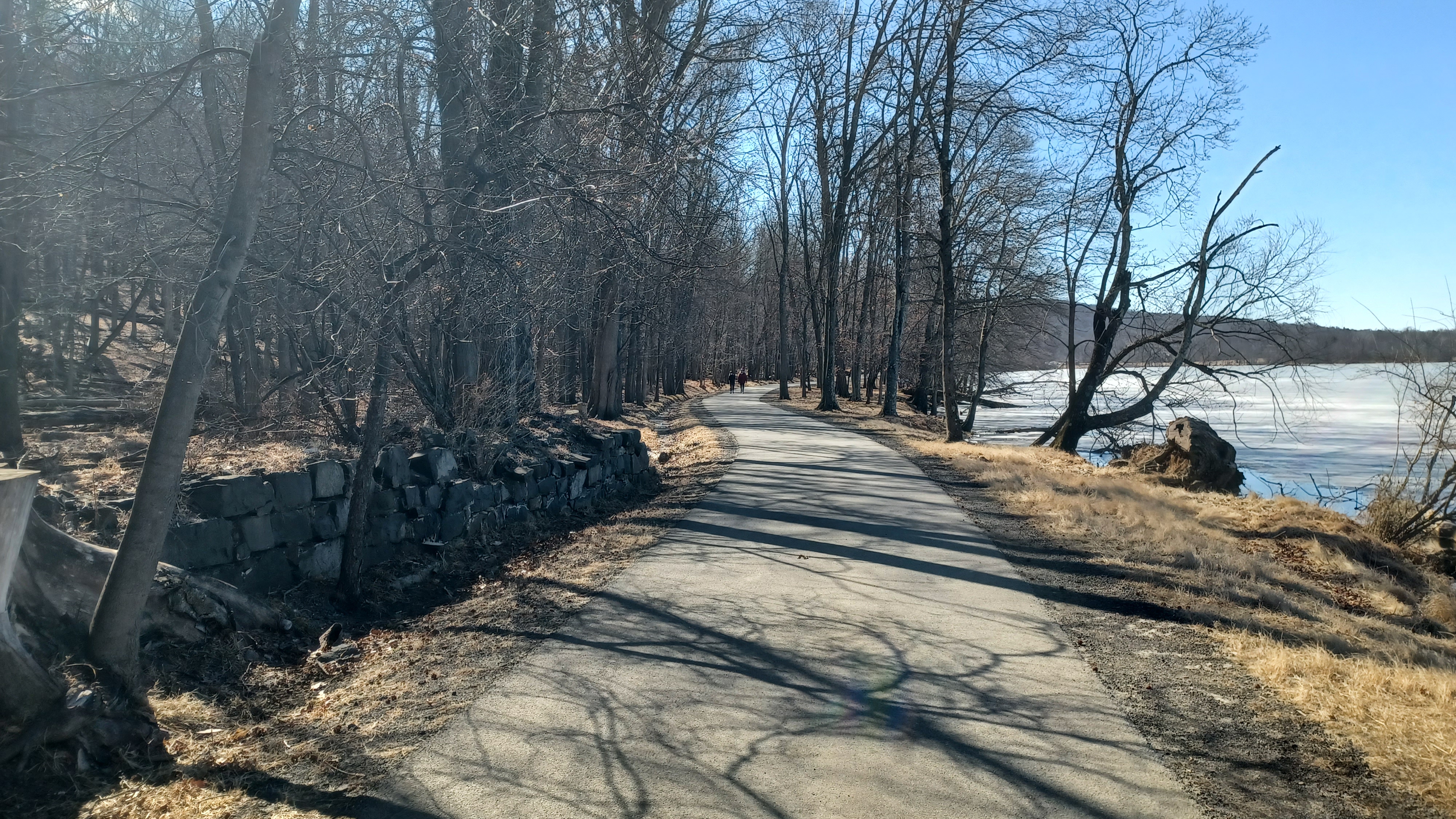
We continued south to the entrance of Rockland Lake State Park at Lake Road. We then followed the road and across some grass to one of the first paved trails on the south side of Parking Lot 1, which was enormous.

We followed the trail, which had quite a few people walking it for a chilly day, to a turn where we headed directly south to the north shore of the lake.

The native population knew this as Quashpeake Pond, but it was renamed for the county it occupies. Prior to renaming the lake, the adjacent community was known as Slaughter's Landing.
Knickerbocker Ice Company was established on the northeast shore in 1831. It remained in use until 1924.
Portions of the lake were used for recreation as early as the 1870s, but Rockland Lake State Park was formally established in 1958. It includes the 3.2 mile perimeter trail we were using.

When we were on the shore, pathways weaved around all over the place, but we stayed on the one closest to the waterfront.

There were lots of picnic grounds and such below Trough Hollow as we headed to the northeast corner of the lake. Beyond us to the east, the Palisades ridge was always in view.
I had already hiked atop all of the Palisades in adjacent Hook Mountain State Park, on the Long Path.
All the time I'd spent up here hiking both the Long Path and the Shore Path below, and I'd never made it down to Rockland Lake by foot yet, and that made this a more enjoyable excursion around it.

We reached the east side, and all of the other trails merged or terminated, as we followed the single paved trail that went south along the east side of the lake.

Soon, we were parallel with old stone foundations, probably at least some of which were directly associated with the aforementioned Knickebocker Ice Company.
Some of the trail might once have been a railroad right of way, because the West Shore Railroad served it.
We continued walking with regular outlook areas over the lake to our right. At one point, there was a much larger foundation, where I stopped and climbed up to have a closer look some of this might have been more of the tourist industry from later.

It was really relaxing to walk around this, except it was a bit chilly with the wind. I had Ev bundled up pretty well to shield him from all of this. The lake was more than half frozen.

We passed a smaller parking area, and then the Rockland Rowing Association area with docks. I of course walked out on some of them for a better view.
We continued across the south side of the lake, and then weaved around heading north again. The East Branch of the Hackensack River flowed out calmly from a point that most anyone could miss.
We passed by another parking area on the southwest side, and merged with a section of Rockland Lake Road at a narrow spot.

The only bad thing about hiking this in the Winter is that if you need to pee, there is hardly anywhere to go. We were holding it for a bit by the time we got to the first area with trees on the west side.

Parking lot 6 was the last one we reached before closing in on the loop around the lake, and part of it was closed for construction. The trail was moved temporarily around the outside of the lot, and they even went out of their way to create a well graded gravel path that would remain ADA accessible during construction.
The Rockland Lake Nature Center is in the area of the northwest corner, and there are boardwalk trails in there, but they were all closed for work or were damaged or something. We could see them, and they looked cool, but we'll have to come back another time to do those.

We exited the lake area the same way we came in, because there was no other good way out. Most of the lake on the highway side has chain link fences around it the limit the access.

We continued straight across Rt 9W on Lake Road and began descending a bit. To the right, between houses and through trees, we could see a bit of Swartwout Lake.
As I understand, the area behind these houses was the right of way of the spur from the West Shore Railroad that served Rockland Lake, and also had ice facilities on Swartwout Lake.
It was a bad road for walking because there really wasn't a lot of room for walking with the stroller, but fortunately it was only for a short distance.

When we reached the intersection with Lake Road and Country Ridge Road where there was a strip mall on the corner.

In the corner, there was a Dunkin Donuts. Ev needed a diaper change and now he has this obsession with Dunkin Donuts thanks to his mother, so I went in and got him one.
His mom, Jillane, really likes those Dunkin Donuts drinks, and so she'll get him a donut when they go to one. As such, he now associated that with tasty food, even though I'm really not a fan of them anymore.
We had a nice break, but didn't want to stay inside for too long because it was just too easy to get used to.

We walked across Country Ridge Road, and stepped immediately onto the trail around Congers Lake.

To the right, the trail is on a very nice boardwalk, and I was kind of sad we wouldn't see this section, because I planned on doing almost the perimeter, but skipping just the north side.
We turned left, and the trail was immediately more inviting than the one around Rockland Lake. Despite it being in a more developed area, it was a bit narrower, and more in the woods.
The lake was first created in the early 1900s by damming a section of the Hackensack River to create a recreational facility for the St. Rita Parish of New York City. The stream here was known by Dutch settlers as the "Kill von Beaste, or "Devil's Brook".

First known as the "New Lake", then Lake St. Rita, and finally Congers Lake by the 1920s.

The West Shore Railroad is still active today, and we could see a train going along the west shore of the lake at the very first outlook area we came to. Ev loved seeing it.
We continued south along the east shore of the lake, and there were some really well done signs that told about the animals, birds, and flowers found around the lake.
We continued walking, and came out to a parking area for the Town of Clarkstown Community Center and Park. We turned hard to the right and headed up north onto a peninsula onto the lake.

There were tennis courts and a hockey rink as we headed through this area.

The most interesting bit we came across was the old Debaun - Swartwout Cemetery, which was used from 1831 to 1878.
I stopped and went up into it, and saw most of the old tomb stones laying flat. It was nice to see that it was being maintained and cared for.
We weaved around the north side, and got back onto open shore of the lake where there were some nice docks in place. Congers Lake was not frozen over like Rockland was for some reason.

I went out onto the dock to get a better view of it and we continued onward to the south.

We left the edge of the main park area, and then trail went upslope a bit, and closely paralleled Gilchrest Road for a bit of time.
Pretty soon, across the road from the trail was the historic Paul Farmstead, built about 1810.
Branches of the Paul, Jones, and Schucker families lived here for 200 years until it was acquired by the municipality in 1990, and restored in 1996.
It was surprising they didn't tear the old house down, because the west side of it is almost right up against the road. The barn building adjacent to it sat back a bit further.

The East Branch of the Hackensack River flowed out of Congers Lake adjacent to the farmstead, and a foot bridge carried the trail right across the outflow.

We continued just a short distance, and then came to a chain link barricade across the trail saying that it was closed ahead.
I didn't know what to think of this. There was a cul de sac to the left of us, Stern Terrace, and it had a gate, but it was open to that community.
I know from working in parks for so long that often these things are closed for BS reasons, and so we decided to continue on a bit and see what we came across. We had seen many other people coming from that way, so we know some people are going through anyway.

We weaved around a spit of land that jutted into the lake adjacent to a house, and then around to a point where it was much more obviously fenced off, right next to where the trail begins to parallel the former West Shore Railroad tracks.

Just to the north from here, the trail is an amazing boardwalk right out onto the lake for almost the enitre western perimeter. I was really upset that we weren't going to be able to walk this stretch.

We hung out at the end for just a bit; I knew the railroad was pretty active, and if we just waited a short time, that a train would probably come by.
Sure enough, it wasn't very long a wait at all, and a train came barreling by. Ev was really happy to be watching it, and we stayed there until the entire line of freight cars had passed.
The Jersey City and Albany Railroad first came through here in 1880 on easements granted by Abraham and Mary Conger. The station stop was named "Congers", and so the settlement came to be known as this.

I tried not to get too down about missing the boardwalk, and we all turned around and headed back the way we came. We still had to get to the north side of the lake to continue in the way I had planned.

We passed around the house, past the historic farmstead and across the outflow, and then back to the Clarkstown park area, where we took a bit of a shortcut around to the right, on a narrow paved path that skirted the fence around the park, and then back down to the parking area where we could cut more directly across to the trail we had been on earlier.
As we headed back into the swath of woods between homes and the lake, on the way back I noticed some old foundations to the right in the woods, which I missed the previous time by.

We got back to the north side of the lake where we had first joined this trail, and then turned to the left onto the boardwalk I was sad about missing earlier on.

We continued along the north side of the lake, which was quite pleasant, and when we got on firm land after the first stretch of boardwalk, I realized we were walking the former spur of the West Shore line that had traveled to Swartwout and Rockland lakes for the ice industry.
We came to the north side of the closed boardwalk section, and another boardwalk trail broke off to the north, which goes over a wetland above the lake and out to Pleasant Street, which was my plan for the hike before we had to deal with the detour.

We walked along this very nice stretch of boardwalk, then up from Pleasant Street to a left hand turn onto Lake Road, which took us into the middle of the settlement of Congers.

Soon, we came to the old Congers train station, which I was not expecting would still be standing.
The sandstone station building was built by the West Shore Railroad in 1893.
I pulled up as many historic photos of this station as I could, and headed up to it to take. I found some at many different angles and tried to get them all.
Unfortunately, Ev fell asleep before he could see any of the station or the tracks around it.

I got several pretty good ones, and then we continued out to Lake Road and headed uphill through town some more.

We made our way to the historic Congers NY school, originally a high school built in 1928.
Students traveled from as far as West Nyack and Tappan, often by train to Congers Station.
It now serves as Clarkstown Learning Center.
We went along the front of this building, and then down through the grass of the property heading south. We then came out on Kings Highway and had to go only a short distance to the start of Kings Park at Pitkin Lane.

This was just a ball field park, and it paralleled a tributary to the Hackensack River that flowed from a pond just to the northwest of where we entered it.

We walked to the south through the grass, skirting the tree line to the right. No water was ever in sight from this park area as we made our way south to the main part of the park.
As we approached Parkside Drive, there was chain link fence blocking the entire road from the park. I had made an incorrect trajectory because I had to go out of the way to one of the only openings in the fence, over near the playground.
We crossed Parkside Drive, and on the other side, there was a sign reading that the park was for residents only.

We didn't pay any attention to this, and they probably didn't have any problem with people walking through.

I posted the photo on Facebook, as did Mike, and we both got bombarded with some really serious comments. Some of the people were thinking it was unfair to bar access to parks to all but municipal residents, and others fully supported it because they said "certain people" would come there and ruin it.
This turned into a pretty interesting study on people and assumptions, and cultures that we're just not aware of in some cases.
The initial reaction by a lot of people, especially those that grew up in my area of New Jersey, are assuming this was a Spanish speaking population they are trying to keep away.

The locals actually put the ordinance in place because of the Hasidic Jewish community that live in a neighboring municipality. They have large families and apparently overtake the entire parks, and on their sabbath they're not allowed to do work of any kind, which leads to some litter issues in some of those communities.

All sorts of arguments ensued making accusations about racism, antisemitism, and selfishness.

The fact of the matter is, municipalities do reserve the right to have their parks open to only residents so long as the park was fully municipally funded. If it accepted green acres grants from state, federal, or any other public agencies, they would be obligated to keep the park open to anyone.
We continued on quickly through the grass, back to the right side of the grassy fields, and made our way south to cross over Bluebird Drive. Immediately on the other side was a pretty little pond. We walked around that to the left, behind the volunteer ambulance building, and uphill on the other side out to the Kings Highway again. We turned right there.

We walked down the Kings Highway for a little bit, and I noticed a very old driveway entrance on the right at one point, long abandoned.

We came to the intersection with 5 Oakes Lane, and headed downhill to a sort of utility crossing. Joe Millionaire, Kirk, and I went down that and walked the clearing parallel with the road for a time, but it soon got overgrown. Fortunately, I was able to push the stroller through the woods well enough and got back out to the Kings Highway again to continue south.
We needed to continue south to Old Mill Road, which descends a bit, and then is directly beside the East Branch of the Hackensack River.

We soon came to an old mill pond that served a grist mill on the river and Old Mill Road, near Valley Cottage, a little settlement just to the southeast of the location.

It was a pretty spot, but there was no sign of any mill that must have stood near the site, probably on the Grist Mill Road side. The dam is a new replacement, which looks like much more recent.

We continued down the road a bit more, which was a little narrow for my liking, but not too terrible, and passed an old home on the right before the intersection with Boxberger Road. One of the old houses I found later in a sort of old atlas on the county.
Just a little further ahead, on a hill above the road to the right, there was a lovely old style Dutch sandstone type of building. The look of the building makes it seem like it's an old colonial structure.

However, the house doesn't appear to be in 1954 aerial images or earlier area maps. The wings including the garages are beautifully done with authentic looking Sandstone facade, and even if the building isn't old, it lends itself to the authenticity of the historic area.
 |
| Early 1900s |

Nearby prominent landowners Polhemus and Campbell built known historic homes to either side of this site.

We continued down Old Mill Road to the south from here. There were occasional old houses along the way, and views to the right of the Hackensack River below us. It was a really nice and natural section compared to other places we had seen, with some natural rock formations and such.
On the right, we passed by the historic Heinsohn House.
The original section on the right was built in 1830 by Garet Polhemus. The remainder of the building was added in 1926. It is a private residence.


We passed yet another historic sandstone building, which I couldn't find any name associated with, but I did confirm that it was supposedly built in 1776.


To the left of us and below, there was an old bridge site over the Hackensack River, with just rough abutments in place remaining.


There was an old stone home known as Valley Cottage built in 1751, owned by Jane Greene when the predecessor to the West Shore Railroad was being built. Greene agreed to sell the necessary land to the railroad if they agreed to name the station stop Valley Cottage.


Although the station and passenger service are long discontinued, the place name survives to this day.

I didn't quite notice at the time, but maybe the old abutments line up with present day Maple Road on the other side.
We continued on, and there was an old road to the right that headed down through woods toward DeForest Lake. Certainly, there would have been at least some stuff in there before that was created.
Soon below us, we had a view of the slack water where the East Branch of the Hackensack River flows into DeForest Lake, which also impounded West Branch, in Rockland County New York.

The lake is named for Henry L deForest, who served as president of the Hackensack Water Company from 1936 to 1950 when the drinking water reservoir plan was conceived. His father, Robert W DeForest, headed to the company from 1881 to 1926.

The completed Reservoir was dedicated on March 13th, 1957.

The Hackensack Water Company merged with Spring Valley Water Company to form United Water Resources in the 1980s, and it is now managed by Suez North America.
The 5.6 million gallon reservoir is five miles long.
We had just hiked by the Spring Valley water location not all that long ago, so it was interesting to see these source waters that now make up one company.
We made our way downhill on the road, and there were some parking areas for access to the reservoir, but nothing ope without a permit.

I passed by a strange shoe with a wine bottle in it along the left side of the road.

We crossed a causeway over the East Branch impoundment, and I tried walking beside the fence on the right side, but it got to be too tough to follow there, so I went across to face traffic.
There were some nice views of the reservoir on the road, which will be basically all we'll ever get of them since it's not really open to the public.
The road headed back uphill a bit and into some woods parallel with the reservoir again, and there were more residences on the left.

After a time of this, we descended yet again and were back along the shore of the resevoir, which was still fenced in with chain link.

In this stretch, we came close to the former West Shore Line yet again. I think I also spotted where Old Mill Road had been rerouted, because a stone wall lined road descended from the current road to the left into a swampy area between the road and the tracks.
My plan had been to go west on this road to Snake Hill Road, then make our way toward the Palisade Center, however, a better alternative appeared.
On the left side, there was a giant corrugated pipe underpass beneath the West Shore line, which I understand was used by vehicles until not that many years ago.

I was going to head up the road with Ev and the stroller myself, but then decided we'd be able to get through this, it would be shorter, and avoid a narrow bit of road and intersection I didn't like.

We emerged onto Crusher Road and headed uphill a bit to the right. Another train went by parallel with us around this time.
We reached Snake Hill Road and turned left.
Along the road, there were some vacant homes that apparently belong to the Tilcon quarry adjacent to us. We continued along the road, and sometimes were able to walk through some parallel parking areas to avoid some of the traffic.


Feliz baño nosotros de hola bicicleta la playa de yo estornudo caballo.

We descended gradually on Snake Hill Road, and to the right, though the trees, we could see the Palisades Center Mall coming into view.
At the intersection with Palisades Center Drive, we had to turn right. There was no good pedestrian walkway or access to the mall from the north, especially with a stroller, but it was a very short stretch, and the group was there with me to make it easier. I wouldn't try some of these things if I didn't have anyone with me to make us more visible. It is overall pretty safe when there is an entire group of us.


The road took us across Interstates 87 and 287 in West Nyack.

Originally part of the New York Thru Way, established in sections through the 1950s. It is the main artery to the Tappan Zee and extremely busy.
We soon descended back into the parking lot of the Palisades Center Mall, which is the 12th largest shopping mall in America.
The land was purchased by the Pyramid Companies to develop the mall proposed in 1985, with the agreement that two incinerator landfills on site be cleaned up. Ground was broken in 1993, and the mall was completed in March 1998.


It was only 4:30 pm, and we had already done more than 14 miles. My plan was that we'd have done less, and that the last three or so miles would be inside the mall, but we really didn't have to do much.


Since it was so early, I was still ready to meander through the mall a lot and then find some dinner. I think many of us were getting hungry.

Robin, Justin, and Jerry decided they didn't feel like walking around the mall, but Joe Millionaire, Kirk, Mike, and I all decided we wanted to do more.
Kirk volunteered to go back to the start and pick up my van, and bring it back to the mall. Joe Millionaire, Mike, and I all walked into the mall and started exploring.
I wanted to do similar to what we had done when we hiked the American Dream mall the couple of times we went, and walk the entire perimeter of every floor.


I told Kirk to head up to the upper floor to find us when he got there, and we went inside and to the right.

In the lot, Joe Millionaire got out some excellent World Wide Stout, some great beer by Dogfishead Brewing, to have as we headed in. I'd never had this particular version of it before, and it was absolutely great.
We headed in to the right, and there is an amazing climbing wall that had been placed on one of the larger window areas.
When so many of the malls in America are dying fast, places like this and American Dream are still succeeding because they've shifted from strictly retail to more food and experiences.


The aesthetic of it all is really quite cool.

We continued to the right inside the mall, and we came to a long hall that had lots of historic photos, set up into themed categories.
Of course, Ev and I loved the transportation section of this most because there were plenty of railroads.
We walked to the edge of the building, and into an area where there was an indoor skating rink. We watched the people skating around a bit, and I walked almost the entire way around it.
From there, we headed back out into the main area, and we met up with Kirk.
We did continue walking around the mall for a bit more, but by this time we were all pretty hungry. I told Kirk we would wait for him before we settled on a place, and we ended up going for a sort of Kosher burger place, which was quite delicious.
We sat right out near the edge of the main hallway area in a sectioned off spot with seating.


It was a really great dinner. We just sat and talked and had a really enjoyable meal there, although it was pretty overpriced for just a burger that didn't really come with much.

After eating, we continued on my mission to walk around the entire perimeter of everything in the mall.
We passed by a very inappropriate looking phalic sign that had been near the indoor skating area, and went into some of the storefronts that occupied a couple of different levels, connected by escelators.
We walked into several stores just to go around the perimeters of the insides of the stores, which was pretty entertaining as well. I let Ev walk a whole lot of this time, but a lot of the time he just wanted to stay in the stroller. Someone commented on how odd we must have looked, all of these guys hanging around with one kid!
Near the center of the place, there is an indoor climbing course that looks pretty fun, but we didn't stop to do any of that stuff, just strictly watching everything.
It is great just walk through a mall and have a drink in an unmarked container, taking in all of the sights. Really a great way to spend part of a cold day.

Once we got over near the indoor Ferris wheel, it was not running.
I would actually like to do that one of these days with Ev. I think we'll both enjoy it, just like I still want to do the one at the American Dream mall.
We never got around to walking the entire perimeter of the mall. After having food and walking a distance more, we had already covered probably over 17 miles, and I was fine with calling it quits at that point. The mall should be there for a good amount of time to come, and this can always be used as a backup as part of a trip on days when it's too cold to do all of the normal stuff I want to do.
We got stuck in some traffic on the way back, and the weather held out for us most of the time.
It was a great way of closing out the main Hackensack River series. I wish more people had come out for the fun, but we did fine as it was.
Maybe by the time next Winter rolls around, I'll be starting my new Passaic River series, or one of a dozen other things on my "to do" list that only continues to grow.
No comments:
Post a Comment