Hike #1507; 10/9/22 Bellaire to Mt Gretna with Professor John DiFiore, Diane Reider, David Adams, James Kohan, and Everen
This next hike would be the next in our Highlands Trail series, which we started with the Pennsylvania section at the Appalachian Trail.
This would be the seventh in the Highlands Series, and the third
since that route broke away from the Mason-Dixon Trail.
The designated route is pretty much just a piggyback on other
major trail systems, much of which I have already done, but also includes
several that I’ve never done before, so it wouldn’t be too boring.
As usual for lately, I had a couple of versions of the hike that I could do either as a regular hike, or as one that I could bring my son on.
Much of the route was possible to do with a stroller, but there were sections of it that would be a bit tougher I figured. There was always a way of shifting that a bit, and it'd work out fine.
My original plan was to follow a whole lot of different trails besides the designated Highlands Trail route, including a lot of other stuff in the Governor Dick property. With the stroller, it would prove a bit more difficult, but we managed to do most of my intended route with it anyway.
Prior to the hike, I got a call from police in the Brecknock Township PA are saying they had my drivers license and my state credit card, so I had to go out there to get it.
It made most sense to do this hike sooner so I
could go pick the stuff up. What happened to the rest of my wallet and
On the last hike, we covered the former Cornwall and Lebanon Railroad on the west end, which is part Conewago Trail, part Lebanon Valley Rail Trail, part still somewhat active. The Highlands Trail route follows this railroad to where the Horse-Shoe Trail crosses, and then continues along that route to Valley Forge.
I had already completed the entire Horse-Shoe Trail, so I am prepared to do some of this as repeat hikes, but there are also a lot of other trails that connect with it that I’ve never done.
I am fully intent on doing
that trail again, but with all of those connecting trails as part of it to make
it more interesting.
This time, we would cover just such things.
The previous hike had started at the Brielle Woods Nature
Preserve where we did a loop. That preserve wouldn’t have fit in with anything
else we were doing otherwise, and it’s a perfect example of why we are doing
what we are doing, and the way we are doing it.
Lawn, Faye Carullo Collection
This time, we already covered that preserve, so we would instead
cut back to the west a little bit and start at the nearest trail parking area
at the former site of the Brielle Station. 
Lawn Stock yards, Longenecker collection
We shuttled to that location from
the little settlement of Mt Gretna to the east, near where the Mt Gretna Narrow
Gauge Railroad broke away from the Cornwall and Lebanon Railroad.
1906 Longenecker Hotel, Lawn
The line we were following was developed in 1883, in direct
competition with the Cornwall Railroad, which served the Cornwall Furnace from
Lebanon PA.
It was incorporated by Robert Habersham Coleman, who was
interestingly the son of the Cornwall Railroad founder William Coleman and
cousin of William Freeman, the competitor’s President.
The
line was extended west to Conewago Station, and continued hauling iron ore,
military personnel, or local goods, but passenger service ended in 1928.
The Pennsylvania Railroad purchased the line then, and it continued in service
until Hurricane Agnes in 1972, after which it was pretty much abandoned.
A stub
of it is still in service out at Conewago.
We started at the Brielle Station site, which might be the store building that
still stands there, it might not. The building has an old schedule hanging in a
frame on the outside of it, but I have also heard that the station was a
separate building. I have never seen an historic photograph of the station
building, so I can’t be sure.
The area of Brielle was apparently intended to be a bigger settlement at one time, but never really came to be anything big.
We headed east from here, and there is an old coaling trestle off to the left
here the piers have had a roof put on them to use for storage.
The trail entered the woods parallel with the Conewago Creek and crossed over Prospect Road. This was where we
had joined the rail trail the last time we were out.
We continued a bit beyond there to the east, and soon crossed over the county
line from Lancaster County to Lebanon County. It is at this point the trail
name changes from Conewago Trail to Lebanon Valley Rail Trail.
There was an old marker that read the county names on either side, which might be original, but might also be a reproduction in concrete.
If it is the
original, they at least put a concrete base on it to keep people from stealing
it, because that part certainly wasn’t original.
The temperature was cold when we started, and I had to put a hat on little Ev to keep him warm, but it was getting much warmer as we moved on, and we were out in the bright farm lands with no shade for this next bit. There was pretty farm scenery to both sides as we went past the area with the home and out buildings.
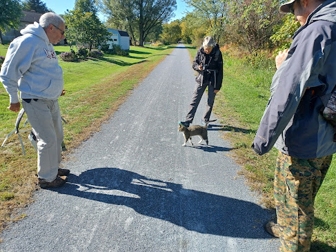
As we walked by this bit, a very friendly cat came out to greet us. It was an interesting brown and white cat, with tabby markings on its face and on its legs, but just plain brown on the body with white legs and chest.
The cat wasn’t apprehensive really at all; it came right up to me and
immediately enjoyed being pet, but then went the rounds and visited everyone in
the group for more petting. John got out some turkey to share with it, but it wasn’t
really interested in it at first. It was far more interested in more petting.
When the cat was about as trusting as it was going to get, I picked it up to
show it to Ev. Surprisingly, the cat was pretty much okay with that as well. I
thought it might even try to follow us, but it didn’t.
We continued along the trail and passed beneath the Pennsylvania Turnpike, crossed Eckerd Road, and then passed through more pretty farmland along the Conewago Creek on the way to the former site of Lawn Station.
When we crossed Railroad Street, also known as Lawn Road to the west, the station used to stand on the left side of the right of way.
I had done a then and now compilation of the Lawn Station site the last time we
were out in the area, on the way back through after the hike was over.
From the station site, we continued north parallel with Rt 241, and eventually crossed it at an angle heading northeast. There was lots of pretty farm land to the left through this stretch.
Ev was
getting super tired and fell asleep through this bit heading toward the village
of Colebrook.
We didn’t
go as far as Colebrook; the Horse-Shoe Trail crossed over the Lebanon Valley
Rail Trail in this area, and we turned when we got to that point.
It is a really pretty little spot, and I had hiked the Horse-Shoe Trail through
from this location before, but I was worried about what conditions we would
come across for the stroller to get through.
I didn’t remember it so well
except that it was not level. I never gave any consideration to what I’d done
in the past and whether it would be good with a stroller.
My original intention was to take Lawn Hill Road up to the south from Lawn Station area, and then pass beneath the PA Turnpike and turn onto an old road into State Game Lands #145, but I decided instead that it might be better to just take the Horse-Shoe Trail to the east a bit more and then I’d turn from that. One of the things I wanted to hit was a natural rock formation called the Dinosaur Rock that looked like a dinosaur head, which I’d never been to before.
The Horse-Shoe Trail took us somewhat steeply uphill to the right on a woods road, and then shifted to the left into an open field area.
The trail was not very well marked
this time; I remembered it being really well marked the previous time I was out
on this, which I did as a loop several years ago, but we eventually saw the
yellow blazes, so it was alright.
The
Horse-Shoe Trail is a very interesting route that was first devised to connect
the Appalachian Trail with the City of Philadelphia.
Henry N. Woolman, founder of Abbots Dairy, took a two week horse back trip
through the Great Smokey Mountains in 1926. He declared that the area of
southeastern Pennsylvania was at least as beautiful, and it should have its own
trail.
At the time, horse back riding on the Appalachian Trail was not prohibited, and that route was more old woods roads amenable to that use anyway, and he used the AT through Tennessee and North Carolina.
With
the help of riding and nature clubs, Woolman began marking the trail in 1934
through the Furnace Hills of PA. There were very old trails that connected
between the iron furnaces already, so some of the word was simply formalizing
these old routes.
The
trail was christened in 1947 as a through route from Valley Forge to the
Appalachian Trail in Manada Gap.
Eventually, the AT was moved from Manada Gap further north into St. Anthony’s
Wilderness, which forced the trail to be extended north as to continue to the
Appalachian Trail.
The trail is in constant danger of closure because it goes through so many private lands, and efforts have been in place to permanently protect much of its corridor.
What I love about this trail is that it’s one of those weird ones that is
always changing. It’s not always on a ridge top, nor is it always in the woods.
It passes through farm land and historic sites and never gets boring.
That being said, most all of the section we would be following was actually in the woods, and on old woods roads this time, but we wouldn’t be on it all that long.
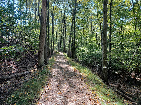
We skirted along the left side of a lovely little field and then passed through a section of woods on a woods road through the game lands.
Ev slept for a while
through all of this first part.
We
eventually came out to Mt Wilson Road. My plan here had been that we would turn
to the right on this and head up to the Dinosaur Rock, then follow another
different woods road through the game lands that I’d never done before.
When we got to this road, it was pretty busy with no shoulder, and I decided
against heading that way with little Ev in the jogger stroller, so we decided
to stay on the Horse-Shoe Trail this time. I had a good way of adding this to
the next hike without that road walk, and it would add more new stuff to that
next hike.
We went directly across Mt Wilson Road, went around a gate, and then reached
the edge of a large cultivated corn field.
There was the choice of going left or right there, and it turned out the Horse-Shoe Trail went to the right, so we followed that.
We passed
through a section of woods, skirted another field area, and then came to a
woods road intersection where the trail turned right uphill a bit more.
Up in this area was evidence of recent controlled burn I assume. The ground
through the forest was all charred and free of understory except a little new green stuff coming in. We took a
break near the height of the hill. Ev woke up and I gave him a pierogi or two,
as well as a little squirt applesauce thing.
1894
The trail curved again, and the woods road that I was considering using earlier came in from the right.
We continued ahead on the Horse-Shoe Trail, past a
giant tree, and then through a parking area out to Pinch Road.
I had been surprised to see how many cyclists and hikers were using the state
game lands property through this stretch when the Governor Dick property just
to the east has so many other formal trail.
Horse-Shoe Trail crosses Pinch Road and goes through a narrow bit out to follow the outside of a retention pond. It was here that my plan was to continue on the White Diamond Trail from Horse-Shoe Trail across the Governor Dick property.
Since colonial time, the area ahead has been known as Governor Dick’s Hill.
It was heavily used for charcoal production during the American Revolution to power the nearby furnaces where slaves, Hession prisoners, and other colliers worked twenty four hours a day producing the product.
One slave on the books was noted as “Governor Dick” who lived in a hut on the west side of the hill.
It was
a common New England practice for a foundry owner to elect a slave leader and
give him a title such as “Governor”, which is probably why Governor Dick was so
named.
Governor Dick is believed to have been purchased out of Maryland in 1776, and
at age 50, he was the oldest of 25 slaves registered by the foundry owner in
1780.
At the age of 66, Governor Dick escaped and there is no solid evidence of him
ever returning to his namesake hill.
Horse-Shoe Trail
The 1105 acres of land were purchased by Clarence Schock, co-founder of the Schock Independent Oil Company, in the 1930s.
Schock felt that after making provisions
for his family, his wealth should go to the general welfare of the public. He
opened the property to public as early as 1936.
In 1941, aside from a modest living for himself and his wife, Schock decided
that his profits should go to schools in the districts served by his company.
Schock passed in 1955, but he had set up a Deed of Trust for the Governor Dick
property, so that it would be “In trust
forever as a playground and public park”. Lebanon County is now the sole
trustee to the property.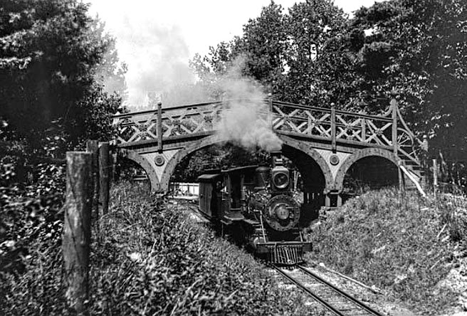
Lancaster Historical Society
We turned right along the retention pond where the Horse-Shoe Trail went left, and picked up the White Diamond Trail.
I saw on the map that this trail was
open to both hiking and mountain biking, so I figured I might be able to get
the jogger stroller through the entire thing.
The problem was, this trail was 2.6 miles long. If it was difficult, it would
take us a very long time.
I was able to push him through and maneuver through the rocks at first. There
was a little bell along the trail to the right that we could ring, as a memorial
to a kid that had passed.
1890 Thomas Taber III collection
It was getting far too difficult, and I would have needed constant help to lift the front of the stroller over some of the rocks.
We could have done it, but it
wasn’t necessary this time, so I decided we would forego that route and turn
back to change the hike a bit. This turned out to be a great move in the long
run.
We got back out to the retention pond and headed onto the Horse-Shoe Trail.
This brought us down and across the main entrance road to the Clarence Schock
Memorial Park at Governor Dick.
On the other side, the trail split in two. I
decided to take the left fork; the right fork was the Horse-Shoe Trail, but
much of that would be part of my route on the next hike, and I didn’t need to
be repeating so much.
1907 Journey Through the Past Collection
The trail was pretty easy to cover. There were a few rocks and such, but nothing I couldn’t easily maneuver the stroller through.
The
trail stayed really close to Pinch Road, and soon crossed the Fire Road, which
leads all the way to the top of Governor Dick Hill. I had never followed that
all of the way up, so we started climbing that.
It was easy terrain for the stroller, but it was quite a push for me. It’s not
a terribly high hill or all that steep, but pushing and continuously going up
was a bit taxing.
Harpel Park Studio image
As we headed up, we soon crossed the right of way of the Mt Gretna Narrow Gauge Spiral Railway. This route opened up between the settlement of Mt Gretna and the top of Governor Dick Hill in 1889.
The settlement of Mt Gretna was a railroad stop on the Cornwall and Lebanon Railroad, with community started by the Chautauqua Society who appreciated the natural landscapes.
The settlement grew considerably with tourism through the 1890s, and there were several different towers up on the hill affording views.
The first tower was erected on the mountain here in 1882, made of Chestnut trees.
It quickly became a tourist destination and justified the construction of the Mt Gretna Narrow Gauge Railroad. When Clarence Schock purchased the land, he erected four wooden observation towers on the Governor Dick area, where visitors could see the entire South Mountain range of the PA Highlands and Susquehanna River Valley.
This rail line started at the Cornwall and
Lebanon Railroad station at Mt Gretna, and carried passengers to the tower, as
well as National Guardsmen to their rifle range near Conawago Hotel. The
railroad closed after a military accident in 1915 and was never re-opened.
The current tower was built around 1954 to
replace the original wooden structures. Mr. Schock had the others he built
closed due to constant vandalism that occurred.
The tower is climbed by a series of ladders with backboards to the commanding 360° view.
As we pushed toward the top to reach the tower, John and Dave went way ahead
while I was further back with Jim and Diane.
On the way Diane noticed a Paw Paw tree growing to the let of the trail, and it
was bearing good fruit! We stopped and started eating whatever good ones we
could find.
Paw Paws are the largest fruit native to North America. I had
been wanting to try one for many years but never caught them on time until the
recent Mason-Dixon Trail hike where we found quite a lot of them.
The fruits can be yellowish, green or brown and still be good.
They generally live in warmer climates from the Gulf of Mexico to the Great
Lakes.
The fruit tastes like a cross between banana custard and mango.
Hotel Conewago
The skin and seeds are toxic to humans and contain annonacin.
To eat, I was shown to cut the fruit in half and eat it out of the
skin with a spoon or fork. I had to remove the seeds, which are annoyingly
large.
John and Dave came back after wondering where we’d gotten too, and so they
began enjoying the fruit as well. Dave came up with a new strategy for eating
these that worked quite nicely: He cut it in half, and then treated it like a
push up pop, biting off and spitting out seeds as he went.
I shared some of it with Ev, and he seemed to like it pretty well again.
1910 Lebanon Historical Society
As we hung out eating, there were just tons of people walking by, coming from
different directions and different trails than we did. 
1906 Library of Congress
They were all curious
about what it was we were raving about, and so Diane gave everyone a little
lesson on Paw Paws for which they were very thankful.
From this point, we were nearly to the top of the hill, and it
was leveling off. It was a much more relaxing walk on the fire road from here
out toward the Governor Dick tower. Some of the trees were being removed as we
headed toward it, and signs explained that it was preserving the view while
reforesting with appropriate things, removing invasive species.
We reached the tower, and many people were there trying to head
to the top. I think the tower used to have a single spiral staircase or
something, but now it has two sets of ladders much of the way to allow people
to go up and down in flights.
To me, it’s quite amazing that it has been left open because of how crazy
everyone has gotten with liability.
The ladders go up in flights, with a back board one can lean into while climbing up to make it a bit easier.
The ladders are offset, so if there was a
fall, one would not fall all the way down to the bottom. The only spot with
foot traffic going both directions is near to the top.
I waited with Ev at the bottom while the rest of the group all climbed to the
top of the tower for the views.
There were people showing up via the fire road, and upon arrival
were disappointed that it was ladders, because they couldn’t go up to the top
with their kid or whatever.
When John came down, I ran over to the tower and climbed up all of the ladders as quickly as I could.
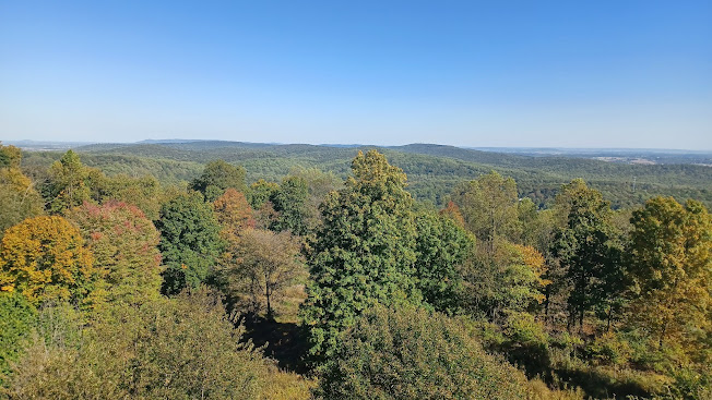
At the top, there were pretty great views in all directions. I could see up
north to the Blue Mountain, and east and west along the top of the Furnace
Hills.
To the south a bit, I remember the last time I was up there being able to see
the steam from the cooling towers at Three Mile Island. I looked for it in the
distance, and then realized that the facility had recently closed I think,
which would explain how I didn’t see anything this time.
When I’d gotten photos from all directions, I hurried back down the ladders as quickly as I could on the other side, and ran back over to Ev, who was quite content sitting and talking to John.
I took Ev out of the stroller for a bit while everyone was milling about on top of the hill and gave him a diaper change since there was a trash can handy.
From here, we began walking to our descent from the hill.
The route we would take down would be the historic route of the Mt Gretna
Narrow Gauge Spiral Railroad itself. I had followed much of it before, but
never the entire thing. I’d end up finding out this time that it was much
longer than I realized and that there was so much more of it I had not seen
before.
On the way, I looked for the locations of historic photos I’d
had along it, but it was hard to tell the exact locations. I did find one of
them for sure, at a bend with one of the original towers in view, taken in
1894.
1898 Edmund Stirling
We continued down the slope past beautiful giant trees, and then reached the fire road we had come up on.
We went directly across it on the railroad bed, which then weaved around sharply to the right, and then back over the fire road again.
This was the worst part of the way down because it was so
bumpy.
Dave mentioned to us that his dad holds the record for having led the most
hikes up to the top of Governor Dick hill of anyone in history. Through this
admission, I assumed that Dave has been up this more times than he could count
as well, but he didn’t seem to realize that the narrow gauge right of way went
over the road on the way up, and he thought it was really cool.
It really was, because the section goes onto a surprisingly high fill for
something that had been built solely for entertainment. For the group, it
seemed like a theme because we had just hiked the route of the Dunderberg
Spiral Railway the previous week in NY.
The Horse-Shoe Trail came back in along the way here, but we
didn’t stay on it. We just continued on the railroad right of way beyond where
I had followed it before.
After the parallel trail on a woods road moved away, the rail bed led out to
Pinch Road once more.
At the
road crossing, we passed the plaque commemorating Governor Dick along the rail
bed just before crossing the road, and it is believed to be the first such
plaque in America honoring a slave, erected in 1959.
The plaque also went into detail about Schock and the fact that it was erected
on the old rail bed.
When I planned this hike, I figured we were going to be looping through
Governor Dick to the east after the white diamond trail, and then back on the
blue diamond trail, but I had to do something different for my mileage.
What we decided upon was to continue following the right of way of the of the
narrow gauge right of way to the west.
Mark Cain collection
The line went across Pinch Road and back into State Game Lands 145. At first, it looked like it went up an access road that led to a building that I’m not sure its purpose.
Once we were past the gate and out to this building, which had stone components
but I’m not sure how old it actually was, we had to figure out where to go
because the rail bed was not obvious.
We headed straight ahead on a woods road, which seemed right at first, but
couldn’t have been. I had to go out and around some weeds in an indirect way to
get the stroller through.
We walked this road until a point where it started to descend far faster than the railroad bed ever would have, so I knew we had gotten off of it, but it couldn’t have been by far.
Soon,
there was a mess of trees over this old road route, and there was really no
good way of getting the stroller through it, or of us climbing through it
easily for that matter.
Looking at the maps, we could see that the railroad bed was just below us a bit.
We decided we would try to bushwhack down the slope to the left to get down to
the right of way.
Dave helped me lift the front end of Ev’s stroller, and we pushed our way down
the hill and could soon see the rail bed.
The last bit was the toughest part; we had to very carefully step down the
slope and make sure the stroller kept pretty level. We managed, and were were
soon on our way along the rail bed again.
1895 Lebanon Historical Society
This section of the right of way was basically a narrow foot path, but obviously level enough that we knew what it was.
 |
| 1895 Lebanon Co HS |
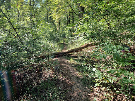
Occasionally, I had to lift the stroller
over some fallen logs, but overall it was good enough to push the stroller the
entire way.
I think
we lost the right of way in the area ahead yet again because at some point, the
path became less obviously flat, and we had to descend some to reach Mt Gretna
Road. I waited for the others when I got out to that point.
The railroad actually whipped around to the north to go around Conewago Lake, and then to the Mt Gretna Station area.
From this point, we weren’t going to
follow that. Our route as I had planned was to follow the Mt Gretna spur of the
Cornwall and Lebanon Railroad. That line had a short branch that went out to
Conewago Lake, parallel with Mt Gretna Road almost all the way out to the main
line.
Almost directly across from
where we came out on Mt Gretna Road, Timber Bridge Road went out to a water
treatment area, but it would have crossed over the C&L Railroad spur, so we
walked out it.
A short distance out there, we could see to the right where the railroad grade
was coming in. We could see where it used to go in the other direction, which
some maps showed as a trail, but it certainly didn’t look to be one.
It was
badly overgrown. It might have been something we’d try on foot, but I was not
going to push the stroller through that.
We headed back out to Mt Gretna Road and started heading to the west. Soon, the
right of way was close enough to the road that we could kind of recognize it
along the way. There was some sort of concrete thing along the road where there
might have been a building, but I don’t know what it might have been.
After a little bit on the road, another unpaved road went hard to the right and
crossed Conewago Creek on an old concrete road bridge into more of State Game
Lands 145.
The road walk was kind of sucking and we didn’t see much of the railroad spur
at all, so we decided that we would cut into the game lands and follow what was
shown as a connecting trail to get us through to Lebanon Valley Rail Trail
again.
The road, which is designated Boy Scout Road on Google maps, looks like it
might once have been a through connection to Timber Road to the east.
We crossed the bridge, climbed uphill a bit, entered a field, and then at the northern end of the field, we turned left along top of it.
The road along the field came to a fork, but we continued straight from the end of the field, down a hill through woods, and then out to the Lebanon Valley Rail Trail.
I had been in some of
these woods before. When Jillane and I backpaced from Clark’s Valley in St
Anthony’s Wilderness to Lancaster, we stealth camped in these woods one night.
It was a bit rough trying to get down the slope to the railroad bed, but once we were there, it was just a joy to walk.
The surface was so soft and easy to deal with.
We continued to the east without incident, and pretty soon a platform started
to appear to the right of the track bed, at the approach to Mt Gretna Station.
A path went up to the right from the trail onto the platform toward a private home in Mt Gretna, reading “private sign do not read”.
We continued ahead and
soon reached the historic site of the Mt Gretna Station. The area was once a
major spot with a grade crossing walking path, but also a foot bridge over a
station area that had shelter cover on both sides.
I had a whole lot of then and now compilations I wanted to try to set up at this site. I owe most of the credit for the photos from here to Greg Pawelski who has put together an amazing collection of historic photos of many different railroad lines, complete with his own then and now compilations.
He hadn’t done them of all of
these locations, but he did do some. I wanted to try to get the different
angles of the ones he hadn’t gotten especially.
We continued ahead, and I
started by making a compilation of an historic photo taken in 1898 by Edmund
Stirling.
There were several photos at several different angles I had to figure out based
on how the track was aligned. 
I determined about where the pedestrian bridge used to be over the tracks, and where the station building was because the foundation is pretty well intact, then tried to figure out all of the angles of the historic photos.
There was gravel pile just to the east I was able to use
to get the needed height for one of them, and then others I could just angle
right when I figured out that the curve to the east of the station was the main
identifying factor for the images.
I realize as I caption all of these photo compilations that I can deal with the frustration of having people constantly stealing them and reposting them with no credit, that I can just put my son in them and it would be better than a watermark.
The others started
heading out the side path from the station, which follows the beginning of the
right of way of the Mt Gretna Narrow Gauge Railroad. The trail is paved there
at first.
We eventually followed the trail off toward where we were parked. The old water
tower base was still visible to the right in the weeds along the path. There
are more ruins in this area including the old fountain site and the railroad
turntable, but we didn’t have time to really be looking around for it this
time. I’d hold off on that until the next visit.
We continued past a path that leads to the roller rink, and then out to the parking area on Timber Road to finish the hike.
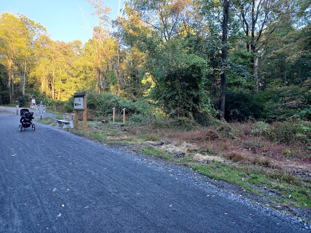
The group helped to shuttle and bring my car back to the
end point since I didn’t have a second car seat for shuttling purposes, and we
were done before the sun went down, which was really nice.
I sat in the parking lot for a while with Ev, who crawled through the gravel
and kept heading back out to the road. The railroad used to cross over through
this lot.
The next hike in this
series would be a good one to bring Ev on as well, because it was mostly all
strollerable. I could do the Horse-Shoe Trail in a loop with the Lebanon Valley
Rail Trail, and it would make for a perfect trip. I’d have to do that one as
the November hike.
John Denney Jr collection
I was really enjoying bringing him along with me on these things, and I started
planning the hikes more specifically so they would be appropriate for him.












No comments:
Post a Comment