Hike #1498; 7/29/22 Allaire State Park to Brielle with Stephen Argentina, Gregory Andres, and Violet Chen
This next trip would be a point to point between Allaire State Park and Manasquan NJ area and Brielle. I tried to put it together in combination with one that Serious Sean was posting as a night hike since he's begun filling in on the night hikes for me since I couldn't.
Attendance on this one was light because I had to do it on a
Friday.
My work schedule had gotten quite out of whack compared to
anything I’d done in the past.
I at first always had it worked out that I had Saturdays or Sundays off to the
hikes. It was my experience earlier on that jobs would work with me because I’m
providing a free community service. It’s not like I’m just going out and hiking
to enjoy it, it takes a lot of time and effort to plan out the routes and learn
about where we’re going beforehand. I love doing it, but it isn’t necessarily
easy, and many of my jobs realized that.
I was able to take time off at many of my retail jobs, and even Walmart, for whom I worked for a couple of years, did not make me work Sundays because of the service I provided. Taylor Rental I didn’t work Sundays, and then when I went to work for parks, Hunterdon County made special concession for me where I worked only one of the two weekend days, which would allow for me to continue leading the hikes every weekend.
It wasn’t until working at Spruce Run that they tried to put me on full weekends. At first, I offered to work every Saturday, and then I could have every Sunday off.
Everyone like that at first until there were problems
with the supervisor causing problems and I had to rotate all of them. For two
Summers, my coworker Darryl worked all of my Sundays and I worked all of his
Saturdays, so I could continue them. When none of that was an option any more,
and some folks were getting rowdy about it, I just started hosing night hikes
on the full weekends I had to cover, and that was alright.
This year, things had changed where being a new father came into play. I
offered to give up all of my night hikes, but I would continue doing my one
weekend hike per week.
It didn’t seem too much to ask. That can go off on an entirely different tangent, but for work I was fortunate to have my buddy Tom filling Darryl’s past role, working my Sundays, and I his Saturdays.
It
actually works out better for management purposes as well, because there is
less inconsistency in leadership styles when dealing with seasonal staff.
The only real benefit of doing the full weekends was that I’d have Thursday
through Sunday off, ten days on and four days off, and I could use that in
combination with other benefit time to do more vacations. Everyone of course
likes that.
Unfortunately for me, with the baby and doctors’ appointments, I could not do
that, and I would have to take random days for my days off to deal with those.
In that way I suppose it was a benefit.
In the mix, there were just a couple of weekends where Tom and I were scheduled to cover the weekend together, so then we could not cover each other.
I would have to work it. My choice was either to do a night hike that
Saturday, or I could take of the previous Friday and do the hike then. I chose
the latter, and that’s what this ended up being.
Because of all of that, it meant having less available
participants.
I thought that maybe by posting familiar place names it would mean getting more
participants, but that didn’t work out either. I was just happy that I had some
friends show up.
There was a little lack of communication for this one, because I didn’t realize the day Sean posted his hike was the one where I would end up having to do a day hike on a Friday.
A lot of the group were already signed up
for the night hike by the time I posted mine and I didn’t realize it at all.
Stress definitely allows for things to slip through the cracks.
My meeting point would be in Point Pleasant on Forman Avenue, adjacent to Pleasure Park, which was a simple little block long park with basketball and tennis courts and a few trees. It was just a good free spot several blocks from the beach.
From this point, we shuttled to the starting point, which was an obscure lot off of Herbertsville Road, just to the west of a power line crossing in Allaire State Park.
Allaire State Park is a pretty huge park, full of trails and
such that people tend to ignore, because the primary focus is the historic
Allaire Village, originally Howell Village, a small nineteenth century iron
town. The geology of the area is lots of podzolic soils, which are high in iron
content that was harvested. The town is named for James P. Allaire, founder of
the Howell Works that were established in 1815.
As I understand, the park and lands around it were acquired and laid out around
1940 during a time of planning many new parks. The park was dedicated in 1957,
and reopened officially in 1958.
Unfortunately, all of the land acquisitions
and other interesting stuff that has to do with the land have been stripped
from the DEP website, and all it talks about is the Allaire Village itself.
Barely a mention of the old Freehold and Jamesburg Railroad that is the most
major path to pass through, or any of the other lands.
It seems the state websites have been truncated with their information very recently, and it has done a great disservice to the agency because it should be the one that offers more, not less information.
I really don’t know anything about the tract of land that we
were hiking through at first, but it was quite pretty.
I had hiked some of this before on a hike Serious Sean and Lerch
guided us through a few years ago. The first part of our route would be the
orange blazed Pine Trail to the north.
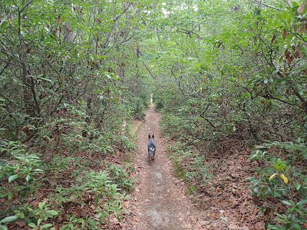
The Pine Trail and a woods road ran parallel with one another, and we opted for the woods road for some of the way because it was more direct. We crossed the power line and headed northeast for a bit, and then an unofficial trail went off to the north further.
We followed this and eventually
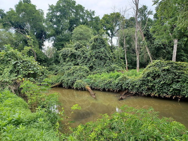
got down to along the shore of the Manasquan River at a nice spot where it’s
deep, and there is a mess of trees jammed up forming sort of a dam. We had swam
here last time I was in the area. I decided to go in for a dip again at this
point.
I’m not sure what was going on with the land down in this area, but they were like giant retention ponds through the woods. The informal trails were following the berms of these little basins. I think maybe some of it might have been borrow pits for sand for beaches or something, but I’m just not sure.
We continued from taking a dip up a trail that went steeply on a
sandy slope into the woods south of the Manasquan River again.
We returned to the Pine Trail again, but then made a right turn to reach the
white trail, which was the Oak Trail. It swings back and forth quite a lot on
switchbacks, and I opted to do this one because I had a lot of distance I wanted
to rack up in the park, to cover as much trail there I could that I’d never
done before.
We weaved back and forth for a while on this gradually descending through a
sandy mess.
We might have actually been on the combined white and orange at
this point. I actually can’t quite remember. Both of them go all over the place
for a time.
Eventually, the trail brought us out to the south parking area on Hospital
Road. We didn’t go directly out into the parking lot, and there was a park
police car parked there anyway, so rather than talk to anyone about where we
were going, we just turned right to follow the orange Pine Trail to the west a
bit more, which ran parallel with Hospital Road.
I watched my phone GPS closely in through here, because we would soon have to cut away from the trail and go out to Hospital Road.
There was a faint path when we reached the point I was looking for out to
Hospital Road. Directly across the road from where we emerged there was a sandy
ATV type of path going directly into a meadow area. I don’t think this was park
property, but there were no signs saying to stay out.
We went on the most obvious path directly across this property, and then into
more dense woods. This soon intersected with the pink blazed Boy Scout Trail.
We turned left on this.
We continued through pleasant woods to the north part of the
trail, which cut to the east, and then in a section of woods we came to an old
farming plow implement, just sitting amongst the trees.
We continued around on the pink blazed trail to the east side below the group camping area of the park, and there was an unmarked trail going down a slope toward the Manasquan River.
I had come up some of this way before
when Lerch showed me where it was years ago.
We headed downhill, and there was a small spring creek flowing in a lovely way
over some roots and ground formation into a wetland before the Manasquan.
The trail crossed this and other little wet areas on tiny wooden bridges made
by the mountain biking groups.
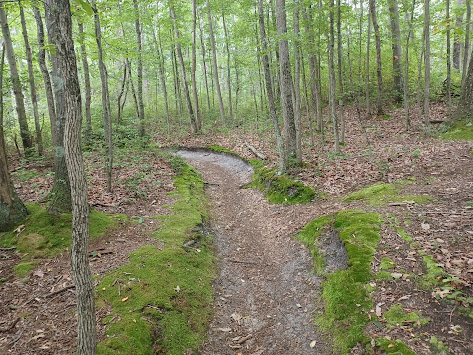
Alllaire State Park is full of “rogue trails” made by mountain bikers that are
in many cases better than the regular trail system. One such trail is the Tiger
Woods Trail over in the main part. This one had more structures on it that made
it cool.
We went over another little bridge, climbed a bit to a tree, and
continued on the south shore of the Manasquan River heading east.
The trail eventually led to a very interesting spot where it
crossed over the Manasquan by way of a log with a wire secured above it for
balance.
I was wondering if we would actually find this tree still in place so many
years after the last time I went across it, but I figure the log stays so wet,
because it is mostly under the waters of the river, that it wouldn’t rot away,
and a lot of the larger debris would probably flow over top of it at times of
high water.
The near end of the log was already under the water as it was.
I went across the thing first, which was kind of slippery. The wire made it much easier to get over to the other side though. Everyone took their time on it, but made it across with no problems.
The trail continued on the north side of the Manasquan, still
heading east, and then reached the bridge that carried the Garden State Parkway
over the river. One of these bridges had just been built the last time I was
out there, and the entire group stopped and swam among the coffer dams under
the bridge. I didn’t stop and swim at this point this time I don’t think, but
it was tempting.
We continued under both bridges, and then the trail started to turn inland to the left a bit, parallel with a small stream. We continued north there, and then turned right to cross a bridge over the stream, and then emerged at Robert L. Brice Memorial Park.
We moved over to the right in the park, and there was a really
nice view of the Manasquan River from a steep shore line. One would think the
river was quite low, but based on the look of the log we crossed, it wasn’t
really low at all.
We headed through the park over to a nice pavilion in the middle
of it near a parking area. We took a break in the shade there and sat for a
bit, which was quite nice.
From here, I had a bet in my mind that we could continue on without doing road walking, but it was a bit of a gamble.
We had to go over to
the right and out across a little foot bridge in the park, then across a field
to Lakewood-Allenwood Road. My guess was that there would be a trail continuing
along the Manasquan River on the other side, because at this point it becomes
Manasquan Wildlife Management Area and there was good access.
The bridge the road took over the Manasquan looked like one of those kind of temporary structures we often see, a sort of a galvanized through truss we often see as temp bridges while the new ones are in design stage or whatever.
The bridge site was historically the site of the last King patent tubular bowstring arch pony truss bridge in the State of New Jersey. Sadly, that original bridge was replaced in 1992.
Right next to the bridge on the other side of the road, the
trail I was hoping to find was in place. It brought us into the woods, directly
parallel with the river.
I didn’t realize it right away, but this trail follows part of a road that used
to be a through route, possibly to an intersection at the bridge. It was a
continuation of Lark Drive to the northeast.
We continued along with some really great views of the Manasquan River, and then turned to the left, away from it a bit, or rather parallel with a lesser tidal flow of the river. The pavement of the old road became more apparent, and there were some scenic ponds to our left.
As we walked, we crossed over pipes that used to carry water beneath the road, and the road went from being recognizable at times to otherwise just looking like a foot path.
We stopped at one of these little pipe areas and tried to walk the flow out to
the right, to get a better view of the Manasquan.
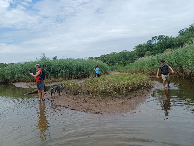
Walking through the water this way brought us to an absolutely beautiful tidal
spot on the Manasquan with views in both directions. The base of the river was
hard packed enough that it was easy for us to walk in.
We turned the same way from here, and then continued walking to a Department of
Fish and Wildlife boat launch, from which Lark Drive is still accessible.
 |
| A. Pierce Bounds for the Historic American Engineering Record. |
It was kind of surprising that the boat launch was only a tiny distance from
the spot we had waded out to just a few minutes earlier!
We stood in the water and cooled off again here. There was just about no one
around using the site, despite it being an absolutely beautiful spot. We also
checked out another landing just to the east, but it looked a bit overgrown.
From here, we headed north on Lark Road out of the Wildlife
Management Area. I had considered using a different route through fields to the
east, but that would probably add a whole lot of distance I didn’t want to be
doing.
When we got to the intersection of Ramshorn Drive, a police officer
pulled over to ask if we were alright and where we were going. I let him know
where we started and where we were headed, and he seemed somewhat impressed. I’m
just glad he didn’t see me drinking a beer in public or being somewhere I wasn’t
supposed to be.
I had been hoping to go straight across to possibly get on the Edgar Felix Memorial Bikeway not far off, but it looked to be private property, and with police already having been there, I didn’t want to go that way.
We turned left on Ramshorn, and followed it to the west a bit to reach where the trail, former Freehold and Jamesburg Railroad, crosses.
It wasn't all that bad to head down the road to the left a bit to the former rail crossing.
The line was originally
the Farmingdale and Squan River Village Railroad in the late 1860s. In 1879, it
was one of three rail lines consolidated to form the Freehold and Jamesburg
Agricultural Railroad Company, operated by the Pennsylvania Railroad.
This section, the part from Sea Girt to
Farmingdale, was reportedly abandoned in 1964, and all torn up by 1966.
We turned right on the paved trail heading east. This is also supposed to be part of the Capital to Coast Trail, which is one of those flowery ideas that is nice in concept but no one ever seems to be doing anything about it. Probably tied of in bureaucracy.
The rail bed was pleasant and easy walking for a while. There was almost no shade through the section, but it wasn’t all terrible.
Directly
across, the rail bed went through a parking lot, so we continued to follow it
there.
We continued
on the rail grade through the lot to Osborn Ave, and then straight across
through a small car lot. We walked around the building and past a frozen
dessert delivery van or something, which had on the side of it, in bigger words
than any of the product being advertised, that the driver would not answer frozen
dessert bar questions.
We emerged from this lot onto Atlantic Avenue.
As we looked down the street, I noticed something interesting I pointed out to
the others.
The first house next to us was set back from the street quite a lot. The second one was a little closer, and the next one was closer than that.
The final house in the row was almost right up to the street. I pointed out that this was because the railroad right of way was right in back of these houses.
Their
building lots were only the size they had recognizing the pre-existing
property. I always love to point out how the old transportation infrastructure
to this day effects development going on.
We turned left in front of the Manasquan High School ahead, parallel with Broad Street, and there was a nice giant tree in the front lawn. This school was built in 1933 to replace the original 1918 structure.
The
elementary school was directly across the street from this, and I wanted to try
to get out back of it over near the former junction site on the railroad. I
think when I’d walked the line before, we must have gone to the south. Eagle
Park is built part on the right of way but does not go anywhere. We ended up
cutting through something that time, but I don’t remember what.
The last time I hiked this branch, back in September 2008, I was in a bad place
and my relationship with ex, Cathy, was just starting to sour badly.
I dealt with it by drinking a lot more than I usually would have and got to the point of mental breakdown. So, by the time I got to this point, I couldn’t remember much of it.
Just to the
north of the elementary school was a stream known as the Judas Creek. There
were two enclosed pedestrian bridges that connected two sections of the
elementary school across the creek, so I figured we would walk beneath these
and get to the fields in the back.
When we got there, the area around the back looked too fenced off, but there was a third foot bridge that went over the creek. We climbed up onto it and around the back of the next buildings. There was a little community garden there that read “Manasquan Square Garden”.
We ended up having to walk north up Blakely Avenue where the sidewalk came out, and then to the right to Parker Ave back to the south again. We would cross over the former rail line we were walking on this route.
We reached Stockton Lake Blvd, and turned right just a block to make a lunch
stop at the Surf Taco place to the right there. I forget what kind I had, but
it was pretty good. I also checked out a local liquor store to see if they had any interesting beers, but didn't see anything really.
The next leg of the hike was pretty nice, heading east along the south shore of
Stockton Lake. The Jersey Shore has a lot of lakes just inland that were
developed as part of the barrier island topography, and offer some nice walking
today. The north side of it can’t be walked because it is now a National Guard
Training Center, but the south is nice.
We had to make a slight right on Potter Ave, then left on Ocean Ave for several more blocks, and we crossed over what I guess is considered more of the Judas Creek that flows out of Stockton Lake.
Once across, on the left side was the historic Squan Beach Life Saving Station #9 established in 1902, in the community of Manasquan.
The Deluth-style shingled building is located 1000 ft off the Atlantic Ocean, and was used to serve volunteers and store equipment, and to view shipwrecks and locate survivors off the Manasquan coast.
Earlier structures for the same purpose occupied this site from the 1856, and were damaged by storms or found inadequate for service. The original was replaced in 1871, and that one was replaced by the current one.
Ship wrecks were once common, but safer vessels
and practices of the 20th century meant different needs, and it became
Manasquan Coast Guard Station in the 1930s.
The site was decommissioned in 1996, and sold to
the borough for one dollar.
Today, the site serves proudly as museum to the lifesaving
and maritime heritage of the area, managed by the Squan Beach Life Saving
Station Preservation Committee, Inc.
We continued
walking Ocean Avenue directly east to Seawatch Beach, and turned to begin
following the shore.
It had been my intention from this point to follow the beach all the way south to the Manasquan Inlet, someplace I hadn’t been to in years.
It’s a really beautiful
spot with towers at either end of the jetties. Greg had to stay inland because
his dog wasn’t allowed on the beach, but he had a parallel route he would be
following.
I started
looking at the time while we were on the beach, and we were running a bit
behind for those who were going to be coming out for the night hike. We wouldn’t
be able to make it to the inlet.
I turned us back inland at Brielle Avenue, and let Serious Sean know we were on
our way out that way, but that we had to make a shortcut. His plan was to use
the train for part of his hike, and so it would be necessary to get out that
way more quickly.
I called Greg and got him before he got too far out of the way, and we continued west on Brielle Ave. We crossed a finger of the Judas Creek again, and then headed out to a lovely spot on the old Manasquan Inlet area known as the Glimmer Glass.
This is a navigable tidal inlet of the river still today. To the right of us on this body of water was some sort of community fair with amusement rides going. The clouds overhead made for a beautiful late day ambiance over the water.
At the center
of this water body is the historic Glimmer Glass Drawbridge, built in 1898.
It is said to be the only counterweight drawbridge
of its kind in the eastern United States, perhaps the entire country.
It is a cable lift bascule bridge with curved
track and rolling counterweights.
It was this style bridge that was once favored by
New Jersey railroads for the purpose of crossing canals.
At an island out on the Glimmer Glass, Green
Avenue goes left.
We turned
left at that point, and continued walking just a bit to the south.
It was less than two miles to the end from this point on the roads, and I was
just going to walk it, but I think it was Stephen that ordered an Uber to get
us all back a bit quicker, and then they could get on with the night hike.
I had intended to meet up with and walk with the group for a little bit of the
start of the night hike, but stress gets to me and I had to get home to my son.
I can never really do the hikes any more free of any guilt trips or angry
retaliation, so I figured it best that I just headed out and tried to get home
a bit faster.
It was overall a really great day though, and I was very glad to see so many more trails I had not yet covered, as well as visit others I’d quite liked.











No comments:
Post a Comment