Hike #1508; 10/11/22 New Hope/Washington Crossing Loop with Shane Blische and Everen
This next trip would be another weekday adventure loop on the Delaware Canal and Bel Del Railroad grade between New Hope and Lambertville NJ, and Washington’s Crossing and Taylorsville to the south.
I had done this is a loop
multiple times at this point since little Ev was born. The first time I did it
with him, his mom backed out a couple of miles in and left me to finish it with
him.
I ended up going back and doing it with Shane, and the route led to several
great then and now history shots.
The last time we’d tried to do this loop in the Spring, the overflow at the Pidcock Creek was roaring like crazy and we couldn’t get across it, so we went back and changed our loop.
This time, we could do
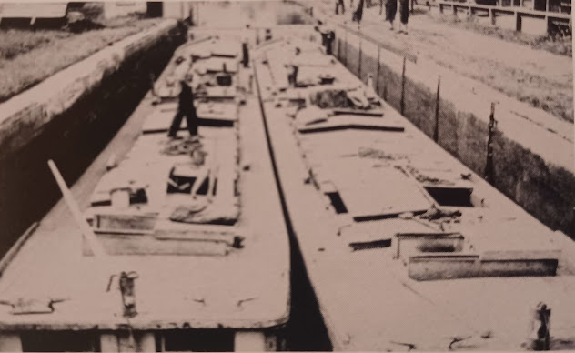
the entire loop as planned, and I had several photos from the Delaware and
Lehigh Canal photographic history book I wanted to emulate that I hadn’t gotten
the previous time.
Usually, when I do this hike we meet in Lambertville behind the hotel and station restaurant on the old Bel Del line, but this time since it was just my car, Ev and I just met at Shane’s house.
He’s right up above where the former New Hope Branch of the Reading Railroad crosses over Ferry Street, and is now the New Hope and Ivland Railroad excursion.
I started in the parking
lot by giving Ev a diaper change and getting all of the stuff we needed for the
day together. I sort of have a check list of important stuff we need, like diapers,
wipes, a bottle, a change of clothes in case he makes a mess, snacks, and more.
It took me a little while
to get everything together, and then we headed out.
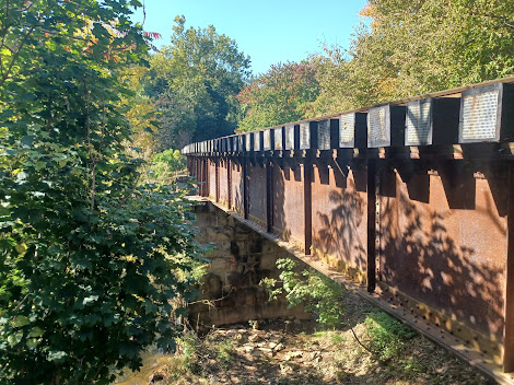
I took a shot of the plate girder bridge over the Aquetong Creek, which Shane insists is the Ingham Creek. I suppose the original Native American name was Aquetong, but the later colonial name or something must have been Ingham. I can see a town like New Hope pushing to change it back.
We walked down Ferry
Street and over the tracks and turned a right on Stockton Avenue to get across
the creek, where there was work going on to the east side with coffer dams and
such. This was some sort of remediation still going on from the last flood.
We turned left on Mechanic Street, crossed the canal, and then turned right to
get over to the Delaware Canal towpath to begin heading south. I had several
photos of the areas around the locks in town that I wanted to get.
When the Delaware Canal, or Pennsylvania Canal Delaware Division was completed
in 1832, perhaps no other town other than the north and south terminus
benefitted as much as New Hope.
The town had four locks, which meant the settlement was basically a parking lot for boats passing through. When it was necessary to stop, they might as well engage in some trade and purchase provisions. No other town along the entire canal had so many locks in such a closer proximity.
We only walked the canal
towpath for just a little bit when we came across a sign reading that the trail
was closed due to tree work.
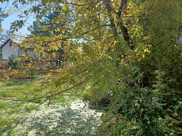
There were people over on
a private property adjacent to the canal doing tree trimming. I wondered about
the legality of doing this, because it was privately hired contractors closing
off a state park property.
It was such a short stretch, and I thought maybe I needed to be over there to get one of these photos, so we went through anyway.
We hurried, because they were dropping branches on the trail. No one stopped us, which tells me they probably were closing it down illegally.
We got to the other side
and examined the photos. We brought my book with me so that we’d have an easier
time located the spots with captions, since it wasn’t supposed to rain.
We walked across the canal on the foot bridge across the upper end of Lock 11. I had a shot to take up the middle of the lock, and then others of this lock from the other side. The lock house is still standing, where the tender used to live and work, but one of the adjacent buildings is now gone.
A shed on the west side of the lock is either still there, or a reproduction.
I had to kind of hang over the side
to try to get that shot matched, and another had to be taken from just to the
north in a parking lot with an enormous Sycamore tree growing in the pavement.
I could probably get some of these shots a little bit better if more leaves had
been down from the trees, but I settled for the best I could get this time.
We headed back over to the canal, across the top of lock 11, and then gently down the stairs with the stroller to Rt 32.
Lock 10 was crossed by the predecessor to this road, and the
current Rt 32 was built over the buried lock, so there’s really nothing left to
see of it. That made doing the next then and now series a bit tougher.
I got one of the
buildings on 32 across the canal, and then one of a man named Sheetz who I
think was a lock tender, seated at the approach to Lock 10. I had Shane sit
close to the original location leading in to lock 10.
We dashed across Rt 32, which amazingly has no crosswalk for the canal trail. I find it quite insane that in a town like New Hope, there is no ADA accessible route down from lock 11 to the highway, and then there is no crosswalk for the trail that has been there since before we had numbered roads. Sometimes crossing at this spot is really dangerous.
We descended from Lock 10
site toward Lock 9, and there was a basin in between the two lock sites. I
identified one of the historic photos as having been the basin in between these
and set up that photo. We then walked on past Lock 9.
We turned left from the main towpath down a path to the left that led to the outlet lock to the Delaware River. This was part of a little spur canal that was connected about 1850 to allow for the passage of boats from Delaware Canal to Delaware and Raritan Canal. The route is watered and pretty well intact.
We walked that out past the new Odette’s River House. The original Odettes Tavern was moved up the road a bit adjacent to the west side of Lock 10 on an island of grass to keep it safe from flooding, and the new restaurant building was put up where the original used to be, adjacent to Lock 8.
The main canal and outlet canal come together on the south side of that property.
I had one more historic
shot to get in this area looking south toward the Union Paper Mills property on
the canal. Some of the buildings associated with the old mills are now upscale
apartments.
Just past these buildings, we continued through the well shaded area past the former paper mill site. There is actually a fifth canal lock in Lambertville at this site, which was unnumbered and referred to simply as the “Paper Mill Lock”.
It only had a lift of about two or so feet, and it was placed not so much for navigation, but to provide a little extra water needed to power the paper mills.
One of the plate girder bridges over the canal in this area is originally the access to the paper mill property.
We continued south from
there, and at first Rt 32 was closely parallel. We then moved away pretty
quickly and got to much more secluded and lovely settings.
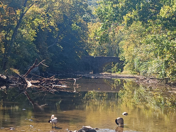
At some point, a creek came in on the right that I can’t remember the name of, which had a nice stone arch bridge carrying Rt 32 in the distance, and Shane pointed out how the old trolley line used to cross on the near side of it. An abutment was still visible.
A little further from this point, we came to where a side trail to the left led up into the Washington Crossing Historic Park property on the hill.
Washington of course is not known to have crossed here, but what general public
do not realize is that Washington’s Continental Army crossed the Delaware all
up and down from the traditional crossing site we know today.
We headed slightly uphill and through the shade of the picnic grounds and an old pavilion heading to the south, more close to the Delaware River than the canal goes at this point.
One of the spots I had never bothered going to directly in this area was the unknown soldier grave and memorial at the south side of the property.
I think the flood of 2004 took out the bridge connecting the two bits of the
park over Pidcock Creek, and the approaches to these roads are still in place,
but we would have to weave back around to the canal towpath, then take a narrow
paved trail out to the memorial from the north side.
We entered a stone wall
area and a grove of trees to a spot with I think about twenty three grave
stones and an American Flag.
Behind each of the nice white grave markers, there are old stone
original grave markers. The white ones were replacements ones installed in 1997.
The only known grave I'd that of Captain-Lieutenant James Moore.
For two weeks prior to General George Washington's famous crossing of the Delaware on Christmas Day 1776, part of the army was encamped at this site. Many sick and wounded soldiers died during that time, and are interred here.
It was a really nice site
and I was glad we covered a bit of something new. We continued from this point
along a parallel trail to the towpath that continued to the south a bit,
another little bit I’d never followed before. The Pidcock Creek spillway was
completely dry the entire way across, so it didn’t even involve getting
slightly wet.
The trail came back to the canal towpath and we continued following it to the south.
A little further ahead,
we crossed over a weir where the excess water flowed over and down to the
Delaware. It was flowing with crazy force so I stopped Ev there so he could
look over and check it out. He seemed pretty interested in it.
Just past the weird, there was a guard gate over the canal, which is sort of
like a lock. The weir is made to drain off the canal if needed for maintenance,
and the sections beyond can remain watered, which is why these couple of bits
of infrastructure were in such close proximity.
We passed beneath a driveway bridge and did a little group shot in one of the
bubble mirror things that are under the bridge so fast moving cylcists could
see if anyone was coming beneath before flying through.
The next section is one of my favorites on the way down to Washington Crossing. It comes up right alongside the Delaware River, and the views are just fantastic. We stopped and took some photos of the views as we passed on through. We could see Baldpate Mountain clearly across the river.
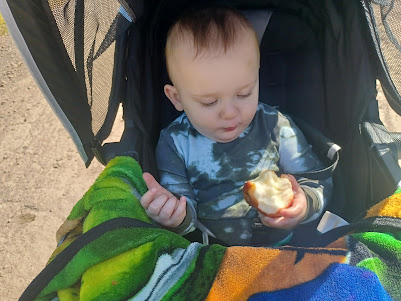
There was one guy that was about to pass us on a bike when he saw that was drinking a bottle of Double Dog 18, one of my favorite IPAs, and I’d handed the empty one to Ev to hold.
The cyclist thought it
was the funniest looking thing ever, and he stopped to talk to us a bit. I was
pulled off the right side of the trail and he was on my left, but not taking up
the entire path.
As we talked, some guy on another bike came flying by at a very high speed and
clipped the guy we were talking to while exclaiming “G*d damn!”
Some cyclists are just jerks. National Park Service imposes a fifteen mile per
hour speed limit on multi use trails for cyclists, and almost none abide by it
nor is it anything that the park service enforces.
We walked along and had an enjoyable time. I tought Ev the proper way to eat an
apple.
After the pretty section, we passed beneath Rt 32 and began getting closer to
the Washington Crossing turn around.
We started watching along
the canal in this next stretch to see if we could see some historic kilns that
used to be along the way in the Taylorsville area.
It’s a really pretty section passing through Washington Crossing Historic Park, with a lovely pond to the left of the towpath.
Unfortunately, we never saw any evidence of lime kiln sites through any of this.
It might be that the kilns, which in the book
were simply located in Taylorsville, might have been a little further south
from where we finished so we didn’t see it.
We turned left on Rt 532
and started heading toward the Washington Crossing Bridge.
Before getting that far, we stopped at Original Dominic’s Pizzeria for lunch.
When I was working at Washington Crossing, I would go across there pretty
regularly for their amazing specialty slices.
I had done a lot of loop and point to point hikes down at this location when I was working down there, and this was one of the many loops I would do while I was there. It was very convenient.
We went in and got a got a couple of slices. I think one of the ones I got had some penne on it so I had something I could give to Ev.
He ate pretty well while we were in there, which was very good to see.
There was music playing inside, and the employees were enamored with watching a
soccer game that was showing in the big screen TV. I’ve lately been telling Ev
to dance and he sways back and forth and turns his head. I got him and Shane to
do it on cue for a video which was adorable.
When we were done eating,
we head out and toward the Washington Crossing Bridge.
The third bridge on this
site, it opened in 1904 to replace the 1841 covered bridge that washed away in
the Pumpkin Flood of October 1903. The first bridge was completed in 1834, and
also destroyed by flood.
We made our way off of the bridge and to the left; Ev and I headed onto the old Bel Del Railroad bed heading back to the north while Shane walked down the right of way to get a few photos.
I passed the big Washington Crossing State Park parking lot, and continued on along the edge of Titusville.
Shane called me, not realizing that I had moved on ahead, so Ev and I waited
for him near the former site of the Titusville Station on the Bel Del line.
I had recently been reading into the canal and the railroad, and found that
although the Delaware and Raritan Feeder Canal was completed in 1834, it was
not open to navigation until about 1850 when locks were added for that purpose.
This is significant because everyone always refers to the trail as the “towpath”,
which is false. It always bothered me that they called it the towpath as far as
Frenchtown, because there was never a canal in Frenchtown, and as such, it was
only rail bed, not a tow path.
This is even more significant because even I had always believed that the side of the canal closest to the Delaware was the original towpath, and that it was moved when the railroad was built in 1850.
If the canal wasn’t upgraded for
navigation use until the same year that the railroad was completed, it means
there was never a towpath on the river side. It had to be on the inland side
all along, and it is inaccurate to refer to any part of the right of way the
trail follows as the towpath, except for a couple of sections where the trail
diverges and actually follows only the canal in Lambertville and in Trenton.
I did another then and now compilation using a Richard Samsel photo when the tracks were still active, ripped up about 1983, and we continued to the north.
Shane found a few railroad spikes through this stretch, which is surprising because one would think by this time they’d all have been taken.
We crossed
Grant Street and Church Street, and eventually River Drive heading to the
north.
We continued on to the Moore Quarry bridge site. One of the couple of spans that went over the canal is still in place on the other side of this bridge, but the other is long gone. Just before we reached that bridge site was the former site of Moore Station. I had done a then and now of that one the last time we hiked this.
We continued north from there a little bit more to the Montgomery Quarry spur bridge.
This bridge is kind of in
danger. The wooden structure is failing and sinking into the canal, and it had
a metal swinging section when navigation was happening on the canal, but it’s
been fixed in the same position for year.
Shane was saying that he would really like to see the structure saved and
turned into a sort of pedestrian bridge, but it might not be stable enough for
that to happen, as it doesn’t even sit straight.
It does make sense for the location since there is a rather new Mercer County nature center just on the other side, and there isn’t really a convenient way of connecting otherwise.
We continued to the north
from here, past a view of the old Montgomery Quarry building that’s still
standing, and on to the bridge that comes across the canal from near the
intersection of Rt 29 and Valley Road.
Here, we decided to try
something new that I’d never done before.
The Fireman’s Eddy Preserve now makes a loop from the Fireman’s Eddy Bridge down toward this area, with mowed trail along field edges out along the Delaware River and along the edge closer to the Bel Del rail grade.
This was a great idea to
go that way. It was a beautiful stretch of grassy, easy terrain with some nice
views just as the sun was about to set.
We continued to the north
and it kept getting darker. As we walked, someone came up behind us on a
bicycle and asked if I was M’ke.
This was none other than Joe Donnelly from the Delaware River Joint Toll Bridge
Commission out to find us!
Mr. Donnelly has been a great presence on the Metrotrails media, always adding excellent historic information to compliment (and sometimes correct) some of the information I had in my own historic presentations.
We had just missed meeting him at the grand opening of the new walkway at the
new Scudders Falls Bridge, so we finally caught up with each other!
We walked along with him and chatted about history and such, and was with us right up until we got to the outlet lock where the connection was made with the Delaware Canal on the other side.
It was kind of dark to get a good then and now compilation this time, but I still tried to set it up anyway.
Before Mr. Donnelly left
us, he recommended that we take a trip out across the lawn at the water
treatment plant because there was some infrastructure there from the canal
days.
We walked down, and it brought us to where we could look over the lock outlet with a better view, and the wall along the river apparently might have been used for mooring and such.
I didn’t know there was that much associated with the canal left in place, so this was a great little thing to check out with the last bit of daylight we had left.
We headed back onto the
rail bed and continued out to behind the Lambertville station restaurant hotel,
then past the restaurant that occupies the station to the New Hope-Lambertville
Bridge.
The sun was going down beautifully and everything was a silhouette in this section, across the creek and then through the lot out to the bridge.
The walkway across was loaded with people meandering between the two towns, just because it's the trendy place to be, to see and be seen or whatever.
I almost feel like a hipster claiming that I was doing this when I was 17, and now it just seems like it's lost something of the mystique it used to have then. I still love the town, but I appreciate it more for his history than everything else that feels so contrived.
We meandered on along the main drag and then a couple of blocks back to Shane's house and my car to complete the great day. I gave Shane a "happy box" of stuff I'd been going through in my home, which included copies of several books I had doubles of for his collection.
It was really a great, relaxing day, and I needed it pretty badly.


