

Hike #1643: 1/19/25 Hackensack Meadowlands with Kirk Rohn, Mike Selender, Serious Sean Dougherty, and Everen
Last year, when we had just about the coldest day of the year, I arranged a hike that would include the American Dream Mall.
We had an absolutely fantastic time, with ten or so miles outside the mall, and the remainder walking around inside. I wanted to do something similar again, and so I scaled off some potential trips. However, I didn't have that one planned for this day.

I think this one was supposed to be the next hike in my Horse-Shoe Trail/PA Highlands series, but with the amount of snow that was predicted, and the fact that we had to park on odd roads and such, not to mention the potential of unsafe travel with snow cover, I decided against doing that rather last minute.
I canceled the initial hike, copied and reposted it for the near future, and then posted the hike that would fit into more of our Hackensack Watershed series.
I was a bit worried leading up to this one. My record has held pretty strong that someone has always showed up for every regular weekly hike I've posted since early 2004, over a twenty year run. I didn't want to lose that record!
I was thankful that Kirk told me he was coming the night before. That helped me to rest easier. It was great to see that Mike also came out when we arrived at American Dream in the morning.

My initial plan had been that we would walk from a point to the north with a car shuttle, an that if we didn't have enough cars for it, that we would do a loop aroun the mall area in a second alternate route I came up with.

Because Kirk rode in with me, and Mike had limited room in his car, we opted for my loop, which turned out to be really quite interesting anyway!

Further, the snow, which initially looked like it was predicted to happen all day, did not occur at all until we were nearly finished with the outdoor portion of the hike.
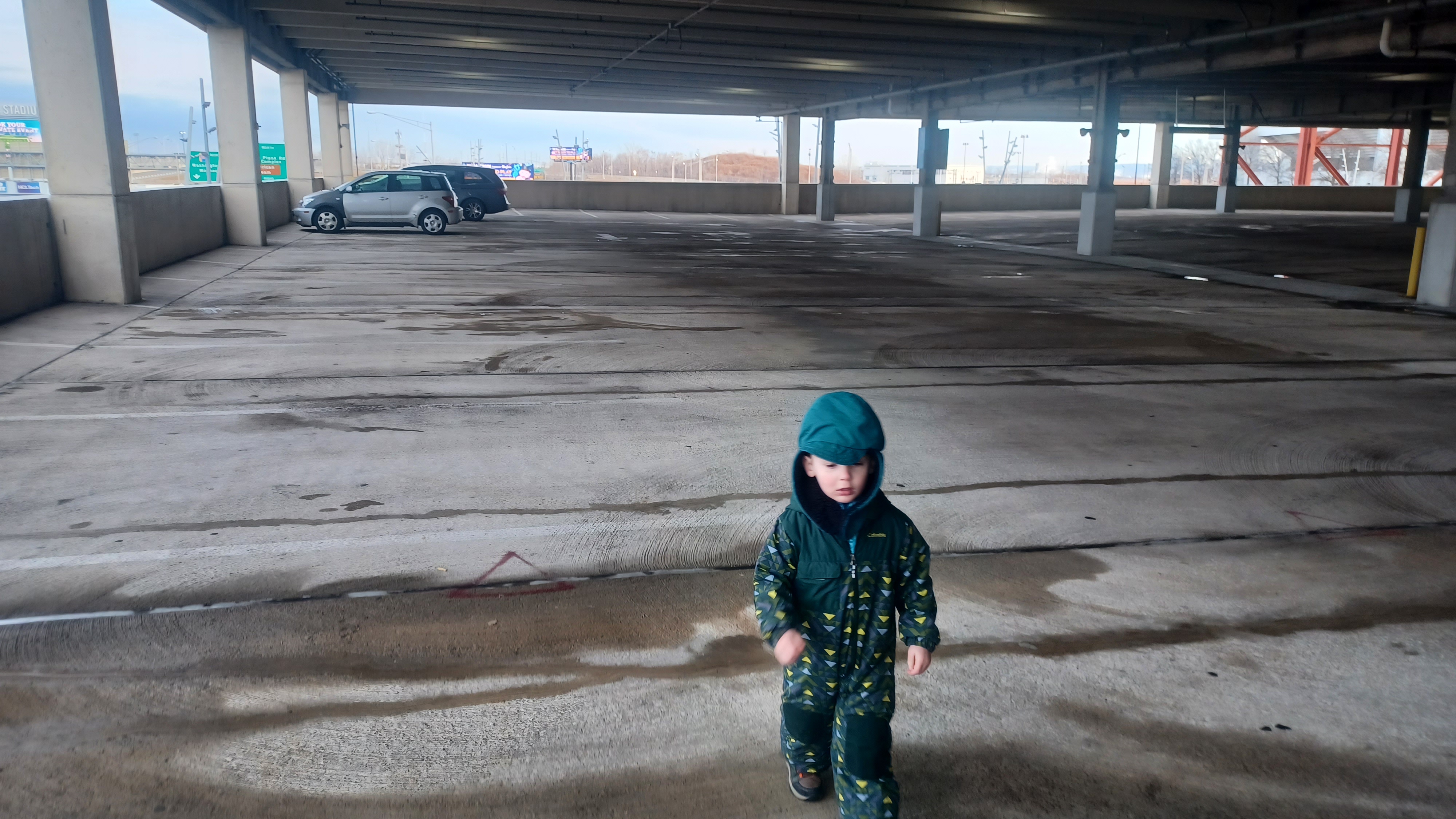
We parked inside the parking garage for this one. There is a steep parking price for the mall as I understand, which I got away with not paying the last time, but this time I was just so happy not to have to cancel, that I happily used the parking garage without thinking on it further.
It was pretty cold out, but not too terrible. Still, I bundled Ev up really well so he would be comfortable. I got him out of the car, and he immediately began running around the parking garage.

We were up a level, near the north side, with a spot overlooking the new Giants Stadium.

The new stadium, officially called the MetLife Stadium, was completed in 2010, to replace the 1976 Giants Stadium.
The site has been home to New York Giants, the Jets, and a list of other sports teams, and countless large concerts.
Old Giants Stadium came down in 2010, with no sign of Jimmy Hoffa, despite all of the claims that he was buried there.

The new Stadium, to many, was a seamless transition that many didn't even seem to notice. I was definitely one of them, just because I really never cared much at all for sports, even though my Uncle Brian was a linebacker for the Giants until the early 80s.

I think I had only ever been to the original stadium one time, when I saw the Rolling Stones and Alanis Morrisette there back in probably 2006 or 2007.

The entire area has gone through so many transformations that I really don't have a frame of reference to recognize. The mall itself is a major development, and it is shocking it was even built when so many other malls are going out of business all over.
The American Dream Mall opened in late 2019, after years of stalling.
Proposals for this mall, which was initially named Xanadu, have been going on since the 1990s, when so many more Mall related stores were prevalent. Ground was broken around 2004, and ownership shifted several times.

Soon after it finally opened its first sections, it was forced to be shut down completely due to the 2020 pandemic.

It looked as though the mall would never have a chance to succeed, but it is pleasantly surprising. It is always very busy and has quite a lot to see.
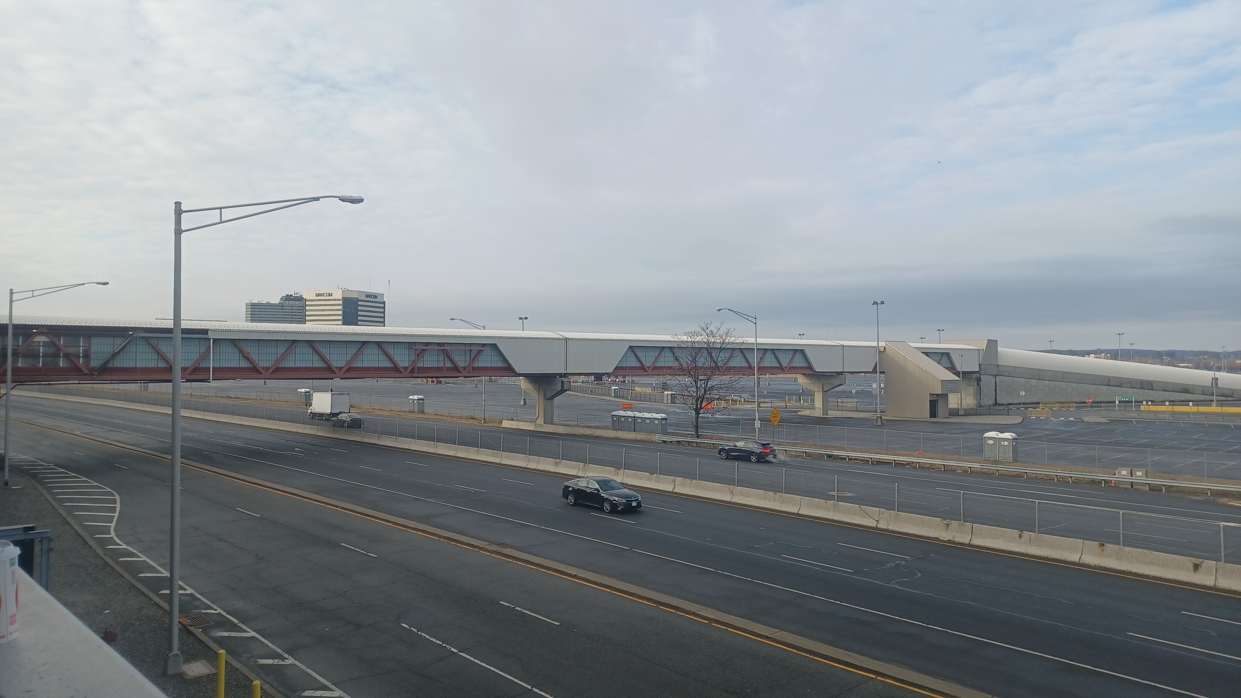
We were parked on the correct level to make our way over to the long pedestrian bridge, which connects the mall parking garage with the larger parking lot at the MetLife Stadium. This is reportedly going to be replaced for some sort of World Cup thing that's going to happen there.
The bridge was pretty cool to walk through. Ev wanted to run through the entire thing himself.

We made our way though and out the other side, into the parking lot. Kirk headed to use a porta john outside, and Mike, Ev, and I headed through the lot to the far south side where the entrance is from Rt 3.

We followed the sidewalks along the south side along the Peripheral Road, and headed west. We soon came to a small metal gate and a gravel road into a sort of retention pond area. There were no signs saying to stay out, so we decided to walk on in there and have a look around. The gate was so high that I could push Ev in his stroller beneath it.
The access road moved along the body of water, and then to the right was a dock out onto it, with a metal grate walkway out onto it. I pushed the stroller out onto it for a better look around, which was rather interesting. I couldn't belieave there were not any no trespassing signs on this.

I let Kirk know where we had gone, and he was heading out to catch up with us. We made our way past the dock and around to the east side of the pond, often with some nice views, and then to the south side.

The access road made its way to a large billboard visible from Rt 3. I knew from aerial images that this would be a dead end, but an interesting one, and so we turned back there.
Kirk made his way around most of the way, and went out on the weird metal dock thing we had done before.
We made our way from here back out to the outside road, which is called Stadium Club Road at this location, and continued to the west.

We passed an entrance from the NJ Turnpike, which becomes Road D toward the stadium, and continued along the south side.

Areas to our right are apparently where they have flea markets seasonally, but nothing going on this day. We did see one other person walking by on the road, which was really odd. I suppose most people walking would choose to do that in the mall.
We continued west, and on our right was the New York Giants building and training center. I suppose this must be new stuff. I'm not sure when any of this other stuff was built in the area.
Road C had gone right just before we reached this point, and we continued straight on Service Road. That road weaves around and under Rt 3, and there is no way to get back of we followed that. It also did not look at all pedestrian friendly ahead.

We turned to the right after the Giants building lot on Berry's Creek Road. There were some access roads around little ponds to the left, which looked somewhat enticing, but we opted not to go through because we would have had to come back the same way ahead.

We continued past the Giants Training Center, and there was a bit of a view to the body of water and some sort of building beyond.

Ahead, we went around a corner with a helipad, then turned ninety degrees to the right. There was a good grassy swath to the left of the road parallel with the Berry's Creek Wetlands for a while.
We continued around a curve to the north, still with pretty good grassy lands to follow on the left side.
This changed names to Road A Plaza, and we continued along to the north and northwest.
We sort of weaved around to the north and then the west, above an area where they could take entrance tolls or something I suppose when games are going on.

When we got past this, there was a larger swath of grass to walk over again on. We turned to the north a bit on Road A Plaza, and soon approached the light rail bridge, a relatively new structure that connects to the Meadowlands

This is mostly filled lands of what was the Walden Swamp a century ago. Before that, in the late 1800s, it was known as Boiling Springs.
The modern branch rail line was completed in 2009, and despite completion of the new Stadium in 2010, and the mall in 2019, it still does not see daily service. It breaks away from what was historically a branch of the Erie Railroad.
It is proposed the line will be extended south onto the Essex-Hudson Greenway, or that a bus only highway on the same route will be used for alternative connection.

That is very recent development announced through DEP, that the controversial $65 million purchase from Norfolk Southern, would be used differently than had been previously stated.

The line of what was originally the New York and Greenwood Lake Railroad, later Greenwood Lake Branch of the Erie, and most recently, the NJ Transit Boonton Line, was to become a pedestrian only route some nine miles from Jersey City to the south side of Montclair.
NJ Transit operated this as daily commuter rail until 2002. Now, after constant hoorays for this being New Jersey's latest state park, they are now saying NJ Transit will operate the easternmost section again for either light rail or bus only highway, with a pedestrian path beside it.

I am all for extension of commuter service, but what did we pay for? This heavy price tag, which was already illegal because it was against federal Pay to Play Laws, is now going for putting back in service what had only been cut out of service for about twenty years prior to purchase. Until about a year ago, the rails were still in place!

It was bad enough that the state purchased the right of way from Norfolk Southern within a year of that organization more than doubling its campaign contributions to the Democratic Governor's Association, which Murphy chairs, and the National Governors Association, which he vice chairs, and both provide him with funds. Every time I think this garbage deal can't get any worse, they manage to make things worse. Also recently, Murphy changed OPRA laws which limit what we can look up in terms of campaign contributions. He's broken federal laws, and creating state laws to cover his tracks is what it looks like.

I really like the trail plan, but not for that price tag, and not for the underhanded way things have come to pass. It all sets a dangerous precedent for any politicians to follow Murphy.

When we got to the bridge, we took a quick break. Ev was getting tired and starting to nod off. I made sure he was well wrapped up in the stroller, and I walked off under the bridge for a few moments.
The footings had higher ledges that could be stepped on, and I headed out as far onto the wetlands I could without getting soaked. It offered a unique view of the underside of the bridge. Already, this hike was quite a lot more interesting than I'd anticipated it would be.

We continued from the underpass out on the A road toward Paterson Plank Road, where we shifted to the right along an entrance road, to where there was a good crosswalk to the other side.

This portion was originally the Paterson-New York Plank Road, a toll road developed in the 1850s.
Washington burned a bridge somewhere in this area to hold off British soldiers from interception during his Revolutionary War retreat from Fort Lee.
We had a sort of reasonable sidewalk along this stretch of road, and we continued to the east for a bit.
We passed some sort of advertisement for vitamins that claimed 82% of all black women are deficient of Vitamine D. Never something I would have considered would be a thing.

Soon, we turned left on Gotham Parkway, which took us to the north a bit over part of Peach Island Creek, in what used to be Eight Day Swamp many years ago.
We were coming into the community of Carlstadt, in a area where it was mostly industrial and commercial buildings. The original settlement of Carlstadt would have been a bit to the west, across the Berry's Creek closer to East Rutherford.
We continued to the north, and eventually came to a spot where railroad tracks were clearly visible to the left of us, in the pavement of parking areas.

The rail line broke off of the former Erie Railroad to the west, maybe at a time that it had already merged as Erie Lackawanna, but I think it might have been just before. It split into two branches, south and north, and came back together again on the west side of Gotham Parkway.

It looked as though only the northern leg of this little loop had been active more recently, but even that had been cut off for some time.

Across the street, to the east, there were two sets of tracks going off into the grass. The northern one, to the left, was the through route, and the one to the right cut off and was apparently the siding to the industry there.
I had planned to walk further north, thinking that the rail line would not be accessible for walking, but seeing it in person made it look much more inviting. As such, we turned right, and began following the sets of tracks into the lawn to the east.
We passed by the first building on the right and soon paralleled the second one. The tracks remained pretty heavily overgrown through this section. We were able to continue through on grass.

We opened up to one more lawn, and then to parallel the side of a parking lot. The tracks became a bit more clear as we got to this lawn area.

To the left, there was a path cleared across the tracks and out to Commercial Avenue to the north. Ahead, the tracks were overgrown, and a bridge was missing that would have carried them across a small ditch.
This entire section of Carlstadt was probably wetlands that had been drained off by such ditches and then back filled.
There was no good way to get through on the railroad bed. If we could have gotten into the next lot, we probably would have been able to follow it all the way to its eastern terminus.

Here, we had no real good choice except to turn left on Commercial Ave, so we got over the tracks and started following the road to the north, through the commercial lands.

We continued north until we came to the first regular intersection on the right, where Commercial Ave continued straight, and the creatively named Commerce Road turned right.
We passed Sunbelt Rentals, which had all sorts of lifts for rent that made it look like some sort of giant serpents with their heads up.
The road turned hard to the right, and we continued around, as it then shifted back to the east again. We continued on the road until we came to the intersection with Washington Avenue, where there was a Quick Chek on the corner. We stopped in for snacks and such.
When we were done in the store, we headed to the south side of the lot, where there is a very historic cemetery, which we had gone by on the opposite side of the road on our last visit to the area about a year earlier. At that time, we didn't get to go into it for a closer look.
This was the obscure Outwater Cemetery, used from 1752 until 1892.
In addition to being the Outwater family cemetery, 18 Hessian soldiers who died during the American Revolution are interred beyond the obvious stones in unmarked graves.

Old brown stones in this plot are reinforced with concrete for stability.

The cemetery was abandoned for many years and subject to vandalism. The grave of Revolutionary War veteran Captain John Outwater was dug up, and his skull was stolen.
A boy scout group worked to refurbish the site in 2005. Sadly, a bronze cross installed at the site was stolen, as was ground hog deterrents.
Today, the site is better watched over, but still quite unknown.

I let Ev out of the stroller at this point, and he hurried right up the steps, which ascend directly from the Quick Chek parking area into the cemetery. He ran around a bit, but was more interested, it seems, in the wall surrounding the thing. He would keep going back down the steps and trying to get on the border wall around this graveyard.

We walked around and checked out the oldest stones, which are still brownstone, but with encasings around them. The Outwater stone has been replaced by a modern one near the center.

We eventually made our way to the front of the cemetery, and descended own to Washington Avenue to continue south back toward the American Dream Mall.
At first, we were on the west side of the street, then switched over to the east side as we got closer to the underpass below the Paterson Plank Road entrance to the mall.
We cut to the left at the Redd's Restauran lot, an continued on on the other side of it, and then behind the Goodman Logistics Center building. This brought us out to the Paterson Plank Road and the east entrance to the mall area.

However, we would not be going to the mall just yet. I had one more spot I wanted to check out and get a few more outdoor miles before we headed in.

We continued on the old Paterson Plank Road, which is a dead end at this point. It used to continue out across the Hackensack River out there, but now comes to an end.
I've never seen a photo of the old bridge that crossed at this location, which is odd since it would have survived well after the days of photography. The search on this revealed only a sketch of what it had looked like.
After the mall entrance parallel with us ended, we climbed a bit toward a bridge over the entrance to the mall from the NJ Turnpike.

The tidal floodplain of the Hackensack River was in view, created by the Wisconsin Glacier some 20,000 years ago. It's quite a scene when we gain some elevation.

We continued on a bit more, and soon we crossed over the NJ Turnpike itself, by the toll plazas.
The route was first planned is two separate highways, Route 100 from New Brunswick east, and Route 300 from New Brunswick west to the Delaware Memorial Bridge.
Originally planned as a toll free road, the state did not have the funds to complete it and little work was done under those original designations. The New Jersey Turnpike Authority was created in 1948 to finish the job, and it opened in 1951 as a single Highway.

It has been extended for a total of 117 miles, and is the sixth busiest toll road in America.

At the bridge, it was pretty obvious that the original plank road was a bit to the right over the wetlands, rerouted over slightly for the newer construction.
We continued down the ramp on the other side, and it was rather overgrown on the walkway. I was able to push the stroller over the walkway on the bridge itself, but not beyond due to weeds. It was alright though, there were barely any cars on this anyway.
In the past, this was probably a much busier route. When we turned to the left on Outwater Lane, where the Paterson Plank Road would have continue straight, there was a large abandoned building on the right, part of a former bar and driving range.

This place was known as LT's, associated with former New York Giants player Lawrence Taylor. He's good friends with my Uncle Brian, and I remembered looking through family photos, and there were some of my mom dancing with LT, and another where my mom and LT were taking photos of one another with cameras held up to their faces.

I never asked where the photos were taken, but I think it might have been this place. If it wasn't there, it might have been at Satin Dolls, which was another my uncle and aunt owned, which became famously known as "Ba Da Bing" on the Sopranos TV show.

I never asked my mom which of the two it was, but I suppose I'll have to do that.
The entire building was really badly beat up. It looked like it had been abandoned for quite some time. Really a wreck.
We continued past a couple more properties heading down the road, and then approached River Barge Park on the right, an interesting spot for sure.
The entrance to the park is the formerly neon "Barge" sign, where a popular restaurant known as The Barge Club in the 1970s and 80s utilized two covered badges. The owner's collection of nautical and regional artifacts, which include old ballasts and channel markers, are displayed on the 5.5 acre property.

In the 1940s, this was the site of Sky Harbor, a seaplane base where hundreds of aviators were trained during World War II.

The park and public boat launch opened in 2008.
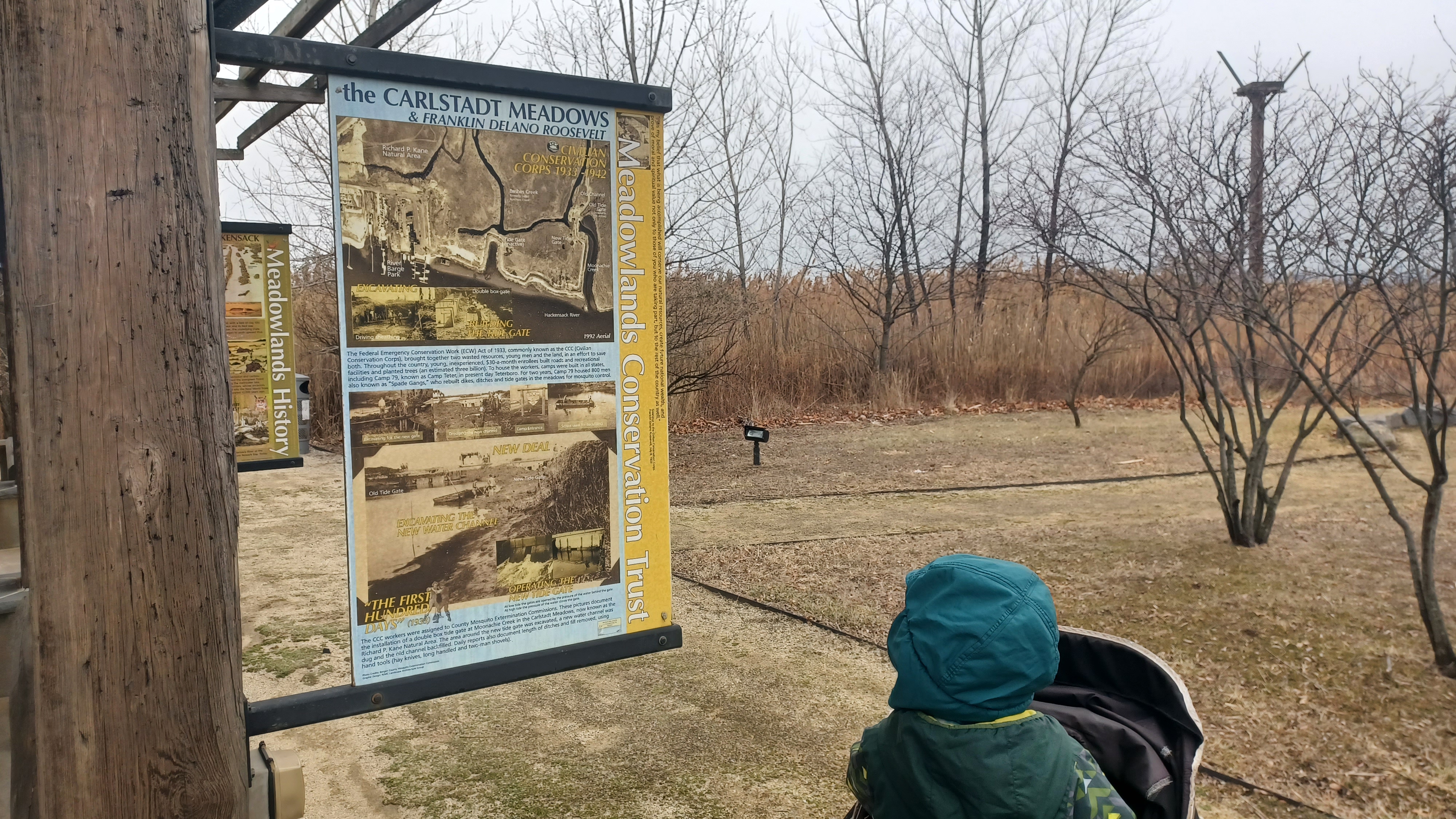
We kept to the left and headed around a building to the far end of Outwater Lane, where there was a little path heading toward a pavilion, and some good historic markers about every aspect we could ask about on the river in this area.
There was a giant boat propellor on display at the entrance. We headed from here to the pavilion, which memorializes Robert Ceberio. There was an anchor on display, and then more history markers.

Some of them talked about the dikes, dams, and ditches, about milling, and then draining the wetlands. One talked of the New Deal and the work of the Works Progress Administration under Roosevelt. Another talked of slavery in the area. Another covered the history of river barges, and yet another the history of the roads and railroads.

I went through and skimmed the text of all of the signs, and then continued on to the east a bit, where there was a grassy trail toward the wetlands that just ended abruptly.

We checked out every nook in this park as we headed around the east side, out to the waterfront.
We headed to the first of the docks, on the east side of the boat launch, and walked out to the end. It turned to the left at the end, and was down really close to the river. I held onto Ev's stroller very tight on this as not to drop him in. It's a little unnerving, but really cool to be out on.
Downstream, we could see the two Rt 3 bridges for opposing direction traffic crossing over the Hackensack River.

We could also see the large carousel at the American Dream Mall.
Upstream looked pretty desolate on the near side, with just the wetlands, but directly across us was part of the Secaucus Greenway, which we had hiked near the beginning of our Hackensack River series. We could also see toward the trolley park where the original Paterson Plank Road came across.
We headed back out to the land, and out the other side a bit. We walked just about all of the floating docks that we were allowed to use out there.

There was an enormous mess of goose crap on these piers.

This is of course disgusting, and horrible for water quality, but now we have to worry about the Bird Flu issues.
While this Bird Flu (H5N1) is not currently a concern to humans, there are several other repercussions.
This has become so serious that chicken farms are closing their doors, and even approaching vehicles must have their tires hosed when nearby.
Dead or dying geese are contagious to other birds, and now felines.

I got a lot of information about the Bird Flu concerns from my friend Robbie, who is our local animal control officer, and it was interesting and alarming to hear about.

If you love your cats, leave your shoes outside if you've been anywhere with goose population especially. I certainly don't want my cats to be getting anything. Ev's mom always shouts at me if I leave shoes in the house, so I typically leave them out anyway.
Bird Flu has also already been confirmed to effect Red Tail Hawks.
It is a major concern that this might spread to and harm the bobcat population, right when we are finally getting to preserve large tracts of land to protect their numbers and habitats.

Animal Control officers say dead birds should be bagged, and then brought somewhere to be incinerated, but are not recommending public handle them. Sickly birds should be eliminated to curb the spread. Animal Control, Game Warden, or conservation officer would be best contacts.

Officials have indicated frustration about lack of government guidance or action on this serious concern. Recently, confirmed cases led to the temporary closure of Merrill Creek Reservoir, one of the only agencies taking this issue seriously.

We can help by avoiding areas with lots of goose crap, by reporting dead or sickly birds when observed, and cleaning shoes well. If you keep chickens, definitely take these extra precautions.

Of course, we couldn't avoid this at this moment really if we wanted to see the river. And, we wouldn't be going straight home or getting in cars any time soon.
We headed out around the visitor center buildings, and then north back to Outwater Road where we turned left, to return on the road in the direction we had come.
We made our way down the road a bit more, and passed LT's Place again, looking forlorn, and continued on down the road for a bit.

We turned back to the right on the old Paterson Plank Road, and ascended to cross the NJ Turnpike once more.

By this time, it started to snow just a bit. The forecast had held out for us pretty much the entire time we were outside walking. Initially it looked pretty grim, but we got over ten miles in outside!
It was getting pretty cold and wet by the time we got across the turnpike bridge, and I tried to keep Ev covered over in the stroller as best I could. We were really only out in it for a short time.
Once we got across the on ramp from the turnpike on the bridge, we turned left into the mall lot area on the North Connection Road. There was a bit of a walkway I suppose on the far side, and we headed south.

This was not a great route because it got to be too narrow to fit a stroller along it. This mall is certainly not intended to be pedestrian friendly for access.

As we made the corner approaching the mall, there was a big sign reading "not a pedestrian walkway". Clearly, they don't encourage anyone to travel to the mall by foot at all!
We just hurried along carefully, and pretty soon we were beneath the parking garage levels of the mall.
It was still a little cold and somewhat windy in there, and Ev had just about had enough of it because he started hollering, so the timing was good that we reached the mall at this point. Soon, we reached door entrances and were inside the mall.

I seem to recall we got on the elevator and made our way to the top floor. My plan was to walk the entire perimeter of the mall on every level this time.

We actually didn't even need to do that much with all of the mileage we had done first. I was planning on minimal mileage outside and more inside, and really didn't expect that we would knock out a full ten outside.
The mall is full of all sorts of weird art and sculptures and such. The first order of business was to find a restroom so I could give Ev a diaper change and get him out of his many layers that he was not going to need inside the mall.
From there, I let him walk on his own as long as he stayed close. Last year, we had him on a leash so that he wouldn't run off, but this time he did pretty well without it.
We passed by a large sculpture of a weird hollow horse, and then came to a nice little pool full of coi fish, which Ev was happy to watch.
I probably have Ev thinking that I'm obsessed with fish, because I constantly change the subject to fish.

Everything, chocolate milk is fish milk, peanut butter cups are fish cups, and he has come to calling it all fish milk and fish cups. I'm really very much like my grandfather with all of the constant silliness I subject him to.

I really like walking this mall for all of the trippy oddities we see throughout it. It is almost too much to perceive, but it is so much different than everything else. Maybe it's too contrived. Maybe not. Whatever the case, it is really a great thing to walk.

We assume that humans evolved over thousands of years interpreting the world, traveling by foot, and that we are programmed to perceive the world at this pace. Perhaps this conditioning unlocks in hikers a level of perception and appreciation unfettered by modern indulgences.

Everywhere there was some kind of art. All sorts of oddities. Maybe it's too much stimuli for me, but maybe not. My mind was going a million miles of minute and all sorts of things flew through that I wished I could articulate at that moment, but then there was something else.

Tools and gears and objects that create power and propulsion were subject of one area. There was an enormous bear statue that was made up entirely of spark plugs, but we wouldn't have noticed that bit without getting right there up close to it.

There are physical hand tools and there are figurative mental tools. When you combine them, you get art. From that people literally and figuratively may draw inspiration.
I was so happy walking through. The relief of being out of the cold, the amazement of sights and sounds, and a little euphoria from my normal beers I like to drink, which had been switched to my tall can of Arizona as not to have a problem with any onlookers.
As we walked, Serious Sean found us walking the other direction. He had Cindy Browning's dog with him, out for a walk, and so he joined us for the remainder of our mall jaunt, which was great.
We hadn't seen Sean in quite some time. He'd been dealing with a whole lot of stress from trying to help some friends out with a place to stay, and they overstayed their welcome. Then he had just purchased this house, but was working too far away for it to be that enjoyable for him.
I'm sure he liked getting out and socializing a bit too, especially on a cold and snowy day where hardly anyone wanted to go out anywhere.

We continued through the mall and made our way to an interesting sort of winter themed garden area, in one of the sections that opens up to all three or so stories of the mall.

We continued all through the mall, took a side trip over and saw the indoor ski slope, and made our way to the Nickelodeon Universe section of it.
The last time we were in the mall, we went all through that section and Ev, Brittany, and I rode the elevated train inside.
If more people had shown up, we probably would have spent more time in there and gone on one of the rides. I think the large ferris wheel was not running because of the weather, and I do want to get on that one of these days too.

By this time, we were all pretty hungry, and so we had to make our way to the food court area.

I didn't know how to get anywhere in it, and basically let the others sort of figure it out. We'd walked almost all the way around the upper level and stores and such, and would have to break our consecutive walking route in the loops to get food, but I didn't care because it didn't effect the miles we did.
We finally reached the food court, which has a lot to choose from. I can't even remember what I selected this time, but it might have been a cheeseburger or a cheesesteak. I think I went to a couple of different places to make sure there was something Ev would eat.

We sat around in the food court for a while, and Ev ran around moving chairs and such. The mall wasn't terribly crowded, so it was pretty easy for him to have some fun.

Mike sat with us for a while, and decided to head out before we walked any more of the mall to avoid any highway conditions. He'd only had to go to Jersey City, so it wasn't too far.
Serious Sean left us too after a bit to get back with the dog, and so Kirk, Ev, and I continued through the mall for a couple more laps.
It was amazing that so many people were still at the mall walking around despite the bad weather outside. I wasn't too worried about it, because most of our traveling would be on the interstate.

We eventually reached the parking garage level and exited. I made sure that Ev was bundled up a bit better at the bottom of the last escalator ride.
He was really funny going over these because he hadn't done that many of them before. I had to hold onto the stroller going down the things, so he had to be close by, and the bottoms of them where the steps flatten and turn under were scary. I kind of remember those days myself, and seeing him experiencing it was fun.

I suppose parking at the spot that had a view was a bit of a mistake because I actually had snow on the front of it when we arrived, and if I'd parked inside farther, there'd have been none. Still, it was only a tiny bit and we were good to go.
As if the day weren't already great enough, the parking fee came up to be only five dollars and change! I was shocked!
On previous trips, and from what I'd read online, it was like twenty dollars to park at the place for the day, so this was a big shock, but a welcome one!
We exited the place and got on Rt 3, then made our way to Rt 78 west to head home.
It was extremely slow going for a while on the highway, but not really too unsafe. There weren't many idiot drivers speeding by us. It was probably safer than it would have been usually in these conditions.
We made our way back home safely, and I felt really great that had been such an enjoyable day.
No comments:
Post a Comment