Hike #1628: 10/20/24 Fort Frederick Area Loop with Jenny Tull, Diane Reider, Robin Deitz, and Everen
This next trip would bring us once again back to Maryland for another loop featuring the Chesapeake and Ohio Canal, Western Maryland Rail Trail, and Fort Frederick State Park.
I'd been absolutely loving the series on the C&O Canal and vicinity the past two years, and I just can't get enough of it.
I actually didn't want to do any of the C&O trips, at least not in the west where we still are, to be during cold weather months. The Potomac River along the canal has been clear and inviting on every trip, and I just love getting in it.
This would be one of the last dips of the season for me on this one, so I didn't really miss out either.
This one would be my third trip to the canal and vicinity, and my sixth full day on these properties.
On all of the previous ones, we did two days at a time. First between Cumberland and Paw Paw, then between Paw Paw and a point east of Little Orleans, then most recently two loops out of Hancock.
This would be only a one day trip, and the reason for that was because it was a sort of standalone, verses what I could do as two day trips. I was trying to figure out ahead of time what the future hikes were going to look like, and I found that I could do a good two point to point days out of Williamsport, but there was this one standalone section that would be only one day.
I didn't want to mess up my potential for a good two day trip, and so I decided I would just take the three hour drive and make this a single day one. Then I would be ready to go for another two day trip on the canal in Spring.
I reworked the mileage on this one a couple of times.
We had done the entire Western Maryland Rail Trail from Little Orleans through Hancock to a point known as Parkhead to the east of there, and had only a few miles left of it. I couldn't do a full loop with both the canal and the rail trail again to the east of there, because the railroad becomes heavily active.
Fortunately, a short distance east of the town of Big Pool MD, where it becomes active, is Fort Frederick State Park. There are many trails there that could make up a lot of the mileage I needed for this trip, and then do a loop through those areas with just a little road walking.
At first, I was looking at starting at Fort Frederick at the river, but then it didn't seem far enough. I looked ahead and found a good spot at the McCoy's Ferry Access. It worked out quite well.
We could head west from there, explore Fort Frederick, get back on the rail trail to where we left off in Parkhead, and then return to McCoy's Ferry. Perfect.
I love doing these areas that are entirely new to me. It really breaks things up and gets my mind going in ways that staying very close to home can't always do. There is enough related to back home, but it's just far away enough that it's broadening by interest and knowledge.
I carpooled down with Jenny, and Robin met up with Diane and carpooled with her. It was just the five of us at the start, but that was fine.
I can't expect people to want to go so far out of the way, although I figured I would have more carpoolers after I got the mini van for that purpose.
We had a nice drive on out to McCoy's Ferry, and found good parking between the Potomac River and the canal.
The access was a very interesting aqueduct structure. A stone culvert with a concrete extension on the river side was an aqueduct carrying the canal over top of the road. It must have been quite an important transportation route for the consideration of a major cut stone underpass.
Of course, a ferry over a river is a major route.
The historic ferry site was an important strategic location for movements during the Civil War. Confederates tried to seize the ferry in 1861 but were driven off by the Clear Spring Guard (Clear Spring is a nearby village we passed through on the way down, on the historic National Road).
I wasted no time getting all of the stuff together in the stroller to go.
Ev decided to walk right from the start, and we continued back to the west through the picnic ground area, and then turned to the right toward the canal.
We all walked through the tunnel beneath the canal, and Ev made echoes.
There is a lot to see in this first few feet of this hike. As soon as we got out of the tunnel, we emerged with a great view of the tall active railroad trestle that carries the former Western Maryland Railway.
This line was chartered in 1852 and became the Western Maryland Rail Road Company in 1853. Work began on the first section of it in 1856, and it reached Westminster in 1861, and Union Bridge in 1862. Work was halted during the Civil War, but resumed in 1872 when it was extended to Hagerstown.
The line was further extended to Williamsport Maryland in 1876.
This section we were seeing on the high trestle above us was built in 1892 as the Potomac Valley Railroad, which was controlled by the Western Maryland. It established a connection to the Baltimore and Ohio Railroad across the Potomac by use of a bridge at Big Pool MD.
The entire Western Maryland Railway became a property of the Chessie System Holding Company in 1973. The lines remained in operation until 1975 when many of them were abandoned in favor of the parallel Baltimore and Ohio rigths of way. This section above us was one of the few sections of the WM to remain in service after this.
I got several shots of the impressive bridge. I'd love to be able to walk over it, but it's far too active to be taking any chance like that.
We continued walking from here north on McCoy's Ferry Road, which is a small, un-lined road, perfect really for walking.
Ev was still walking right from the start, and in a very good mood. Unfortunately, when he gets happy and fast, he also gets very clumsy.
He soon took a bad spill while running on the gravel portion of the road. Both of his knees got skinned pretty badly, and I know it hurt him to move them. I cleaned them out a bit, but it was definitely not something to be messing with a band aid on.
I had to pick him up and put him in the stroller to relax right away, and fortunately he didn't cry for very long.
We all skin our knees at a young age, and I certainly remember skinning mine countless times. Many of mine looked absolutely awful. I remember clearly blood running down my legs from these scrapes.
Once he calmed down, my biggest worry was his mom seeing it and flipping out on me overreacting. It did initially look kind of bad, but then he was fine.
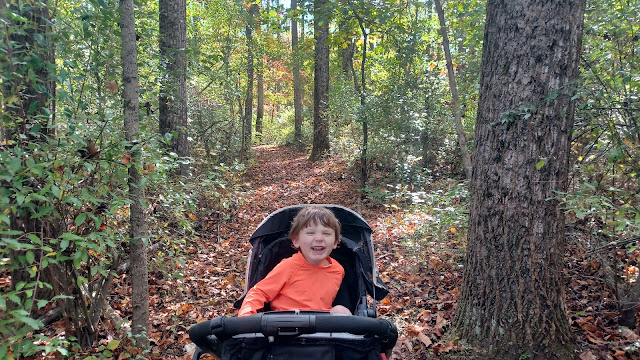
I try to be as careful as I can that Ev doesn't get hurt or even make a mess of himself too badly, because I don't want anything to get in the way of bringing him out on these things. For selfish reasons of course, because I love having him close, but because it is so incredibly apparent how much he gets out of it. Seeing how excited he is at different turns, pointing things out; it is beyond words.
 |
| Washington County Public Library image |
At this point, Ev has begun talking far better, and he's constantly asking questions. Not complicate, but just the "Daddy, what is?" as he points. I love that he is so curious, and I love that I can answer him.
He cried for a little bit, and we continued walking north on the road. Ev calmed down when we passed a private driveway that had a handsome covered bridge on it.
"Us go through it?" he asked as we walked by. I had to explain that it was private property, and that we couldn't go that way.
Ev is getting really good at recognizing private property and pointing it out along the way as we go.
The road we were following closely paralleled a stream known as the Green Spring Run.
We continued north out to Rt 56, Big Pool Road, which is a much busier road, and turned to the left.
I announced that this would be the worst part of the entire hike. There just wasn't a good way around without walking this stretch of busy road, for a distance of 1.2 mile.
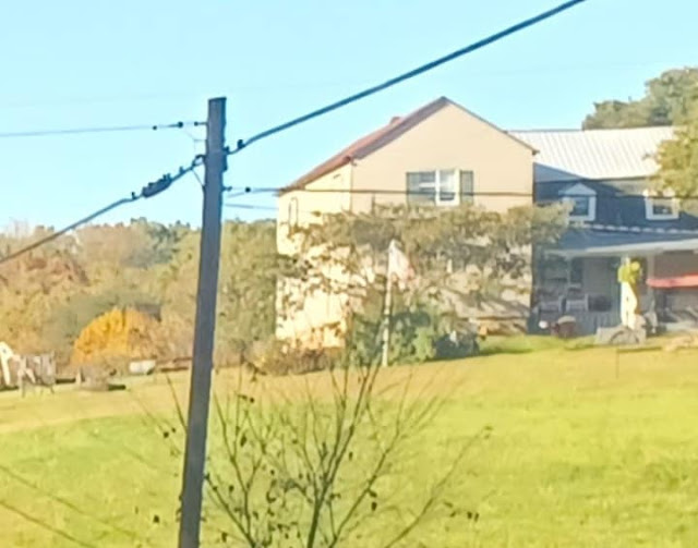
There was a nice farm on the right, north side of the road as we walked. Something about it led me to taking a few photos of it, and it turned out to be a good thing, because I inadvertentely got a then and now compilation out of doing so.
There was an historic marker about the homestead near the intersection with McCoy's Ferry Road, but it did not specify which house it was, or if it was even still standing today.
I photographed the sign to look up details later, and I confirmed that the farm I was photographing was the original, although somewhat altered.
It was the historic Green Spring Farm, also known as the Lancelot Jaques homestead, on the outskirts of the little settlement of Clear Spring.
Lancelot Jaques was a French Huguenot who partnered with Thomas Johnson in 1768 to build the Greenspring Furnace. Johnson dissolved the partnership in 1776, at the time Johnson became the first governor of Maryland.
The house on the hill we were looking at was built in 1766, with two log sections. The middle section was a store building, which was converted to the modern residence with the rear section. The front cabin section, which was very likely to be the oldest part of the home, is now gone.
President George Washington, Governor Johnson, and Johnson's brother dined and slept here on a trip to identify locations for the nation's capital.
A story I read about the visit had it that Govenor Johnson was having stomach trouble during dinner, and said that a buttermilk or something that had been brought out was too rich for him. As the beverage was being taken away, Washington stopped it and said it was not too rich for him.
It's interesting that these three prominent men, at the time when this was more a frontier, had to share beds when traveling like this.
We passed a modern home and then a garage type of structure, and could see where the earlier alignment of the highway had been just below a bit.
There was a curve and a hill ahead, which was a little unnerving. I didn't like pushing Ev ahead into traffic, and so I had to switch sides back and forth based on how well my line of sight was.
When I had plenty of vision ahead, I walked facing traffic, but before coming up over one of the couple hills, I moved to the right because cars would be approaching without much time to notice and move.
After a section of woods, the areas to the right opened up into very pretty farm lands. Thre was a farm pond and some really nice pastoral scenery to the right.
We went around another bend to the left, and then my turn came into view on the left, Shanktown Road.
The others were still behind me, but quite a long way away. I was really pushing fast to be done with the road walk as quickly as possible.
I hurried down Shanktown Road just a bit, to get away from the main road, and Ev and I paused under a small fruit tree for shade.
Once everyone caught up, we began walking Shanktown Road to the south.
I downloaded the map of Fort Frederick State Park to my phone, and I noted that the largest loop trail made its way very close to the eastern boundary of the park, right up to Shanktown Road. I checked some street views, and it looked like we might be able to cut through some trees to get to this trail from the road.
I also thought that maybe we would get lucky and there would be an access trail going in rather than having to bushwhack.
We continued down the road, and there was an old farmstead on the right side. Initially, it looked totally abandoned, but then I saw vehicles outside. None of the land around it was cultivated, but it was obvious that it had been in somewhat recent years.
I figure this property is now state park land, and probably a park employee. There were signs that looked like park ones rather than private property signs, but still saying to keep out.
We continued down the road a little bit more, and I was elated to see that there was a gated opening to an old road into the park on the right.
 |
| Maryland Historic Trust/Peter Morrill |
The gate seemed to sit upon a large utility pole on the right, but when I went to get the stroller under it, the whole thing fell over. I had to prop it back up like we hadn't gone in.
There were no signs saying to keep out of there, but this path was not on the maps. It wasn't even on Alltrails.
We followed this into the woods to the west, downhill and past a sort of cut trail that didn't look particularly welcoming. We passed that one, went downhill more, and then reached the first trail I was looking for. I'm not sure what the previous side path we saw was.
The trail was the Ridge Road trail as I understand. Much of it looked like it could have been an old road, but other bits were more like a foot path.
We could have gone either south or north on this system, to loop back, but I figured going to the north was the best strategy at this time. It looked like the way we would see the most of this park land.
We headed uphill on this trail, and then weaved around pleasantly through woods with very limited undergrowth. We then dipped down and crossed a little bridge. I think the farm we had seen from the road came into view to the right of us as we turned a bit to the west.
It was a splendid little park area with nice woods. It soon led us out to a good sized pavilion, and opened up into a larger picnic area.
This park was preserved by the state in 1922, an area of acreage surrounding the colonial fort, and then developed with facilities by the Civilian Conservation Corps in the 1930s.
We turned right on the park road where we emerged from the trail, and I was rather shocked to see stone drinking fountains almost identical to those that used to work in Hacklebarney State Park in NJ, which was also a CCC facility. Even some of the restroom buildings had that look.
I actually think the restrooms were built a bit later, but they just have that style about them.
Even more exciting was the fact that these old water fountains are still working. The ones at Hacklebarney had been out of service for probably decades by the time I got there. Some plumbing out in the park was working because we had to seasonally run hoses through the woods to them, but that was a whole lot of effort for not much.
We walked the access road through the picnic grounds all the way to a cul de sac at the end. The trail map seemed to show that another trail went into the woods at the end of that, but we didn't see anything there. We had to backtrack.
We went back downhill a bit, and made used of the restrooms. A little past them, another trail broke off to the right and entered the woods.
This was the Plantation Trail. Had we gone just barely into the woods at the cul de sac, we would have been on it.
It's surprising there no informal path connects from that spot onto the trail.
We followed it along a rather steep little escarpment that almost seems unnecessary with how close it is to the picnic grounds and road.
Soon, the trail turned away from the open area a bit and crossed a small stream on a foot bridge.
Along this trail were several historic markers, all focusing on women in conservation that were somehow associated with this state park.
The trail weaved around a lot, and was at times rather tough to get the stroller through, but with a little help on steps at switchbacks and such, we got through, and it got easier when we got near the north end.
The trail reached rather close to Rt 56 again, and then weaved from going north to west to south, but just after the turn to the south, there was a sign and a side trail denoting that an historic school house was out this way.
I decided we should take the side trip and check out what this was all about.
The trail emerged on an access road, at an angle across from a well restored old school house.
This was the Williams School House in Fort Frederick, which had been rather recently restored.
The historic one room school has quite an interesting history.
This was one of the earliest schools in the region to serve African American pupils.
In 1857, Nathan Williams, a free black man, purchased 115 acres of land that included the old colonial Fort Frederick. He operated a successful farm on the location, and bought the freedom of his family from slavery.
This school constructed in 1900 replaced an earlier 1895 structure, and it served the local black community near Big Pool Md until 1914. Some of the Williams family served as teachers.
After the school closed, the building became a private residence, a two-story addition was built, and layers of new stuff masked the history of the building for many years. It was referred to as the Hornbaker House for the family who occupied it from 1950 to 1973 when it was purchased and annexed to the state park. It was then rented as residential for a number of years.
After 2020, with generous grants from the African American Heritage Preservation Program, and donations from Friends of Maryland State Parks, and Hagerstown-Washington County Convention and Visitors Bureau, the modern layers were peeled back. It has been restored to how it would have looked between 1900 and 1914.
We headed back the way we'd come, back to the Plantation Trail, and continued to the south.
We went downhill a bit, and then crossed a former road route, which the map of the park denotes as "historic trace". The trail continued directly across on the other side.
It seemed odd that the trail meandered around and never really followed much of the historic trace, and actually crossed over another one.
As we reached the southern end of the Plantation loop, we turned to the left. There were more historic markers about women in the park, and we crossed another historic trace just before closing in the loop and emerging back at the same spot we had gone in, in the picnic area.
We turned slightly right, and went over to the playground nearby to give Ev a chance to play. Surprisingly, he was not really into it and just wanted to continue on.
We continued south along this park road through woods, and then emerged into the wide open area, with the historic fort on the right side. We left the road, and I pushed Ev in the stroller up the steep, grassy hillside toward the edge walls.
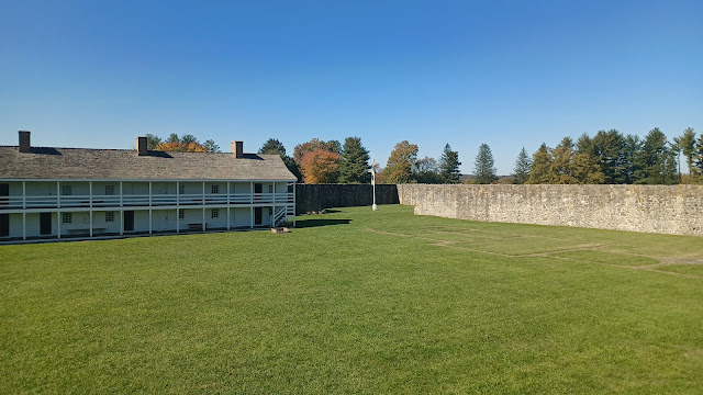
We headed south, along the east wall, and then west along the south wall to reach the entrance. I didn't know whether to expect the fort itself to be open, but it was, and it was far more impressive than I ever would have guessed it would be.
There was a girl doing interpretation at the entrance, and she really knew her stuff. She was ready to answer all of the questions we had about the history of the site, and interjected some of her opinions on the interpretations when pressed for more. It was really great.
She was dressed in period clothing, but with colorful shoes. Jenny pointed it out, and it was revealed that the color she was wearing was in fact available during the time of fort activity, and she even told us the company she goes to to find authentic historic outfits.
Normally, when I do a hike to a substantial location like this, I read into it much further ahead of time, but this time I really didn't get that into it, and figured I'd find out when I got there, and read into it more later.
As such, I was shocked that the site was used through three different major wars, and that it was far older than I'd anticipated. I thought it was just going to be a Civil War fort.
The stone fort building was completed in 1756. It was authorized by colonial Maryland governor Horatio Sharpe, as a frontier fort to protect from attacks during the French and Indian War. It was named for Frederick Calvert, 6th Baron of Baltimore.
The square fort has about 100 ft protruding bastions at its corners and walls are 4.5 ft thick.
The bastions don't have anything up against them now, but they were loaded to the top with earth so that cannons could be placed on top for firing out. That earth was removed in more recent years because it was found to be undermining the walls under the weight.
3 barracks buildings for enlisted, officers, and governor existed.
The fort was used again during the American Revolution as a Prisoner of War camp. From 1777 to 1783, as many as 1000 British and German soldiers were incarcerated from the Battles of Saratoga and Yorktown.
The fort property was sold at auction in 1791, and was dormant until the Civil War, at which time it was the Williams farm.
The old barracks were collapsed at the time, and the enlisted stayed likely in tents. The fort was garrisoned to protect the Chesapeake and Ohio Canal and Baltimore and Ohio Railroad which are both very close by. The site fended off Confederate raiders Christmas day 1861.
All military activities ended at the site in 1862.
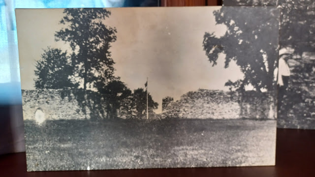
The fort was abandoned until it was acquired by the State of Maryland in 1922. Walls had deteriorated to about 8 feet or so.
The Civilian Conservation were active developing facilities through the 1930s, and the fortification was fully restored. About 70% of the fort walls are original.
The east and west barracks were reconstructed on the original footings, but the governor's house, which stood in the middle, has not been reconstructed. Different rooms in the barracks have been furnished to represent different aspects of life at the fort.
Once inside, the young girl we met directed us off to the left to talk to a guy doing a demonstration on bread making in colonial forts.
He explained to us that the soldiers had to prepare the food for themselves, and that it would have been done with a large community oven, like the one he was using, only on larger scale.
He was admittedly no chef, but wanted to have the full experience, and so learned how to bake break using this method for better understanding and interpretation.
It was absolutely wonderful to see and meet interpreters who were so deeply invested in the resources they've been entrusted with.
From here, we went on to explore the buildings. I wasn't expecting the amount of stuff to see to be nearly what we came upon.
There were barracks buildings reproduced on both sides, and each had important rooms represented.
The first room we entered on the bottom floor of the west building was the guard room. Guards at the fort would work in two hour shifts, and 18 to 20 men would rotate this duty.
The next room over was the enlisted men's quarters. This was a long room with bunks and exposed hand hewn logs.
One of the things the first interpreter told us was that this was inaccurate. They shouldn't have needed to have hand hewn ones because sawmill processes were available.
Each of the barracks buildings would hold about 100 men, and companies of eight would share four bunks.
There were other barracks rooms, then a representation of prisoners quarters, and then women's quarters. Many find it surprising that women were living at the barracks and were given important uniform jobs and such. They weren't just cooking, as mentioned previously, because the men cooked for themselves.
Ev went with me into each of these rooms, and then went up a level across the porch of the barracks and into the rooms along the top.
When we finished with the first building, we crossed to the other side to explore the displays there. We could see in the mowed grass the foot stones of the former governors mansion that stood within the fort.
The first room we came to in the east barracks building was a representation of a store room and Cherokee gifts. Gifts would be presented as a sort of bribe for the native people to ally themselves with the colony of Maryland.
The next room over was the King's Storehouse. Historically, this room would not have been in the east barracks, but rather in the governor's mansion. Valuables like this and possibly the room with the Cherokee gifts might have been kept in the Governors Mansion for safekeeping.
Next up was a representation of the armory and workshop, which I'm also not sure was in the barracks, since so much of the important stuff was in the Governor's home.
The next room we went in was noted as a representation of what would have been inside the governor's home for certain. This was the "main hall".
This room was reserved for larger events, which could host up to about sixty people. Major trade with native people would have taken place in this room.
The next room over was a representation of the Junior Officer's quarters, with bedding and uniform hanging.
There was another non specific furnished room, and then one that was the Captain's Quarters. This one was also historically located in the Governor's mansion, but represented in the east barracks.
Another room was full of historic panels on the bottom floor. Some talked of colonial conflicts, and others about the CCC years at the park.
There were mannequins wearing uniforms that would have been seen at the fort.
A the end, Ev and I ran up the steps to the top level of the east barracks to check out the rooms up there.
Ev was very happy to be running around on the porch and up and down steps, but his knees were bothering him from the fall he took a little earlier.
He was wearing shors, but they were the kind that went to just barely below his knees. As a result, he would be running around holding onto his pant legs so that they wouldn't be chaffing up against the scratches he'd gotten in the morning. It didn't stop him though!
One of the next rooms we checked out on the upper level was the hospital area, which had several beds and tools in place on tables.
After looking all around, we made our way back down to the lower level and out toward the front of the fort again.
I was a bit worried that we spent the better part of two hours at this spot, but there was just so much to see. I was so impressed, and very happy we stopped.
Still, we weren't even nearly done. We exited the front of the fort and thanked the interpreters, and then moved downhill slightly to a building that stands a little down from the fort.
This was built apparently as a park office or something after the park was established. The girl we'd met in the front recommended we check it out, because it had been made into a sort of CCC museum.
Uniforms, photos, and maps were all well displayed in this handsome building that had a sort of cabin-like appearance. I was surprised that no interpreters were inside this one.
After looking over the stuff in there, I headed slightly downhill to get some then and now compilations using some of the historic photos.
From this point, there were some buildings to the west of the fort, so we headed over to them.
The most prominent one had a similar log cabin type of look about it, known as Captain Wort's Store.
This building was actually the park superintendent's office built in the 1930s. It now serves as the park concession, named in honor of a civilian peddler who operated a provision store at the fort in the 1750s.
I parked the stroller alongside the building, and we walked around the front to see what was offered inside. Ev had seen someone with ice cream before, and was talking about it.
Ice cream did sound good, and so we went in. They had prepackaged little ice cream cones, and I forget the branch that was offered, but it was actually really delicious.
Everyone basically had to get at least one of them, and we sat on the porch in front to finish them off.
While we were stopped, I got a text message from Pete Fleszar. I wasn't expecting to see him down this far, but he had managed to come and was trying to intercept us!
It was good timing for him to come, since we were stopped and eating.
He had already made his way further up into the park and onto the trails we had already been on, so he had to make his way back to the Wort's Store. He noted that he had left his bicycle at the bike rack there, and that he had important items in it.
I should have noticed Pete's bike. It was right there, and it looks very odd with its little wheels and bag on front. I just had walked by it a couple of times and didn't recognize it.
While we were sitting, Pete made his way around the west side of the fort, waving as he walked our way. He had to get some stuff together before he could move on with us, but that was fine. He had the bike to go faster on.
We started making our way onward, a bit to the northwest of the Wort's Store. This brought us soon to the old blacksmith building.
This was built by the Civilian Conservation Corps in the 1930s to fabricate items needed for the development of Park facilities, both for this park and Washington Monument State Park.
We went in to look around the blacksmith shop, and then moved to another building behind it, close by. It was labeled the CCC Camp Building.
A walkway continued near the road out toward the regular visitor center, but we opted not to both with that one. It was the only major building we didn't on this hike, and I don't feel terribly bad considering everything we'd seen.
We walked along the lane to the north a bit, and came to a large parking area. Pete caught up with us pretty quickly on his bike and stayed with us through the lot.
We continued along the main access road from the parking lot, which weaved to the north and then back to the east before turning north again to Big Pool Road.
Pete went out the road to get to Big Pool Road, but the rest of us cut off to the left of the road at a very large Sycamore tree, and then skirted a tree line heading north toward Big Pool Road directly.
I should have cut through the tree line to the next field, and then we would have reached Big Pool Road a little further to the west, but I didn't know if it would be cleared or plowed at all. It ended up being fine, and we could have gone through, but we had to do the road walk.
There was a very nice view ahead as we headed downhill on Big Pool Road. Pete sped far ahead to avoid traffic on this stretch. There were some pretty farms and barns along the way.
The road was a little sketchy to walk again, because it was so narrow, but we only had to go 0.7 mile on it to reach the eastern terminus of the Western Maryland Rail Trail.
We started entering the little settlement of Big Pool, with houses on the right, a couple on the left, and then an access over to the former Western Maryland tracks on the left of us. We were able to get off of the road here, thankfully.
On the right side of the road was an old white church, which had been converted to a private home. I couldn't find much information on it other than that it had been built in 1910.
Of course, this little settlement grew with the Western Maryland Railway development.
As stated earlier, the line connected across the Potomac River from Big Pool earlier, but an extension of its own tracks competing with the Baltimore and Ohio line began work in 1903. It was completed to Cumberland in 1906. That had been the line we followed as Western Maryland Rail Trail on the past few C&O Canal series hikes.
I pushed Ev through the grass, and then into the parking lot for the rail trail. There were interpretive signs and kiosks here, and an ascent to the level of the Cumberland extension of the line.
The Western Maryland also extended further from Cumberland to Connellsville, which was the Great Allegheny Passage we had previously followed. Work on that started in 1910, and was completed in 1912.
The Western Maryland line where we were getting on it here still had the active tracks across the Potomac immediately parallel with us, but the right of way that is now the trail has been abandoned in this area since 1988.
Just ahead of where the parking lot is today, there used to be both passenger and freight station buildings, although they were very small.
I got to Pete at the head of the trail first and looked over some of the signage while we waited for the others to show up. I'd gone pretty fast to avoid the traffic.
I had several historic photos I wanted to try to get of the area, but having never been there, I had to try to figure out how it all worked. At first, it seemed a little complicated.
The original 1892 grade that continued off to the south, to Cherry Run, West Virginia, is much different today than it was when it was built.
The "Western Subdivision" as it was called in this area of the Western Maryland, continued to Cumberland on a grade that is today at a higher elevation than the earlier grade to our left.
Originally, this grade ascended on a wooden trestle that curved off to the south, then crossed the C&O Canal, followed by the Potomac.
This lasted until I believe the 1920s, when the original grade was excavated down for some reason, and a different approach over to the crossing of the canal was taken on fill rather than atop a long trestle.
I didn't realize just how active this line was when we got there. I did consider trying to walk those tracks before taking on this hike, and I'm glad we didn't!
Just as we were all getting up on the trail, we heard a whistle. At first, I figured it was on the former Baltimore and Ohio line across the river, but it was coming on the tracks immediately below us.
A very long diesel engine pulling freight cars soon passed us, and blew its horn at us.
I couldn't figure out exactly the spot the station buildings used to stand to get good then and ows of it, but I did manage to get a couple of them of the former rail grade with the trestle before it was changed.
The train went beside us for a little while, and pulled away just as we were departing from the earlier line on the Western Maryland abandonment.
It was really relaxing to be on the rail trail. At this point, it felt like I was barely pushing the stroller at all. It was just totally easy to walk and sip a drink with absolutely no bumps.
We continued on, and soon reached the Ernstville Road underpass.
There is a narrow culvert that is far too narrow to have carried trains, built for the trail, which carried us beneath this road.
When the railroad was first built at ths point, in 1904, it was a grade crossing. Liabilities led to the construction of a bridge to carry the road in 1930.
There was an historic marker showing a photo of the original bridge there, and so I used that to do another then and now compilations before we moved on.
The trail ahead was much like other rail trails I've enjoyed, with a mix of woods and farms. We passed a handsome brick farm house on the right, and crossed a driveway.
A little ways further, we reached the second crossing of Ernstville Road. This one was apparently always a grade crossing, because I had an historic photo to emulate at the site.
It was, however, much changed after the abandonment of the line. We could see the original road alignment looking to the right, where it came up closer to a private home, but now was rerouted to a gentler grade over the track bed.
We passed through more pleasant farm land ahead, and Ev fell asleep for a while.
Pretty soon, the trail took us into pleasant woods. There were tons of bikes and people walking throughout this stretch. It seems that most cyclists prefer to take the Western Maryland Rail Trail over the C&O Canal because it is flatter and less bumpy.
I don't really get it, because the only point would be to go faster, and these people are missing so much more by taking the railroad bed.
There was one guy we passed a while earlier coming out of Fort Frederick that had a big set up on his bike, as he was sort of "bike packing", and was upset that there was no signage to say that the rail trail just ends and he'd have to get on the narrow road. I think Pete directed him town to the canal through Fort Frederick.
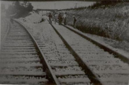
We continued through woods, and Interstate 70 began coming closer to the right of way.
The last bit of the rail trail we followed on the previous trip was loud alongside the highway.
 |
| 1970 Cody Haer collection |
After a little while, we came to the bridge over the Licking Creek. This was the sign that we were nearly to where we left off.
We could see the adjacent interstate highway bridge to the north, and to the south, the old Licking Creek Aqueduct on the C&O Canal that we would be crossing rather soon.
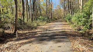
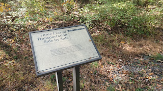
In this area, there was a sign about the transportation history of the area.
The sign alluded to three eras of transportation, but seems to neglect the early 1800s development of the National Pike, which even predates the Chesapeake and Ohio Canal. The canal came through in 1838, and used some of the route of the National Pike. Some of the National Pike had to be completely moved because of the canal development.
Just beyond the bridge, we reached the crossing of "Mile Marker Road" as it is apparently called, but no signs show this. I understand that this road is the old National Pike route.
We drove some of that route on the way in, and we passed by the historic Potomac House in Clear Spring, which was one of the old stage coach stops.
I'd get a comparison shot for that one on the drive home.
The hotel house or stage coach stop as we often call them, was built in 1830 along the historic National Road to serve travelers with food, drink, and overnight accommodations. Many hotels thrived on this route in the early to late 1800s.
The National Pike was the first federally funded US highway, also known as the Cumberland Turnpike and several other variations.
It follows natural opening in the mountains through this area and out to Cumberland. George Washington had interests in this area as a young surveyor, and in later years had an Ohio Company for the western expansion of the transportation system. He pushed for the expansion of the canals westward during his presidency.It was not until 1806 that Congress under Thomas Jefferson funded the construction of the National Pike, which began in 1811 to connect the Potamac and Ohio Rivers. Construction began in Cumberland MD.
Expansion was stalled during the Financial Panic of 1837, and work ceased at Vandalia, Illinois, which was then the edge of the Illinois Territory.
Eventually, improvements and rebuildings completed the route between Baltimore and the Missouri border. During the rebuilding of the 1830s, the National Pike became the second Macadam highway in the US.
Macadam is named for Scotsman John Loudin McAdam, who is responsible for developing the paving process. McAdam developed roads overseas, and the first US Macadam road was the Boonsboro Turnpike, between Hagerstown and Boonsboro MD. When that project was finished, sights were set on the National Pike.
 |
| Jim Coshun Collection |
McAdam's technique involved compacting small stones and material, in an argument that large stones were not needed, and a surface "crust" would provide solid enough base for the roads if kept dry.
Centers for roads were three inches higher so water would drain off. His Maryland roads were also the first to be rolled with a steel roller rather than compaction through usage.
The process of Macadam changed a lot over the years, especially with the advent of the automobile. The methods used for carriages no longer worked for how much the cars would kick up. The old style was designed with rocks in mind that would not effect carriage wheels. McAdam told his workers that they could measure the rocks needed by whether or not they could fit inside their mouth!
The use of tar to hold macadam together became more commonplace, and the industry improved.
The National Pike, over the years, became US Route 40. As time went by, larger and better roads overtook or replaced the old National Pike, and through this area came Interstate 68. Some sections of the old road are still now Rt 40, or "alt 40" variations, as well as Rt 144 and byway designations.
Parkhead was a station stop location on the line affectionately nicknamed the "Wild Mary", near Licking Creek in Washington County Maryland. I actually wish I'd been using that term for the line all along, but I didn't know about it until this hike.
This was once the area of a long passing track. The area is much changed with the development of Interstate 70 immediately adjacent to the right of way. There was a long double track, and one bit had three tracks. I understand there was at one time an overpass in this area as well.
Parkhead is a name not often referred to today, but it is an important trail connection spot. It is one of the points where there is connection between the rail trail and the C&O Canal, and it is also where the Tuscarora Trail crosses.
The Tuscarora Trail was originally intended as a replacement route for the Appalachian Trail before that corridor was protected by the National Trails System Act in 1968. It is a wilder route than the AT, and connects with that route in Great Smokey Mountains to the south and Carlisle Pa to the north.
We had done a series to hike the Tuscarora Trail down from the Carlisle area, and reached Parkhead a couple of years ago. We then did the bit along the canal a month prior, and all I have left to do is the south half. Maybe one day.
We still weren't to where we had left off on the previous hike however. We had to make it to the next parking area first.
We continued beyond the crossing to the formerly three tracked area, and pretty soon came to the historic cemetery located on the left side between Mile Marker Road and the rail bed.
We had visited this for the first time when doing the Tuscarora Trail, and this time we actually took the time to get into it and look more closely.
We continued from the cemetery to the west a bit more, and pretty soon we came to the parking area for the Western Maryland Rail Trail, and the access down to the canal towpath.
Pete broke out the gift he'd brought us, a few beers. Not strong ones, but not bad either. They were named "Graffiti Highway" for the popular abandoned Rt 61 in Centralia PA.
We did our group shot in this area, because Pete had to get all the way back to his vehicle in Williamsport to the east, about ten miles farther than we were going for the day.
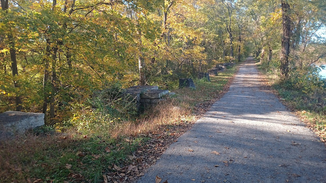
We started heading east along the towpath, and it felt really great to be on it, knowing it was just this to the end point.
Getting back on this route is like coming back to a story from a cliffhanger chapter ending. I can't wait to see what's next. I've already got the spoilers in my guide book on it, but there's always so much more to it.
After not long, we approached the Licking Creek Aqueduct that we had seen just a little bit earlier from thhe former railroad bridge.
The 90 ft single arch span was the largest single arch masonry span in America when this section of the canal was built in 1835-39.
It was built of Tonoloway and Conococheague Limestone by Enos Childs.
By 1870, the "inferior stone" was cracking, and iron clamps and ties were were used to secure the entire aqueduct.
In 1874, a wooden trunk replaced the upstream side, which apparently deteriorated away completely. It is now open today on that upstream side completely.
Maintenance and patrol vehicles travel through the canal bed today due to narrow width of towpath on the structure, the same as with all of the other major aqueduct structures we had crossed while hiking the canal.
Licking Creek Forge, built in 1775, once stood at the Potomac confluence, which would have been in view from the structure.
We checked out the details of the structure, with a view to the metal supports holding it together from the west side, and then again from the east. On the east side, I climbed down the side briefly to see if I could get a better view of the structure.
I thought to climb all the way down, potentially for another compilation thing, but it was a bit too tough to get down the steep slope. I didn't want to risk falling, so I backed off of it.
At the top, I noted that thee were some initials, maybe B and M, and some other badly faded numbers, followed by a date that looks like it reads 1828, although it might be 1879. 1828 would conflict with numbers I've read, but maybe it was started earlier. I honestly don't know.
We continued beyond the aqueduct, and the Licking Creek Campsite was just past it. In the past, we went to the campsites and used them as opportunities to get down to the river, but this one was quite a bit more inland, so we just kept going. This one had a water pump right up on the trail like the others too.
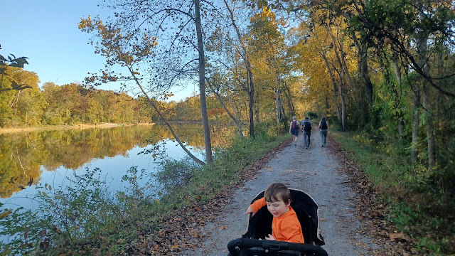
The part ahead was wonderfully pleasant. I walked ahead of the rest of the group pretty far, took in the scenery, and just talked to Ev about what we were seeing.
This entire section ahead was not right on the Potomac River. We were quite a distance inland, first in forest, and then surrounded by some fields.
We eventually came to a part where we closely paralleled Ernstville Road. When the road came close to the left, there was an access trail down through the canal to the bend in the road.
At this point, there was a post on the edge of the canal which had a marker for the American Discovery Trail. This was the first time we had ever come across a marker for that particular major trail.
American Discovery Trail is mostly a rail trail and on road route that goes across the country east to west. I find it surprsing that it doesn't go farther to New York, but I suppose it is appropriate that it come from Washington DC.
Maybe one of these days I'll more actively try to trace that trail as a series.
Ev and I waited for the others to catch up at this access point, then continued ahead again.
After just a little while, we reached the bridge that carries the former Western Maryland Railway over the canal and then out over the Potomac River beyond. This was the line that broke away from the trail just a bit earlier, that was built in 1892, the earlier western terminus of the line.
Like the segments of this we had seen just to the north earlier, the approaches on either side of the truss bridge over the canal had previously been large wooden trestle sections, which were later back filled.
I had some more historic photos of this, but at first I figured there was no way I was going to get those comparisons.
We took a little break under the bridge and I got a few photos, but then figured I would have a closer look at the structure by following a pathway that went up to the right.
As I went up a bit, I realized I could probably get some of these shots after all.
When I got up next to the edge of the bridge, I looked off to the north toward the crossing of the Potomac, and it became pretty obvious that one of the historic shots I'd saved to my phone was taken here.
At that point, I climbed up to the top and turned to the south. There was a walkway along the edge of the rails across the truss section of the bridge to the west, so I crossed over.
Looking back toward the canal below, I was afforded a good view of Big Pool straight ahead.
This is an extra wide section of the canal, where it looks like an enormous basin.
The extra wide section was a natural side stream of the Potomac River beside a large island. The ends were filled and the channel became the "Big Pool". To the west, Little Pool used sort of the same tactic.
Rather than dig down, the towpath follows a sort of contour of the land that had been a part of the island historically.
The engineers used a series of natural ridges in the former island area to form the towpath rather than build any more fill. The "Big Pool" section is 1.5 miles long.
I got across the bridge onto the fill on the other side, and descended slightly down the ballast slope to get yet another shot looking toward the truss section, to compare with a pre-1920 shot showing the original wooden trestle approaches.
I got up to the other side of the tracks and got another similar comparison facing toward the truss section.
I started walking back after getting these couple of shots, and then a whistle sounded.
I thought for sure that like before, a train would be coming from the near side to cross the Potomac.
I ran as quickly as I could for a few moments, and then more carefully across the bridge, and down the slope again. We waited at the bottom for the train to approach.
After about five minutes, there was still no train. It turns out that this one was actually on the south side of the Potomac, on the former Baltimore and Ohio Railroad. It was disappointing, because I'd have loved to see a train going over this bridge.
From here, we started making our way to the wide waters of Big Pool. It opens up really wide right after the railroad bridge.
There are some wetlands off to the right in this area, which must have been the original channel of the river before it was closed off for canal use.
Pretty soon, there were openings through the trees to the left, sometimes with paths down toward the water. It was an absolutely beautiful section to pass through.
The group got pretty far ahead of me at some of these points because I would go down side paths to get photos of the Big Pool.
I got one more then and now compilation that I think is at a pretty accurate location based on the views of the pool in the area.
We re-grouped a little further down along the pool, when we reached a sort of stone structure to the right. Fortunately, I had my guidebook on the C&O Canal to tell me what this was.
It was long 121 ft spillway that helped to regulate water levels in the Big Pool. A waste gate was at the east end, but is filled in today.
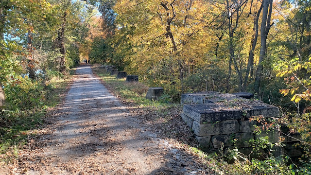
Mules would walk through the water, but walkers would use a pedestrian bridge, the footings of which are still in place on rather small square stone pillars that line the right side of the towpath as we headed east.
This spillway structure may have been rebuilt following flooding in 1890-91 that destroyed many canal structures.
 |
| 1904-24 |
While we walked this segment, we heard yet another train whistle. The former Western Maryland tracks travel along the north side of the Big Pool, and we could hear the train as it was going by, but could barley see it through the trees.
As we reached the east side of the Big Pool, there was a little launch area where boats go in. This is a part of Fort Frederick State Park that we didn't walk to.
We soon reached the end of the Big Pool. There is another wetland on the right side of the towpath, which is up on a rather high ridge. This would have been part of the channel that brought the original side stream back to the main flow of the Potomac.
Today, there is a campground in the state park on the other side of it. We soon reached the road that crosses the east end of Big Pool and heads to these other park facilities.
The road crosed a stone abutment structure that I didn't recognize as being particularly important at first. I soon realized that this was a stop gate, which made it possible to keep the Big Pool watered when other canal sections were drained for maintenance.
It was interesting, because it didn't seem that the canal could have been maintained too much deeper from this, but the trail we were following was often quite a bit higher than the level of water in the Big Pool.
Historically, the site would have looked quite a bit different. There was a pedestrian bridge that was fixed in place and went quite high above the canal channel to allow for the passage of boats.
Other vehicles would have used a swinging bridge, which could be swung out of the way when boats passed, but remained otherwise at the height of the stop gate.
Fortunately, I realized this was one of the sites I had an historic photo of, and managed to get a final then and now compilation for the day before we moved on.
We had reached the home stretch, and it was still much earlier than I'd anticipated we would be getting done.
I was concerned about doing something so far away, because Ev's mom has been giving me a hard time about getting him home late. Doing this far away trip was certainly something that I felt would end up being a late night, but we'd actually end up being okay. I don't even think she's aware that we went to Maryland on this trip, not that it really matters because it was the closest part of it.
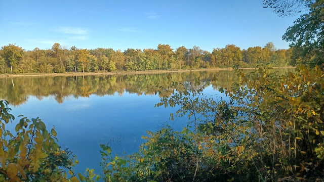
It was very pleasant and wooded for all that remained, and never really went over beside the Potomac River. Really none of this entire trip had been within sight of it except the start and end point. That ended up being all for the better because we didn't miss out on all of the swimming stuff.
There were a couple of historic culverts beneath the canal in this stretch, but we didn't really see them. These spots are defined where all vegetation has been kept cut from the canal, to keep the root systems from undermining the arch structures.
Before we reached McCoy's Ferry again, the former Western Maryland Railway tracks started coming into a view on the shelf to our left.
Soon, the large trestle at McCoy's Ferry came into view right from the towpath, which was quite a sight.
Pretty soon after that, we came upon a sign for the history at McCoy's Ferry. We then crossed over the road on the stone arched aqueduct culvert.
Soon after the culvert crossing, a narrow foot path descended to the right from the towpath, back down to the McCoy's Ferry picnic site.
We walked over past the cars, but then I continued on down to the edge of the Potomac River. I didn't want to go all that far and not see it at all, let alone get in.
It wasn't very cold out, and I'd been sweating a good amount still, from the burden of pushing the stroller the entire day. I decided I would take a dip in the river, which would end up being my last full immersion swim of the year.
The water looked as crystal clear as everywhere else we had swam in this beautiful river. I parked Ev in the stroller on the boat launch with the brakes on while I took this dip.
I had already felt like we had the final hike of the Summer, but this was like a coda to that.
We got back to the cars, and headed on home, with a stop for food on the way back at Sheetz I think it was.
History keeps repeating itself for me when it comes to the hikes that I'm least enthused about in a series. I knew this would be good, but I wasn't expecting it to be as excellent as what it was.
From where we left off, I am prepared to to a two day trip with Williamsport being the overnight spot when it gets warmer again. This next section of the canal is much closer to the Potomac River, and I don't want to miss out on swim spots by doing it as a cold weather hike. From there, there are plenty more trips that look like they'll be great heading toward Washington DC.
I really want to see to it that I finish the remaining four days in the 911 Trail series I never got around to completing between Johnstown and Garrett over the Winter.
I've been saying I want to do this for what seems an eternity, but at this point, I really need to knock those out.
I want to do these as two trips, two days each. The first one between Johnstown and Flight 93 Memorial will be toughest, because one of the days is 25 miles of mostly back roads. The other three days are typical about 15 miles and much easier because they mostly involve trails and railroad beds.
Hopefully I'll be getting around to it pretty soon.






















No comments:
Post a Comment