Hike #1551; 5/21/23 Speedwell Forge to Middle Creek with Kirk Rohn, Diane Reider, James DeLotto, and Everen
This next hike would be a point to point, the next in the series we've been working on to hike the Pennsylvania Highlands.
I think this would be the thirteenth one in this series, which I've intended to be something to cover all of the connecting trails around the route designated as the Pennsylvania Highlands Trail network. Further, that trail is one that fills in the gaps in the middle of the 911 National Memorial Trail, and I'm working on filling in all of the stuff in that giant roughly 1,400 mile triangle.
I'll be talking about that more as we get back to more of it, but for this one, I put together a trip that would bring us from where we last left off on the trail route eastbound to Middle Creek.
The meeting spot I chose would be the Millstone Trailhead in Middle Creek Wildlife Management Area. My plan was to do some extensive exploring in Middle Creek, and that stuff would be mostly pretty easy, while the harder stuff on the Horse-Shoe Trail would be the first portion of the hike.
This one, like some of the previous ones, would end up being quite a bit tougher than anticipated.
On our last trip through the area, we had left off on the Horse-Shoe Trail at Speedwell Forge and went a bit south.
The Pennsylvania Highlands Trail has been routed on the Horse-Shoe Trail from a point in Colebrook out to near French Creek State Park.
I'd already done those parts of the HST, but there are reroutes on it, so it warrants doing it again, plus its part of doing the entire PA Highlands series, for the sake of everyone else, its' a great trail to do.
We shuttled from the Millstone Trailhead to the west, to Speedwell Forge site where there is parking close to where the Horse-Shoe Trail emerges from atop the Furnace Hills in State Game Lands 156.
The location we parked was the site of Peter Grubb's Upper Hopewell Iron Forge, built in 1742. There is a plaque and memorial to the place, constructed out of ruins from the old operation.
This location is also the northern terminus of the Conestoga Trail, which I was ready to start doing as a series again as well. I'd already hiked that too, but it also has some reroutes worth doing.
I parked my car sideways along the trees, and as I was getting stuff ready to go, there was a bird going crazy on my car.
This bird seemed to be attacking its reflection on the blue surface of the Honda Element, as well as in the rear view mirrors.
The bird was an American Redstart, which is a species I'm really not used to seeing much of.
We started our walk heading to the north on Pumping Station Road, a pleasant side road parallel with the main Rt 322.
At the intersection to the north, we turned right along 322, crossed the Hammer Creek, and then headed only a short distance to where the trail turned into the woods to the left.
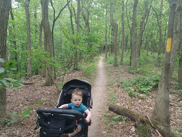
There was a nice, big sign, and the remnants of an old walled in spring to the right. The trail followed a very old roadway along the Hammer Creek for a bit, and it was pretty easy to get the stroller through. I tried to keep Ev in the stroller for as long as I could, because I knew it would get a bit rocky up ahead and we wouldn't be able to keep him in it.
The trail started to turn right away from the creek, and things got tougher. I could push the stroller along if Ev wasn't in it, so I let him out to begin walking himself.
There were some good switchbacks at times as we ascended the the slope of the Furnace Hills in State Game Lands 156. Ev was doing really well at first, but then pooped and needed a diaper change really quick. I managed to handle this in one slightly wider spot on the way up, and we were on our way again. I worked on getting the stroller through, and the others helped Ev when he requested, and held his hand over some of the rocks.
Ev did really amazingly on this. I was quite impressed that he didn't really complain and was happy to keep going up this somewhat strenuous climb. He didn't need to be picked up. He just walked it.
When we approached the top of the hill, we left State Game Lands and entered Boy Scout Camp Mack property. There were signs forbidding anyone from mountain biking through, but we did end up seeing someone pass through the other side when we were moving along.
As we continued slightly up from here, I got a call from Jim DeLotto, who was on his way out to join us for the day. He had made his way south to our lunch stop, which would be the Pretzel Hut a bit further down. I told him where we were headed and he made plans to meet up with us.
We continued climbing just a bit more, and soon reached Eagle Rock.
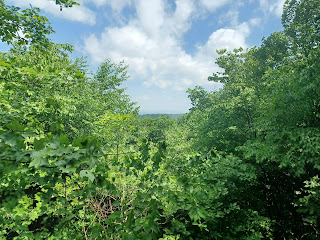
This was once a prominent overlook on the Horse-Shoe Trail. Even when I had hiked it before about ten years ago, there was still a bit of an overlook there. Now, I had to climb up onto the rock itself and look out, and then there was barely any view in the distance. Many of these old overlooks in the Furnace Hills have since grown in because the trees from the last cuttings have all matured.
Just beyond Eagle Rock, some of the trail got pretty nice and I was able to have Ev back in the stroller again. He went rather happily this time after all of that exercise going up the hill.
We continued along, but it eventually got rocky again, and I let him back out to walk on his own while I either pushed or carried the stroller among the rocks.
Pretty soon, in this section, Delotto walked up on us from the opposite direction. He had managed to get his car all the way up to the trail by way of a logging access off of Explorer Lodge Road. He had talked to people who owned a house at the bottom, and they let him drive on up.
We continued walking along, through very pleasant woods, and I could put Ev back into the stroller again. The treadway was really quite nice.
Soon, we reached the edge of a somewhat cleared area where there was a lot of recent logging going on. This afforded us a bit of a view through the trees to the north.
The trail followed a woods road through some of this area, and Delotto was parked just ahead on the edge of the clearing. He noted that we were getting pretty close to the Pretzel Hut, and that we might want to call in and order whatever food we wanted ahead of time.
We paused in this clearing, where there were some limited views to the hills to the north, and called up the Pretzel Hut to order some food. I ordered a cheeseburger and some seasoned curly fries. Ev loves fries so I knew he'd at least eat those.
From the overlook, I was looking for where the trail should go. There was a pretty good path that diverted off of one of the woods road sections, but I got a very short distance without seeing any yellow blazes, so I turned back.
We had to look around for a little bit to try to figure it out. Diane had a track of the trail, where it was supposed to be anyway, on her GPS, which helped us to find where we were going.
Right when we emerged at the clearing, we were supposed to turn hard right onto a woods road heading downhill on the south side of the Furnace Hills peaks. The blazes were not so obvious due to the recent logging.
The route down at first was just an easy woods road. We continued downhill, and then the trail turned off to the left, onto more of a foot path.
I had done a group hike on this section back in 2012 I think it was, and at the time I think the trail was different, on a washed out old woods road.
This area now had a completely different, nice switchback heading down the hill. It was more distance, but I was able push Ev's stroller through the entire thing without too much problem.
There were a few rocks and roots, but watching the pivoting front wheel and its placement allows me to keep it on the trail.
At some points, I could see the older trail route, washed out with lots of rocks, junked up with sticks so people wouldn't try to find their way to it again.
We regained that route again just before the bottom of the hill, as we emerged into the back of the Pretzel Hut, where there is a little petting zoo on the property.
There were little goats running around everywhere, quite cute, and Ev was taken by them of course.
We made our way through the property, then up to the right, and to the left to make our way out of a gate to the restaurant establishment. There was a gate we were to open and close before going in.
I went around the front of the building with Ev in the stroller, and almost got a table up there, but then a family hurriedly grabbed it up before I had a chance to sit down.
There were no free tables at all out in front of this place. It was apparently very popular. The last time we were here, the food was great, but there was at least a place to sit.
Fortunately, Delotto had already scoped the place out, and he found a nice table, in a much nicer spot than all of the ones in the front. It was back behind the building in the area of a little evergreen grove.
The spot was perfect. I put all of my stuff down with the stroller there, then walked with Ev down some convenient wooden steps to the front of the building.
Even though I ordered ahead of time, there was a long wait on a line in order to even get into the door.
I held Ev until we got inside, then I let him stand. There were some other little kids that came in behind us that he seemed interested in, but it didn't go beyond making some indiscernible noises.
I grabbed a few drinks to wait on line with, because it seemed there wasn't really much organization about how to get into this place. There were two lines, but I think one of them was strictly for ice cream.
Eventually, we got our food and headed up to the benches. I had a very excellent burger, and the fries were delicious too. I think I got Ev to eat some of the burger, but he was definitely more interested in the fries, as well as in running around.
He'd gotten to that age where unless he's secured into a chair with nothing better to do, he'd rather be running around like a lunatic than sitting down to eat.
By the time he actually gets extremely hungry, the same food isn't available, so I have to make sure to have some sort of healthier snack for him when we're on our way. Fortunately, he did eat a bunch of stuff during his running around. He was also a bit tired earlier this time, probably from the amount of time he spent walking up the hills himself.
After our excellent meal, we were on our way along the trail.
The Horse-Shoe Trail crosses over the road directly across from the Pretzel Hut, and I think this section might also have been different than it was the last time I had done it.
I think the trail used to come out to the road over near Spring Lake across the Furnace Hills Pike from the Pretzel Hut. I seem to recall coming off of there.
This time, the trail turned right along that highway to the south a bit, and then dipped down parallel with it. I saw Pennsylvania Dutch boys walking into the front of the place as we left.
The culture of the area is all pretty well dressed people, dresses and collared shirts all the time. They weren't in all black like the Amish, but it was certainly a different thing to see. It was more like stepping back to the 1950s.
I pushed Ev ahead of the group on this grassy trail below the highway, which at times got pretty muddy. It could have used a mow, but it wasn't too terribly bad.
We entered a section of woods, and I looked back to see the others had remained on the highway most of the way, and came down only when we reached the wooded part.
The trail continued parallel with the highway a short time, then turned to the left to descend to the Furnace Run.
The trail crossed this stream by way of a series of concrete cylinders that had been placed in the water. I was able to push Ev and the stroller across parallel with them, and then continued uphill for a bit.
Pretty soon, we got to some more somewhat rough stuff where I couldn't easily push Ev in the stroller, so he got out to walk again, I folded the stroller up, and put the rest of the stuff in my backpack.
We continued to climb the next bit of Furnace Hill slope north of Brickerville, in an area known as Cannon Hill.
On the way up, I noticed an old charcoal hearth along the trail, which was probably one of the old colonial roads used to reach the site.
It was in these areas that colliers used to make charcoal, which would involve creating a level area, and building a teepee type structure and fire around it to super heat the wood. Until better technology came about, all of the furnaces were charcoal fired, which is why each of the furnaces had to have such huge land holdings. Tens of thousands of acres were cleared of forest for the purpose of smelting iron.
We continued uphill, and it wasn't a really terrible climb, but there were a few switchbacks. I got ahead a little bit while Ev was just happily walking up, with one of the others helping him when he needed a hand over the rocks.
There was a nice looking Box Turtle in the trail on the way up, which we stopped and showed to Ev. I don't think he'd seen a Box Turtle yet as I recall.
We passed through some rock outcroppings before reaching the upper end of Cannon Hill. Once we were on the top, the trail became a bit more of an old woods road. It had some foot path sections, but those were a bit more level for pushing the stroller.
Ev was of course happy to get back in after the exercise going up the hill, and he hadn't had a nap yet, which at this point was uncommon because he usually takes one between 11 and noon.
As we continued on this next woods road section, we came to a very odd vertical rock outcropping to the right. Google maps shows this area as being the "Elephant Rock".
I guess this is that rock, but it really doesn't look like an elephant, except the fact that maybe the texture of the rock might somewhat resemble an elephant's skin.
The natural outcrop appears to be some sort of sedimentary conglomerate of reddish material and little pebbles mixed all through, and an upper portion a more solid mass of slightly different material.
It seems the stuff underneath is sort of holding the more solid mass up like a pedestal. We walked all around and examined it before we continued downhill to the north off of Cannon Hill.
All of this land was part of State Game Lands #46, and the next bit was probably among the most pleasant weeds we would follow on this hike.
The woods road segment wasn't too hard to push through. The occasional stone or log was doable.
Near the bottom of a slope, the trail turned away from the woods road we had been following, which continued north, and we turned right down through a bit of a dip, over a small stream, and then to the right again on foot path. We had to watch a bit for the turns, because the Horse-Shoe Trail was one of many clear paths that pass through this section of woods.
Eventually, after just a bit more uphill, we came out to a pleasant gravel road, turned and followed it a bit, then dipped down on more clear trail to reach Seglock Run, a pretty little stream.
We emerged onto parallel Seglock Road, and the trail turned right briefly to cross Seglock Run on an old stone bridge, which appears to have been upgraded with a concrete top.
The lower end of the bridge was still a stone arch. We decided that this would be a good place for a little break and a dip. I was sweating quite a lot, and I knew Ev would love the opportunity to throw some rocks into the creek.
The water got a bit deeper as it neared the arch, but there was a lot of debris in it that, when churned up, got kind of gross. I got in and got totally soaked enough to be refreshed and all of the sweat off of me and I was pretty happy to go.
We paused here for a little bit, gave Ev a diaper change, and got ourselves situated to go again.
Across the unpaved Seglock Road, an Amish buggy was parked with the horse tied to a tree. It seemed that the trail went in right about where that was, and so we made our way over just as the very large family was coming back to the buggy.
I thought it was really cool that the Amish folks were out for a hike, but I didn't want to be in their way and I especially didn't want to spook their horse.
We headed into the woods, and in a short distance I realized we had gone the wrong way! We had to go back out and past them again, which was somewhat embarrassing.
We headed out past them again, and found that the Horse-Shoe Trail actually goes south on Seglock Road slightly further before it cuts into the woods and goes uphill again.
We had to ascend once more, which would be another rough section requiring Ev to walk, and for me to carry the stroller and wear my backpack. Fortunately, he was not too knocked out to do this yet, and he managed to do the climb really well.
This section was a climb to a section of the Furnace Hills known as Black Oak Ridge. We pushed to the top of this without too much trouble, and then emerged on a gravel road at the top. The Horse-Shoe Trail turned left to follow this, and Ev could relax in the stroller again.
We were now on the property of Middle Creek Wildlife Management Area, which is an odd anomaly within the public lands of Pennsylvania.
We use the term "wildlife management area" all over the place in New Jersey, but in PA, it seems that most of the public hunting grounds are State Game Lands.
This property is indeed PA Game Commission land, but it is different than the other state game lands.
It is property focused around Middle Creek Reservoir, which was created in 1971-72 by the Game Commission specifically to create a resident population of Canada Geese.
By modern standards, this seems insane. Today, Canada Geese are majorly overpopulated, and have devasted water quality most everywhere they thrive.
They have no major predators, and are overall an unpopular game species because of their poor quality meat, which people describe as oily or gamey.
The property is very popular with hikers, and we came across other trail users for the first time in this section, save for the one cyclist we passed near the scout camp at the beginning.
We continued along the pleasant gravel road and reached Elder's Run Trail. This trail went both north and south over the Horse-Shoe Trail, and was also a woods road. Delotto wanted to cut out early, but we had a long way to go to finish the hike as I'd planned it. We ended up running a bit behind because we were at the Pretzel Hut for so long, and because the three uphill sections took so long carrying the stroller and having Ev walk up them himself.
Delotto decided he would cut downhill toward the Middle Creek visitor center and then get an Uber or
something from there back to his car at the Pretzel Hut.
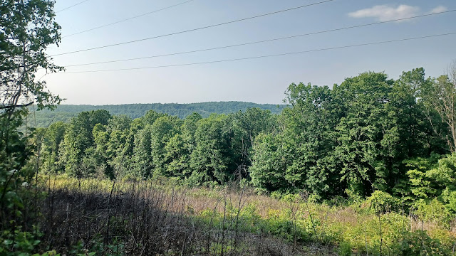
Kirk, Diane, and I continued along the Horse-Shoe Trail to the east, which remained on the gravel road for a while, and came close to a bit of an overlook along a parallel power line in the segment ahead.
We continued further along the trail route, and entered the woods away from any woods road. There were side trail connections to the left, which lead to Valley View Overlook, but I wanted to remain on the Horse-Shoe Trail, at least for this time.
It was getting a bit tougher on the trail as we started to descend from the hills again, but I managed to keep pushing it through this time without taking Ev out.
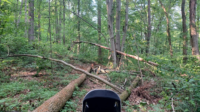
The trail was alright much of the way down, but when we got closer to the bottom, there were a lot of trees down from some sort of recent storm damage.
The Horse-Shoe Trail makes its way to join the Middle Creek Trail, which is apparently an old road along the Middle Creek itself, but we couldn't reach the exact connection. We had to bushwhack with the stroller through the weeds to the right, and out to the Middle Creek trail that way, then head upstream along the creek to where both trails come out on Kleinfeltersville Road.
It was at this point that we would leave the Horse-Shoe Trail for this hike, and for the rest of the season until cold weather comes back again.
I had planned to do this in this way, and actually figured I might not do this hike until the fall, but the weather hadn't been warming up as quickly as I'd thought, so knocking out one more Horse-Shoe Trail and adjacent trails section before the real Summer season started seemed like a good idea.
I had planned to start doing Conestoga Trail hikes for the Summer months earlier, but then held back on that in favor of doing this one more on Horse-Shoe Trail.
From this point, the hike was to be focused on Middle Creek Wildlife Management Area, and I was planning to do more of the trails within the property than we ended up doing.
We turned left on Kleinfeltersville Road, where we turned left at the fork. It was actually easy and quick to get back to the cars if we had turned to the right on Millstone Road, but that would have put us well under fifteen miles, and taken away a lot of what I wanted to do.
We kept to the left, and it was definitely the right move, because the remainder of the hike was both relaxing and beautiful.
We came up on the main dam at Middle Creek, which was a nice scene, but beyond we had a great view of a peak known as South Mountain, which sits at 1,338 above sea level. It is significantly higher than all of the other hills around it, and would be a prominent view for much of the remainder of the hike.
Soon, we turned left on unpaved Laurel Drive, further back into Middle Creek Wildlife Management Area. There are trails that are parallel with this, but the road was quite pleasant enough to walk as it was.
We continued through the woods on the road, passed parking for the Valley View Trail on the left, and that trail went across into the woods below us to the right. I kind of wanted to do it, but I had also had enough of the crazy stroller terrain. The way we were going, the rest of the hike was going to be easy pushing. Ev also fell asleep in this stretch, now that it finally wasn't rough terrain, and I wasn't about to wake him again.
Another right turn on the Spicebush Trail was tempting, but I avoided it in favor of staying on the pleasant dirt road.
After a bit, there was a right turn on the Museum Road, which was also unpaved, heading downhill to cross over a small tributary. There were people parked all over the place. A parking area on this side road had another couple of Amish buggies pulled off in them, and a couple of women standing with them.
We continued uphill slightly, and the Visitor Center was off to the left. I think it was already closed by the time we got there, because it was later in the day than I'd anticipated being.
There is also the Conservation Trail that I think is mostly mowed paths in close proximity to the visitor center which I plan to do the next time I'm out there, possibly as part of the next hike in the Horse-Shoe Trail series.
This time, we just turned right to continue on Museum Road out to Kleinfeltersille Road again, and turned left to follow it to the north. Buggies were going by in this stretch as well.
The Amish and Mennonite communities are very friendly, but I love that when Ev is in the stroller or walking, and he sees and waves at them, they get these enormous grins and wave back.
We continued walking north on the road for a bit, which afforded us some great views of the reservoir as well as some wetlands on the west side of the road.
There was also a nice big snapping turtle on the road below us, which we pointed out to Ev.
We continued a bit further to the access road to the Willow Point Trail, an out and back trail that was one of them I was not going to skip this time, because I figured we might never get back to this spot again.
We continued into the access road and parking lot, and the Willow Point Trail started at the end, which was a multi use trail, very easy to take the stroller down.
We started walking down the paved trail, nice and relaxing, and came upon a bench that had the John Muir Quote: "And into the forest I go, to lose my mind and find my soul".
However, the quote was attributed on the bench to Glenn M. Straub. It must have been a memorial bench, but was misleading as to who's quote it was.
Directly behind the bench was a "no trespassing" sign. I found it to be somewhat ironic that the poet tells you to go into the woods, but the government tells you to stay out of the fields.
We continued out along the trail to its end, where there were good views out over the reservoir. There were a bunch of birders, a couple of them solo, and some of them apparently part of a group on the one side.
One of the bird watchers who was on the trail we stopped to chat with. We talked about the birds we'd seen, and I mentioned the bird that we had seen attacking my car in the morning.
I showed him the photos and the video I took of it, and he identified it as an American Redstart, as prior to this, I was not sure what species it was, because I'd never been so close to one before.
There was a nice pavilion at the end of the trail we took a break under and chatted with some of the birders there. We also used a scope to look at some of them out over the watered area.
Soon, we headed back the way we came along the Willow Point Trail, and back out to Kleinfeltersville Road, which changes names at about this point to Hopeland Road.
This was actually the boundary line between Lancaster County and Lebanon County. The entire hike up until this point had been just barely south of the Lancaster County line, and here we crossed for a short time into Lebanon.
We made a right turn onto the Interior Road, which is part of a wildlife drive within the area. It is open only seasonally as I understand, and it is only one way traffic, so it made for a very good walking route.
We turned right onto the road, and there were barely any vehicles on it. The sun was beginning to go down, and so there were not that many out there anyway.
The first bit was through a wooded area without a whole lot of interest to see. There would not have been much shade, so it was a good thing to be doing it at this time of the day.
Ahead, we reached the intersection with Chapel Road, where we turned to the right.
Here, we actually passed by a few cars that were heading the same direction as us. No one was driving very fast, just taking in the scenery, so it was nice.
We went slightly uphill on Chapel, and there was a pull off parking area on the right side, right at the county line where we crossed back over into Lancaster for the remainder of the hike. There were nice views in all directions, toward the reservoir to the southwest, and to the north, the aforementioned South Mountain's peak started to appear on the horizon before anything else.
At the county line, Chapel Road changes names to Pin Tail Road. There were a few nice, huge trees along this route, but mostly just open fields and continuous views.
I was extremely happy by the time we got to the county line. This was a perfect close to the hike, even though we still had a couple of miles left. The scenery was beautiful, it wasn't too hot out anymore, and I was drinking the drinks I'd brought since getting onto the easier stuff, which I couldn't do when I was covering all of the strenuous ground earlier.
Ev pointed in all directions, saying "this" and "that", some of the only words he was saying (soon, he would give up on this and that, and shift to a slight "UH?" formed as a question whenever he pointed).
We soon made our way to another intersection, and turned right on Furnace Hills Road, ninety degrees. This road again turned ninety degrees from south to east, which really provided for some interesting lighting as the sun was going down.
We continued on Furnace Hills Road with a couple of final views of the reservoir, and we exited the wildlife drive area at a one way stop sign.
Here, we turned to the right on Girl Scout Road, which bordered the public property, with private lands on the left.
We headed down and up slightly, and then turned right on Millstone Road for the home stretch, which was one more nice, unpaved route.
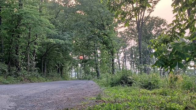
As we reached the height of our very last bit of elevation, there was land to the right that looked like it had somewhat recently been logged off, and so there was a bit of a view between trees.
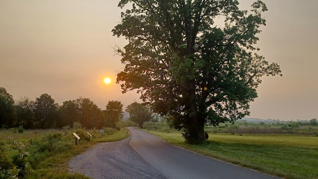
Through these trees, the sun was setting beautifully in a deeper red than we'd seen before. Previously, it had almost a haze over it, which might have been the result of some of the Canadian Wildfires.
These wildfires had started in late April, and so the effects were probably reaching us at the time, but I don't think I was as aware of it yet. I don't watch very much video on anything, and I typically see stuff on social media via whatever comes up. I try to avoid any mainstream news ever since the virus thing and tend not to believe it anyway, since I was literally the subject of such lies.
The deep blue-grey skies with the red sun over it made for such a beautiful scene that I almost wasn't ready for the hike to be over with.
It was going to be a late night getting home, and I knew Ev's mom would probably be giving me a hard time over it (actually she didn't, and I think on this night she didn't even know I was out late because she didn't come through the door until the wee hours of the morning herself).
I got pretty far ahead of Kirk and Diane, and Kirk ended up much further back, sore form all of the terrain and then long pavement walking.
Ev and I got back to the parking area where we had met, where there's an enormous tree along the left side of the entrance. The sun was going down as we were arriving, and it would be dark very soon.
From this parking lot, the Deer Path Trail I think it is travels to the west to where we had been just a bit earlier, so I will probably use that as part of the next hike I do out there, and I thought to check it out this time, but it was just getting too dark.
Diane and Kirk showed up pretty soon, and since it wasn't too terribly far of a drive to get back to my car, Diane drove Kirk back to get that, and then he came back to get Ev and I. We waited in the parking lot as the sun was going down, and the last few people moved on.
We had a nice ride back from there through Pennsylvania Dutch country, after getting a pretty good workout. I was probably most impressed with little Ev, and the fact that he probably did about 1,000 feet of uphill hiking himself on this one, with only a hand to hold for assistance some of the time. His coordination while walking is improving all the time, and Diane has been making note of it regularly.
I hope Ev will be happy to do this stuff more and more as he gets older. It is just becoming more enjoyable all the time.














No comments:
Post a Comment