Friday, June 23, 2023

Hike #1535; Cornwall PA Loop


Hike #1535; 3/12/23 Cornwall PA Loop with Kirk Rohn, Professor John DiFiore, James Kohan, Mindi ?, Pete Fleszar, and Dan Asnis

This next trip would be the next in my continuing Pennsylvania Highlands Series, which incorporates the Pennsylvania Highlands Trail designated route. I think it was the tenth in the series.

Of course, I'm not doing it the normal way. I'd already hiked the entire Horse-Shoe Trail, on which some of the PA Highlands Trail is superimposed, but there are tons of side trails I'd long wanted to do, so it makes it all worth it to try to get through.

Further, some of the Horse-Shoe Trail had been rerouted since the last time I'd been out there, so I wanted the hikes to include some of those sections. The area was also full of all sorts of old rail rights of way and iron mining sites that were high on my "to do" list. 

As such, I put together another exciting loop that would involve a lot of what I wanted to do.


Unfortunately, much of this ended up being far more difficult than I'd anticipated it would be. The mileage would be more like twenty than fifteen, and we'd have the worst bushwhack I'd ever attempted with little Ev in the stroller.

He'd already begun walking, but he wasn't doing well enough that I was going to let him walk on the trails for all that long. They would be rather difficult, and this was probably the coldest start of a day we'd had all Winter. I had to have Ev bundled up pretty good, which meant he was even more uncoordinated. 

The meeting and starting point was on Schaeffer Road, where the Cornwall Station used to stand on the Cornwall and Lebanon Railroad, which we'd followed extensively on previous hikes.


This line was completed to this site in 1883, and extended to the Pennsylvania Railroad at Conewago in 1886. It was in direct competition with the Cornwall Railroad which had been on site since 1850 serving iron interests.

The line became a branch of the Pennsylvania Railroad in 1913.
The station here was also served by the area trolley as seen in an historic photo here.
Sadly, this station burned down in 1933.
The line was abandoned in 1979, and is now the Lebanon Valley Rail Trail. A pavilion occupies the station site where there is parking.

We started our walk directly from the former station site to head westbound. The C&L goes more southbound from Lebanon, and shifts at Cornwall to go to the west.
Directly parallel with the C&L to the west of us at the station was the earlier Cornwall Railroad, the great competitor. It crossed over the C&L at a point just barely below the C&L's station.


Originally, the crossing here was at grade, but it caused major problems, so it was changed so that the C&L would be raised and then pass over top of the older line by way of a through truss bridge that still stands to this day and carries the trail.

The Cornwall Railroad was constructed in 1855 to connect the town of Lebanon with the iron interests of Cornwall. Competition came in 1883 when the Cornwall and Lebanon Railroad was completed serving the same furnace and mines. Originally, these two tracks crossed at grade, and so the Cornwall Railroad employees sabotaged the C&L. This led to litigation, which favored the C&L. Still, it was eventually decided that the C&L would build its grade up and cross the earlier line on the through truss bridge just west of here.
Robert H Coleman ran the C&L, and the original Cornwall Railroad President was his cousin, William Freeman.
The old Cornwall Railroad station still stands today, and serves as the local police station, although at first glance one might not recognize it as a station. A brick-looking facade was added to the building in the 1950s, and an addition that stretches back to the C&L fill covers over some of the railroad grade making it more unrecognizable. I had walked by it before but didn't know what I was looking at. This time, I knew the details I had to look for to see the station.

The closing of the Cornwall Mines in 1973 left the lines with little purpose. The Cornwall Railroad was pretty much finished by 1968, by which time it had been acquired by the Reading, and the Pennsylvania Railroad owned C&L was abandoned in 1979.


The Lebanon Valley Rail Trail follows the route between Conewago and Lebanon, but the routes to the south from here have not really been developed for recreational purposes. Still, I wanted to try to see what was left of them, and so that is why I planned the hike the way I did.

I had prepared to do a whole lot of then and now photo compilations at the start of this hike. Greg Pawelski has an amazing collection compiled ad he'd already done a lot of them in the area, but there are just so many to do, and through doing them, help us to understand what used to be there. 

Right from the start, I was ready to start getting ones of the old station and such. When we started walking, we headed to the west on the old Cornwall and Lebanon line, and there was just a ton of stuff to see.

We crossed over the older Cornwall Railroad on the old metal truss bridge, and then continued to cross the Burd Coleman Road bridge, where there were two more historic photos taken from the higher rail grade I wanted to emulate through then and now.

The old Cornwall Railroad below, as planned, would be our return route. 

It was a very pleasant start to the trip, just heading west on the railroad bed. We'd done this segment already before, but it's so nice that it was just fine to repeat the short segment again, because the rest of the hike would be entirely different.


We passed beneath Creek Drive, and then crossed Overlook Drive at grade. The pleasant section of woods had a mountain biking side path along it much of the way, usually below to the left.

We continued walking through nice woods, and parallel with some new developments. We crossed Alden Way and passed trail parking we had used in the past on these hikes, and then passed beneath Rt 322 and 72, Horseshoe Pike.

Once on the other side, we went just a bit further toward the bridge that carries the rail bed over old Rt 72, now known as Mine Road. There is a little side trail down to the left that leads to the road level. We followed that down slightly, and then turned to the left across Rt 117 onto Mine Road.


It was a steep bit to start with, uphill into the Furnace Hills. Partway up, we let Ev out to walk for a bit, and he did really well making his way uphill, mostly in the section where it is closed to traffic.

After a house up on the hill, there is a gate, and the road is abandoned, on the east side of the Clarence Schock Memorial Preserve at Governor Dick (Governor Dick was a slave leader that escaped, and had the hill named in his honor. Clarence Schock was an entrepreneur that opened his property as sort of park land before it was formally preserved. See previous journals for more on these individuals).

Trails broke off to the right into the Governor Dick property, but we remained on the old highway this time. We had to continue on that until where the Horse-Shoe Trail joins from the right.


We had done the previous section of this on our last hike, and this time my plan was to continue on that trail to the east, to where it passes through State Game Lands, and I worked out a route that would involve some more game lands as well as the railroad grades.

I had hiked this section of the HST before while backpacking with Jillane, but that was back in 2011 and for all I knew it could have been all rerouted through the section.

We continued on the old road route after the trail joined, and came back out to Rt 72. The trail continues straight across the street onto Spring Hill Lane, and so this section was quite easy and pleasant.

I think we turned right on Aspen Lane, followed by Ash Lane, and then cut to the right from there at some point in a short distance. 


The trail took us down an easy, clear route through trees that led down to the back of a private property. That's one of the things I love so much about trails like the Horse-Shoe Trail; they do so much weird stuff and go places one might not expect.

Once we got to the back of that private property, the trail turned to the left onto an abandoned road grade heading south sort of parallel with the Schearer's Creek. It was a bit bumpy, and Ev was getting pretty tired. It was already getting to be time for his morning nap and he slept through some of this chaos.

We continued on, and then got to a spot where the old road used to cross a bridge over a tributary, but it was washed out. I got assistance to get the stroller across, and we were on our way on the other side. 


We crossed a power line clearing with a bit of a view, and continued on the good road grade to the south, which in a short while led us to the edge of a plowed corn field. 

We skirted the field briefly to the left, and then continued on another woods road parallel with the fields to the left. The route leads sort of south toward the Pennsylvania Rennaisance Faire. 

Before reaching the next field opening, the trail turned to the left into the woods on a footpath, which descended gradually toward the Schearer's Creek. Just before reaching the creek, we noted an old mill race somewhat parallel with it. It must have been a pretty substantial raceway to travel so far above the creek for so long. I wonder what industry it once served.


We crossed Schearer's Creek on a foot bridge, then meandered through more woods. At one point, the trail got to an area that seemed quite flat. 

I couldn't help but wonder if maybe this was part of an old logging railroad right of way that operated through this section of the Furnace Hills. I think it might have been, because the Strause Company Logging Railroad operated all through this area. I'm not sure the extent of their operations, but we'd reach some of it later.

Eventually, the trail turned to the left and began ascending more of the Furnace Hills again by way of an old woods road that weaved back and forth, sometimes through a rather deeply eroded cut.


Getting the stroller through wasn't really terrible, but I was wary of the tires going through this. At the time, the front tire was regularly going flat, and I was pushing it along sometimes at too low pressure. 

I purchased a super light weight pump from Walmart around this time that I'd use at the start of the hikes, which would usually provide enough air pressure in the tire for the entire hike.

At the top of an ascent, we reached the power line clearing we had crossed a bit earlier. We turned right on the path along this power line. The Horse-Shoe Trail follows the line for a pretty good distance, but it's not too hard to walk.

Somehow, in this past section, when we had first turned away from the fields toward Shearers Creek, Dan continued going straight toward the Ren Faire property and lost us. 


I got hold of him on the phone, and he had to backtrack through the farms to find where he lost us. At some point on the power line, we determined where he had lost us and he got back on track.

We continued up and down some slopes on the power line for a bit, until eventually the ground around us started to even out. On this stretch, we came upon the edge of a wye where trains could be turned around from what used to be known as Penryn Park and head back toward Cornwall and Lebanon. We could have cut a corner and turned here, but I wanted to tie up the loose ends on the Horse-Shoe Trail, so we continued on the trail straight ahead.

The trail followed one leg of the wye, as well as the power line, and some of this power line section got really extremely wet. There was no good way around it, and so we muscled on through it. Eventually, the trail turned to the right away from it and into the woods.


We descended for just a bit, and crossed the former Cornwall Railroad, which is partially on or next to Penryn Road. The Horse-Shoe Trail turns right on the road, and then left away from it along the Penryn property, more recently Camp Shand.


There's quite a lot of interesting history associated with this property. 

The camp was formerly the site of Penryn Park, which was the Cornwall Railroad's sort of answer to the Cornwall and Lebanon Railroad's resort area known as Mt Gretna.
We had hiked Mt Gretna as part of this series already a couple of times over the past several months. That settlement still retains much of its historic ambiance, but Penryn Park has almost nearly vanished compared to what it once was. Although the Cornwall Railroad came first, it didn't originally go much further than Cornwall.


When completed, the Penryn Park grounds included a pavilion, bandstand, fountains, dancing floor, and a 45-foot observatory atop the mountain. A man-made lake for boating fed by the Chickasalunga Creek was also constructed.
1911 James W Kerscher Collection


Passenger service to the site began in 1885, and in 1886, the Cornwall Railroad officially merged with the Cornwall and Mount Hope Railroad, which extended south to the Reading and Columbia Railroad at Manheim. This brought in passengers from Lancaster and areas south. It was built as a separate line in 1884.

The park grew to include a merry go round, a whip ride, and a ball throw.
The Strauss lumber company began operated in the area around the park, and when the property passed to Bethlehem Steel along with the railroad in 1923, more improvements came.

Success was short lived, as a terrible flood destroyed much of the landscape in 1925. Repairs were made, but the park was abandoned in the 1930s. Passenger service on the line ended altogether in 1929. The lumber company continued operations for a few years following the park abandonment.
1911 James W Kerscher Collection


The property was deeded to the the Lebanon Valley Family YMCA in 1949, and a great deal of work went into restoring the grounds as a youth camp known as Camp Kiwanis.

The land went to the Lancaster YMCA and renamed it Camp Shand, which it remained in name until 2020 when the Lancaster County Commissioners purchased the property and leased it to the Lebanon Valley YMCA. It is now referred to as Camp Rocky Creek, which is a reference to the Chickasalunga Creek.

The line became a branch of the Reading Railroad, and it was abandoned in 1964 from Cornwall to Mount Hope.
Only the ticket booth remains today, moved to about the location of the old station stop pavilion.
Mark Cain collection


One of the very interesting points between Penryn Park and Mt Gretna were that they were just one of the pieces of a bit of a family feud.

The original Cornwall Railroad was being run by William Coleman Freeman, and he was developing Penryn Park as a response to the work of his cousin, Robert H. Coleman, who was developing Mt Gretna for the Cornwall and Lebanon Railroad.
We passed where the Horse-Shoe Trail turned to the left, and continued walking along Penryn Road toward the Camp Shand property, now the Camp Rocky Creek.
I understand that this property was basically private before, but the current understanding is that it is now public land since it was purchased by the County Commissioners. Either way, we weren't there to harm anything, and no one stopped us.
Mark Cain collection


We walked down the road, and the railroad bed was immediately adjacent but overgrown to the right.
After a little bit, there was a bit of a clearing on the left, and a small utility shed of sorts.
I knew before coming out that this was the original telegraph shanty from Penryn Park, and that it was refurbished when the campgrounds there were re-done. It was moved to a point that was close to the old station site from the park days.

The station here was not as grand as the one that was at Mt Gretna, but still had a pretty long platform and awning. I moved around and tried to get as many accurate then and now compilations as I could.
L G Harpel 1910


Ev was asleep, so it made it an easy to to get through and try to finish all of them. It was a bit tough trying to figure out exactly where the station stood, because the historic aerials seem to show that it was slightly off from the area that is cleared where the telegraph office sits today.

It was also in this area that the wye broke off to the right and goes back up to where the Horse-Shoe Trail is, where we had crossed before. I called Dan back up to check on him, and to let him know he could cut the corner by coming in on the old wye, but he still wasn't quite near us yet.
The rail bed joined with the road into the camp in this area, and we continued to the east a bit to the pond from the former park. There was some sort of building that looked occupied on the other side of the lake, and I understand there is a live-in caretaker, but whoever that was didn't come out to greet us. We just continued on beyond the pond to its end, where the rail bed continued clear into woods.
Pereg image


I didn't want everyone to hang around the pond for too long, although it would have been a good spot to do so. I didn't want to cause any stir about us being back there, even though it seems allowed now.

We headed into the woods, and the Chickasalunga Creek flowed out of the spillway of the pond in a stone-lined sluice parallel with us until it passed soon under the right of way, which had a grated metal bridge spanning the old stone abutments.
We were parallel with the power line the Horse-Shoe Trail followed earlier, but there was still no sign of Dan yet.
We continued into the woods for just a bit more away from the camp, and the railroad bed was a very nice, clear gravel road with the creek to the north side. I figured it was still easy enough that Dan would be able to hop across when he got close.
Manheim Preservation Foundation image at the pond


I called Dan up again, and he was pretty closely parallel at this time. He bushwhacked into the woods to the south of him and toward the railroad bed. Eventually he found a good way to get across the brook, and we all continued together on the railroad bed to the west.
L C Harpel, 1895


The creek crossed back over to the left side of the rail bed after a bit, and meandered through the woods on that side. We continued ahead and the line lost elevation very gradually.

After a bit, I noted a stone wall, and what looked like it might have been another railroad grade breaking off to the left into the woods. I assumed that this might have been the Strause Company rail grade that I'd been reading about a bit.

The Strause Company constructed a 36-in narrow gauge track in 1923 from the former Cornwall Railroad near Penryn Park in 1923 into the Furnace Hills to move lumber for shipment. It was at one time the only logging railroad operating in Lancaster County.
The logging line was scrapped in about 1941. Today, only some remnants can be seen of the grade of the once very prominent business. 


We continued ahead on the woods road section, which seemed to get even steeper on the down grade, on a fill, then into a cut. I thought to myself that it was going to be quite the climb to get back up.
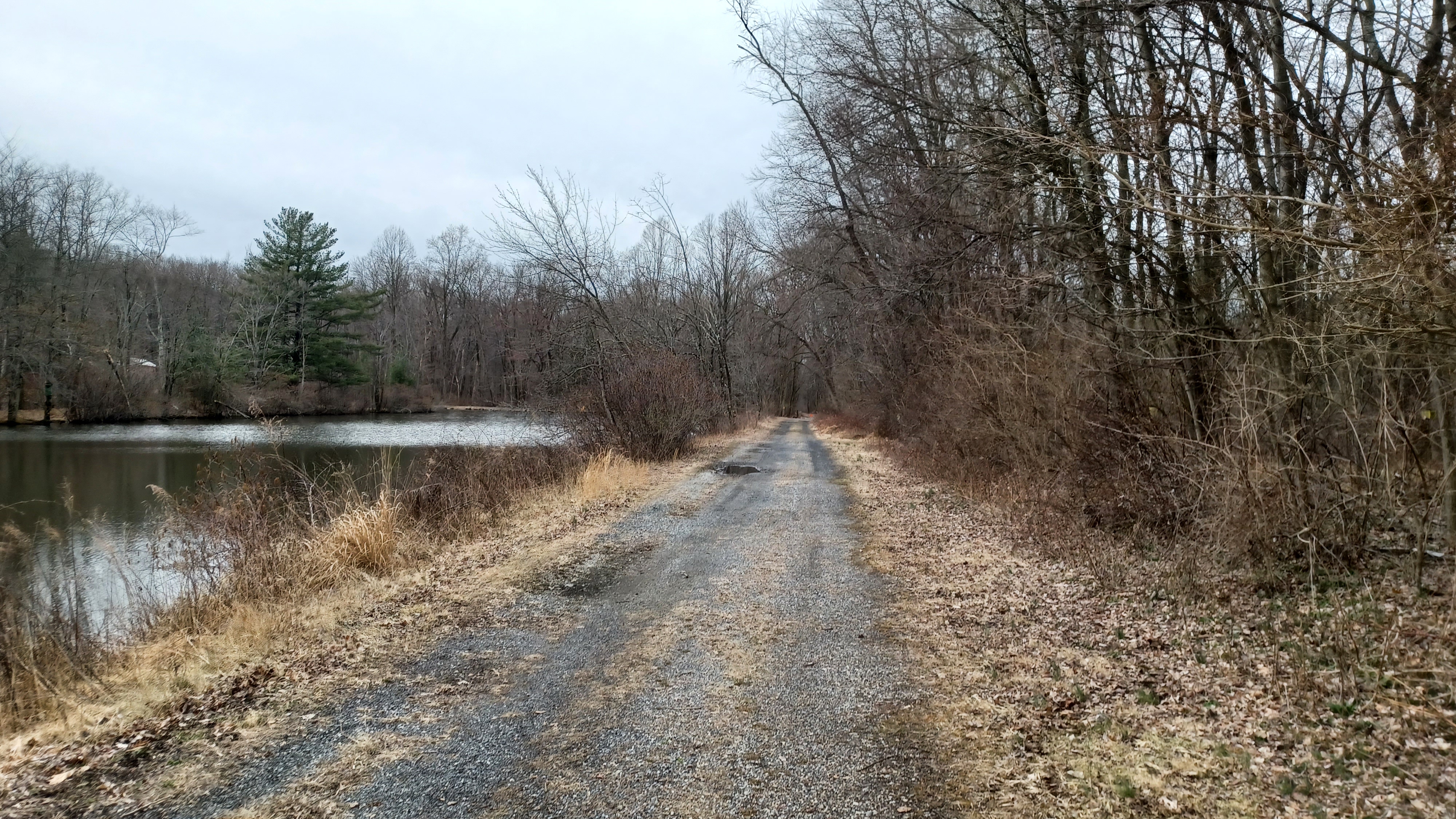
The walk was very pleasant through this entire section, which eventually led into State Game Lands #156. 

I wasn't sure how far the woods road would continue on the railroad bed, but at this point so far, it was way better than I'd anticipated it would be.

Just about where the right of way shifted from heading west to south, the woods road cut off to the left to some sort of private weekend home or hunting camp, and the route became very overgrown in a deeper cut straight ahead. It didn't look too terrible at first, so I continued pushing the stroller through.

1929 Strause Lumber Co image

There were a lot of down logs, so it took a lot of help to get Ev over the things. It kept getting harder.

We pushed ahead, and I noted what might have once been a siding track to the right of us, around the outside of the cut, either that or more of the lumber line. I'm not sure what it was honestly.

The right of way started to straighten out a bit. Trees to the left of us were painted white denoting the State Game Lands boundary. Ahead, there was a lot of Japanese Barberry growing in over the rail bed. it was obvious that this was somewhat passable not so many years ago, but it has gotten really bad. If I didn't have the stroller, we would have been able to push through this segment with very little trouble, but everything is different now.


It got too bad to pass through, so I watched the aerial images and GPS location on my phone to see where we might be able to start pushing uphill into the game lands to reach some of the trails and roads on that property.

Dillon Bomberger image of the pond at Penryn

A corner of the state game land woods roads can be seen on Google Maps, and so I was trying to aim for that, but it was really rough going east, uphill with no trail. I was hoping that we'd have some woods without much undergrowth, but this was a mess.

We pushed on, and zigzagged uphill. I could not handle pushing the stroller any further through this bit, and thankfully my friends offered to help take the slack. I picked Ev up from out of the stroller, and Kirk took on the stroller while I pushed ahead further.

I fast got ahead of everyone else, and Ev seemed visibly stressed although he didn't holler or yelp until some bit of vegetation would touch his face.

There was no easy way through; I just made my way through as best I could, and eventually we made our way out to a vegetative clearing along a woods road up the hill. 


From there, we just walked through the high grasses to reach the woods road. I put Ev down when we got there and I called out to the others to see where they might have ended up.

Jim showed up first; he used the term "chunk it up" when it came to how we handled the stroller situation. Kirk kept the main frame of the stroller, Jim took Ev's seat, and John picked up my pack and stuff from under it. Kirk ended up well out of the way from where the rest of us got through. 

This was the worst part of the entire hike. It was really tiring. I was glad when it was over with. This experience led me to change how I looked at the remainder of the hikes in this series and how we would handle all of the stroller type stuff.


When we all got back together, we continued along the woods road to the east. It went very gradually uphill with some relaxing bits. There was some recent tree clearing in some sections of this which provided for some views to the northwest as we climbed. 

It seemed like every time we thought we were at the very top of the Furnace Hills in this area, we just kept going up higher. I found out later that this section of the Furnace Hills sits at above 1,000 feet above sea level, which is a bit odd for a Highlands geological province summit.

We continued along past the clearing from the logging, and I didn't realize it at the time I don't think, but we crossed over and joined briefly one of the old Strause logging railroads. It appeared from the left in an area that was somewhat cleared, turned off to the right, and then another game land road was built over some of it.


We continued up the last ascent, and then had a relaxing bit out until where there was a gate, beyond which the road can be driven. 

Right at about this point, where there are some communications towers, we reached the Horse-Shoe Trail. It continues ahead on these game land roads, but we had to head back in the direction we were previously, down the ridge.

At first, I was able to push the stroller along the foot path section, but then it got very rocky and steep. I wasn't going to be able to do it myself again, and Ev was not quite able to handle such rough trail walking yet.

Thankfully, we had figured out how this worked, and everyone helped to get all of mine and Ev's stuff down the north side of the Furnace Hills again. In the future, I'd make sure to have it so it would be less a burden when we got to places like this, so I could put most stuff in a pack.


Most of the trail was probably at one time a woods road, but it had washed out pretty badly over the years to the point that it was very hard to just push a stroller through.

When we got down to a level where it became easier to traverse, there were some stick forts and such, apparently from the YMCA kids that camp in the area. The trail turned to the right on a woods road system, which took us through a bit of an activity area. A lot of random stuff was all secured to wooden boards including pots and pans, sandals, and all sorts of stuff.

We made our way further down and crossed over the creek again. It was much smaller in this area, but there was a good foot bridge there.


Pretty soon, we came back up to Penryn Road and the old railroad bed. We simply turned right and remained on the road, with the railroad bed beside us to the left, and passed where we turned from the Horse-Shoe Trail before. This time, we would continue trying to trace the old Cornwall Railroad back into Cornwall.

We passed by a ball field on the right where supposedly Babe Ruth had played once.

To the left, a double stone box culvert reminded us that the railroad bed was just to the left of us. The gravel road took us uphill slightly and gained the same elevation as the rail bed, which at this point had been quite a bit above us. 

We continued on the road out to the power line crossing, the same the Horse-Shoe Trail followed for a time. At the power line crossing, the old railroad bed weaves off to the left for a bit, and then goes through some private land.


We continued on Penryn Road, and the rail bed emerged again near the entrance to someone's driveway. It paralleled the road for a bit more, and then turned away again when the road went right. 

The Cornwall Railroad continued north to pass beneath Rt 322, but we had to continue to the right on the Penryn Road past more private homes.

When we reached Rt 322, I headed over to the left to check out the bridge, which is still in place, that carries 322 over the former railroad. Everyone was pretty tired by this point because the mileage went well over what I was planning on doing. I think before the end of the day we ended up hitting 21 miles instead of 16. I thought I had it right because I planned on a route that would be accurate Horse-Shoe Trail miles, and pretty accurately on the railroad bed, but I guess we did a bit more than I had anticipated.
We headed from 322 north onto Boyd Street, which closely parallels the old railroad bed.

Strause logging rr begins to appear on the left here

We were all getting really tired, and I started falling behind the group a bit, pushing Ev more comfortably in the stroller by this point.

The railroad bed was below us in a rather deep cut at first, but we descended on the road a bit until it was just along side us to the left. There were some seriously rich people who lived along this stretch of road, one of which had a very imposing gate in front, and had all sorts of anti-pandemic signage out in front of it with just about anything you could imagine to say against the management of it.

Soon, the right of way crossed over Boyd Street and went into property where it was gated with a chain link fence. Even without Ev, I wouldn't have bothered trying to go through that segment.


We continued on the road, which didn't have the greatest shoulder for walking, but we got through it alright. It wasn't terribly busy. 

I recall that Iron Valley Road was on the right, and that it was apparent where the tracks used to cross that, but we continued on Boyd until it crossed that too. It was really overgrown at this point, and there was also a second right of way parallel with it at this point, which was associated with the rival Cornwall and Lebanon Railroad. It came in to the north of the Cornwall Railroad track, and there were more tracks that weaved around hillsides for the purpose of extracting iron ore.

I wanted to focus more on the Cornwall Railroad this time, but really neither were well accessible, and we had gone so far on this one that I didn't want to push anyone any further.


Boyd Street turned hard to the right and to the north of the railroad bed anyway, and so we had to continue on that. It was fine by me, because I wanted to walk through the intact historic miner's village.


We continued around another bend, and into the start of the community, which is simply known as "Miner's Village" to this day.

These company homes were built for workers starting about 1865, when the Coleman family was running the furnace operation.
The first section of them we came to were some of the later ones, because they were all made of brick.

The mines of Cornwall were worked uninterrupted for 234 years until Hurricane Agnes in 1972, and it was no longer cost effective to pump them out. They filled in with water and were left alone.

The furnace and its associated buildings were deeded to the Commonwealth of Pennsylvania in 1932, and the homes in the miners village remain private residences.


The homes, and the furnace buildings (which are maintained by the Pennsylvania Historical and Museum Commission), retain their historic charm and are well worth the visit.

I held back in the neighborhood as we headed into the older portion of it. The material of the buildings changed from brick to fine cut stone, and some of them had the reddish corner stones known as red quoin. I had a couple of historic photos taken in 1900 and 1910 in the same vicinity, so I held back to try to emulate them. 

At this point, only John held back with me while the others pushed pretty quickly ahead.

We made our way out of the town, and the road ascended a bit. There was a big hillside that once had rails to it and mines and such I understand, and the main mine pit started coming into view to the left.


This giant pit was to the left, and I had several historic photos I'd seen through Greg's collection I'd wanted to get through this area. John and I reached the peak of the hill, and there was a small wall from which I noticed some of the land profile looked just right.

It was just by chance I noticed this first one, and because I was watching for such things, I was awake to finding more of those then and now opportunities.

I ended up getting several of them that were taken from around the elevation of Boyd Street. If I come back another time I could get more from the slope across the street, but I wasn't going to try it at this late point in the day, and with Ev in the stroller. I don't like running off and stressing him out.

Some sort of modern industry is using buildings down along the edge of the mostly watered mine pit. The railroad was right there below us and parallel with Boyd Street for a bit, serving those industries. 


I thought I could see some of the right of way parallel with the road while looking beyond the chain link fences to the area below. It's amazing to think these areas were mined starting in 1739.

We weaved around a corner and slightly downhill. No one else was in sight anymore, but this was coming into some of the really cool stuff I'd hoped to spend more time looking at. 

There was a reason I chose this particular hike on this particular day, besides the fact that it was the next in the PA Highlands series.

I had found out through Diane that the Cornwall Iron Furnace museum was having a free open house day, which occurs once a year, and I figured this would be the best day to have a hike through the site. 


Diane comes out on most every hike, but she was going to miss this one because she had pre-made plans to be at the museum open house. I decided that my hike would involve going through the open house, and my plan was that we'd be back to the museum well before it closed at 4 pm or so. 

Unfortunately, because of some of the hardships we were facing, it set us behind quite a lot. We missed the closing by probably almost an hour, but we still got to walk through the grounds anyway.

I find it amazing that these ironworks started in 1742, the same year that the Union Ironworks started where I work, and that was only a year after the Oxford Furnace, also very near my home, began operation. To put it in perspective, Oxford Furnace was only the third mined iron furnace in America, and by a year later, they were popping up all over the place.

George I Slonaker image


I even understand that William Allen, who was one of the owners of the Union Furnace, was involved in the Cornwall Furnace as well.

We missed Diane by quite a while because we ran so far behind.

As we headed downhill and slightly to the right, the next historic building we came across was a sort of stone mansion house on the right, the former Manager's House.

The ironworks manager was second only to the owner and resided in this house starting in the early to mid 1800s. In the twentieth century, Bethlehem Steel used it as their local office building. Today, it serves as a daycare center.


Directly across the street from the manager's house was a handsome stone building known as The Abbatoir. This was a Gothic Revival style smoke house with quatre-foil windows, built to serve the estate.

We headed across the road from the manager's house, past the Abbatoir, and then to the north a bit more to the old blacksmith shop and wagon shop. These buildings were of great importance to the operations of the ironworks, and are as I understand part of the museum grounds today.
Consequently, it was Margaret Coleman Freeman Buckingham, great granddaughter of Robert H. Coleman, who donated the lands to the Commonwealth of Pennsylvania in 1932.

We turned to the left and began heading slightly downhill to the main furnace complex, and there was a large kiln off to the left, with a sign reading "roasting oven".

1972 Robern M Vogel


This kiln was where the iron ore was "roasted" to eliminate sulfur impurities before it moved on to the smelting process. 

It is believed that this building was probably built in the early 1800s when the local mines began yielding lower grade ore making this process more important. 

The views of the main furnace were really amazing as we got closer. The entire place was not what one would expect of a colonial iron furnace, because the original furnace is almost completely encased in a newer building. The 1742 iron furnace only revealed itself at the top of the stack around a Gothic Revival style outer area with sharp, church-like windows, constructed under the Coleman dynasty leadership.

1983 Lebenon Co Historical Society


The fact that the place is preserved so well makes it the finest example of early American charcoal fired ironworks in existence.

John and I meandered through the site and had a much closer look around as best we could without going inside. 

We passed through the property and came out below on Rexmont Road, where I was able to set up a couple more then and now history compilations.

At the ninety degree bend in the road below the furnace, I set up the few shots, and then we reached where the Cornwall Railroad came out along it again, from an industrial site to the left.

1922 Cornwall Railroad Historical Society


I had more photos I'd have liked to get in this area, but again it was getting too late, and we'd already lost almost everyone else. John said Kirk had been close by, but then he disappeared somewhere.

As we walked ahead a bit, Kirk would soon emerge behind us, having made his way off into the woods to answer the call of nature.

We continued along Rexmont Road for a short bit, and then there was a trail going off to the right. This was the former Cornwall Railroad, and it was a trail associated with the Cornwall Manor development.

We followed the trail for a bit to the north from here, which was nice and clear, but it seemed to shift to the right. This meant it was either the original alignment of the Cornwall Railroad, or the Cornwall and Lebanon spur. 


We didn't want to be heading into the development area, plus it was signed, so we headed out to the edge of Rexmont Road where it was obvious the railroad bed was on a fill to our left.

As we were heading off of the rail trail segment at the development, Kirk showed up behind us. I got a call from Jim checking that we were making it back okay, as the rest of the group had gotten back to the cars.

I felt bad that our newcomer, Mindi, was not having such a good time of the hike because it was longer than anything she had ever done before, and went well over what I was planning on doing. The difficult nature of some of it was atypical of what happens with the group, and so she didn't get a totally accurate idea of what our hikes were like. 

1860-1870 Cornwall Furnace, National Park Service Collection


Kirk and I agreed that if Jenny had been with us (she's out backpacking the Appalachian Trail), that she might have enjoyed it more, because she'd have presented it in a better light.

Pretty soon, we crossed where a bridge used to be on the railroad, near the edge of Burd Coleman Road intersection. I had a closer look at some of that for some more then and now history compilations.

Ahead and across the Rexmont Road intersection, the Cornwall Railroad continues overgrown and the other spur heads off to the right into the development. The Cornwall Railroad bed was completely overgrown and pretty much inaccessible ahead. We could see ahead to the through truss bridge that carries the Cornwall and Lebanon line over the Cornwall Railroad, through the trees.

1933 Hagley Museum archives


I wanted to try to walk this, and it might be a bit clearer ahead, but it was not really possible from where I was standing.
1950 Lebanon County Historical Society


Just ahead, the historic Cornwall Mill, built in 1798, used to stand to the right. It was demolished in 1960.
Burd Coleman underpass, Lebanon County Historical Society


We continued up Burd Coleman Road from here and passed beneath a handsome stone arch culvert beneath the Cornwall and Lebanon Railroad, for which I had a couple of historic photos to emulate. It was a narrow culvert, but not a lot of traffic and pretty good line of sight.
Pre 1900 with Cornwall Mill


Kirk fell behind again I think somewhere in this area, and I think I missed pointing out that we were walking over Snitz Creek, which we had crossed where it hits the Susquehanna on a previous hike.


He found it hilarious that other time, and so this time I think I ended up neglecting to tell him we were crossing it yet again.
1930s photo by Luther G Harpel


We exited the culvert, crossed the stream, and then turned hard right where Burd Coleman Road turned. There were some nice views of the culvert from that vantage point.

Pretty soon, we turned to the right over toward the Cornwall Railroad bed again, which is now a parking area for the Cornwall Inn, which occupies the historic Cornwall Store building. 

The store apparently dates to the mid 1800s, and now serves as a private inn. I had a few historic photos of the building I wanted to use to make then and now compilations, so I set those up.

The rail bed from this area heading a bit to the east is now a parking lot that serves at first the inn, and then beyond the municipal building and police station. 

Lancaster Magazine Collection


The building itself is the historic former Cornwall Station for the railroad. To look at it today, it really looks nothing like a train station at all. No one would ever guess.
Minersville/Cornwall collection of Cornwall Store


The building does still have the high peaked roofs similar to what it had when it was the train station, but it otherwise looks like a much more modern design.
Cornwall Station Lebanon County Historical Society


The station underwent a major renovation around 1950 which majorly changed the facade of the building, but kept on the same basic shape, so I was able to set up several more compilations.
Railraod Museum of Pennsylvania


I ran around the front of the building, then around the back of it while John and Kirk stood with Ev and the stroller. I tried to get in every position to get every historic view I could.
Timothy McFeely Collection


There were even some of them I had missed from earlier in the day, taken from up on the slope above on the Cornwall and Lebanon line that I neglected to get while we were up there.
Mark Cain collection


I ran up some faint side paths to get to the other grade from below in order to get these last couple of images I needed.
1950 James W Kercher


From this point, we headed around the outside of the building and onto the road to the east to head toward the cars again.

We reached the intersection with Boyd Street and Freeman Drive, and turned to the right. I managed to get just a couple more shots looking from the former road crossing on the Cornwall Railroad before heading back toward the parking lot.
The right of way is taken over by some yards straight ahead, but I was able to step down and get at least a couple of views.

We continued to the crossing of the Lebanon Valley Rail Trail on the C&L line, and there's an old stone building on the right that looks like a stone railroad station style, but it is not one. The architectural style is found in many of the buildings around the area.

1950s E Scott


We turned to the parking lot, and said our goodbyes, and Kirk and I headed back in the car in the direction we had just walked from so I could get some better photos to match the historic ones before heading home.
1911 James Kercher


I did pretty well and got a huge mess of the compilations I'm very happy about. It took a little extra time at the end, but it took the sting out of some of that extra mileage we had done.
1952 Railroad Museum of Pennsylvania Collection


We were really tired and soon stopped by Sheetz to get some kind of food for the way home. Amazingly, I was really good to drive. I didn't feel myself falling asleep at all, which is always a concern when I have a long drive ahead.
Lebanon Historical Society


This one forced me to do a lot of thinking about how I was going to manage some of the hikes going ahead. Some of the terrain might be tough.

Even though the Horse-Shoe Trail segment was far easier than the bushwhack mess, it still required help from my friends to get the stroller and all of the stuff through. I can't remember all of the details of previous sections of that trail, and so some might be tough with the stroller. 

I would have to plan some of the next ones accordingly, so that there was enough easy stuff to go along with the potentially difficult sections. We could handle a bit of difficult terrain breaking it up in the way that we have, but I don't want to go into it too badly like we did in the mid section of this hike.

Lebanon Valley Historical Society


I figured this could work out really very well; as Ev is getting older and walking more independently, it could all coincide with the continued addition of harder trails that fit his ability levels. If for some reason he is slow to progress in that way, I can adjust plans accordingly.

This would end up being one of the toughest hikes of the year (maybe it'll be the toughest), but it was also a learning experience that would be of value to us.

Thursday, June 15, 2023

Hike #1534; Oxford to Clinton


Hike #1534; 3/11/23 Spruce Run Turnpike/Oxford to Clinton with Justin Gurbisz, Brittany Weider, Robin Deitz, Megan Powers, Diane Reider, Joe Tag, Carolyn Gockel Gordon, and Celeste Fondaco Martin

This next hike would be the last one I would host as a bonus on a Saturday associated with my work as part of a special series. I had started doing this again with the Spruce Run Perimeter hikes I hosted in 2022 with the lower water around the reservoir.

John Taylor Leigh Mansion we parked behind

The first one of those hikes posted through the state went over so well that it was decided I would do it again.

Even I was surprised at how popular these things would become through the state. In the past, when I posted something through the state, only a small amount of people would show up through that posting, if any at all, and the rest would come through Metrotrails.

One of the positive things that came with having a new superintendent was the support to do some of this different stuff, and continue it as a sort of series. Then, she transferred to another park, and while doing these events through work is not out of the question, I'm also working every Saturday, and off every Sunday.


It is good to have consistency in schedule where I can keep hosting these events without issue, but it also comes with its host of problems. One of them is that I can't do stuff like this through the job without having coverage.

At this point in my life, I'm finding myself taking a bit of a step back from modesty and demanding a bit more, because in truth, there are really no other interpreters that are capable of doing as much as I do from memory. This hike sort of served as a remind of that to myself as I was able to rattle off so much history about places we were passing over the distance of 15 miles between Oxford and Clinton.

I'd done this hike so many times, but never during the day, and so this gave the unique opportunity to showcase how much I could remember.

Unfortunately, there was some rain in the forecast, and that scared a lot of people away. Where the previous hikes had over thirty attending I think each time, this one was just a few friends who had done my hikes in the past. That was fine, and probably more enjoyable for me overall.

Still, I would like the opportunity to have someone in a more powerful position to see what I'm capable of to perhaps do more of it in the future. 

For this one, we met at the Clinton municipal building and shuttled north to Oxford. If I'd been doing this as a regular Metrotrails hike (it was, as it was posted there, but it was also posted through the state), I would have brought my son Ev with me, but because it was also a work thing, I didn't take him out this time.

We shuttled in a couple of cars to the north, to Oxford, and spotted Joe's car in Washington to give him an early out. He hadn't done a lot of distance in a while, and didn't want to push it too far.

We parked out behind the bank in Oxford, across the Furnace Brook from the Oxford Central School. From that point it is very easy to walk into town and to all of the historic sites.

As we walked out onto the main street, I pointed out the site of the old Oxwall Building, which was where the Company Store was associated with the ironworks. The historic building was burned by an arsonist in 2007, sadly. It's one of the many buildings in Warren County where I recall there being a pretty strong suspect, but nothing every happened with him. There's more talk on that to come later in this journal.

What remained of the Oxwall Tool Co site was demolished in 2015, and what I considered to be an iconic water tower went with it.

We continued to the intersection of Belvidere Avenue and Washington Ave, which is what I have understood to be the northernmost bit of the Spruce Run Turnpike, and the Shippen Manor is right up the hill.

Considered by many to be the finest example of a colonial ironmaster's mansion, the Shippen Manor was built 1754-55 for the Shippen Brothers. The Manor has gone by many names over the years, and seen a lot of history go by. It's now part of the Warren County Department of Land Preservation and a living history museum.

The Oxford Furnace is just across barely on Washington Street, and was the third mined iron furnace in America, constructed in 1741. It was later the first furnace in America to implement the "hot blast" method where a bellows was employed. 

The mid 1800s foundry building still stands, as does the wheelwright shop across the street from that. 

The Methodist Church building to the right of the furnace was actually the mill associated with the furnace built in 1813. When the mining company wanted the property occupied by the original Methodist church, they offered to convert the mill, no longer needed due to the newer furnace works, into a church in exchange for the original church property. It was agreed upon, an conversion of the mill to a church was completed in 1913.

The settlement was originally known as Oxford Furnace, and the collection of homes up present day Belvidere Avenue was known as Pittingerville. Old Oxford is what today we know as Hazen, closer to Belvidere, which is why the Presbyterian Church at that intersection is known as the Old Oxford Church. Of course, names shifted in the years to come.

In 1856, the Warren Railroad under the direction of John I. Blair came to Oxford. The original route weaved around through Van Nest Gap and behind the Oxford Furnace, then directly behind the Shippen Manor. In 1862, the tunnel was completed to the north, and so the railroad was rerouted through it and most of the 1856 grade through Oxford was abandoned, save for the piece to the furnace and original station site behind it, which was retained for a time as an industrial spur.

I pointed out all of this history and the rail grade as part of one of my longest dissertations for the day before moving to the south along Washington Ave.

Ahead, I pointed out where there used to be a small movie theatre, and where the little library is. 


The Second Presbyterian Church was on the left just ahead on the left, along with a parsonage building, built some time just before 1900. Of course, it has the "second" name because there was already one over the hill at Hazen. This church remained active until just a couple of years ago when it closed its doors. I think the last minister was Joicy Becker Richards, who trained as a minister under one of the Pastors from my church when I was little.

We continued a little further uphill and I pointed out another church location on the right, which I think was a German Reformed or maybe a Lutheran Church. It stood abandoned when I was little, and was then torn down. Another newer church is near that location on the right.

Just up from there is the St Rose of Lima Catholic Church, which was built some time around 1900, with a rectory building next door built I think in 1908.

I like to point out here that the existence of so many denominations is an illustration of what a melting pot this area was of different denominations, all settled here to work the mines and furnace operations. 

We were at the intersection of Academy Street, Jonestown Road, Mine Hill Road, and the road to Oxford Lake. The old Spruce Run Turnpike continued up Mine Hill Road, but this was yet another major transportation history spot to point out.

Imlaydale Bridge

The 1856 Warren Railroad crossed Washington Ave here where it changes names to Mine Hill Road, and Academy Street is built over top of it. It then goes through the new church and out into the woods to the west before weaving back behind Oxford Furnace. To the east, it continues to present day Rt 31 before passing through Van Nest Gap.

Almost at the same spot, but slightly north, the Oxford Iron Mine Railroad, which was eventually a branch of the Lackawanna, crossed over Mine Hill Road after crossing Academy Street, and a small arch concrete bridge is still in place. It then went directly behind the Catholic Church, and the road to Oxford Lake is built on top of it. Then, the original alignment was a switchback railroad up West Oxford Mountain, but it was rerouted later to circumnavigate the topography to reach the mines beyond. 

Another spur to mines went back across Mine Hill Road, around a small reservoir, then across the road ahead to reach Squires Mines, which were on the right side of the former Spruce Run Turnpike. One of them I have watched collapsed further and further over the years along the road. From a distance, a bend in the road has an exaggerated look because it needs to weave away from the mine pit.

The Warren Highlands Trail is supposed to cross the road at this point eventually, but I just don't have the time to work on it any more with my young son. The township is also supposed to fence off some of its most dangerous mines just to the west of the road. The idea was that the county bought some of the land, and the township would use that money to fence things off, but they never went through with it, and we're left with the liability, which is one of the reasons we have not been able to put the Warren Highlands Trail through.

On the left side of the road heading up the hill, there is the base of a former water tower that lasted for many years until recently. 

We passed by the mine, continued uphill to the very peak, and then began to descend. I pointed out that we had left the Pequest Watershed at this point and entered the Pohatcong Watershed.

As we descended, I pointed out a house on the left that when I was little, a dog came out and bit me. This was when my grandfather was hiking this entire historic route with me, which we did in several days rather than just one.

As we headed downhill, there are still some pretty good views down to the left into the Pohatcong Valley, left over from the damages done by tropical storms Irene and Sandy so many years ago. 

The section of road isn't terribly busy, but when cars go by, there's not a ton of room to get off, and they definitely travel too fast.

As we got closer to the bottom, the Fairway Greens community was on the left where there was a porta john to take a break at. No one was playing golf because it was kind of a wet day, so we just meandered along the edge of the golf course rather than walk in the road for the next bit toward the bottom of the hill.

We passed the main golf course building, then crossed the Pohatcong Creek next to the entrance of the natural area of the same name. I bring Ev there pretty often because it's so nice.

Once across, we began ascending into Washington. We came to the intersections with Kinnamin Avenue and Jackson Valley Road, and continued straight ahead on Belvidere Avenue, still the Spruce Run Turnpike route.

As we headed downhill, we soon came to where the Morris Canal used to pass beneath the road. I pointed out the disturbances in the paving, and that it existed as such because of where the "camelback bridge" used to span. The old canal is now overgrown to the west, and the former Warren Lumber is built over it to the east. Since Warren Lumber closed, they are now storing some famous cars there. For a while, the Ghostbusters Ecto-1A was parked there, which was used in Ghostbusters II.

I reminisced about old friends and where they lived as we walked down the street into the main part of town. Larger homes, stately Victorians from the more affluent members of the community in the past started to line the edges of the road.

Soon, we reached the Cornish Mansion. This was the historic home of the Cornish family who owned the Cornish Organ business when Washington was the organ capital of the world.

The house was built in the 1860s with a beautiful Gothic theme, high peaked roofs, porches, and the feeling of grandeur. It was extensively remodeled in 1912 to look more boxy, similar to how it does today, because the Gothic look had fallen out of favor. By modern standards, it was an absolutely awful idea because the original configuration was beautiful. 

The building suffered a major fire, but it survived and remains apartments today, although the grounds were not kept up very well lately. 

Also to the left, we came to the fire department and post office on the left. The current fire department building replaced the original one in the former municipal building across the street, which is now a different business, but the front doors are obviously former bays for the fire trucks. 

Just beyond, on the left side, was the post office. This building as I understand was built in the 1940s and replaced previous structures that served the same purpose. Where the post office and fire department are today were both once stately homes, one a hotel and one a doctor's home, but both were razed. I believe termites were one of the reasons given for it.

There's a watering fountain that served both horses and people on the right by the original municipal building and fire house, which was one of my friend Jeremiah's first official Washington Historical Society initiatives. It had been laying abandoned in the borough park for years, and he wanted to get it back to its historic original location. It doesn't work anymore, but still cool to have it there.

We moved ahead, passed Scotty's Stadium Pub, and I checked to see if my mom was in to say hi. She wasn't and so I continued with the history, this time about the Washington House for which the town takes its name.

Castner grave

Route was originally part of the Easton-Morristown Turnpike, and the settlement of Washington was known as Mansfield, which was the ancestral English home of early settlers, the Bowlby family.
The intersection was home to the Washington House on the northeast corner which burned in 1869 (built I think in 1811). The settlement took on the name "Washington" after this old stage coach stop.
The First National Bank is on the northwest corner, to the right, established in 1868 and later expanded. It was home to a bank from this time until 2021 when Wells Fargo closed their branch. Thankfully, there is still an outside access to an ATV that I use regularly.

On the southwest corner is the "Opera House" as many know it, or otherwise "Stover Building".
The original buildings here, known as the "Mattison Block", burned in 1869, and this building replaced them.
It was originally known as the "Beatty Building" for Daniel F. Beatty, who used it as offices for his organ factory that was located on Railroad Avenue.
The second floor contained an auditorium known as "Beatty's Hall", with pit on second floor and balcony on third.
It became known as the O'Neill Building when sold, and then many years the Stover Building for the family that owned it until more recent years.

The building was long rumored to have a prohibition era speakeasy beneath the restaurants on the corner, and this was confirmed when deliveries were made, and the bar was still down there.
The remainder of the speakeasy was reportedly destroyed around 2018. The tin ceilings were salvaged, but what remains today is unknown. Now, the inside of the old opera hall is being framed out as new apartments, and all of the buildings to the west of it are now supposed to be torn down to make room for more parking. The tenants had received eviction notices, and my mom was one of them.
The southeast corner of town was destroyed in April of 1962 in a devastating fire, which is why the buildings on that corner are so much shorter than the other three.

The trolley, Easton Washington Traction Company, arrived in Washington at this point in 1906, and lasted until 1925 when it was replaced by bus services.

I have some strong feelings about the town of Washington and the near constant assertion that there are something like six Washingtons in the State of New Jersey.

I insist that there really is only one, and that is this Washington, the one I live in.

There are plenty of arguments for this.

For one, it is the only one that you simply put "Washington New Jersey" on the mailing address. If you use the south Jersey one, its usually other area town names that have the postal code. If you refer to the one in Bergen County, it is officially "Township of Washington" as a full name, not "Washington". The one in Morris County is never really referred to. People who live there live in Long Valley or closer to Flanders, Hackettstown, Schooleys Mountain, something like that. They'll typically have a Long Valley address. The municipality includes all of those place names as well as Middle Valley, Crestmoore, Naughright, Flocktown, Scrappy Corners, and more. The Washington name is just a generic municipal name to cover the area.
Then, of course there is the Washington Township that surrounds Washington Boro, the one that is actually referred to as just Washington. That one includes Port Colden, Brass Castle, Bowerstown, Changewater, Imlaydale, and Springtown. Even if residents say they live in Washington there, the address is actually just Washington because of its close proximity.

Furthermore, Washington in Warren County is the only Washington in the state that has a defined center of commerce. Two historic roads come together at an obvious settlement where businesses and residences are all prominent. All of the other Washingtons are either a collection of colloquial place name villages under the blanket name of Washington, or just an urban sprawl without a defined downtown. 

People like to argue against my assertion that MY Washington is really the only real town of Washington, but I think most everyone that lives in Washington would agree with me, as would most people who live in close proximity.

We continued downhill onto Broad Street, the next bit of road that follows the old turnpike route. This brought us down across the Shabbecong Creek, and then up again on the other side to cross the Morris and Essex Railroad adjacent to the Washington Boro Park and pool. The Morris and Essex originally was planned to head through the Delaware Water Gap, but when the Warren Railroad beat them to the punch and became the main line of the Delaware, Lackawanna, and Western, the Morris and Essex shifted plans and extended to Phillipsburg in 1866. It became part of the Lackawanna system anyway in 1869.

We had spotted Joe's car at the park so he could cut out a bit early. He felt that he might be able to do the entire hike, but hadn't gone that far in a while. He was feeling pretty good, so he chose not to try to go too far and cut out at this point very happily. I was glad to see him and that he was doing so well.

We continued from here uphill for a bit past some more grand homes along the way. I had recently been noticing that a few of them were sort of mirror images of one another on either side of the road reaching the top of the hill. I suppose the architects involved must have tried to have it be somewhat similar, but I'm not really sure.

After the crest of the hill, the Spruce Run Tunrpike crossed modern day Rt 31 and then becomes Springtown Road on the other side, but I took the group for a little side trip first.

We followed Cemetery Hill Road briefly, and then cut to the left down into the Mansfield Woodhouse Cemetery. This dated back to when the settlement was still known as Mansfield, and the original church used to stand there. When that church burned, the congregation split between Hackettstown and Hampton area where the new church was built in 1837. More on that later...

The reason for going into the cemetery was to show the group he Castner graves from the Changewater Murders. 

In 1843, the Castner family was murdered by who is still believed today to have been an unknown assailant, but two men, Carter and Parke, were tried for the crime. They were found innocent the first time, but public outcry was that someone had to hang for it. Illegal Double Jeopardy happened, they were tried and found guilty the second time and hung. Carter and Park were buried near the intersection of New Hampton Road and McCollough Road.

It is probably one of the biggest cold cases in the State of New Jersey history, but the problem is, it was officially a closed case. 

We continued down through the cemetery to cross over Washburn behind the Dairy Queen after looking at the three tall grave stones with strangely long a gruesome epitaphs describing the murders. When we got to the Dairy Queen, I decided that I wanted a Blizzard, so I went in and got one as well as a hot dog for the next bit of walk. I was very happy I did this.

Celeste joined in for a bit of the hike coming from Rt 31. She caught up with us on the road and didn't go quite as far as New Hampton, but it was nice that she popped in to say hello for a bit.

We had to dash across Rt 31, and then followed Springtown Road ahead for a bit. As the golf course started to appear on the right, I pointed out some old lime kilns that are still standing just off of the road close to the course. It was also a good opportunity for everyone to go and pee behind it since there wasn't many places with privacy.

Irishtown

There is the Springtown Road Nature Trail on the left ahead, which I incorporated into one hike back in 1998 and haven't bothered with it since. I think Todd Nagy, the son of Gary from Taylor Rental, built the trail as part of an Eagle Scout project. I thought to maybe incorporate it into this hike, but then changed my mind. There was already enough going on along this one.

The first house ahead was where my good friends Jenna and Aaron lived in high school. I went to prom with Jenna, and she was on hike #1 in '97. Aaron did several of the hikes after that as well. Years later, when I worked at Taylor Rental, a girl we called Boots used to live there.

We continued down the road, and I reminisced about when I'd hiked all of this with my grandfather. When that very development was being built, I remember finding a deer jaw in the field to the left which I think I brought to Kindergarten for show and tell. I of course always had the most interesting stuff to bring in because I was out with him so much.

We continued to the end of Springtown Road, to the settlement known as Springtown, which is a good opportunity to show how the main roads have shifted over the years.

Irishtown

The intersection is with the much busier Asbury-Anderson Road. That road has some sharper bends to it at this intersection, but it was not always the more prominent road. Looking to the south, one can see that the right on Asbury-Anderson, and then immediate left on New Hampton Road was once the straighter, more direct route. There are some beautiful old stone houses at this intersection, and the location was named for the many little springs flowing through the area.

We made the right and the left, and then followed New Hampton Road gradually uphill for a bit through a new development from the 80s. I remember this road also being very narrow and with barely any homes on it.

Soon, we descended toward the Musconetcong River. There used to be an old abandoned house on the left at the turn, which I went into with my grandfather when I was little. I found a bunch of stuff inside including a polaroid of a Christmas tree that I had in a box of stuff for many years. That house was torn down probably in the 80s, maybe the 1990s. 

We continued around a bend and over the newer pony truss bridge over the Musconetcong River. This bridge replaced a grated metal beam bridge that had been there for many years. My grandfather says they always referred to that as the old turnpike bridge, and he and his friends and family would go swimming there.

We turned right on Musconetcong River Road, the next bit of the turnpike, and followed it somewhat uphill into the settlement of New Hampton.

The old school house is on the top of the hill on the right and houses the Lebanon Township Historians. Next to the old school is the memorial to Daniel Morgan, who was architect of some of the greatest tactical masterpieces of the Revolutionary War, which played a key role in victory. Morgan was born in New Hampton in 1736. 

The settlement of New Hampton is named for Hamptonshire England. It is actually an older settlement than nearby Hampton, oddly enough.

When the Central Railroad of New Jersey came into Hampton in 1853, followed by the Warren Railroad in 1856, the site was simply referred to as "junction". The generic name would not due with all of the rail junctions cropping up across the state, and so "Hampton Junction" was taken as the name, because of its proximity to New Hampton. When the junction was abandoned in 1955, it became simply Hampton, and so that is how Hampton is a newer town than New Hampton.

To the right, there was the Shoddy Mill. This is an interesting spot because the original four or so story mill burned, was replaced by a brick one, and that was converted to apartments. The old mill was chopped down to a single story and a half height, and is a seating area for the apartments now.

Shoddy does not refer to the condition of the old mill, which is basically crap, as well as the remnants of the now broken mill dam on the Musconetcong. Shoddy is actually a scrap fabric that is processed and reconstituted into other useful things. It could be considered one of the first types of recycling centers.

The bridge over the Musconetcong on Shoddy Mill Road, which becomes Rymon Road just ahead, is one of the highlights of this hike.

There are only three historic pony truss bridges known as Lowthorp bridges in the State of New Jersey, and all three are in close proximity and seen on this hike. The one in New Hampton is the oldest of the three built in 1863. It is an iron, oblong sided truss with a sort of octagonal bracing. They were designed by Francis C. Lowthorp, and built by William Cowin of Lambertville.

We continued ahead, and passed several historic homes in the settlement, and finally reached the New Hampton Inn.

The original New Hampton Inn is a handsome old three story white structure with a long porch, now a private residence. The current New Hampton Inn is a hole in the wall bar that looks like it was sort of slapped together. It's had the reputation as an "old man bar" that doesn't abide by any of the rules and regulations of most any bar. People were still smoking inside twenty years after smoking was banned in bars, and it used to be known as the place underage kids could always get served. My dad used to go there when he was in high school to get beer he'd told me. I remember hearing a story about he and a friend riding on his bike to the place, but then dropping the beers on the way back, so they had to search around in the weeds along the road for them all.

I asked the group if they wanted to go inside for the experience, but everyone declined. 

Just ahead, I pointed out where the original bridge across the Musconetcong was at Imlaydale. There was a pony truss bridge at the base of what is now a driveway, and a second bridge into the little hamlet of Imlaydale on the Warren County side, where there are several homes and an old mill, as well as a busted out dam. The bridges were low, and spanned two flows of the river, with an island in the middle. These bridges were gone pretty early on. I did do one then and now of them.

Just ahead, the next little side trip I chose to do was on the next incarnation of the north/south highway. 

The segment here was originally Rt 30, and I understand that this section of road and old bridge that still stands over the Musconetcong was one of the oldest modern highway projects in America, from about 1913. The bridge is cracked pretty badly and may eventually collapse. There's a good path down to the river to it, at a really nice spot, so we followed that and walked out and back across the old bridge.


Rt 31 was renamed Rt 69 when it was realized there was already a Rt 30 in south Jersey, and then renamed 31 because all of the highway signs were getting stolen.

We headed back to the Spruce Run Turnpike route, which at this point goes directly over present day 31 into Hampton.

We made our way into town, and I pointed out Valley Road where the church was built outside of town in 1837. When the railroads came in less than twenty years later, the town, as planned did not grow around the church, but rather the junction, and so the Presbyterian congregation built another church in town. They attend Winter services in town, and Summer out in the valley. It is a tradition the congregation holds onto to this day. This was the church I attended growing up.

I pointed out a house set back on the left, which has a barn in back, but barely any remaining farm land. My great grandfather, George Prall Allen, came here and worked because it was his uncle's farm, when he married his wife, Gladys Snyder, because he was disowned by his father, Edwin Allen. Gladys Snyder came from a broken family and lived as a boarder with the Evans family, and so marrying her was forbidden.

My great grandfather went to school to become a preacher, but left that practice and got a license to become a barber. He opened the barber shop in Hampton, just up the street a ways. I pointed out the building his shop had occupied.

We passed the church, and gradually headed uphill. Another church from another denomination was on the right, now a private home. 

Further up the hill, we passed beneath the former Central Railroad of New Jersey, which growing up read "Hampton" on it, with a heart for the letter O. I wish they'd paint it back.

My grandfather told me he would watch the guy turn the armstrong turntable for the steam locomotive just west of the bridge. They'd turn it around so trains could head back to New York City the next day.

We continued up the hill, and I could see down the side road where my grandfather was born, and toward his house. The former blueprint shop was on the left, where I used to go with him or my grandmother to pick up his map prints when I was little. In the later years, it was owned by a guy named John Harold something, and I ended up working with him at Spruce Run for a while. He sold me a bunch of old USGS maps back around 2000.

As we were leaving the Hampton area, Carolyn joined in with us for the remainder of the hike and parked on street. 

We headed further to the top of the hill, turned ninety degrees at the Catholic church, and then headed downhill a bit to the right. Just before the road reaches Rt 31 again, the abandoned bank is on the right side. I opened one of my first bank accounts there when I was little, and then one when I was maybe 19 because it offered 25% interest for the first year or so, which was unheard of. 


The place has been abandoned for many years, as all bank branches are basically disappearing.

We dashed across 31 once again to head into Glen Gardner. I had always thought that the name was for owners of the quarry company, but I have since found out thanks to the facebook posts the actual history of the site.

Gardner & Co. was founded in 1863 in Clarksville (called “Glen Gardner” beginning in 1871), N.J., by brothers George, John, Joseph, Oliver and William Gardner. The company started out making picture frames but was known for its furniture after 1870. Gardner & Co. made chairs, benches and settees and held several patents for chair seats and backs. The company’s perforated seats were stronger and lasted longer than cane seats, which were in common use at the time. Gardner & Co. had plants in New Jersey and offices in New York, but it was out of business by 1888. A Gardner chair with a perforated seat and back sells for about $200.

Thanks to Jack Stanley who commented on my Metrotrails posts on this for the great detailed information.

We descended and crossed over the Spruce Run finally, and would somewhat parallel that to the end. It's quite a large creek at this point, and of a river than just a creek.

As we came into town, there was another Lowthorp truss down to the right. This one was built in 1870 and spans the Spruce Run.

We continued through town, passed the Glen Gardner Inn, which has been several different names over the years. It is not the original building despite the fact that signs read that it is from the 1700s. The original building sat further back, and the site of the foundation may now be covered by the Central Railroad of New Jersey track, which is out of service through Glen Gardner. There used to be a station just up the hill from this area.

The entire town sits on a slope, and has antiquated cesspools, so there are many septic issues that contribute to the algae bloom issues in Spruce Run Reservoir. That and the combination of quarry runoff from the quarry just beyond, the farm runoff, highway salt runoff, as well as acid mine runoff from the long abandoned iron mines on the west side of 31.

Still, it's a beautiful little town to walk through, and I've always loved it. The steep walls and houses on the left side are particularly neat.

My great grandfather's last barber shop was on the left in the lower level of one of these buildings. My aunt and uncle rented the house after he died, just three weeks before I was born. He actually gave up the shop a little earlier than that, and had taken a job as the hairdresser up the hill at the Hagedorn hospital, and that was his last job before he died.

We continued through Glen Gardner, and passed the historic Hunt Houses, which are lovely federal style buildings on the left, and the original turnpike is a dead end road ahead. There is a large old house that was probably once a hotel, that was owned by Leo Rosado, who was a great client of my grandfathers and a big personality. I remember meeting with him at different sites with him when I was little. Mr. Rosado passed away in 2020 at the age of 100.

We continued south and reached 31, stepped over the guard rail, and did the crummiest section of the hiking walking Rt 31.

After a short bit, a little side road, the original turnpike, breaks off and runs parallel with 31 to the left, and the Spruce Run passed under 31 to the west side. I understand this little community to the south of Glen Gardner was known as Irishtown.

We walked along this segment, and then back along 31 a little more to the south. 

At a point where there was a higher rock outcrop to the left, I noted what must have been a little bit of the original grade of the turnpike beside the road. 

We continued ahead, and there was an abandoned service station to the left. I guess it was open not all that many years ago, as recently as 2006. I don't remember ever getting gas there, but it's possible. Apparently, a guy named Bob owned it but had to move out of there because the power company on the property next door contaminated the water at the site. 

When I'd walked through this in the past, it was always on a night hike, so some of what we were seeing, I had not really seen in detail during daylight hours, and I'd never pulled over to have a better look. We went around the building, and there was a toilet room still opened up, but no running water of course.

Just ahead of this, there was the electric substation, which apparently once had a different kind of plant on site. I never noticed before, but there were tall metal light poles out in front of it. This was clearly something that was put in earlier, probably the 1940s or 50s when there was a generating plant there. The current substation was put in on the site in the 70s. 

We continued along the highway a little bit further, and we came to where Buffalo Hollow Road turns off. A segment of the old turnpike weaves off of 31 at that point, then comes back across it to the car dealership lot.

In the section along the bus parking place, which is owned by Dave English, there was a sign reading that "crybaby Clinton Toyota deliveries" were not allowed. Apparently, the dealership didn't have enough room for tractor trailers to turn, so they were blocking up the lot Dave English owned and causing problems. 

We crossed over 31, cut through the dealership lot, then crossed Van Syckles Road. The driveway to the abandoned house there, former DEP office, is the old Spruce Run Turnpike. It goes beyond the house and then usually goes under the waters of Spruce Run Reservoir.

ecause the water has been so low, and because it was the anniversary of the turnpike, I wanted to get this one hike out of the way. I'd already recently done the perimeter of the reservoir twice, so this was good to get one more in.

The old office house was reportedly once standing on the Union Road, but was moved to the location where it is now when the area was flooded. Now, the house is scheduled to be demolished, but it just hasn't happened yet. The one out building is already gone.

We continued into the reservoir bed, and reached where the road used to cross the Willoughby Brook. The bridge is still there, although it has no sides to it. I suppose they were removed to keep the flow of water through Willoughby Brook going. I'm not sure why the rest of the bridge was left in place.

We continued past the bridge, and I pointed out where the original Van Syckles Corner Road intersected with the turnpike. It was actually a four way intersection with the original alignment of Cregar Road to the east.

There was apparently once a silk mill and buildings in this area, and it was known as Bakersville, but I haven't found much on it. There is also reportedly a cemetery somewhere sandwiched between Rt 31 and the old turnpike. I've looked for it but did not find it.

Near the intersection area here was the former site of the Union Furnace. It was near where old Van Syckles Corner Road meets present day Van Syckles Road.

These road sections were rerouted around 1963 for the reservoir, which came to be due to the Water Bond Act of 1958. It was planned that reservoir should be built at the site as I understand since the 1930s, but the Flood of the Century in 1955 provided enough jusification for water control that no one was going to argue after the great disaster.

The reservoir was filled up and the recreation area on the north side opened partway through the season in 1972.

The Union Furnace dated back to 1742 when the large tracts of land, known as "The Union", were purchased by William Allen and Joseph Turner. The furnace location near the confluence of the Spruce Run and Willoughby Brook, with the wider flood plain, was chosen because there was good sand, which was an important part of the iron making process. 

The furnace was out of the water at this time, but we didn't go to it because it was so far out of the way. The Union Furnace major operations moved to nearby High Bridge some time around 1760, and ironmaster Robert Taylor came to own the company, which led to the change of name to Taylor Iron and Steel Company, and eventually Taylor Wharton.

We continued to where the old turnpike turns uphill away from the reservoir. Behind Rita's, they have a path and a now beat up foot bridge that used to approach the reservoir, but it is now collapsing.

The old road has a lot of fallen trees over it, and I was kind of glad only for the reservoir edge section that I didn't have my son with me in the stroller. It would have made it a bit harder.

We continued past an old spring house ruin on the right, where motorists once stopped to fill their jugs of water. It is now a rather forgotten roadside attraction and certainly not worthy of drinking today.

We made our way gradually uphill to present day Rt 31 again. We had to dash across the traffic and to the other side where one more segment of the old turnpike goes along the northbound side, up onto a hill along the High Bridge Hills Golf Club. This section can still be driven today, though there is a bit lip to go over on the south side of it to get on. A few years ago, trees had fallen over it making it hard to get on. 

We walked up to the peak of the hill, then back down the other side to come back to 31 for the final time. When traffic was light enough, we turned to the right and crossed. There is an abandoned motel near Riley and Jake's restaurant, called Sunset Motel we had a look at.

A little further on, past the Martin Funeral Home, there used to be a big house on the right, but only the steps led uphill to the former site of it. I understand it was dismantled and rebuilt elsewhere.

We passed by the Valero station, and continued walking along the right side of 31 south. It was only crummy for a short bit, and then we were able to walk the trail/service road along the levee of Spruce Run Reservoir to the right beyond the trees. Some of this might be some of the old turnpike, but I'm not sure.

We walked to the south, then cut across the grass where Rt 513 veers to the right down into Clinton. There's a nice grand lawn with snow fences and some really giant trees in it as we headed past the library.

From the library, it was a nice easy walk down into Clinton. When we crossed the South Branch of the Raritan, the Spruce Run flows in just to the right, within sight of the Old Red Mill, which was built as Hunt's Mill in about 1812. 

The commerce of Clinton owes itself to Archibald Taylor, son of Robert Taylor from the Taylor Iron and Steel Company, who helped to set up the town more as we know it today. Hunt's Mills became Clinton, renamed for DeWitt Clinton, then governor of New York State, who had gained notoriety for the success of the Erie Canal.

We turned right after crossing the South Branch to head over closer to the Old Red Mill, where the final 1870s Lowthorp Truss bridge crosses the the river with great views of the Old Red Mill. The adjacent stone mill on the near side of the river is also quite handsome, constructed in 1836 to replace an earlier wooden one that had burned down. It has been an art museum since the 1950s.


We got a final group shot by the mill, and then continued out to Rt 173 after a stroll down the main street, and cross to Lehigh Street where we were parked behind the municipal building.


Even the municipal building is historic; the John Taylor Leigh Mansion built in 1861.

We shuttled on back to Washington and some cut away early. I drove up the old turnpike section near High Bridge Hills golf club because I thought it would be cool to do it after all these years (I hadn't driven it in maybe twenty).

We then all went to dinner at Juanito's in Washington, and I went and picked up my son Ev first. It was a great end for the day. 

It was kind of sad that this would be my last hike I could offer through work. I was looking forward to maybe doing some more of them, but I would be working every Saturday from April through November as a sort of deal I was trying to work out (which also didn't work out).

Hopefully I'll be able to get back to doing some stuff like that in the future, since most of these have gone so well, and because they were so popular (this one wasn't as popular simply because it was supposed to be rainier than it was).

At the very least, with working every Saturday, I am guarunteed my Sundays and continue to host the Metrotrails hikes without having too much a problem, so there's that, and that's not a bad thing.