

Hike #1601: 4/14/24 Edwardsville and West Pittston Wyoming Valley Loop with Professor John DiFiore, Robin Deitz, Diane Reider, Kirk Rohn, Violet Chen, Sam Chen, Justin Gurbisz, Jenny Tull, and Everen

This next hike would be a great one focusing on abandoned or defunct railroad rights of way in the Wyoming Valley of Pennsylvania.
There had been a great deal of stuff we'd done that led to this point where we started, in the area near Kingston PA.
We had done a hike to here that featured the Susquehanna waterfront once, some of the canal and railroads another time, both loops. We had done the last hike in the D&L Trail series ending in Kingston. We had done plenty of things into and around Wilkes-Barre.

We'd descended upon this area so many times, but the tangled web of rails through the area was something we'd not nearly completed.

One of the lines that had fascinated me quite a lot was the former Bloomsburg Branch of the Delaware, Lackawanna, and Western Railroad.
This line was built as the Lackawanna and Bloomsburg Railroad in 1857, and was taken over by the Lackawanna in 1873. The section to the west of where we would be starting this hike has been abandoned since 1984, but the section from Kingston east has been out of service for far less time.
 |
| Early 1900s Kingston |

I'm not exactly sure the last time it saw any train traffic. There are rails still in place through much of what we would walk on this trip.
 |
| Early 1900s Kingston |

On the "Bloom", as it is affectionately called by locals, I wanted to focus on covering all of the abandoned segments of it most, and for the Summer, I wanted to do the entire section that is now trail west of West Nanticoke.

As such, I needed to do the section through the Wyoming Valley first, out to where it crosses the Susquehanna.
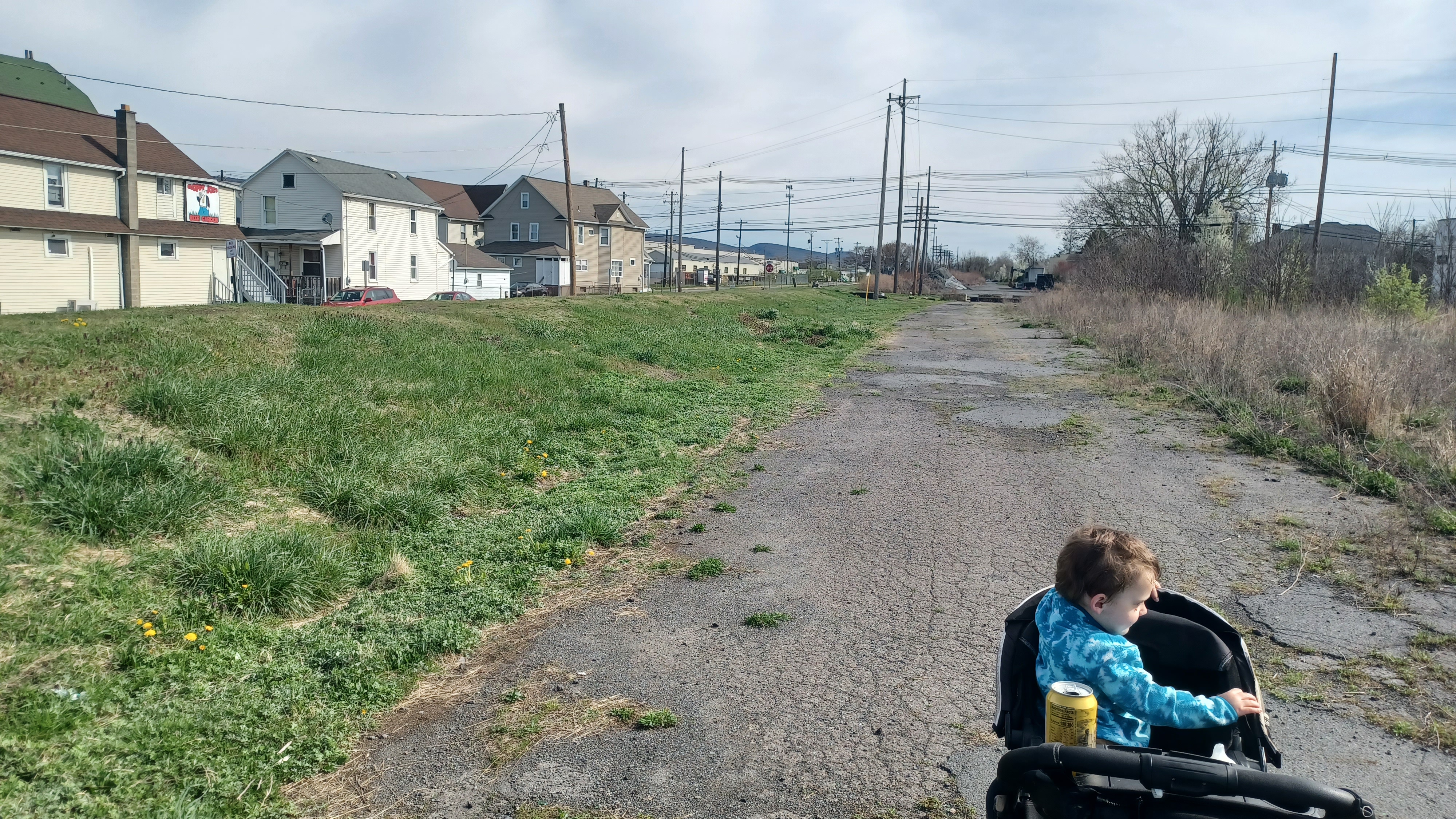
For a meetup and start point, I chose the Lowes Home Improvement Center in Edwardsville Pa, just outside of Kingston. We had hiked out of the Kirby Park a few times just to the southeast, but this time I figured we should start right where we picked up The Bloom the last time.
There was a major coal breaker in close proximity to this point where we'd last picked it up, and we'd be able to pick up the Luzerne Levee Trail, which leads right to The Bloom right from the lot.
 |
| Early 1900s Kingston |

Some of the construction of the levee system has obscured old rail infrastructure in some places, and the Toby Creek, which flows through this area was what it used to cross.

The abutments to the bridge that carried the line over it are still in place, but the bridge is now gone.
From the parking area, we headed west and climbed up the slope to the Luzerne Levee Trail, and soon reached the right of way just to the north.
We didn't think anything of it at the time, but the Toby Creek was rather dry. I figured it was just some sort of drought condition.
Something far more frightening happened during the time we were in town: the Toby Creek had collapsed through its base and into abandoned coal mines under the town.
The rail bed is now the little road behind the Lowes, and we turned right to begin following that eastbound.

We soon reached Main Street near the intersection with Plymouth Street. The rail bed continued as a paved road, or next to it, ahead.
I have no clue what kinds of industries used to be through this area, but it was quite a bustling spot. The Lackawanna Railroad and shops used to be through this area, and the roundhouse had been on the right.
To our left in this area, a track used to branch off to the left, parallel with the west side of present day Roosevelt Street, to Edwardsville Junction on the Lehigh Valley Railroad's West Pittston Branch (I think, I can't be sure about the branch names, but it did break off of that branch).
 |
| 1915 Watson Bunnell, Steamtown NHS Archives |
The spur went on to connect with the Delaware and Hudson No 3 Branch which served a breaker I think.

Up ahead on the right, there was a little line of trees where Market Street comes in, and Schuyler Ave goes off sort of parallel with the former track bed.
At this line of trees was the former site of the Kingston Station.
I had a few early 1900s images of the station from Dan West's West2K website to try to emulate, and I think I got them right.
This had been a very handsome, two-story station, but what happened to it I do not know.

We continued ahead, and had to weave through a line of trees, and then over a bunch of junk laying around. It wasn't too tough to push the stroller through, but I had to watch for sharp stuff.

We continued on a former paved road. The Bloom would have been to our right while we walked this, and to our immediate left, was the West Pittston Branch of the Lehigh Valley Railroad.
Some of the locals argued with me about the existence of the Lehigh Valley line there, but I know that it's fact that it came over this far, and was closely parallel.
There was a big berm of dirt, which someone told me is actually a buried bit of the Toby's Creek. I would never have known it flowed through here otherwise.

We continued ahead to Pringle Street, where we got our first good glimpse of rail, still in the pavement.

We crossed directly and continued on the clear railroad grade. There was a major yard of course, at the station and roundhouse. The entire Bloom was double tracked east of Kingston, and single west of there.
As we walked this section, there were some tracks down in the weeds below us to the right.
Way off to the left, we could see some tracks where the Lehigh Valley line used to be, right into the edge of the parking area for a few businesses on parallel Brook Avenue, which is apparently built over the Toby Creek.

We continued ahead toward Division Street, another former rail crossing. I missed getting a then and now at this location, but I ended up getting one at the end of the day.

I had a whole series of photos that were taken by the Lackawanna professional photographer, Watson Bunnell, in 1915. The collection of Bunnell's photographs are in the Steamtown National Historic Site archives, and I've used tons of them for then and now compilations in the past. I would have many of them this time, because Bunnell took a long trip on The Bloom, and photographed much of the infrastructure.
I did manage to get a reasonable one at Pringle Street I think.
We could see the tracks of the former Lehigh Valley Railroad also in Division Street just to the left of us. We turned to the right slightly and began paralleling the line to the right on Railroad Avenue.
The tracks were all in place, out in the weeds to the left. We walked a ways down, and I had Jenny and John take Ev's stroller while I went with Justin up onto the tracks to walk them for a little bit.
I knew from looking at aerial images and Google street views that a lot of this right of way would be well-walkable, but I didn't know for certain when that would start. It turned out that this was that spot. An ATV path came in from the road a short distance ahead, and it was easy walking.

I went back down and got Ev and his stroller and pushed him back up onto the clear right of way next to the tracks.

Just to the north of us was a giant retention basin with earthen walls, and Toby's Creek first goes underground at this spot. I suppose it was somewhere in this area that the subsidence had happened.
John and Jenny stayed down on the street for a bit more, but Justin and I soon happened upon an old junction site. The rails were still there, and it appeared that this was a connection to the former Lehigh Valley Railroad, which was just parallel with where we were walking still. I'm not sure if the two ever connected there, or if the switch was just another side track to the Lackawanna.

The Lehigh Valley Railroad had its connection here to the Bowmans Creek Branch, which follows the Toby's Creek upstream to Dallas and Trucksville, then continues way into the Endless Mountains.

We hiked most of that line as a series, and it was absolutely outstanding. I have a few more bits left that I want to do of that.
The flood protection stuff on the Toby's Creek destroyed a lot of the northbound Lehigh Valley right of way up immediately to the north, but we did try to walk that in the past. It becomes Back Mountain Trail not too far ahead.
We continued ahead past the junction spot, and the rails disappeared from here at the junction site for a bit, but the ties were all still in place. We had to get over some fallen trees, but overall it was still easy.

My understanding is that both the Lackawanna and the Lehigh Valley had these spurs that served both the East Boston Colliery and shaft nearby.

This became very pleasant. It was a typical spring day, getting warmer, sometimes a little too warm, but with no shade above us yet for relief.
There were lower shrubs and trees blooming beautifully, and leaves beginning to turn green all around.
We passed an old wooden switch box out in the weeds on our left as we continued.
Pretty soon, we reached Union Street. The rails and crossing were still in place here, though they haven't seen a train in quite a long while.

We continued right across, and the ATV path actually continued, with Fulton Street, which paralleled on the left, and Railroad Ave, on the right parallel with us.

We continued ahead and soon approached the Rt 309 underpass. Another junction once broke off from here to the right to an industrial siding of some sort.
I have another then and now that happened by accident, with a photo by Rob Yarosh showing it before 308/Cross Valley Expressway was built.
We moved ahead and took a short break under the highway, then moved on to soon reach Bennett Street. This was another station site, which stood just to the left after the crossing.
 |
| Rob Yarosh photo |

I think some places refer to the station as Bennett Street Station, and others I've seen it as the Forty Fort Station.

The settlement of Forty Fort is a colonial one so named for the fortification built by the original forty settlers that came to the area.
Apparently, the railroad is not within the municipal boundaries of Forty Fort itself, but it is close to it or it makes up the boundary.
There was nothing left to see of the old station, which was one of the beautiful 1880s pagoda style stations similar to the one that used to stand near where I live in Oxford NJ.

At the crossing, we had to make the choice of two roads that paralleled either side of the railroad. Charles Street was to the north, and Railroad Ave was to the south.

Railroad Ave looked like it took us closer to where we needed to be, because it was longer and looked closer to the tracks, which were overgrown, and there was too much crap stacked or parked along it on the other side to stay very close.
There was a metal control box of some sort along the edge of the tracks on the way.
We continued to the east to Elay Street, which turned to the right, too far from the tracks. Fortunately, there was a clear path across the tracks back to the north side, so we took that.

We had a clear walk along the left side of the tracks heading west, past the intersection with Miller Street. The path continued past an industrial site and into the woods.

We soon reached the point where the former Lehigh Valley Railroad's Bowmans Creek Branch used to cross over on a girder trestle. Amazingly, there is no sign of this bridge anymore.
This would have been a major trestle, having made its way here across the Susquehanna from Port Bowkley on the other side (the bridge has little remains to see, an occasional island for pier footing), and then headed north.
Through the developed area, there is nothing of it until it becomes the Back Mountain Trail, and has the junction with the connection we had passed just a little earlier.

I think it was Justin that found a little piece of toy railroad track and gave it to Ev in this area. He loved it like crazy, and hung onto it for the entire day. He even brought it home with him, and it floated around the living room for a while until it eventually got broke somehow and his mother threw it out.
 |
| 1915 Watson Bunnell |

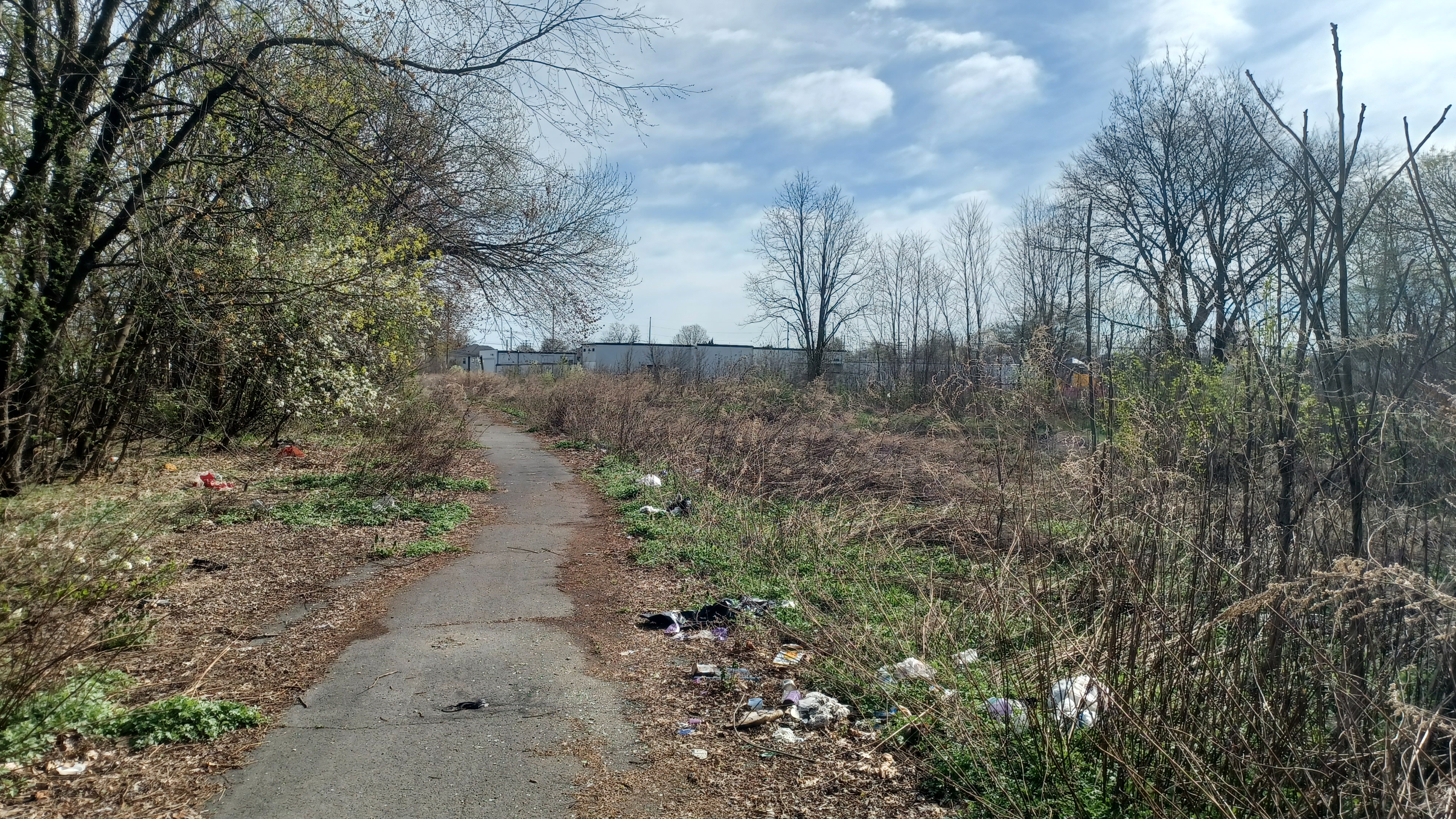
The area of these woods was loaded with trash more than just about anywhere we passed all day, and there was evidence of homeless encampments along it.

Sleeping bags and such were strewn about. On the previous hike on this line, we saw a huge homeless encampment in the Edwardsville area, but this one was much more out in the open. No one seemed to be around while we were walking through, and it didn't look very recently used.
We continued through the wooded swath to the east, and soon reached and crossed Slocum Street.
There was a storage facility on the left, and the tracks became overgrown straight ahead. However, there was a good ATV path that went to the left and headed into the woods parallel.

I got another good 1915 then and now compilation using another Watson Bunnell image of the Slocum Street crossing.

There was a lot of disturbed ground in these woods, and much of it I think are actually rail bed remnants. This was around the area that was known as Maltby Junction.
The Bloom had a spur in this area, which I think was the elevated thing, which went to the north to connect with the Lehigh Valley Railroad branch at Maltby Junction.
The branch continued to the north of that spot to the Harry E. Breaker site, which was owned by J. H. Swoyer, as per the Anthracite Railroads KMZ file I use to find information.

We headed into the disturbed area, and I pushed Ev up the slope to the right onto this parallel grade. A lot of excavation had gone on through this area, but it wasn't unsafe to get through.

The ATV path descended in just a bit, and was soon beside the tracks again heading west. Soon, we passed by an old metal mile marker, with miles removed, growing into some trees.
In this area, Tripp Street used to cross the railroad at grade. There are still north and south ends of it, but they no longer connect across the right of way.
We passed by O'Hara Field and continued through the swath of trees on a clear path heading east.
By this time, we were in the settlement known as Swoyersville, for aforementioned coal man J. H. Swoyer.
 |
| 1915 Watson Bunnell |

We passed by an industrial building on the left, and then approached Shoemaker Street. This was the former site of Swoyersville Station.

This site was reportedly where there was a 145 car train derailment in 1973, at which point it was single tracked, which caused damage to the building to the left of the crossing.
To the right of the crossing, there was a tall building that was reportedly a speakeasy. After the 1930s, Forty Fort became a somewhat dry town, and prohibited the sale of anything but malt liquor, so citizens wanting to get their drink on would have to go to the tracks and head into there.

We had a pleasant walk ahead, in another swath of trees, and soon started making our way onto a fill before we came out to Durkes Street in Swoyersville.

This was a bit different than the sections we had been walking before. It was much more out in the open along the fill.
We were very exposed, with Simpson Street running parallel with the ATV path along the tracks just downhill to our left.
According to the mapping, there was another spur from the Lackawanna in this area, known as the Maltby Branch, which broke off to serve more coal mining interests to the north. I don't know a lot about these, but this one would have had quite a drop down to get through.

Soon, we reached the Hughes Street crossing, with a large brick industrial single story building ahead on the right. The tracks have been removed from the grade crossing here.

Another sort of metal switch box was to the left, and the rails had been removed in a couple of spots just ahead parallel with the brick building.
The building showed signs of serious burn. It must be vacant because of a fire. The tracks might have been removed in little segments in order for ATVs to get through. Even though it was a bit bumpy, it was still pretty easy to get the stroller through.
We very quickly reached and crossed Owen Street, where tracks had also been removed.

We paralleled another brick building and passed another metal box, leading me to believe that this might have had something to do with a crossing mechanism.

We had a nice stretch through a tree line ahead, and our next crossing was Dennison Street. We were passing very close to homes through this stretch, but still had the feeling of seclusion.
We came close to Lackawanna Avenue, and then beyond started getting into some more secluded woods.
A little bit along there had in the past been another junction with the Bloom, where a line went to the north to serve the Maltby Colliery.

It was hard to see any certain remnants of this branch, but it appears to go into present day Frank Slapar Park, and some of it is now the route of Stiles Street.

Stiles is both north and south of the right of way, so that probably went all the way through at some point and was abandoned.
To the left, there was a large pond, which is associated with the Abraham's Creek.
With no real street crossings coming up after a long series of so many of them, I let Ev out of the stroller to walk on his own for a while.
We headed through very pleasant woods above the wetlands of the Abreham's Creek for a while, and eventually came to the enormous Luzerne Levee.

Many who argue for the re-opening of The Bloom to the west through Kingston, simply because there are tracks mostly in place, are not aware of what had happened here.

The giant earthen berm goes right across the tracks here, surrounding the Abreham's Creek as a flood protection. Just to the south of this location, the Luzerne Levee Trail follows the top of it, and I'd hiked that part of it twice before.
It would take some effort to remove all of this and then put in some sort of flood gate doors if they were to try to reactivate the line to the west of here.
This spot was also significant before the earthen berm severed the connection to the east.

Another Lackawanna branch used to break off to the north, some of it completely covered by the flood berm it seems. It was known as the Fuller Shaft Branch, yet another spur for coal interests.

We climbed up the slope, which had a good path of gravel, up and across the levee, and right down the other side back to the edge of the tracks.
Just ahead of this, and too obscure to really see, there was yet another spur line to the north, which served the Fuller Shaft Breaker.
We continued ahead, and actually had a grade crossing, where we had to go out and around metal gates. This was a dirt road known as Swetland Lane. We'd end up using this later as well.

We got to the other side, and Ev continued to walk for a little bit. There were pretty wetlands of the creek still in the area. There were also some ATVs that went by us in Swetland vicinity.

A gravel road was parallel with us to the right for a bit, which goes to what I assume is a model airplane flying field.
This area became much more open, and it started to rain a little bit. It didn't last for long, and wasn't even a bother.
The open flying area to the right is apparently the former Lackawanna Railroad's Wyoming Coal Storage Facility property. I don't know what kind of infrastructure used to be there, but it must have been rather extensive.

This section was coming close to the West Pittston Branch of the Lehigh Valley yet again, just to the north and across a wetland. There was an ATV path that connected it.

The area afforded some views to the north over some wetlands, and we could see the dip in the mountains from which the Abreham's Creek originated.
Pretty soon, there was yet another junction, this one with rails, breaking off to the left. This was a connection to the Lehigh Valley line. I suppose this is why the tracks are still in place on that line to the east of this location, because the junction was maintained to this point for longer.

We continued ahead, and the rain got steady enough that I put the cover over Ev's stroller for just a short time, then it ended.

The next point of interest was the crossing of 8th Street as we entered Wyoming. This was the former site of the Wyoming Station.
The station was on the left after the crossing, which was next to the Nelson Brothers facility, now Diamond Manufacturing. The lost station was built in 1883.
The Abreham's Creek was just to the right of us in a concrete sluice that carries it through the town. A grassy lawn swath separated the railroad tracks from the creek just ahead.

We continued across the lot at Diamond Manufacturing, and then crossed the tracks to pass through the grass ahead.

There was an old mile marker post on the right in the grass.
Soon, we reached the bridge over the Abreham's Creek. This was in actually very good shape, and the ties were so close together that it was easy to just push the stroller over it.
The Lehigh Valley Railroad crossed over the creek just upstream from our location, and while we could see the line of trees that was the right of way, the bridge, which is still in place, was out of sight.

Reportedly, the entire line from here to the east, to the Susquehanna crossing, is still usable, although it hasn't been in years for anything but storage of rail cars.

Beyond Abraham's Creek, we crossed 6th Street at grade and then paralleled Wyoming Cemetery on its north side.
Openstock Home Warehouse was on the left of us, and this area was the former site of the Mt Lookout Breaker.
We went through a bit of a cut, out of sight from everything, and then came upon another little junction spot where there was a siding to the right, but only the ties were still in place.

In this area was also the former site of the Dial Rock Breaker, and the Schooley Breaker I understand. There was also a Schooley Shaft, which would have been on our left.

The Lehigh Valley Railroad also had a spur that served these facilities, which is now the site of a trailer park on the side side of the tracks. The south side was laid out as a trailer park, but I don't know if it ever was one.
The Lehigh Valley spur, from what I can tell on the historic maps, went right through the middle of what is now a grey building owned by Birchwood Village Estates.
Pretty soon, we crossed 1st Street in Wyoming, which serves the trailer Birchwood Village trailer park. A power line went across and off to the left, and it had a black cinder dirt trail going up it, which appears to be on the historic route of the Lehigh Valley spur off of the West Pittston Branch.

We crossed and continued through a more open area, and on the right was another side ATV path through a little scrubby woods of young trees. This path follows on or next to another spur that served the Dial Rock Breaker to the south.

We skirted some chain link fenced in ball fields on the right, and then came out to the end of Laird Street, where Frothingham Court comes in from the right. There was another old mile marker on the right at this location.

We continued on Laird Street ahead. Several trucks and such were parked across the railroad, so it was easier for us to just follow the street, which was a sort of community of mobile type of homes at first.

I weaved Ev's stroller around some of the trucks along the way rather than stay on the road, and pretty soon we reached and crossed Schooley Street.

From here, we started going back up onto a bit of a fill again, and this one was even more interesting than the previous one. We were above the homes, almost enough so that it would warrant that each road should have an underpass, but not quite.
Our next crossing was Grant Street, and this one was rather bizarre. Justin and I sort of looked it it in amazement, wondering if it had ever been an underpass. No large truck could ever get over this particular crossing. It was like a real life Dukes of Hazzard jump.

We continued ahead and crossed a similar crossing at Lincoln Street, and I missed out in this area getting another then and now compilation, which I'd get later.

We passed some yellow forsythia, and a side road called Mason Ct was parallel with us for a pretty long while, a few blocks.
We crossed over Mason Street at grade, and then started heading away from everything again, back into a wooded area.
We went by some sort of commercial building on the right, and then skirted buildings at the end of a cul de sac, then were in the deep woods. There were ATV paths that were going off into these woods to the left of us, which looked to be a very large expanse.

Just ahead, we came upon a very interesting concrete structure, with a tunnel going back into it. This was apparently the ruins of the Exeter Coal Mining and Processing facilities, which are all through the property to the north.

The maps seen to show that these facilities were more closely tied to the Lehigh Valley Railroad, which served them from the north, but it's possible the Lackawanna had some sort of contact with them. I really don't know.

The woods remained very pleasant for a while past the Exeter Breaker site, and pretty soon we approached the crossing of Tunkhannock Avenue, at its intersection with Baltimore Avenue. I had a few historic shots to get around this location as well.
The station that used to stand in this vicinity, with a couple of ball fields to the right across 6th Street, I have found labeled both as a West Pittston Station as well as Exeter Station. It would have been to the right of the tracks in the direction we were walking.

We continued along, and there was a very large tree sanding close to where the station would have been. I understand that this was at one time known as the Maple Avenue Station, but at some point some street names were changed.

Soon, we crossed over Delaware Avenue at grade, with 6th Street still parallel to the right. We then approached and crossed Montgomery Street. Residences were to our right, and industries to the left. One on Montgomery had an overhanging thing were rail cars could have pulled beneath.

We crossed Luzerne Avenue, and there was a concrete shelter of some sort to the right, which appears to have been used by the railroad. Someone had spray painted "jail house" on it.

We crossed Exeter Avenue ahead, and passed the large Hitchner Biscuit Company building, a tall brick structure. By this point, the bridge that carried the line over the Susquehanna was coming into view.
Just after the crossing, there was another junction, to the left, northbound. This was the junction with the West Pittston and Exeter Railroad.
This line was shown on the Anthracite Railroads layer I have on my Google Earth, but had no labels associated with it. I tried tracing it and found it to be quite interesting.

A Facebook page called Anthracite Aerosports has been leaving some good information on my posts, and just through sharing the name, I was able to find its purpose.

Although the last customer on that line was apparently Celotek in Harding, a little community further up the west side of the Susquehanna, it was built, I suppose, to serve a power plant that used to exist up there.
The line continued up along Exeter Avenue well up out of West Pittston, through the little community of Harding, and then continued along the river a little further north, adjacent to some fields, to reach the plant that had been off of Rt 92/Sullivan Trail. Today, it looks like that former power plant site is just a substation location. I'm not sure when it was abandoned, but it might have lasted until the 80s.

We continued ahead, and the street to the right became Maple Street. As we approached the bridge site, we also approached the former site of the Susquehanna Avenue Station. I had more then and now fodder to try to work with while we took a break at this point.

This was the farthest out pretty much that we would be on this hike. From here, we'd have to start heading north and then back to the west to the starting point.

I had initially planned to follow the former West Pittston Branch of the Lehigh Valley Railroad, because it would be far more difficult to trace, but then switched it based on accessibility of the lines. I figured we might get on more of the Lehigh Valley line if we went west to east, but I don't think that ended up being the case. I probably should have done it the other way.
The Lackawanna bridge over the Delaware is certainly not the original structure that carried the Lackawanna and Bloomsburg Railroad since 1857. This was a newer, steel through truss. Based on the historic photos, we know this one was in place since at least 1915, probably a bit earlier.
 |
| Wyoming Station, Dan West Collection |

The group hung out at the intersection, and Justin walked out onto the bridge as far as the first pier to have a look around. I wasn't about to do any of that because there is no walkway, and I understand they still bring trains out onto this for car storage or movement or whatever.

I would really love to continue hiking the historic route of the Bloom, but much of the rest of it is still active. It would probably be a good Winter hike, considering most of it seems to be pretty close to roads that can be walked. I have no shortage of Winter hikes back stocked however.

Once I'd gone over the mapping a bit, we turned to the left from the bridge and started walking Susquehanna Avenue to the north, parallel with the Susquehanna River upstream. We had some good views of the bridge as we continued.

A little bit up the road, we reached and entered the West Pittston Cemetery. This lovely burial ground is right along the river and quite pleasant to pass through. We kept as best we could toward the river side of it.

Once we got to the north side of it, I was rather surprised to see that it was two separate cemeteries. It seems that the north end is a separate one, I think a Hebrew one.
This second cemetery was separated from the one we went through, and there was no way out of it to the left onto the streets. There was a small building at the far north side of the cemetery, so I tried going around that, and found that there was a gap in the fence where we could get through around the outside. Another couple were coming through walking about the same time.

We came out around the edge of this next cemetery on Wilkern Street. We passed Big Top Rentals, and then came upon rails in the pavement. They went into weeds to the south, and disappeared into the pavement of the rental parking area to the north.

This was the tracks of the former West Pittston and Exeter Railroad we had seen the junction for before. I wasn't expecting to see any of this infrastructure still in place.

I don't know that any of it would have been accessible to the north, so we continued out Wilkern Street to the west.
We turned right on Rt 92, Sullivan Trail, to the north for a bit, through developed area. We started talking about lunch, but a pizza place in the vicinity was closed Sundays, so there was not really any option.
We continued on to the north, and there was still a sign showing the railroad crossing over the road at a weird angle, although it had probably been years since it was used.

When Rt 92 turned off to the right, and Slocum Avenue sort of stayed straight across the tracks and turned left, there was a small brown building across to the left of 92. It looked sort of like a station, but apparently was not. It was an office for Pocono Northeast Railroad.

There apparently was once a station at this spot, but on the west side of the crossing.

Beyond this spot to the east, Campbell's Ledge was plainly in view. The amazing rock outcrop is in a mountain that has a bunch of old coal mines in it, informal trails, and an outstanding view on top. We had done it in the Springtime a couple of years ago.
The Lehigh Valley Railroad used to cross over the Susquehanna River just ahead on a bridge that was only very recently demolished, which went over to the Lehigh Valley Railroad's Coxton Yard.
I recall photos of it showing its demolition, and I'm rather sad I missed out on this and others that were in fairly modern times removed.

We turned to the left on Slocum, and the Lehigh Valley line was badly overgrown behind industrial buildings south of this road.

I had thought we might be able to get through on these, and if I didn't have the stroller, it would have been something that we might have attempted, but not with this situation.
There might be a missing bridge over the Slocum Creek just to the south, but I couldn't tell with the aerial images. I know that rather soon, the line crosses Stevens Lane, and the tracks are in place there, but I'm not sure what they're like beyond. They look at least slightly overgrown.

We continued past the large industrial buildings and went down to walk through their loading bay and platform area rather than the road above, which was a good diversion.

To the south, the railroad bed skirts the north side of Fox Hill Country Club, but we remained on Slocum Ave heading west, and slightly uphill after the end of the last long warehouse building.

I think we stayed along the road to the west even when there were side roads going down into a development to the left, which would have had a better walking experience, but I didn't want to add any distance at this point.
We turned left on Packer Avenue heading to the southeast a bit, through some light residential area.
At the bottom of a small hill we crossed Hicks Creek. This stream had certainly been altered to deal with flooding issues as others had, but not with as much berm work. It was obviously trenched with grassy slopes on either side.

We continued past this and uphill slightly. There was a clearing to the left, parallel with the tracks. I've no idea where the access to it was from because I couldn't find anything of it on Google Street View.

I didn't want to plan out any odd route with uncertainty more than halfway through the trip.
I haven't found a whole lot of clear history about this branch, but my understanding is that it was built by the Pennsylvania and New York Railroad and Canal Company between 1882 and 1887, and that at some point after that it was absorbed into the Lehigh Valley system.
On the other side of Packer, the right of way was completely overgrown without even a hint of an ATV path along it. It skirted the back yard of a house, and I didn't want to go and encroach on that. This line, although there was still track in place, was far different than the Lackawanna line, which had a near seamless path along the entire route from Kingston to the Susquehanna River.

However, there was an ATV path that went up a steep slope, just to the south of the tracks, and headed into the woods on what seemed at first like a parallel route. I was able to see that on the street view when I planned it, and looked at that as my way through.

The rest of the group had gotten really far behind me at this point. I had to wait on the tracks through the road for a bit. When they finally got within sight, I pushed Ev hard up the steep slope in the stroller, and then waited where it leveled off a bit at the top.

When everyone was caught up I explained that there was some uncertainty with where we were going to end up. I didn't want to be too much more adventuresome on this one because I knew that the Lehigh Valley line was going to be a mess.

We weaved around through the woods on the indirect ATV path for a bit, and moved farther away from the Lehigh Valley tracks.
Eventually, we emerged into a very wide and open area of old coal waste. This enormous site was once the home of the Exeter Breaker, of which we had seen some of the ruins just a little while earlier on the Lackawanna grade.
The name comes from the ancient city of Exeter in Devon, England.

Coal industry in the area boomed early on, and eventually was knocked out by the Knox Mine Disaster in 1959 nearby, but I don't honestly know really anything about the Exeter Breaker.

Pretty much the only local facts I can give on this was the local kids growing up in the former breaker site referred to it as the "black desert".

Straight ahead of where we emerged, massive piles of coal refuse were seen, and ATVs were riding all over the place. They soon disappeared as we arrived. Maybe because we looked so out of place.
We didn't try to go up the steep coal hill ahead, and instead went to the left, on a more gentle descent to the south. I gave up on trying to continue west at this point along the old Lehigh Valley line, which emerges onto Jean Street before continuing west.
The group wanted to get something to eat as far back as when we reached the Susquehanna, and there was nothing really on our route, so switching it up and heading south through the former industrial property was looking like a good idea.

We could get back on the Lackawanna we walked on the way out, and then head to food from there, then get on the sections of the Lehigh Valley beyond that I assumed would be more accessible.

We sort of skirted a line of trees to the left, still kind of into the open area, and tried to follow the more well worn sectios of the land where ATVs had beaten it down a bit more.
Near the end of the wide open area, we headed into more dense woods on a wider old woods road. I'm sure some of this was probably former rail beds, but I'm not sure how it was laid out at all. The anthracite railroads KMZ wasn't showing much detail through this other than the fact that it was served by the Lehigh Valley.

After a while of going through woods, and around some giant mud puddles (which I mostly walked through), we came to a split. Straight ahead, or whatever was closest to it, would have probably led out more directly to Penn Avenue back on The Bloom, but we went to the left and then right.
 |
| 1915 Watson Bunnell |

I wanted to look around through some of the ruins, and I was rather glad we did.

First, there was a large concrete remnant that was a sort of tunnel underpass. I have no clue what the purpose of the structure was, but it was cool.
In addition to the pathways that might have been railed, there was also a section of concrete slab roadway, also mostly grown over, curving around and only exposed where the modern ATV paths allow for it to present itself.
This was a good spot for a little break, to have a look around, to look at maps, and to get a little refreshment.

On these hikes, I often look around for interesting brews that I'd not sampled yet, and if I can find at least one new one for each of the trips we do, I feel like I'm doing pretty well.
 |
| The grade crossing here is gone. Watson Bunnell 1915 |

Unfortunately, it seems like the stronger beers are both getting more scarce, and people are less into them, because I'm finding less.

However, I found a weird malt liquor one called "Samichlaus" I think it was, which was 14% abv. It was brewed in Austria on December 6th, and aged for ten months. An odd one.
I figured this drink would be great when I popped it out there at the former breaker site, but it was somewhat difficult to drink at times. It just tasted extremely boozy.
Still, at that strength, it was going to make me feel good, so I muscled it down and just got everyone to help me with it a bit.
 |
| Hicks Creek |
We continued on through this former breaker site to the south, and there was much more disturbance than what we had seen before. Some deep dips and more concrete, and narrower ATV paths were what we were coming across.


Eventually, we came to the steeper dip back down to the Bloomsburg Branch. I got there first with Ev, and we waited for the rest of the group to come back down.

We turned right and began on our way back along The Bloom again, and soon reached and crossed Penn Avenue again.
We headed back up onto a steeper section of fill, and soon reached Lincoln Street. This was where I had forgotten to get the then and now shot before, so I stopped the group and got it on the way back here.
We continued west across Grant Street, and then again over Schooley Avenue. We passed the former Schooley Breaker site, and then passed a cemetery on the left followed by ball fields.


The ball fields were of the Exeter Lions Little League. I had been hoping we could cut out to the south here, and we could head to the American Grill and BBQ for our lunch break.

Unfortunately, the chain link fences had no breaks in them, and so we'd have to go a little further ahead to make our way out.
We got past the fence of the ball field, and in that area was where the ATV path broke off to the south through scrubby young woods.
The path follows on or close to the former spur that served the Dial Rock Breaker as I recall.
We had to turn in here, and soon there was a bit of an ATV path that went to the left, much more closely parallel with the chain link fence.
I pushed Ev carefully with his stroller on this path to the left, thinking it would eventually lead us to a spot we could get through, but we had no luck.
 |
| 1915 Watson Bunnell |

Not only was there no luck, it was poor luck. The path basically had disappeared, and we started turning more to the west, away from the fence. The overgrowth such as Autumn Olives and such were getting to be too much to push through.
 |
| 1916 Watson Bunnell |

I really didn't want to push back, and trying to bushwhack down led to a small body of water that would also be a pain to get through. The only logical move was to backtrack all the way we came, and then follow the clear right of way to the south more.


We headed along this path, which was like a long hallway of white blooming flowers, to come out on Wyoming Avenue near Wyoming Catholic School and Cold Case Beverage.

Somewhere along the way, on one of the rail beds, Kirk found an army tank toy and gave it to Ev. He absolutely loved it, and wouldn't let me put it into the underside of the stroller. He had to hold it.
We turned left on Wyoming Ave for a bit, and soo reached American Grill and BBQ.
It was rather nice outside, and we didn't want to impose upon the staff there too much. We let them know we were all really gross from having walked so far, through coal and breaker areas with mud.


We just wanted to be served outside, in the front, on these nice benches, but they didn't really want us out there. I think it was brought up to go on the side, and we settled on going inside.


They had a long table set up for us on the far left side of the building. I think a few people that came later were a little annoyed, either because Ev was loud, or maybe I was laughing too hard, I don't know.

It wasn't like we didn't warn them.
I thought the place was pretty good, and it was great to have a nearly private room off of the side. It was good for Ev to be able to run around in, which is always a plus.
Ev noticed in the place that there was an army tank on the back wall similar to the one he had just gotten, and had to show it to me next to his.
I forget what I got for lunch. I usually either get a burger type of thing I can share with Ev, or I get a dish that has pasta with it because I know he'll eat that. I think that might have been it.
 |
| Photo shared by Joe Ches |

I also had a bourbon barrel aged chocolate stout in the place that was alright, although a little under my usual ABV.
 |
| Photo shared by Anthracite Aerosports |

We left the place and headed back down Wyoming Avenue ahead. We soon reached where we had come out, and took a clearer path to the left of the one we walked previously.

We headed through on where the spur line was to the breaker, and along the way Kirk and Justin checked out some sort of broken down old ATV thing.
We turned left on The Bloom again, and headed out to cross 1st Street, followed by 6th Street again. We crossed back over Abraham's Creek, and then turned right on 8th Street at the old station site.
Soon, we reached the former Lehigh Valley line crossing, where it had its own station. That used to sit to the right at the intersection.

I didn't get a good then and now using the historic photo I had of this station, so I'll eventually have to go back to this one again.


From the former crossing, we turned to the left to trace the line through the grass. We had to cross over the rails onto a good ATV path that paralleled them on the south side to continue.

The ATV path weaved around a bit from where the tracks were, and crossed back and forth again. It was amazing to me that any of this line was still in place. We passed by the junction with where it had connected with the Lackawanna just to the west of Wyoming in this area.
Just past that, the right of way sort of took us out onto a causeway on the wetlands. There were serious large ponds on the left, and large wetlands on the right. The puddles on the ATV path parallel with the tracks were getting to be really difficult to navigate around without getting wet. I just pushed the stroller right through.


Not everyone in the group was amenable to this, so I carried some over, including Justin.

This was not a good time for me to be taking on any extra weight, because just the previous week at work, I had messed up my back while throwing scrap metal into a salvage dumpster.
I was okay at first, and only a little sore the next day. However, after a good night's rest and getting up in the morning, it got worse. Then, at work, all of a sudden without really any major movement, my back went out. Horrible pain shot through it.
I went to a chiropractic specialist place in Flemington where an X ray was conducted, and it showed that the bones in my lower spine were touching.

This was really bad, and I immediately began undergoing electric shock therapy to stimulate muscles and separate this.

I reported it to work a couple of days later that I'd had this issue, and then had it put through the process for workers' compensation. However, it was denied. I was in shock.

It seems like never does something like this get denied, especially at the state, especially when I was obviously throwing heavy objects, and with witnesses.
I went a couple of times to the chiropractor, but that one was out of network for what workers comp would have covered anyway.
My doctor prescribed physical therapy three days a week, but with the claim denied, I both could not afford it, and could not afford to take the time, because that would have put me out another two hours three days a week, which would keep me away from Ev.

I discontinued going to the doctor, and had to start wearing a serious back brace. I didn't wear it on the hikes, because honestly, pushing the stroller and walking feels great. It must separate the bones in my back in just the right way, because it always feels so much better.

We passed a small building and there was an ATV path that went off to the left to connect back over to the Bloom line.

We continued on a good path with the big puddles for a bit, but it started to get really bad. The railroad right of way continued ahead and was very disturbed, but the ATV path went downhill to the right, and the area was very inundated with water.
Some of the aerial images showed that this area had been pretty clear in the past, and that the path went through dry, but that was not the case on this day.
Some of the group remained on the railroad through the rough stuff. I wasn't going to very easily be able to get Ev through any of that, so I went with going downhill into the big puddle.

This ended up being really very wet. I pushed the stroller to the point that the entire undercarriage was getting into the water. All of the stuff I'd brought in there was starting to get wet. I had to make sure to try to keep some of the diapers up, or at least into a bag that sat high enough up.


 |
| Wyoming LV, Harry Owens Collection |
The mud under all of this was also getting really rough to get through, and so we tried to get back up the slope to the tracks again.

I was amazed that there were still tracks up in this mess at all.
They did come to an end at one point where some of the right of way was bulldozed out into a clearer area just ahead, and then strollering became easier again.
I suppose at this point, the connection with the Bloom was further behind us, so tracks were no longer needed to the west.
We headed to a sort of utility clearing, which like before was mostly dry on the aerial images I was studying to plan this hike, but was completely under water this time. I tried wading out into it and to the south, where the ATV path led back over to the Bloom line.
It was rather deep, and we could all get through it, but it was going to be rather tough, and everyone would have to be on board with getting wet. Honestly, it would have been the quickest and easiest way, but we ended up going to the north anyway.
There was some sort of utility clearing on or next to the Lehigh Valley grade right across, but the depth was a bit unpredictable.

Also in this area was once a spur from the West Pittston Branch that went to serve the Westmoreland Breaker.

We turned to the right, and started trying to follow the clearing to the north. The inundation of water from Abraham's Creek continued up through this, and although we were off into the grasses struggling to get through, the area was still wet.
I think everyone must have gotten their feet wet. It probably would have been better heading directly back through the higher water to the Bloom faster, but oh well.
Some of this right of way paralleled the Moonlight Drive In movie theater. There was no way up to it however. We had to continue along the right side until we were more high and dry.

Eventually, we reached Shoemaker Ave, which was a huge relief. This had been a pretty messy stretch, and after that, I was quite happy not to return to the Lehigh Valley line for the rest of the hike.

We continued to the west on Shoemaker for just a little bit, and then turned to the left on Swetland Lane heading to the south.

This was the same road we had crossed much earlier, out in one of the more wooded expanses along the Bloom.
The Lackawanna's branch to the Fuller Shaft Breaker used to run parallel with this road a bit, but I didn't note any remnants of it along the way.
We got to the end of the residences, and there was a utility clearing and a gate to the left, which was one of the spots I had planned that we might come out if if we didn't have water.
I thought at first that this was the railroad bed, but it was not. We continued just slightly a little further uphill from there, and rails were just barely visible in the surface of the unpaved road.
The line was overgrown going in both directions, and to the west, it comes out at the St Mary's Church of the Maternity Cemetery.
Beyond, a couple of short sections of this line might have been accessible by foot, but not much. As such, I figured it might be better to drive along this route first, make some plans, and then eventually have a plan for a better hike on it.
We continued from the track crossing south to the former crossing of The Bloom just ahead.

Back on the Bloom, it was starting to get a bit darker, and it was looking like a storm was coming. We'd gotten some epic views of interesting clouds while we were walking Swetland Lane.

We crossed over the Luzerne Levee again that had blocked usage of the tracks, and then through more woods all the way back out to Dennison Street in Swoyersville.
I dilly dallied a bit in this area for some reason, and fell behind most of the group. I think Kirk ended up behind me at some point because he went to a store somewhere in this area, and I continued down the tracks ahead to the west for a bit.
I continued back across Owen Street, and then Hughes Street, and it started to rain a bit again. I got the cover back out for Ev's stroller and I think he took another nap.
I paralleled Simpson Street and crossed Durkee Street, and then Shoemaker Street a bit after that.
There was still some light when I got back to the former junction site with the the line near the Harry E. Breaker.
I pushed Ev to the right along the top of the beat up grade to the right of the Bloom, and then down the slope to come out by the storage space on Slocum Street.
I continued west and crossed back over Bennett Street. I think a couple of those in the group used an Uber to get out a bit early and back to the cars.


I had learned not to do what I did previously when we got out near Miller Street on the Forty Fort boundary. I continued on the right side of the tracks here instead of crossing over.

I tried setting up some shots anyway, in case any surfaced at some point that I would need the shots for.
Around this point, Kirk joined back up with me, and it was just he and Ev and I for the remainder of the way.
The light rain stopped, and it was quite pleasant for the rest of the walk.
I had one more beer left, which I opened and split with him as we casually walked the railroad back to the west.
Soon, we skirted cars parked along the tracks, and then crossed Bennett Street. We continued from here beneath the Cross Valley Expressway once more, and soon after that across Union Street.
After this crossing, it was the first part of the ATV path section we got on along the route. Rather than head down to parallel Railroad Avenue to the left this time, we continued on beyond the former junction point where the West Pittston Branch of the Lehigh Valley comes in on the right. When the ATV path started to get a bit more overgrown, we cut to the right, to the north side of the tracks, and then on a path from the flood protection levee along the Toby's Creek beside the former Lehigh Valley line.

It was getting pretty dark as we approached the former crossings of Division Street on the two railroads. There was one more then and now compilation I wanted to try to get at this location.


It was one more 1916 one by Watson Bunnell, and then I'd be happy with what I'd gotten for the day.

 |
| 1916 Watson Bunnell |
I was very happy to have knocked out this section of "The Bloom" before moving on to cover more areas to the southwest. I was very excited to do more of it, but felt it would be incomplete if I didn't at least do all of it on this side of the Susquehanna.
I felt much closer to this area after this day. I'd been so very close to everything we walked through in the past, yet every one of these blocks and neighborhoods felt entirely new to me because of this layer of it we'd never explored before. It was simply very fulfilling for me.